Paul Douglas

Calm But Still Chilly Friday - Warming Up This Weekend
We'll see a quiet Friday with partly sunny skies and still chilly temperatures. However, early next week it looks like we'll have a tropical heatwave as temperatures will climb up to around 40F! Click to find out more, including when snow is possible this weekend.
Paul Douglas

A few more light snow showers possible Thursday; 30s expected Sunday!
We continue to climb out of the freezer as we head through the end of the week into the weekend, with highs in the 30s possible Sunday and then maybe 40s next week? We do have to get through a few more rogue snow showers across the region Thursday, however. - D.J. Kayser
Paul Douglas

Temps climb toward normalcy; coating to 2" of snow
Light snow will pass through the region on Wednesday. It won't be much, generally less than 1 inch, but with temperatures still as cold as they are, roads could become icy once again.
Paul Douglas

Gradual Warming Trend Continues. 30s by Sunday?
It'll be another chilly day today, but we get back to the teens tomorrow with a little light snow. Saturday's high could reach the 20s with 30s possible on Sunday! If you're keeping track, that will be +50 to near +60 degree temperature swing from Monday's AM low temp. Talk about a February heat wave! Check the blog for more details. -Todd Nelson
Paul Douglas

Cold Monday. Frigid Air Finally Fades This Week
It'll be another frigid day today with subzero temps and dangerous wind chill continuing across much of the region. A light dusting of snow on Wednesday marks the return of 'warmer' weather. The deep freeze fades over the coming days with an honest chance of cracking the 32 degree mark by Sunday. Hallelujah! Freezing never felt so good! Check the blog for more details. -Todd Nelson
Paul Douglas

Coldest Valentine's On Record Possible Sunday
You might want to cuddle close to your loved one on this Valentine's Day as we'll stay subzero. The record cold high for February 14th in the Twin Cities is -5F in 1920. However, as we head through the work week, we will see some gradual warming, with some guidance showing +30s for next weekend!
Regional Weather

This Weekend is Peak Winter Nationwide
The main storm track will detour well to our south. Parts of Oklahoma may pick up 20" of snow, with 6" in Dallas, even an inch in Houston. Hilly Seattle may see 4-8" of slushy goodness. A subzero weekend gives way to a mild Pacific breeze by next weekend. I see a run of 30s the last week of February. Check the blog for more details. -Todd Nelson
Paul Douglas

Cold Weather Continues Friday Into Valentine's Weekend
The story continues to be the cold weather into Valentine's weekend, with the potential that Valentine's Day could tie for the coldest February 14th on record. The good news is a warm-up is in sight as we head into next week!
Paul Douglas

Light Snow To Cause Slick Roads Thursday While The Cold Weather Continues
We are watching a system that will bring through a batch of light snow as we head through Thursday and Thursday evening. While totals will be light, this will cause another round of slick roads in time for the evening commute. Meanwhile, the Arctic weather continues through the weekend, but there is hope for warmer weather next week.
Paul Douglas

Stuck In The Coldest Week of Winter
The longest and coldest stretch of weather for the winter season continues through the next several days with subzero temps and wind chill values. There's a chance of light snow across the southern part of the state late Thursday and perhaps again Saturday.
Paul Douglas

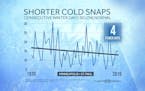
Fun (?) With Cold Weather Statistics
It's too cold for (big) storms, but a disturbance may brush the southern half of Minnesota with a few inches of fluff Thursday. Daytime highs may hold below zero this weekend before slight moderation (teens and 20s) next week. No rapid or prolonged thaw is brewing yet. Check the blog for more details. -Todd Nelson
Paul Douglas

Bitter Cold Continues Through Next Weekend
While the sunshine we saw this weekend looked nice, it certainly was cold if you took a step outside. Unfortunately, things don't get much better anytime soon. Highs for the next week in the metro will only make it to the single digits above and below zero, with morning wind chills in the -15F to -30F range.
Paul Douglas

Character Building Cold - Temps Stay Subzero Sunday
Get ready for the coldest day of the winter so far Sunday, as highs don't appear that they'll make it above zero in the Twin Cities. It'll feel even more brutal out when you factor in the wind with morning wind chills down near -30F, only feeling like -15F in the afternoon. It looks like we'll stay in the deep freeze through next weekend, with highs near or slightly above zero each day.
Paul Douglas

Wind Chill Advisory This Weekend With Frigid Weather Through Next Week
If you have to head outside over the next week, you will definitely want several layers on. Frigid highs in the single digits above AND below zero are expected, and when you factor in the wind it'll feel like the -20s each morning.
Paul Douglas

The Arctic Freezer Arrives In Time For The Weekend
We're past the snow - now time for the cold. We could see our first subzero day since January 2019 as we head into the weekend. And it doesn't look like it'll warm up anytime soon. Bundle up and stay warm!
Paul Douglas

Paul Douglas: Snowy morning with dropping temperatures to follow
We have our eye on a cold front bringing the chance of freezing drizzle and snow through the metro late Wednesday Night into Thursday morning, with up to a couple of inches of snow possible. Temperatures will be on the fall Thursday, with highs not making it above zero in areas this weekend!
Paul Douglas

Coldest Air in Nearly 2 Years Arrives This Weekend
The next 10 days will be the coldest of winter - the core of arctic air arrives late next week, when daytime highs may hover below 0F. The Polar Vortex has been well-behaved up until now, confining bitter air well to our north. Now it's our turn to get a taste. Wind chill readings may dip to -25F by Sunday, maybe -40F late next week.
Regional Weather

Coldest Air of Winter On The Way
A few inches of snow Thursday precedes cold front #1 - temperatures may not rise above 0F from Sunday into Wednesday morning of next week. The Mother Lode of Cold. Not sure we'll set any records, but wind chill values may sink from -25 to -45F by early next week.
Paul Douglas
Quiet Start to February. Arctic Blast Ahead
Quiet weather lingers through midweek before an Arctic front arrives on Thursday with wind-whipped flakes and plummeting temps. Extended temperature forecasts are hinting at sub-zero highs across parts of the state this weekend.
Regional Weather

Lingering Light Snow AM Sunday. Sub-zero Next Weekend
Lingering light snow wraps up across the region today with somewhat sublime weather in place through midweek. Snow chances increase late next week as an Arctic front arrives. There's a 50% chance your favorite meteorologist mutters the word "Polar Vortex" as icy winds and face-numbing cold settles in next weekend.
Paul Douglas weather
Weather forecasts and musings from Star Tribune meteorologist Paul Douglas.