
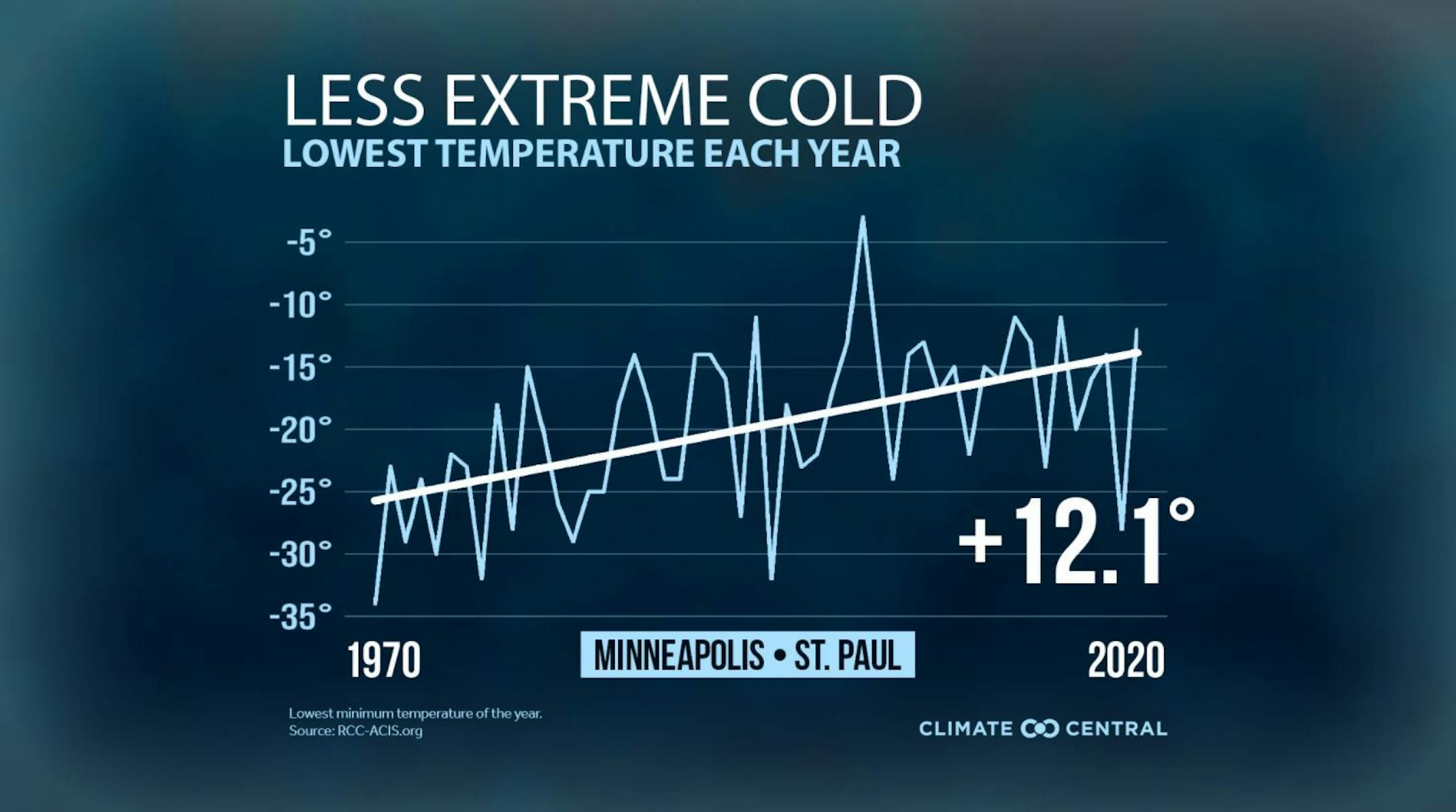
Warmer Lowest Cold Temps Since 1970
Sure, it's cold out there right now, but according to Climate Central, there's less extreme cold than there used to be back in the 1970s. In fact, we've seen a +12.1F average increase in the lowest temperature record in the Twin Cities.
Cold Air Continues
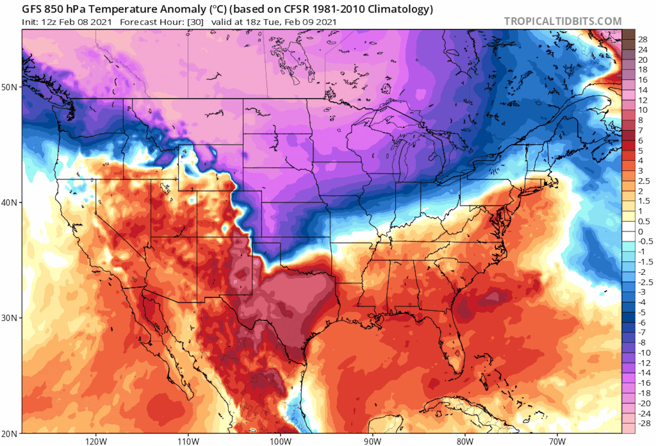
The coldest air of the season continues over the next several days with high temperatures running well below average. Note that highs may not even get above 0F across parts of the state with wind chill values dipping well into the subzero range. Note is some of the coldest air that we've had to deal with in nearly 2 years. Prior to Sunday's subzero high of -3F, the last time we had high temps colder than 0F in the Twin Cities was January of 2019.
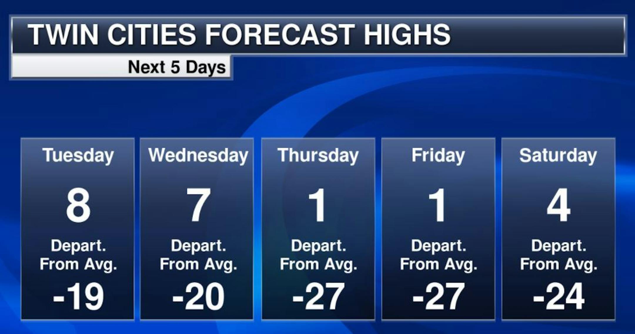
Extended Temperature Outlook
Here's the extended weather outlook for Minneapolis through the week and weekend ahead. Note that temperatures will stay VERY chilly with readings running nearly -20F to -25F below average. This will be the longest and coldest stretch of winter. It does appear that there will be some improvement as into the 2nd half of the month. There doesn't appear to be much in the way of snow chances either. Thanks to the extreme cold, the storm track has been pushed to our south.

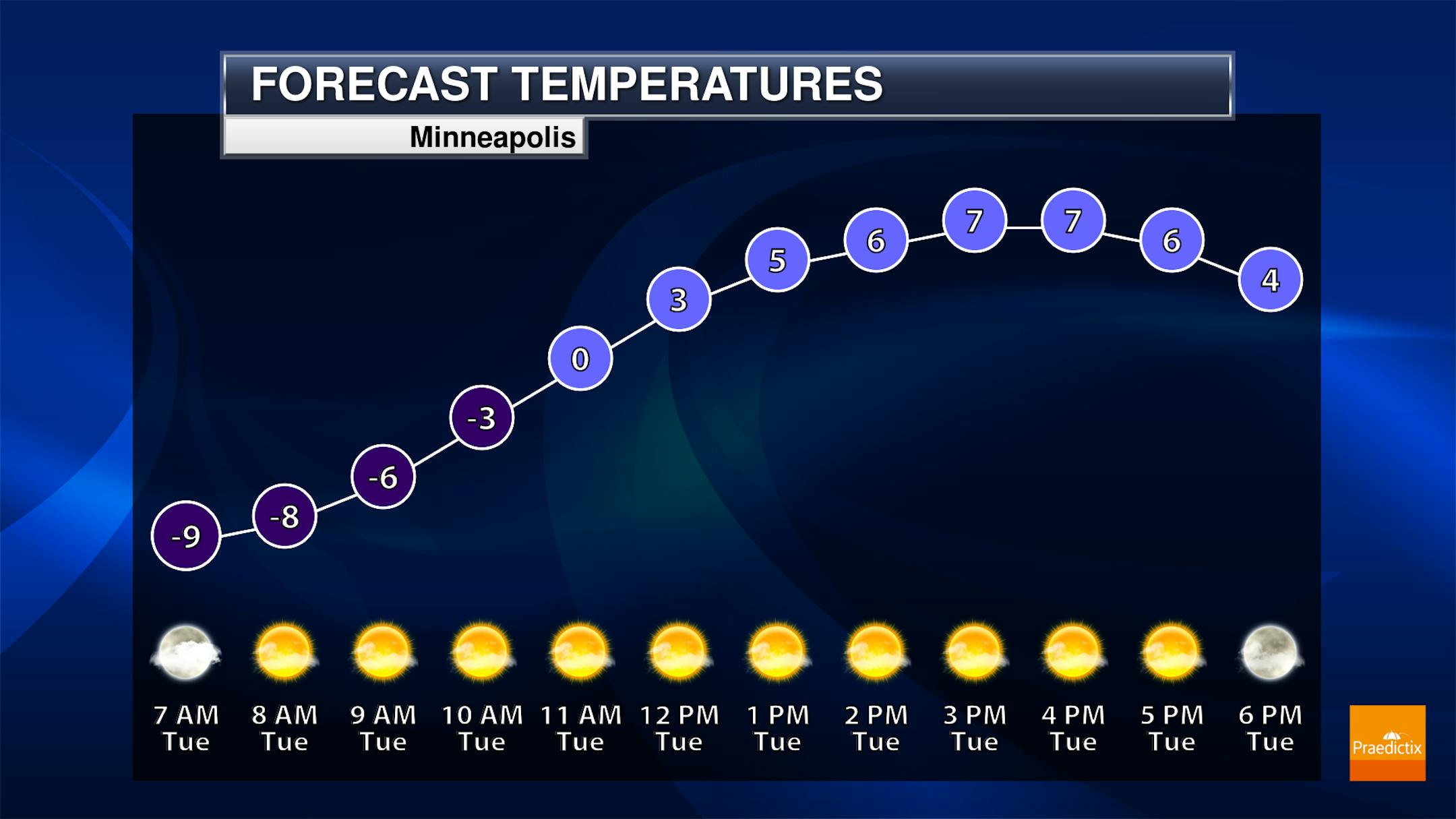
Tuesday Weather Outlook
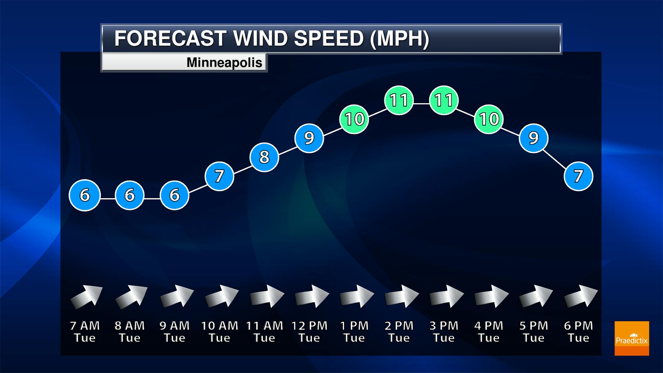
Here's the weather outlook for Minneapolis on Tuesday. It'll be another cold day with highs only warming into the single digits through the afternoon. Westerly winds at 5-10mph will keep wind chill values in the subzero range all day.
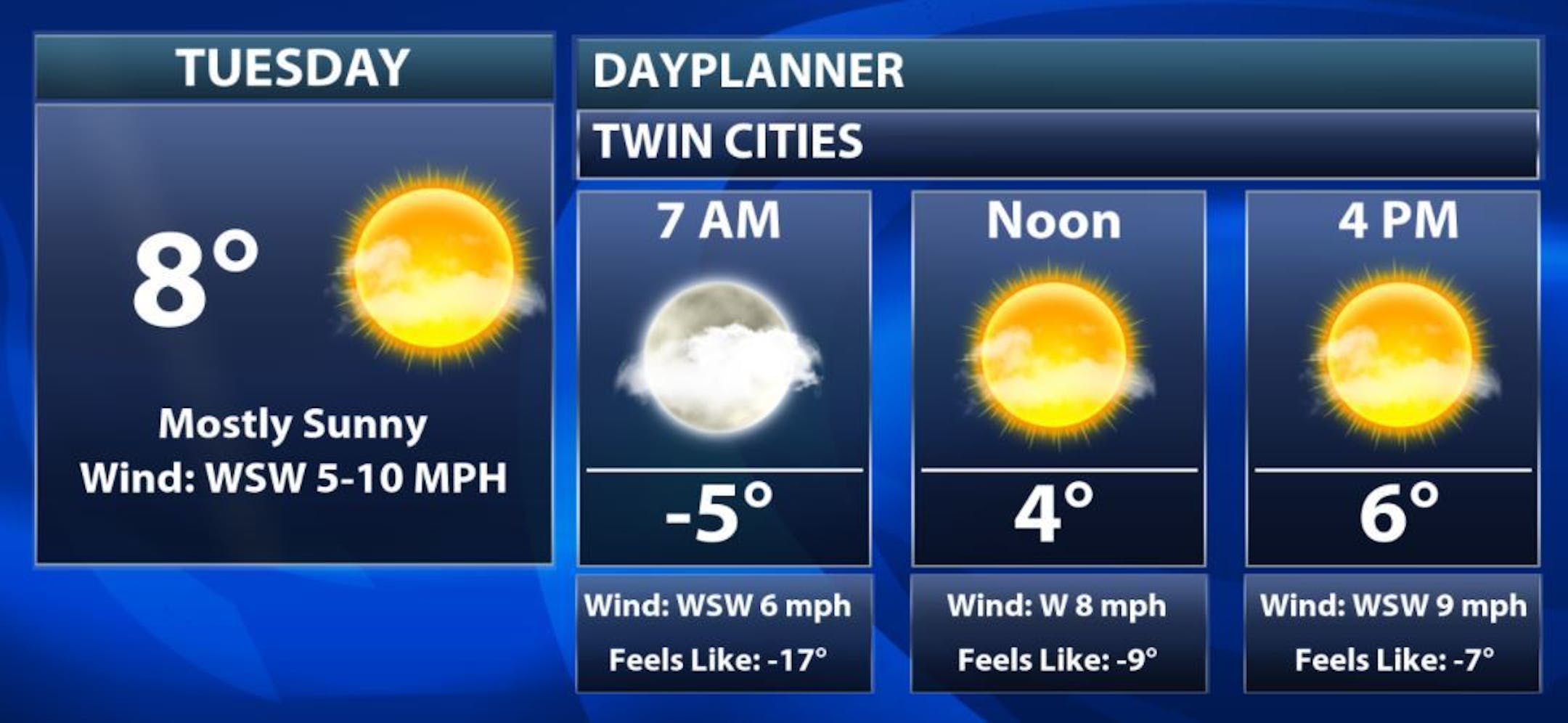
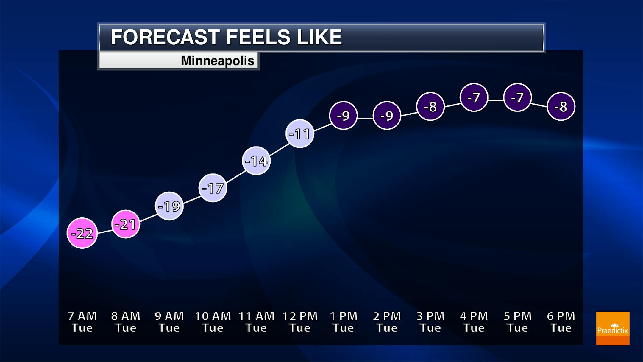
Tuesday Meteograms for Minneapolis
The meteograms the Minneapolis show bright, icy cold sunshine in place through the day Tuesday. Actual air temperature will warm above 0F, but westerly winds at 5-10mph through the day will keep wind chill values in the subzero range all day long. BRR!
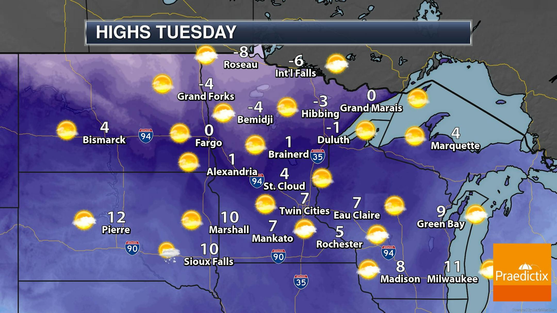
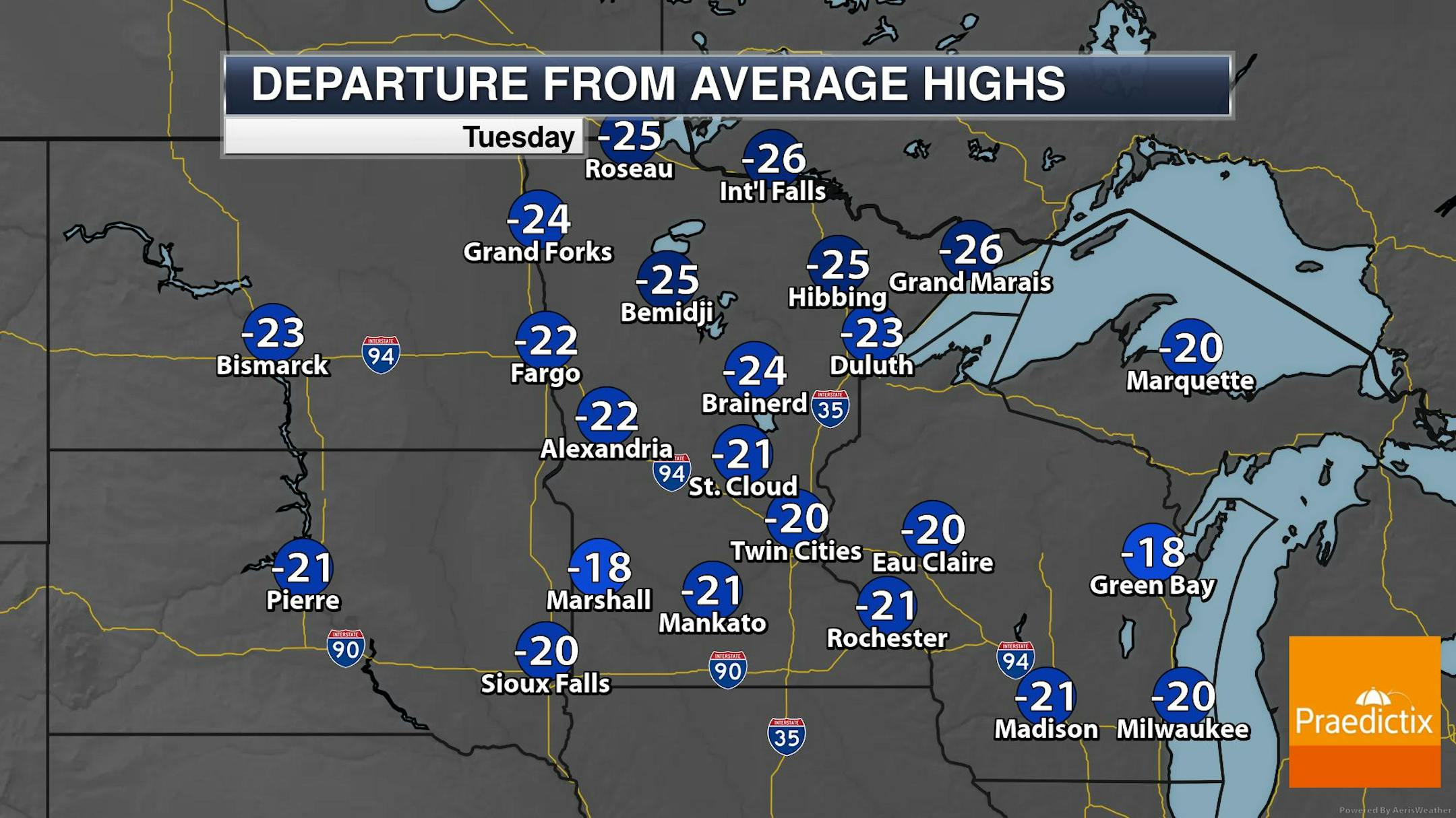
Tuesday Weather Outlook
Here's the weather outlook across the region for Tuesday, which shows temperatures running well below average. In fact, many locations will be nearly -20F to -25F below normal with some folks across northern MN staying below zero.
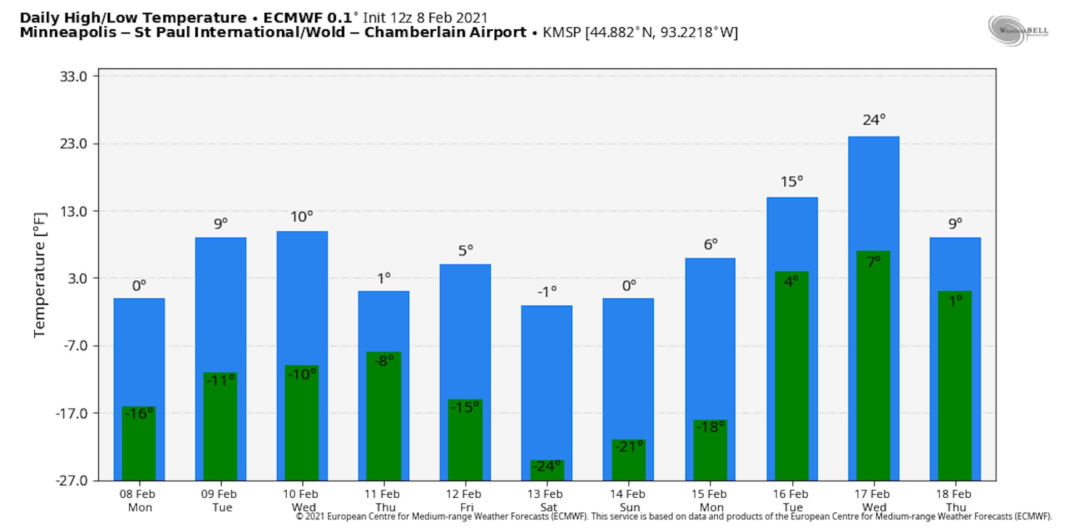
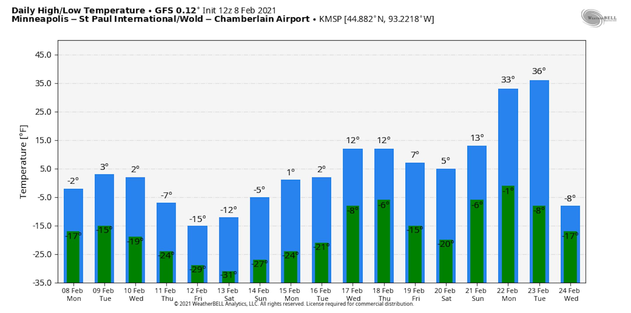
Extended Temperature Outlook
Here's the ECMWF & GFS extended temperature outlook for Minneapolis through the 3rd week of February. Note that temperature readings will still be running well below average through much of that time. The GFS is a little more aggressive with the cold (which I don't believe), while the ECMWF is more believable. Regardless, both models suggest the worst of the deep freeze will be over into the 3rd week of the month. Stay tuned...
Snow Potential Sails South of Minnesota
Here's the weather outlook from midday Tuesday to Midday Thursday, which shows fairly quiet weather close to home. Thanks to the extreme cold, the storm track has been pushed farther south, keeping most of the shovelable snow potential south of us until the foreseeable future.


