

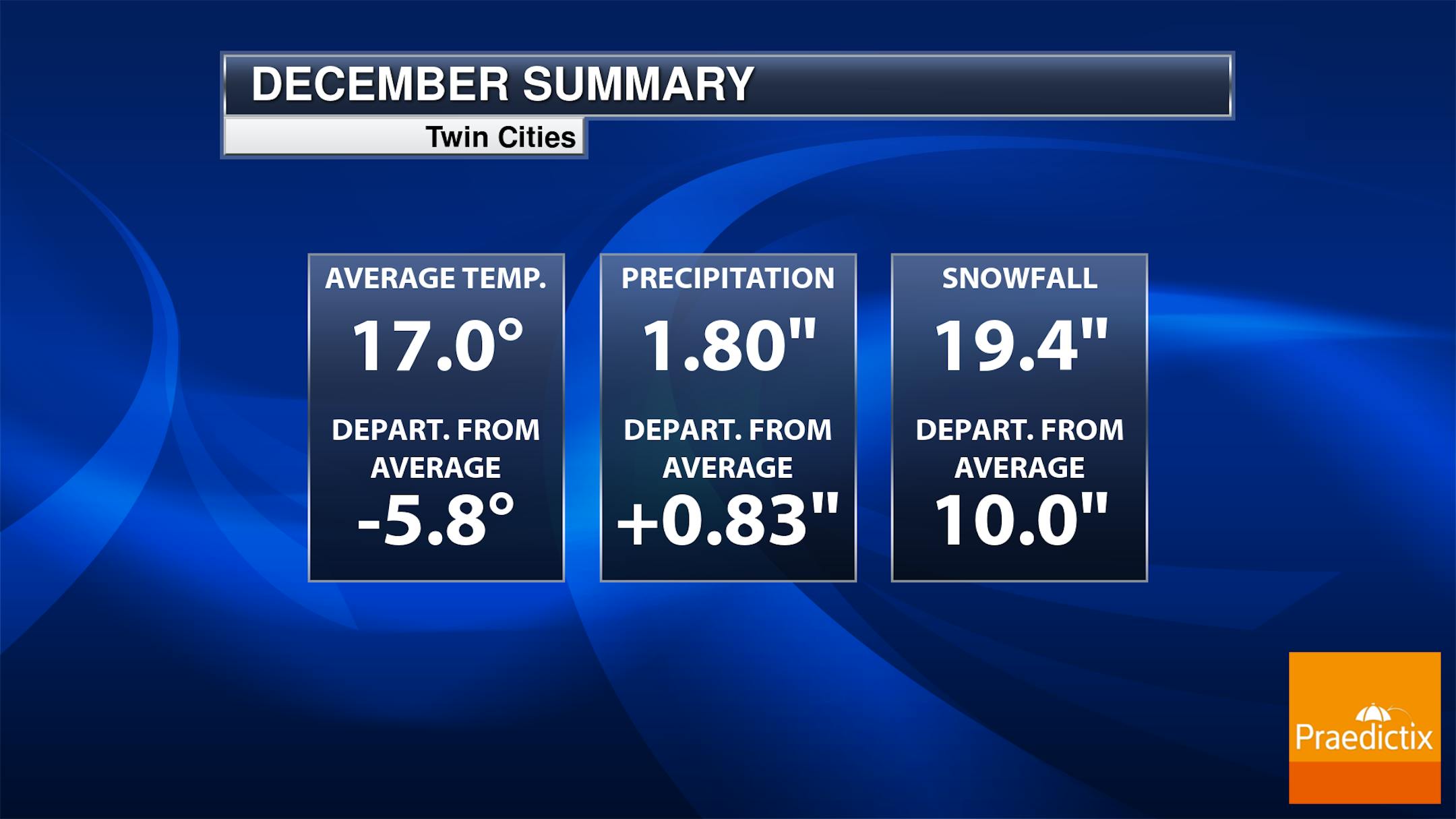
Twin Cities December Stats
December started on a very warm note, but thanks to much colder readings as of late, readings are running nearly -6F below average. Snowfall is +10" above average, which is the 11th snowiest start to any season on record
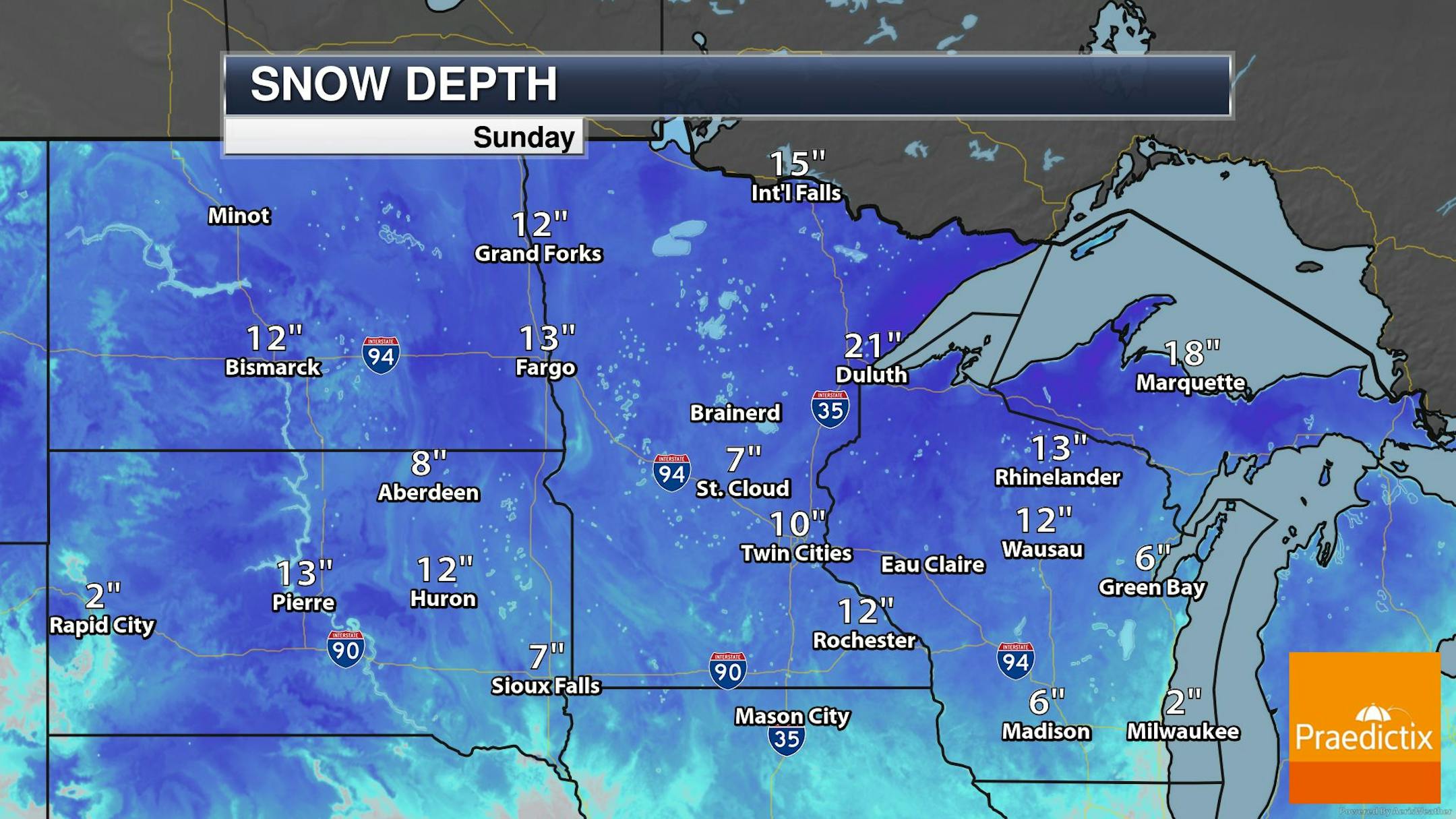
Snow Depth
Thanks to our latest storm system, many places are reporting deep snowpack across the region. The heaviest being found across the Dakotas through the northern half of Minnesota into Wisconsin and the UP of Michigan. Meanwhile, 10" of snow covered the ground in the at the MSP Airport over the weekend, which was the 10th greatest snow depth ever recorded on Christmas Eve in Minneapolis. Duluth is reporting a snow depth of 23", which was the 6th greatest snow depth on record for Christmas Eve.
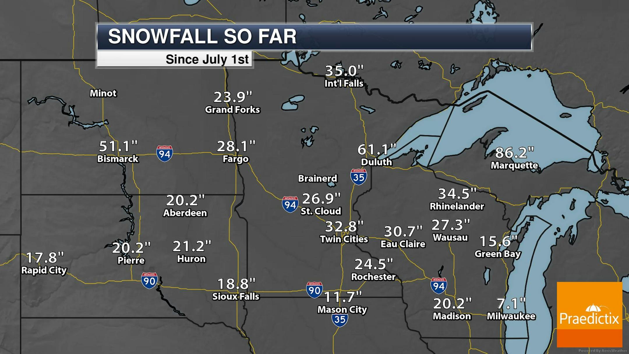
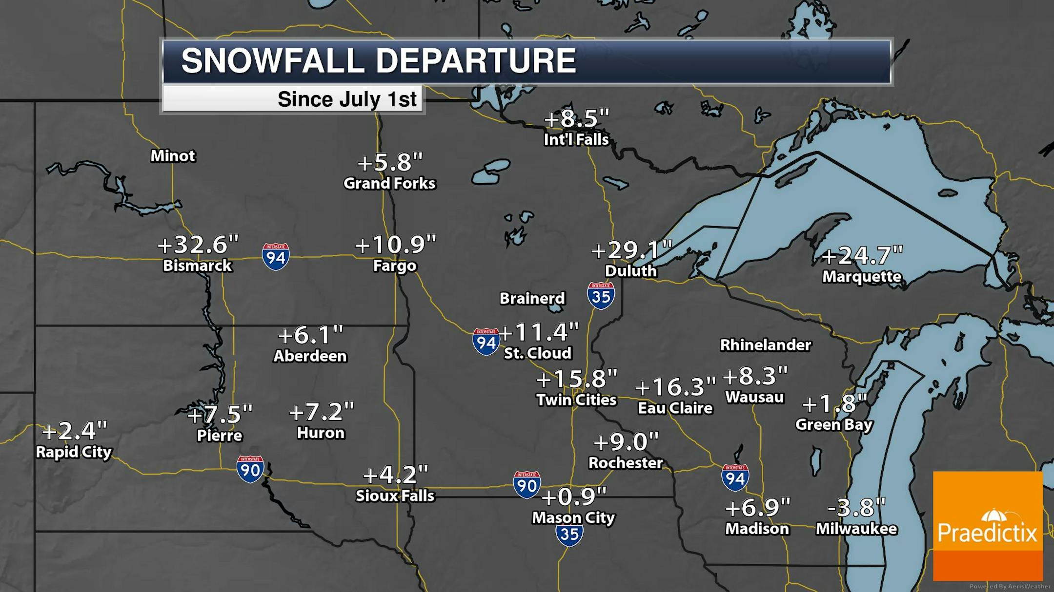
Snow So Far This December
Believe it or not, the Twin Cities has seen more than 19" of snow so far this December, which is nearly 10" above average. Interestingly, this has been the 9th snowiest start to any December on record in the Twin Cities. Incredibly, Duluth has seen more than 43" of snow this December, which is more than 28" above average and the 2nd snowiest start to any December on record.


Snowfall So Far This Season
The Twin Cities has seen nearly 33" of snow so far this season, which is more than 16" above average and good enough for the 7th snowiest start to any season on record. Meanwhile, Duluth has seen more than 61" of snow, nearly 30" above average and good enough for the 3rd snowiest start to any season on record.
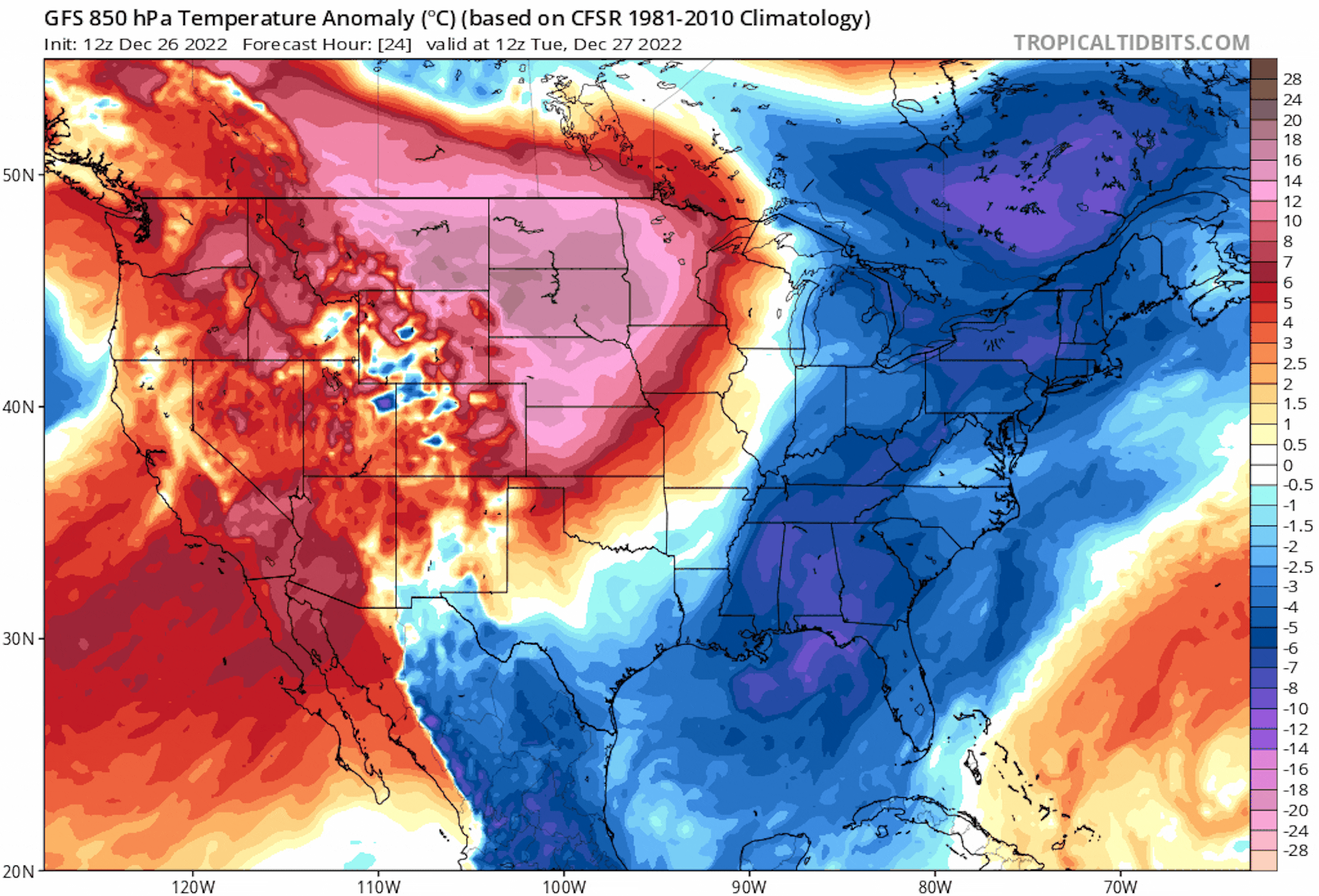
Warmer Week Ahead
The 850mb temperature trend through the upcoming weekend shows above average temperatures now moving into the eastern two-thirds of the nation. This will be much warmer that it was late last week and over the weekend.
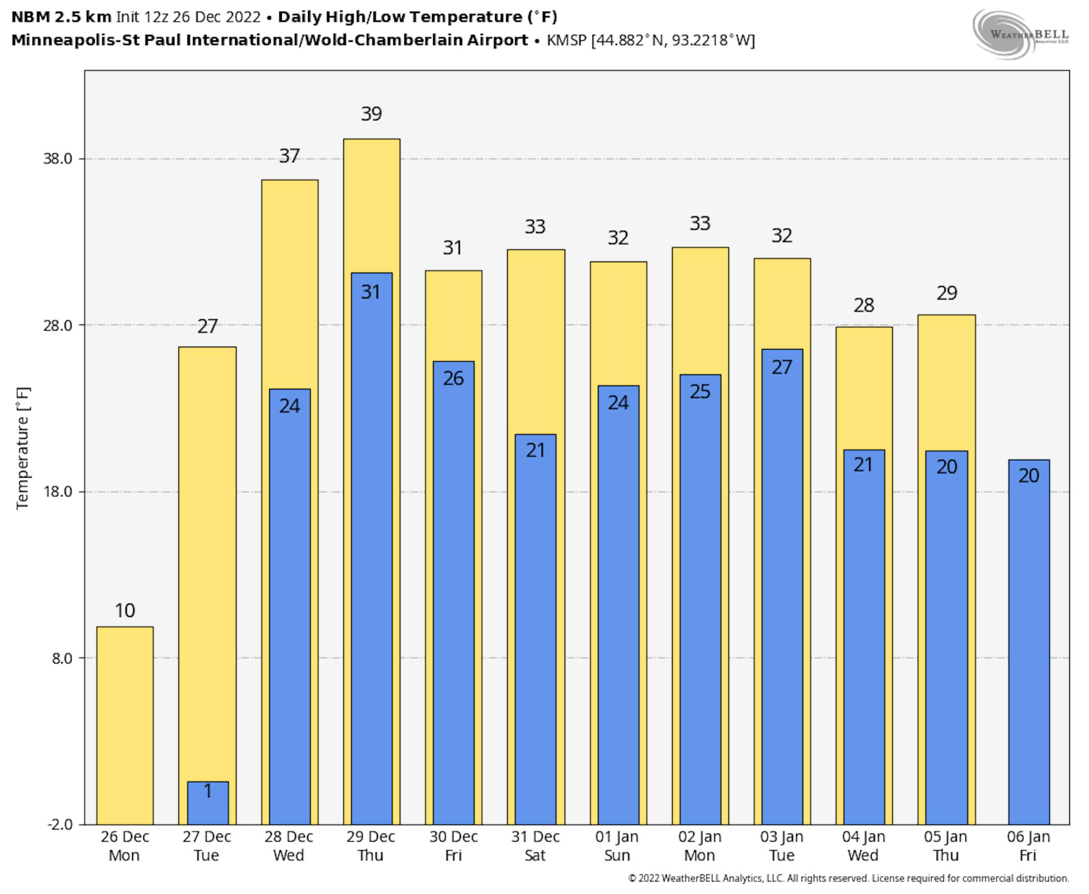
Extended Temperature Outlook
The extended temperature outlook for Minneapolis shows much warmer weather moving in as we approach midweek. There will be a stretch of milder weather that appears to hang around through the early part of January.
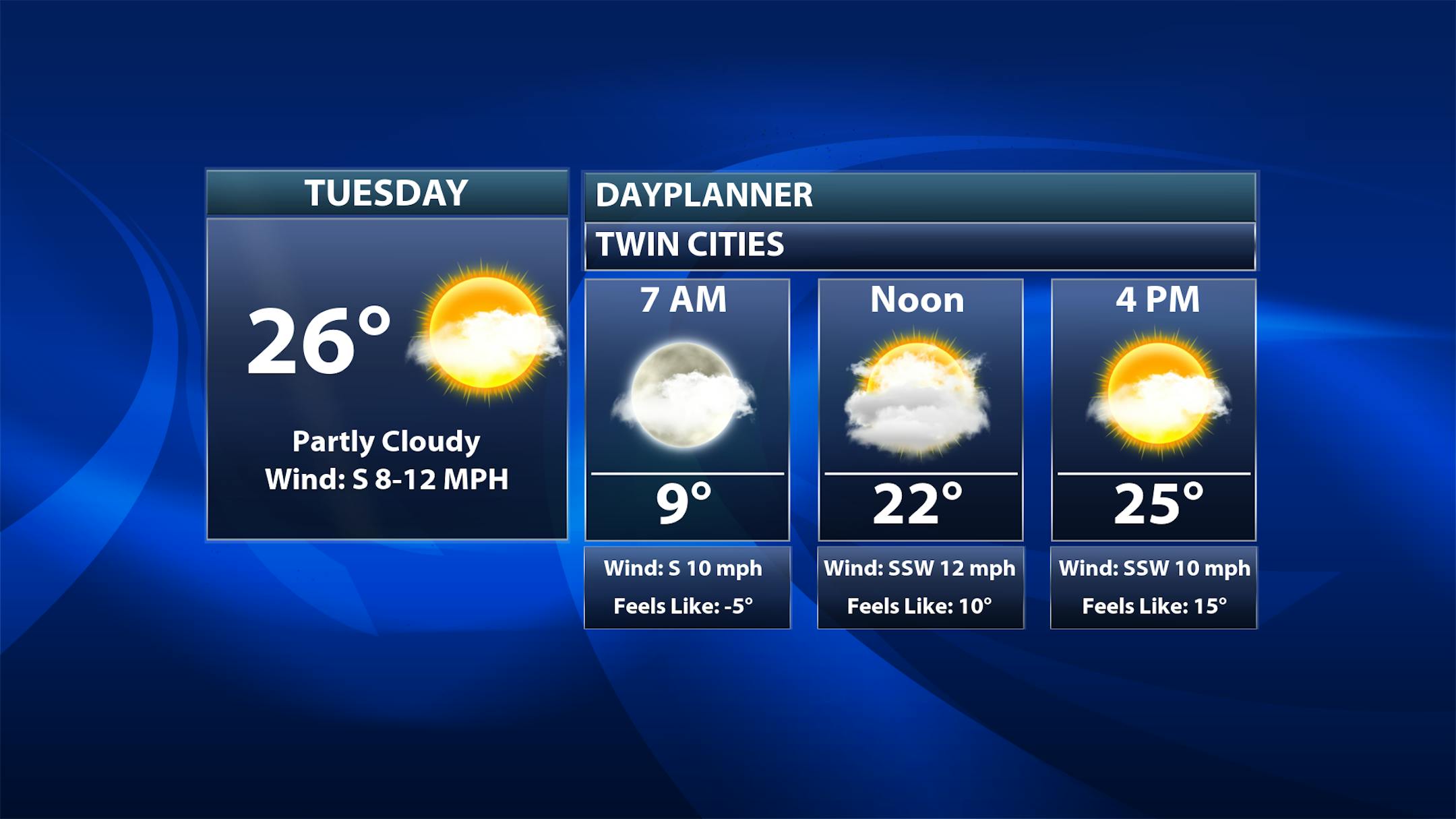
Twin Cities Weather Outlook For Tuesday
The Twin Cities on Tuesday, December 27th will be warmer than it has been over the last several days. Highs will warm into the mid 20s, which will close to average for the end of January.
Weather Outlook on Tuesday
Temps across the region on Tuesday will be closer to if not even slightly above average for this time of the year. Temps in the Western part of the state and in the Dakotas will be nearly +10F above average.


