
Spring Flood Updates
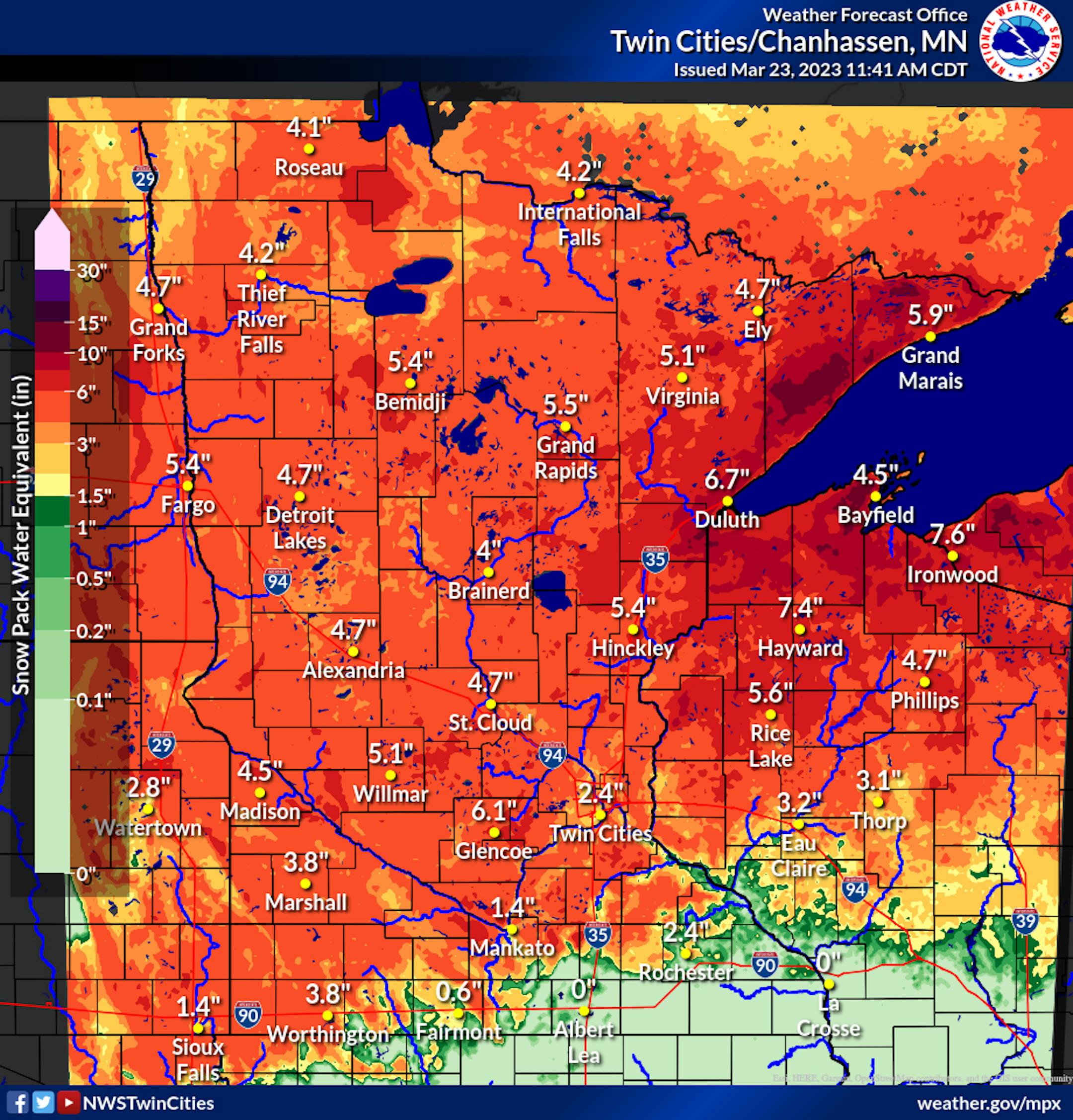
While the Spring flood threat will continue to depend on how fast we melt the above-average snowpack across the region, there continues to be a lot of water packed in that snow, with at least 2-6" of liquid locked in (thanks to not only the snow but rain that has fallen and become frozen in the snow).
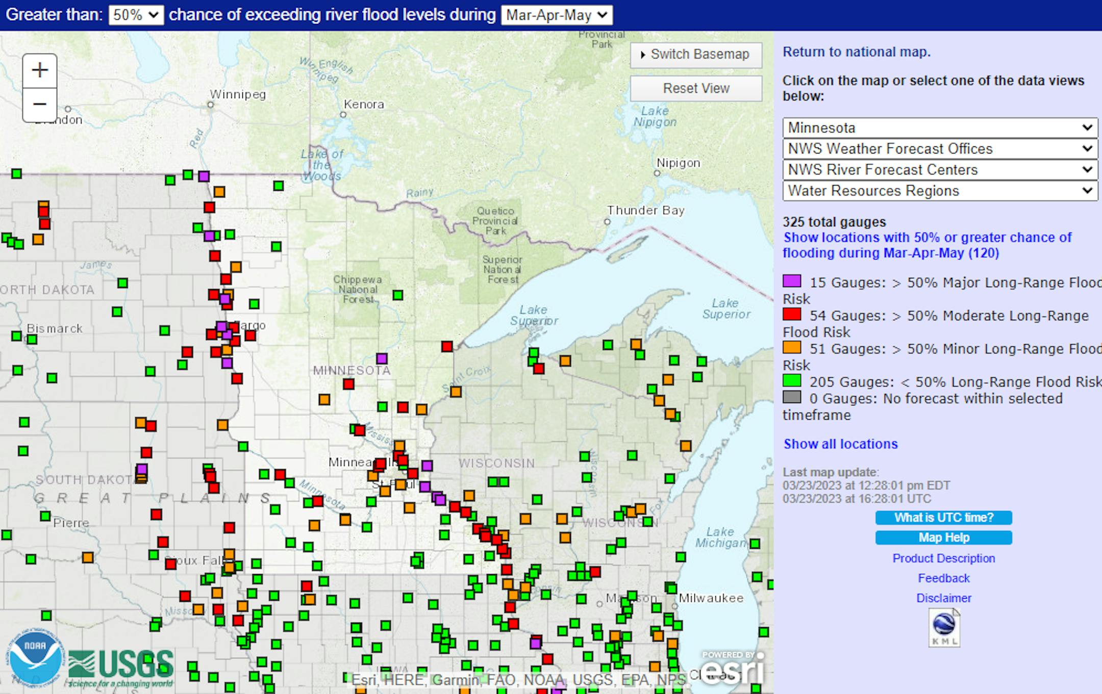
With all this liquid in the snow on the ground and recent increasing snow amounts in parts of northern Minnesota, the Spring flood risk remains high across the region. Portions of the Mississippi River could reach Major flood stage, along with the Red River. You can get the latest outlooks issued today from the following weather service offices: Twin Cities (covering central/southern MN), Duluth (northwest MN), Grand Forks (northeast MN/Red River Valley), and La Crosse (southeast MN).
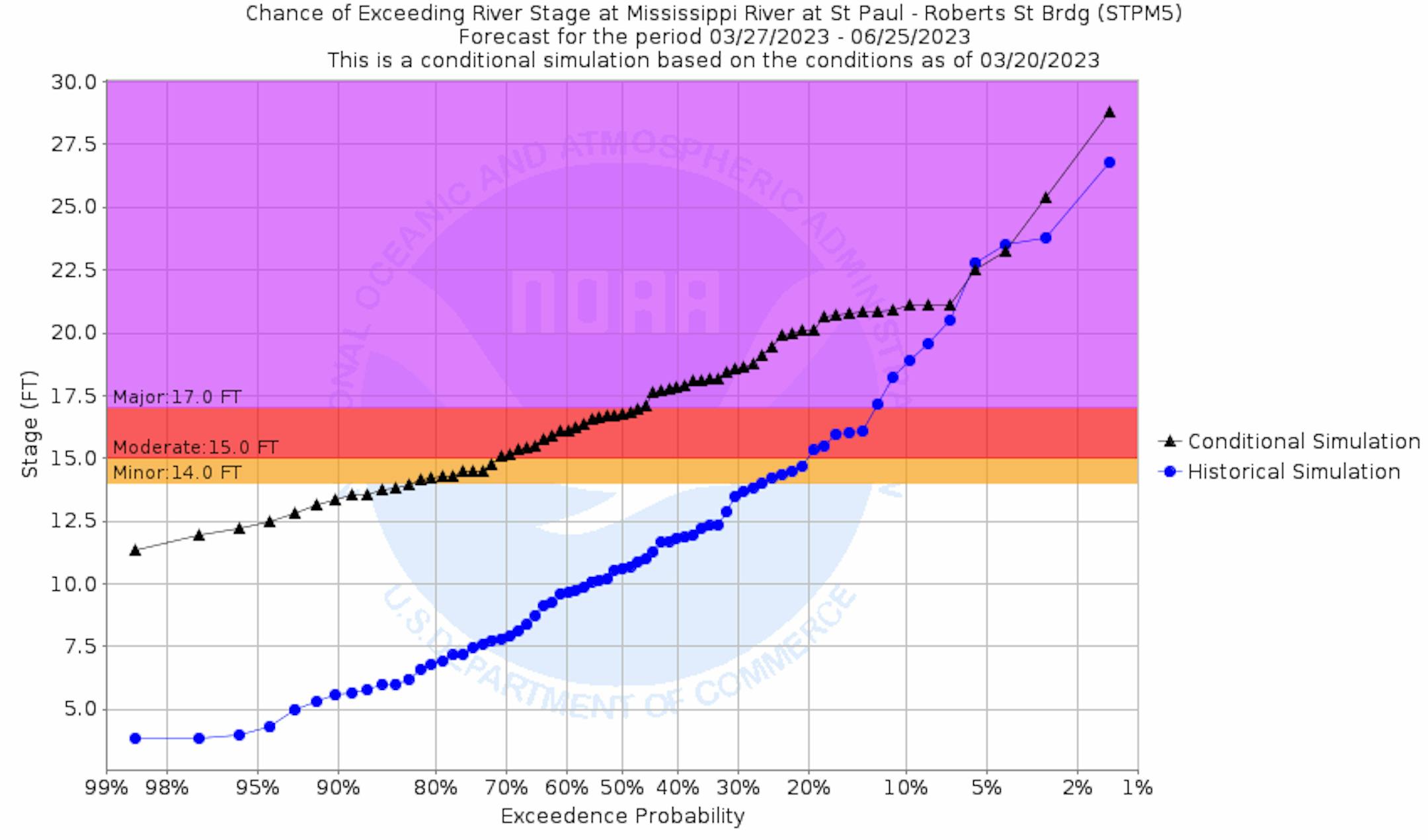
For the Mississippi River at St. Paul, there is just under a 50% chance that we will reach major flood stage and around a 70% chance of at least moderate flood stage.
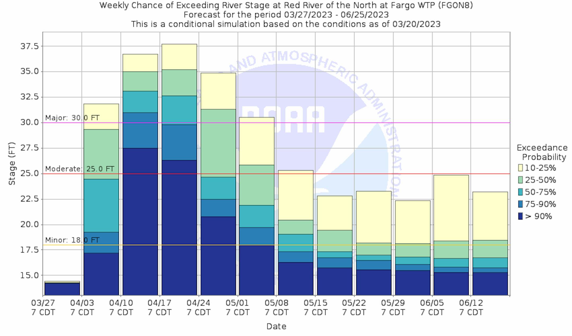
Looking at the Red River at Fargo, there is at least a 50% probability of exceeding major flood stage during the middle to end of April.
_______________________________________________
Snow Totals From The Middle Of The Week
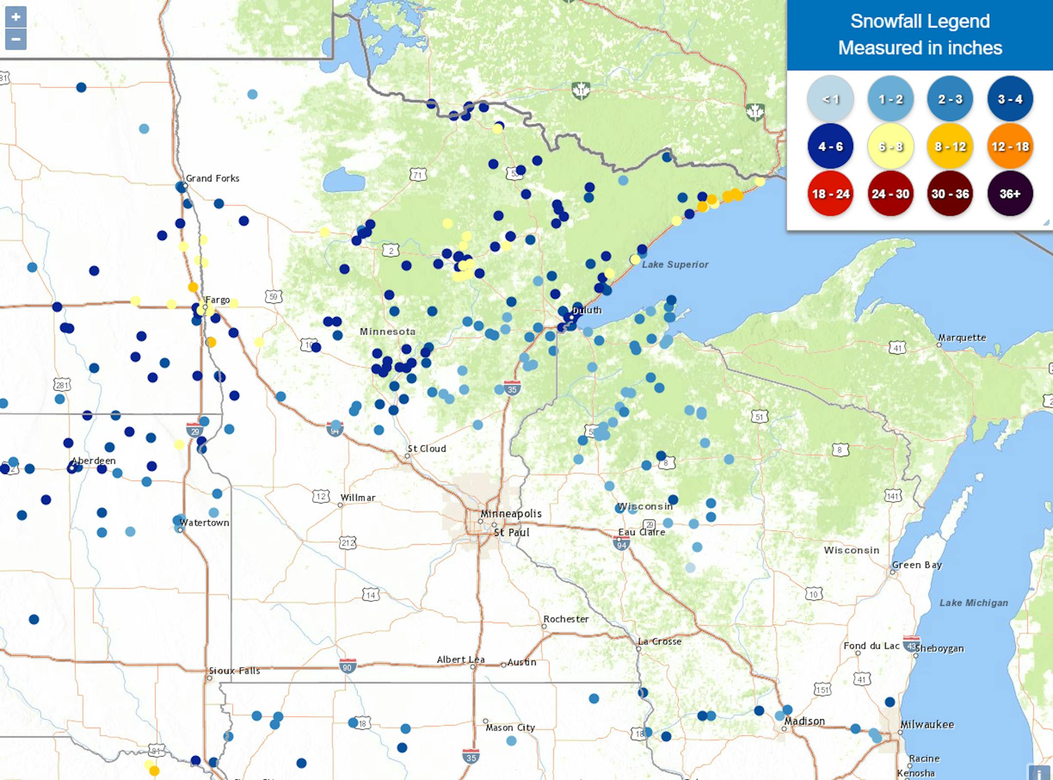
Here's a look at snow totals from the middle of the week, covering both the storm that impacted the state Tuesday into Tuesday Night, and the second that slid just south of Minnesota. With the first storm, the highest report was from Grand Marais where 10.1" of snow well. We also saw 8.2" near Hovland and 8" near Wolverton. With the second system, I did see a trace in Wykoff. That system brought 3.2" to De Soto, WI and 2" to Decorah, IA.
_______________________________________________
Pleasant, Sunny Friday!
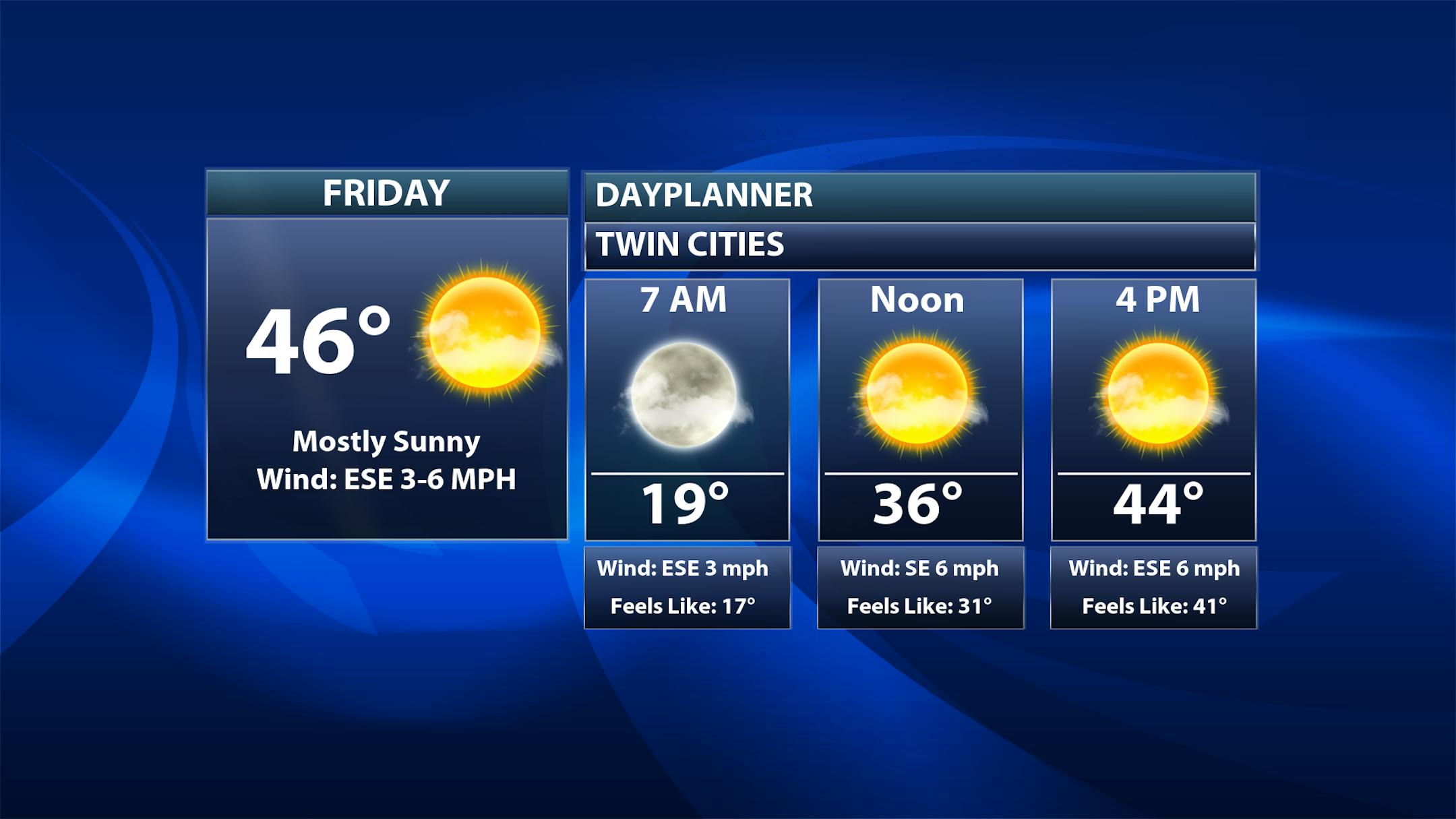
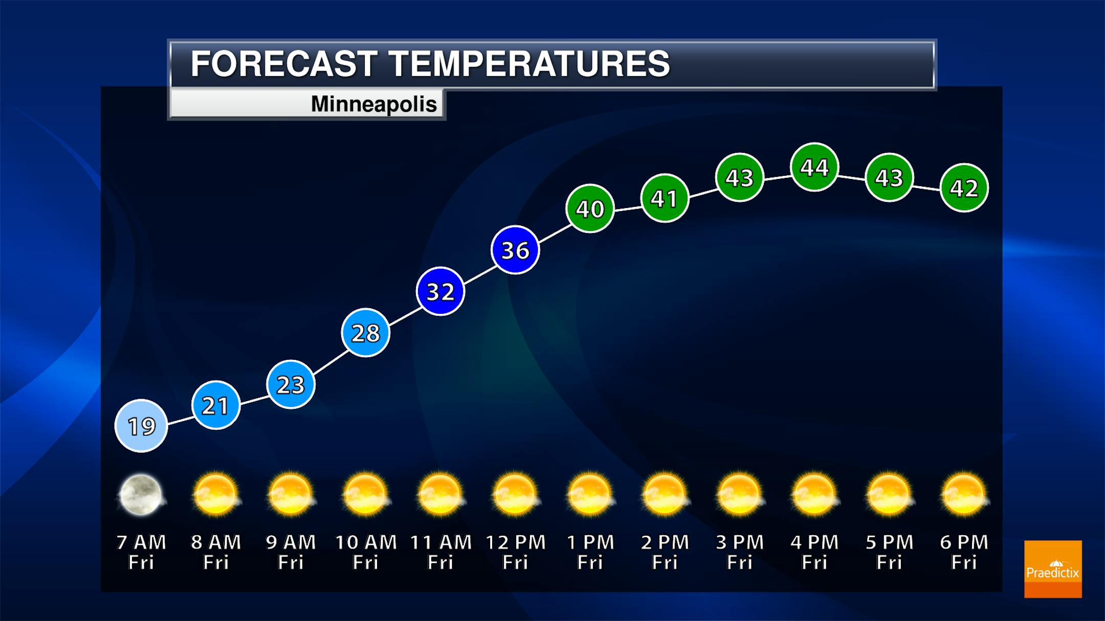
While we will start out with some fog in the metro Friday morning, that fog should quickly fade and we'll see mainly sunny skies as we head through the day. Clouds will start to increase during the evening hours. Morning temperatures will start off in the upper teens with highs in the mid-40s.


