

Dry Week Ahead - Storm Chance This Weekend
Here's the weather outlook from AM Wednesday to AM Monday. Warm & dry weather continues through the next few days before some isolated showers and storms arrive Friday & into the weekend. Cooler temps will filter in behind the front with readings down into the 60s and 70s by the weekend.
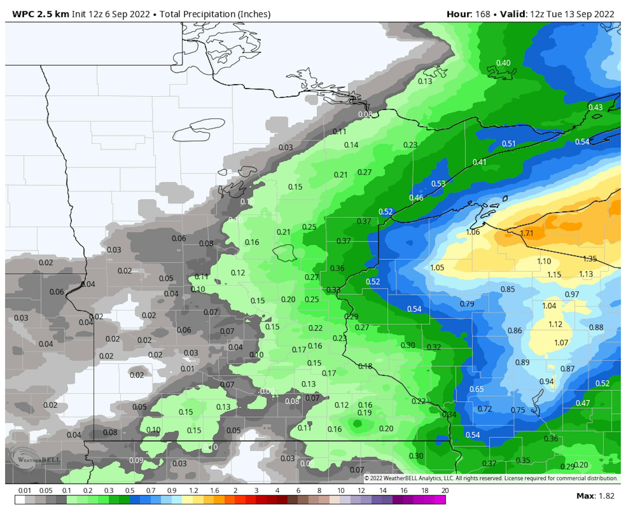
Extended Precipitation Outlook
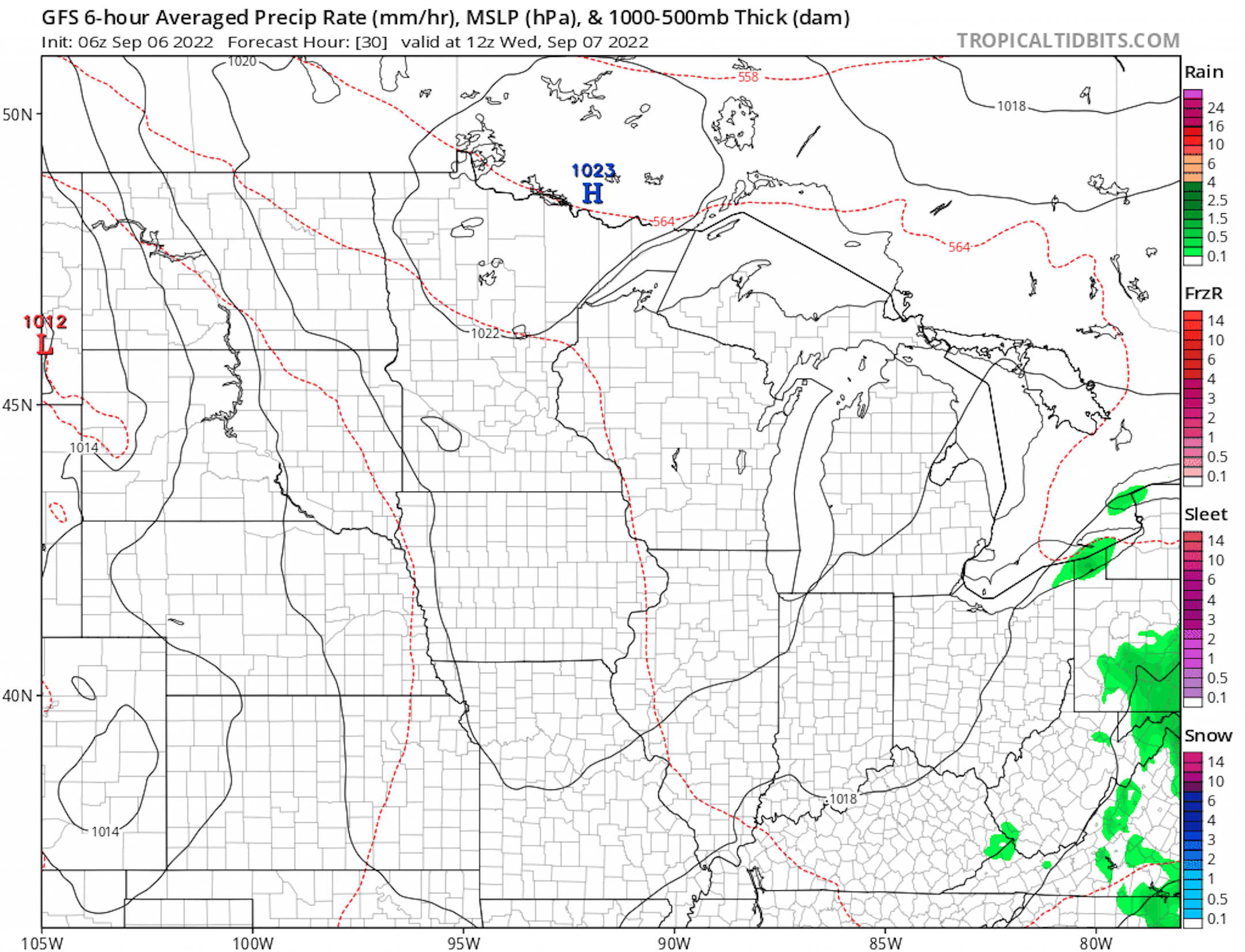
Dry weather continues through Thursday prior to a storm system moving in on Friday. Chances of showers and storms will be possible Friday into the weekend with the heaviest rain into Wisconsin.
Minnesota Drought Update
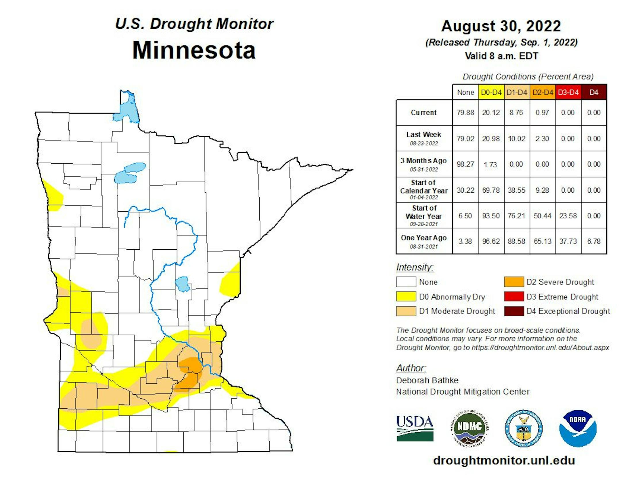
Here's the latest drought update across Minnesota. Thanks to a little more rain last week, severe drought has dwindled to less that 1%, but still encompasses a part of the metro. Moderate drought was at nearly 9%.
Weather Outlook on Wednesday
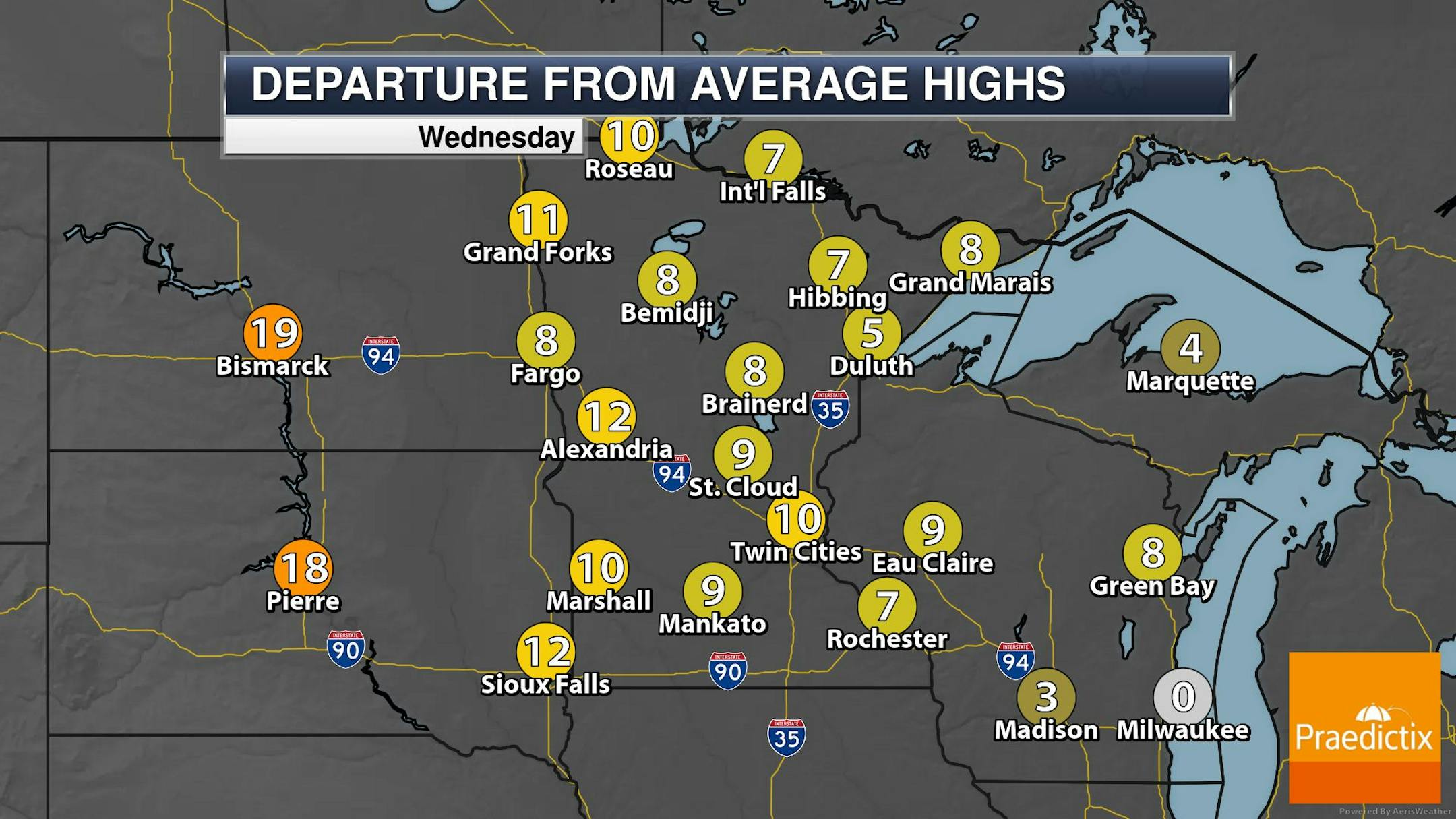
The weather outlook for Wednesday shows another warm & dry day across the region with readings warming into the 70s and 80s, which will be nearly +10F above average. Temps in the Dakotas will warm into the 90s to near 100F, which will be nearly +20F above average. Rapid City, SD could warm into the low 100s and possibly near record levels.
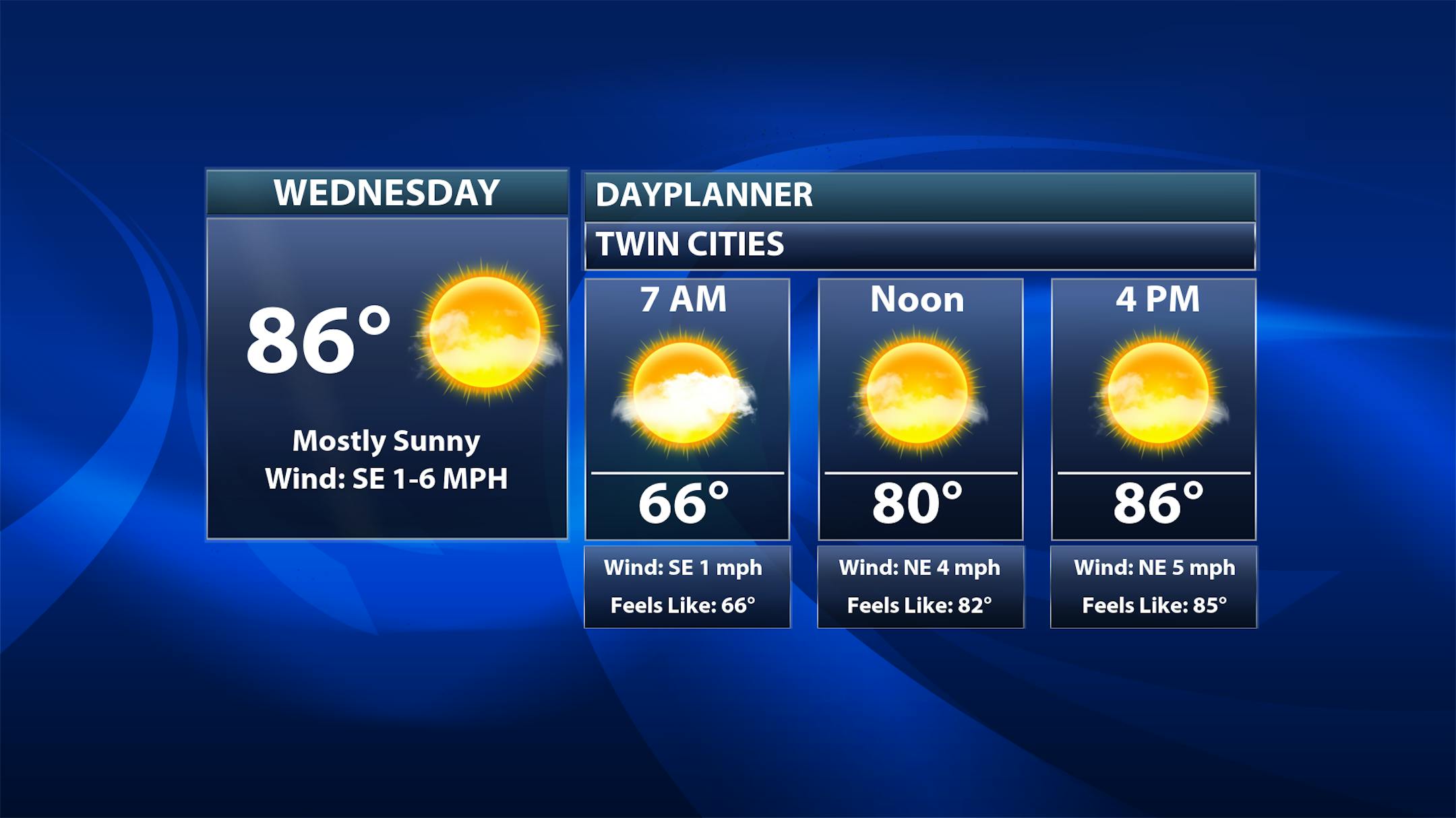
Weather Outlook Wednesday
The weather outlook for Minneapolis on Wednesday shows temps warming into the mid 80s in the afternoon with mostly sunny skies.
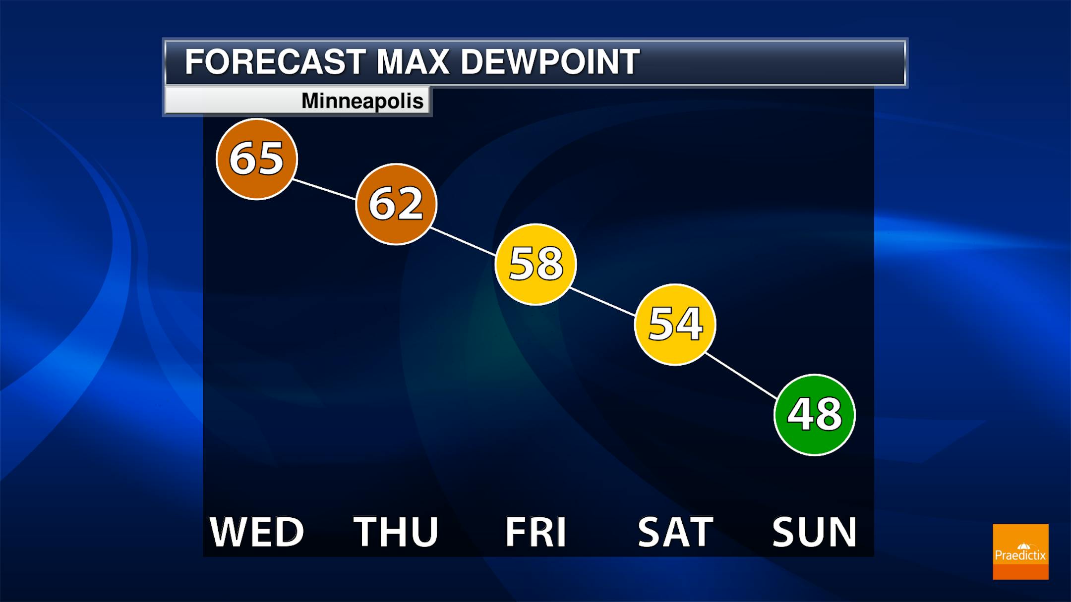
A Bit Sticky This Week
Dewpoints will still be quite sticky Wednesday & Thursday before less humid weather filters in late week and into the weekend ahead. Dewpoints could dip into the 40s by Sunday, which will feel quite fall-like!
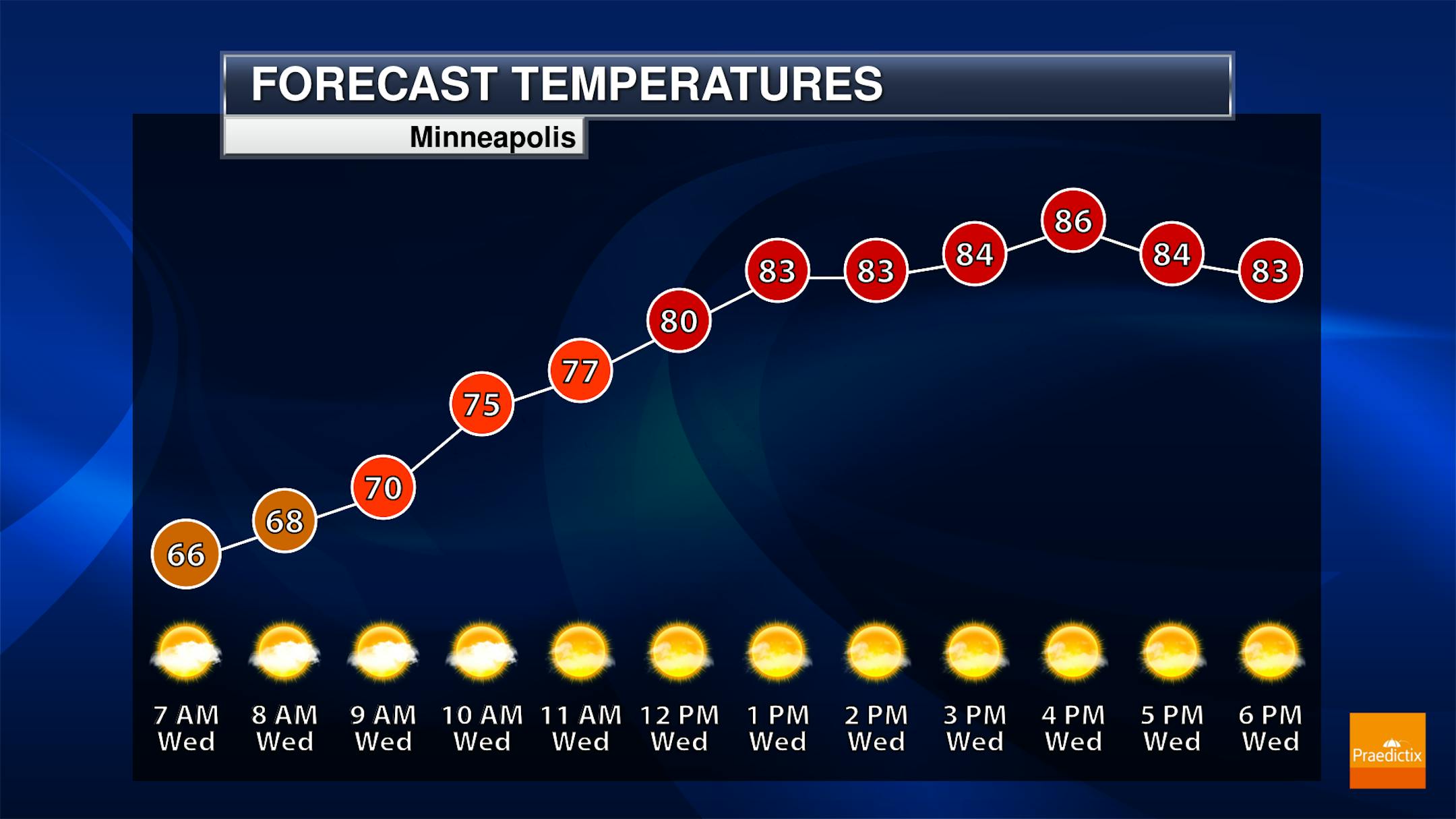
Meteograms for Minneapolis
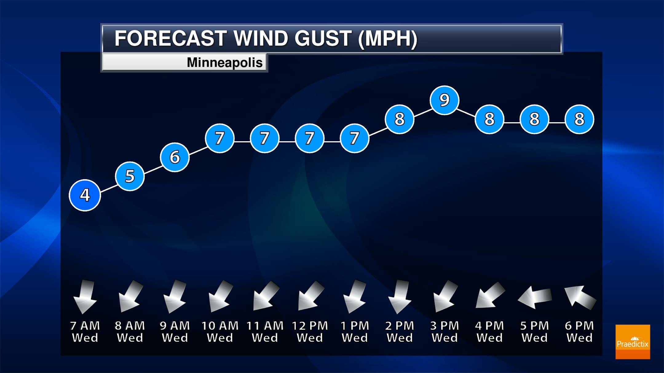
The hourly forecast for Minneapolis on Wednesday shows temperatures starting in the mid 60s and warming into the mid 80s by the afternoon. It'll be another sunny day with northerly winds around 10mph.
Extended Temperature Outlook For Minneapolis
The extended temperature outlook for Minneapolis shows temps running well above average. Wednesday & Thursday will be the hottest days with highs in the mid/upper 80s to near 90F. Temps will be MUCH cooler Friday and into the weekend with highs only in the 60s and 70s, which will actually be a little cooler than average.


