

Severe Storms Potential Sunday Night
Forecast radar loop: 7 PM Sunday to 7 AM Monday.
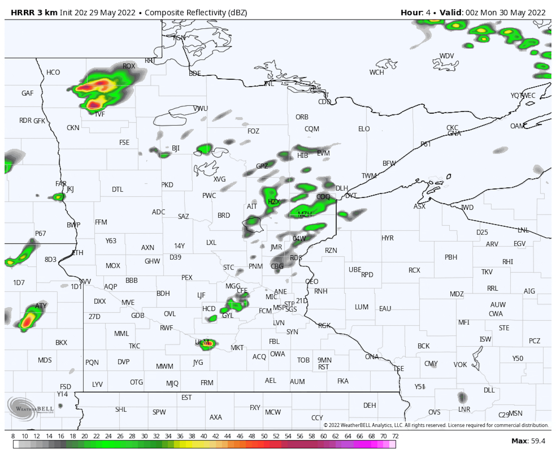
As we look at the rest of Sunday, we will be watching the potential for ongoing showers and storms across portions of northern Minnesota early Sunday evening (with strong storms in northwestern Minnesota), but storms will be starting to form out to the southwest that will eventually work their way up toward central Minnesota and the metro as we head through the evening and overnight hours.
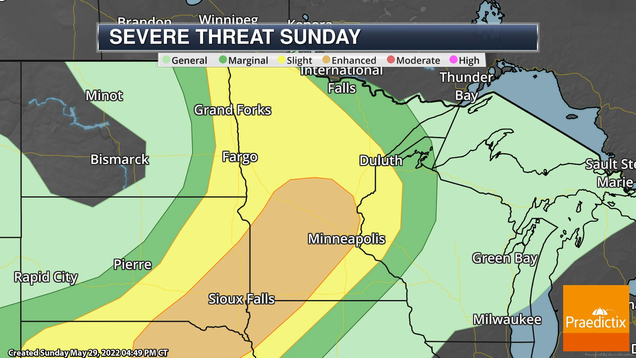
For those storms into Sunday Night, an Enhanced Risk of severe weather (threat level 3 of 5) is in place from central Nebraska stretching into central Minnesota, including into the Twin Cities. The highest potential of large hail will be across southwestern Minnesota, with the damaging wind threat stretching into central Minnesota and the Twin Cities. A few isolated tornadoes could also be possible, mainly southwest of the Twin Cities out toward southwestern Minnesota.
_______________________________________________
Moderate Severe Storm Risk For Memorial Day
Radar forecast loop: 7 AM Monday to 7 AM Tuesday
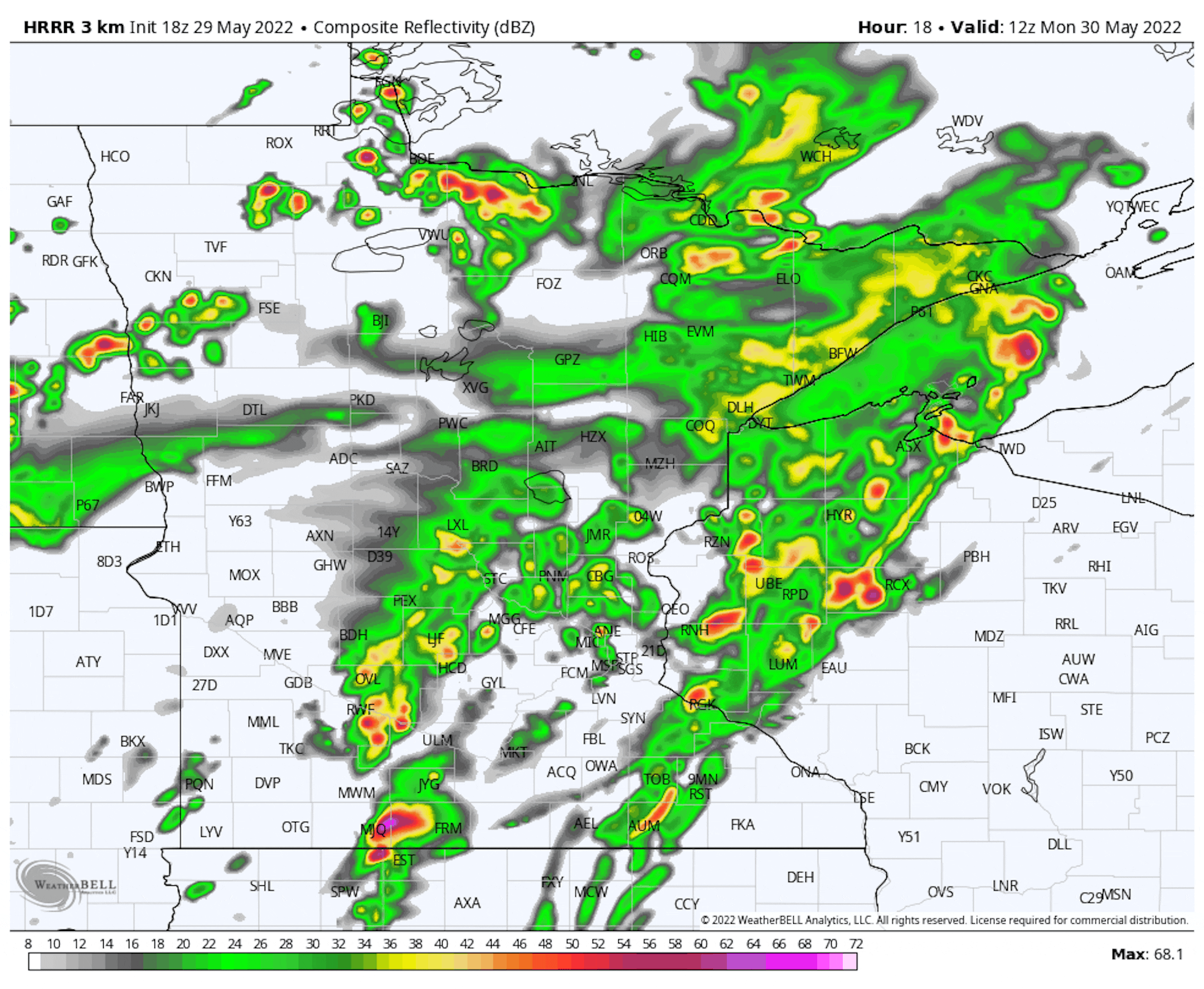
It wouldn't be a holiday without some interesting weather, right? As an area of low pressure slowly moves northward across the Dakotas on Monday, we will watch showers and storms. While some showers and isolated storms will be possible through the morning and afternoon hours, the storm chances increase later in the day out in the eastern Dakotas and western Minnesota near and along the cold front and triple-point area (where the low pressure meets the cold and warm fronts) that will drive across Minnesota as we head through the evening and overnight hours. Storms back in western Minnesota and into the eastern Dakotas will be capable of very large hail (2"+ in diameter) and the potential of strong, long-tracked tornadoes earlier on in storm formation, especially if storms can stay individual. As these storms work farther east, damaging wind gusts to 80 mph will be possible.

For portions of western Minnesota - west of the St. Cloud area, including Willmar, Fergus Falls, Marshall, and Alexandria - we are watching a Moderate Risk of severe weather (threat level 4 of 5) on Memorial Day. The areas under the Moderate Risk have the highest potential of seeing those individual storms capable of strong tornadoes. A chunk of the rest of the state is under an Enhanced Risk of severe weather (threat level 3 of 5), which just nudges into portions of the western metro. We will watch the potential of large to very large hail, wind gusts to 80 mph, and several tornadoes across the rest of the severe threat area.
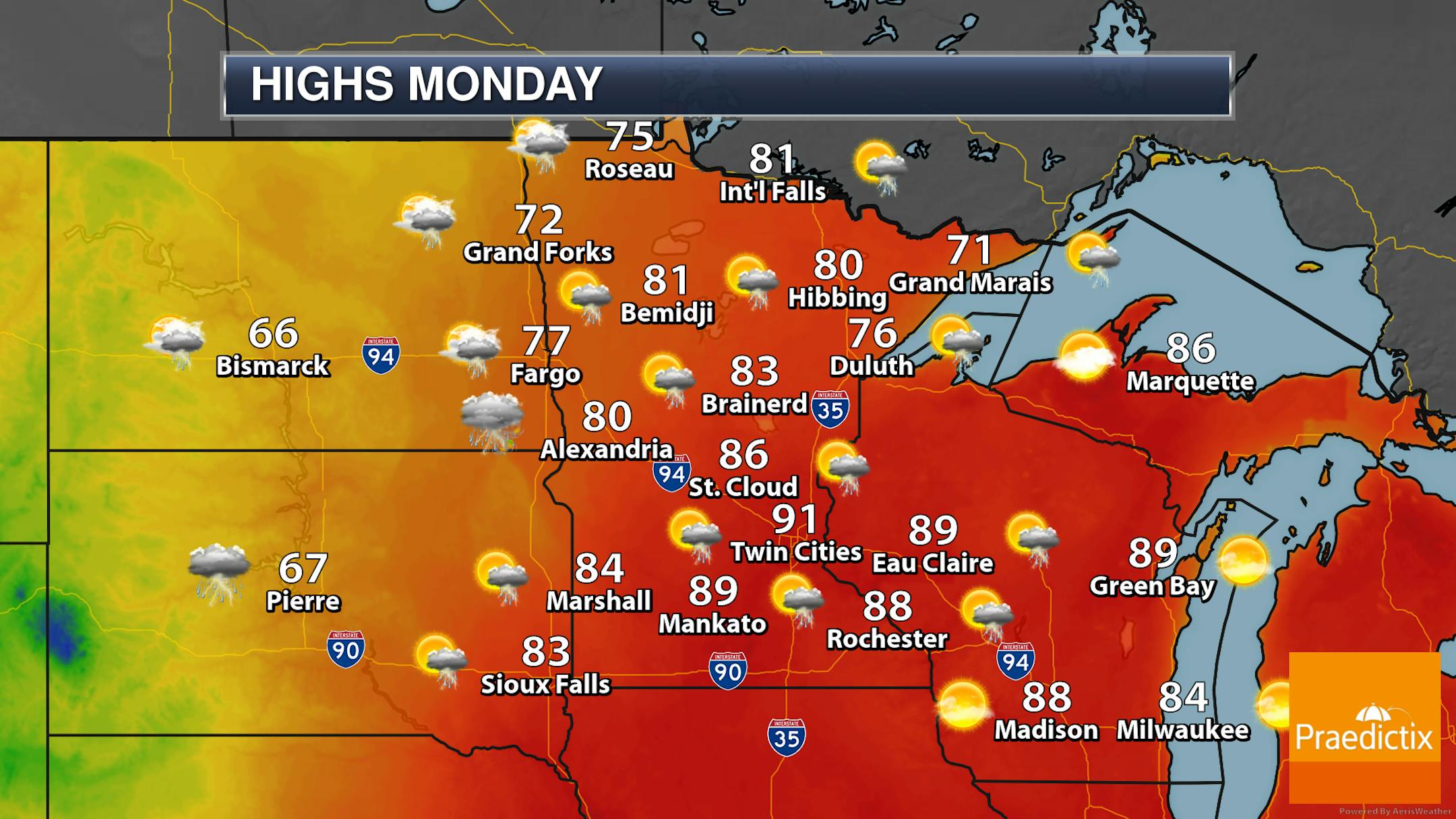
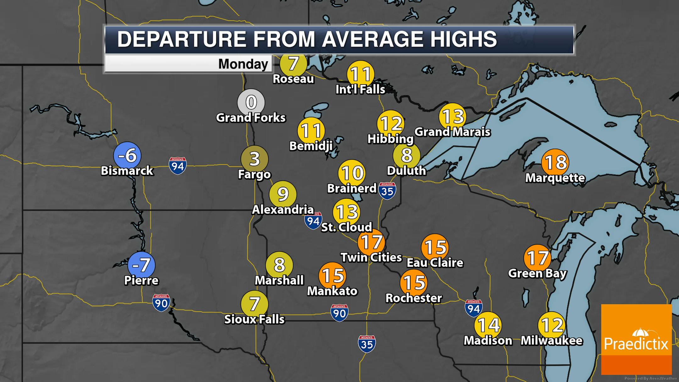
With that severe threat in place, we will watch the chance of showers and storms across the state on Memorial Day Monday. It won't be an all-day washout with the best chance of rain occurring in the afternoon hours through the overnight. Highs will range from the 70s in northern Minnesota to near 90F in southern parts of the state.


