
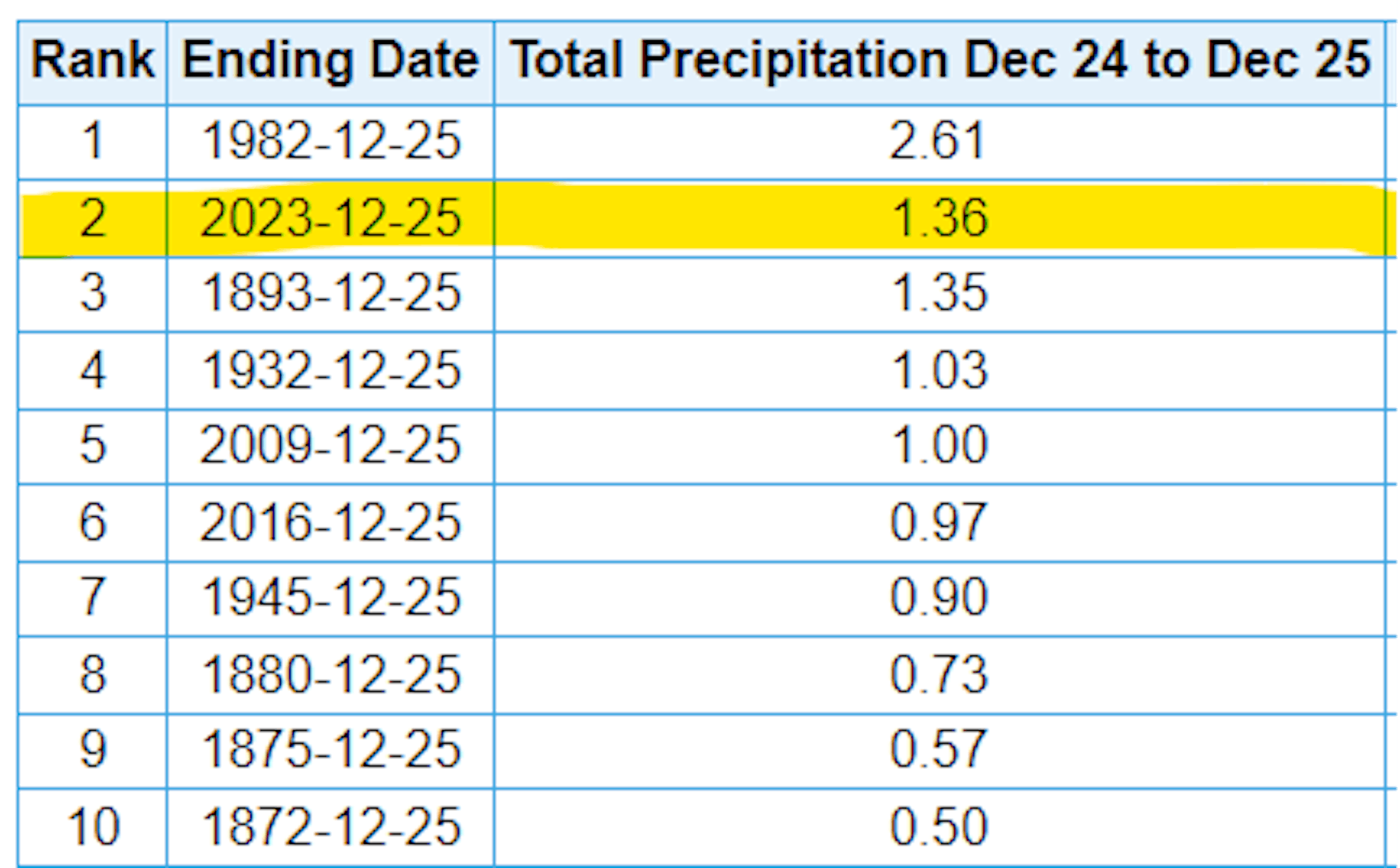
2nd Wettest Christmas Eve Through Christmas Day on Record at MSP
Here are the top 10 wettest Christmas Eves through Christmas Days on record at MSP. Note that in 1982 we had 2.61" of liquid that fell in the metro and the next wettest was in 1893 when 1.35" of liquid fell. The most recent wettest was in 2009 when 1.00" of liquid fell.
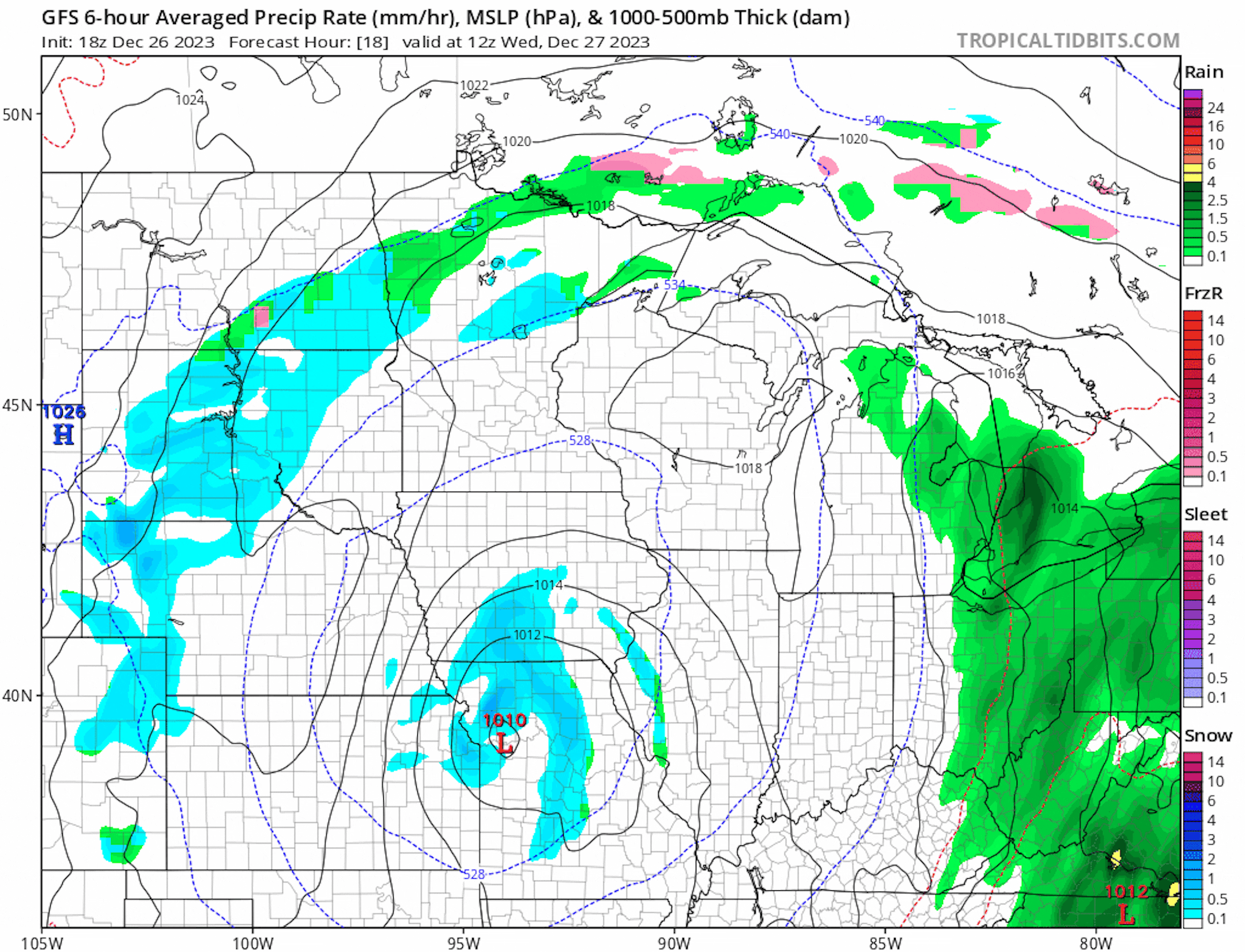
Rain & Wintry Precipitation Ends
A long duration storm system will eventually end through midweek as steady rains turn to a light rain/snow mix across parts of the region.
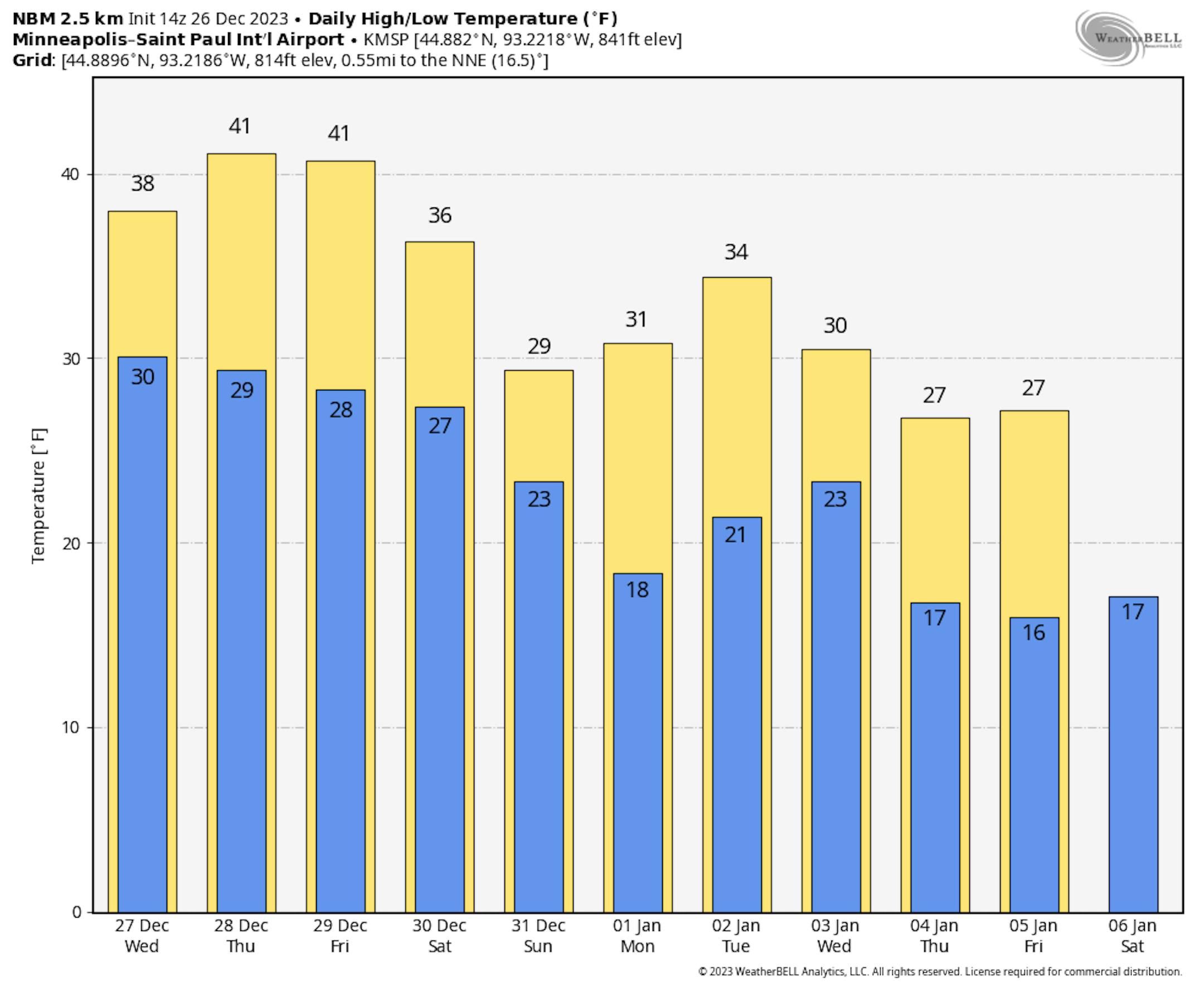
Temperature Outlook For Minneapolis
Temperatures over the next few days will be well above average. We'll see a bit of a cool down into next week with highs hovering around the freezing mark around New Year's Day, which is still above average for this time of the year.
"A Historically Warm and Snowless December in Minnesota"
"December 2023 has been more like November in Minnesota, with bare ground dominating the landscape across the state for much or all of the month, and temperatures remaining mild with a few bouts of very warm weather. Strong El Niño conditions in the Pacific Ocean have kept frigid winter air masses locked up in central and northern Canada, 1,000 to 2,000 miles to our north. Most days have been much warmer than average, and passing cold fronts have struggled to bring in anything other than seasonally-normal air. The lack of snow cover has boosted temperatures further, because bare ground absorbs sunlight and warms the air above it 10-20 times more effectively than fresh snow. Snow cover during winter is a classical climatic "feedback," because snowy ground keeps temperatures lower, making precipitation more likely to fall as snow, which reinforces or deepens the cooling. A lack of snow cover allows temperatures to rise more readily, making rain more likely."

Accumulated Winter Season Severity Index (AWSSI)
"Winter seasons have significant societal impacts across all sectors ranging from direct human health and mortality to commerce, transportation, and education. The question "How severe was this winter?" does not have a simple answer. At the very least, the severity of a winter is related to the intensity and persistence of cold weather, the amount of snow, and the amount and persistence of snow on the ground. The Accumulated Winter Season Severity Index (AWSSI) was developed to objectively quantify and describe the relative severity of the winter season."
It's probably no surprise, but most locations around the Midwest and Great Lakes have had a "Mild" winter so far. This by the way doesn't look to be changing anytime soon with milder than average temperatures continuing and very little snow in the forecast. Again, we're still waiting for the other boot to drop, but being in an El Nino setup, a winter like last year is not really in the cards. The Midwest will likely see an overall warmer and less snowy winter.


