
Cooling Down Late Next Week
Here's the 850mb temp anomaly from Sunday to Saturday of next weekend. Temps appear to be fairly warm through Tuesday, but there appears to be a decent cooldown as we get to Wednesday and beyond. Temps later in the week will likely be below average for many.

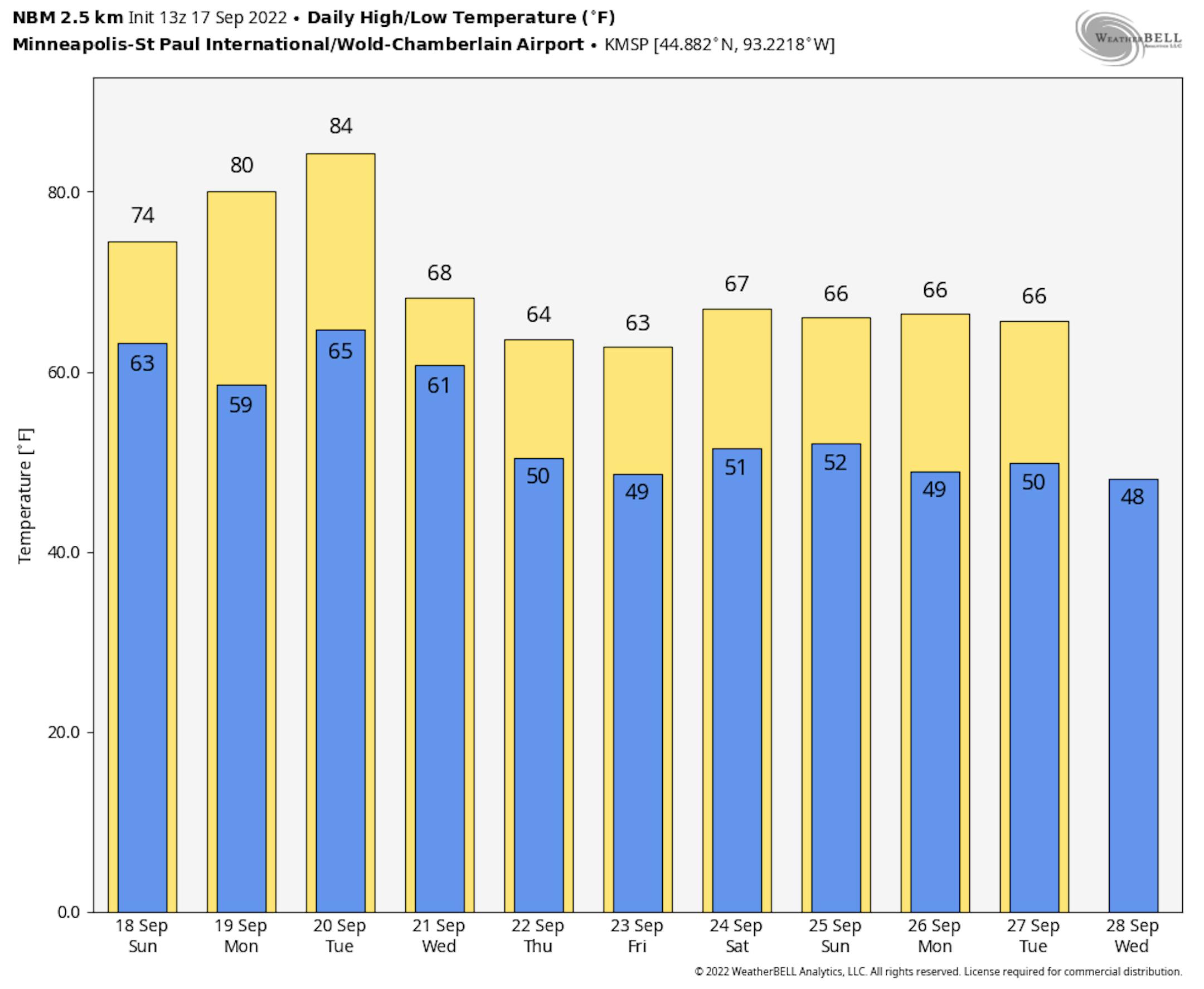
Extended Temperature Outlook
Here's the NBM extended temperature forecast for Minneapolis, which shows mild temps in place through Tuesday before the bottom falls out a bit later in the week with highs only warming into the 60s. It also appears that we could see an extended period of cooler temps into the last week of September. Stay tuned!
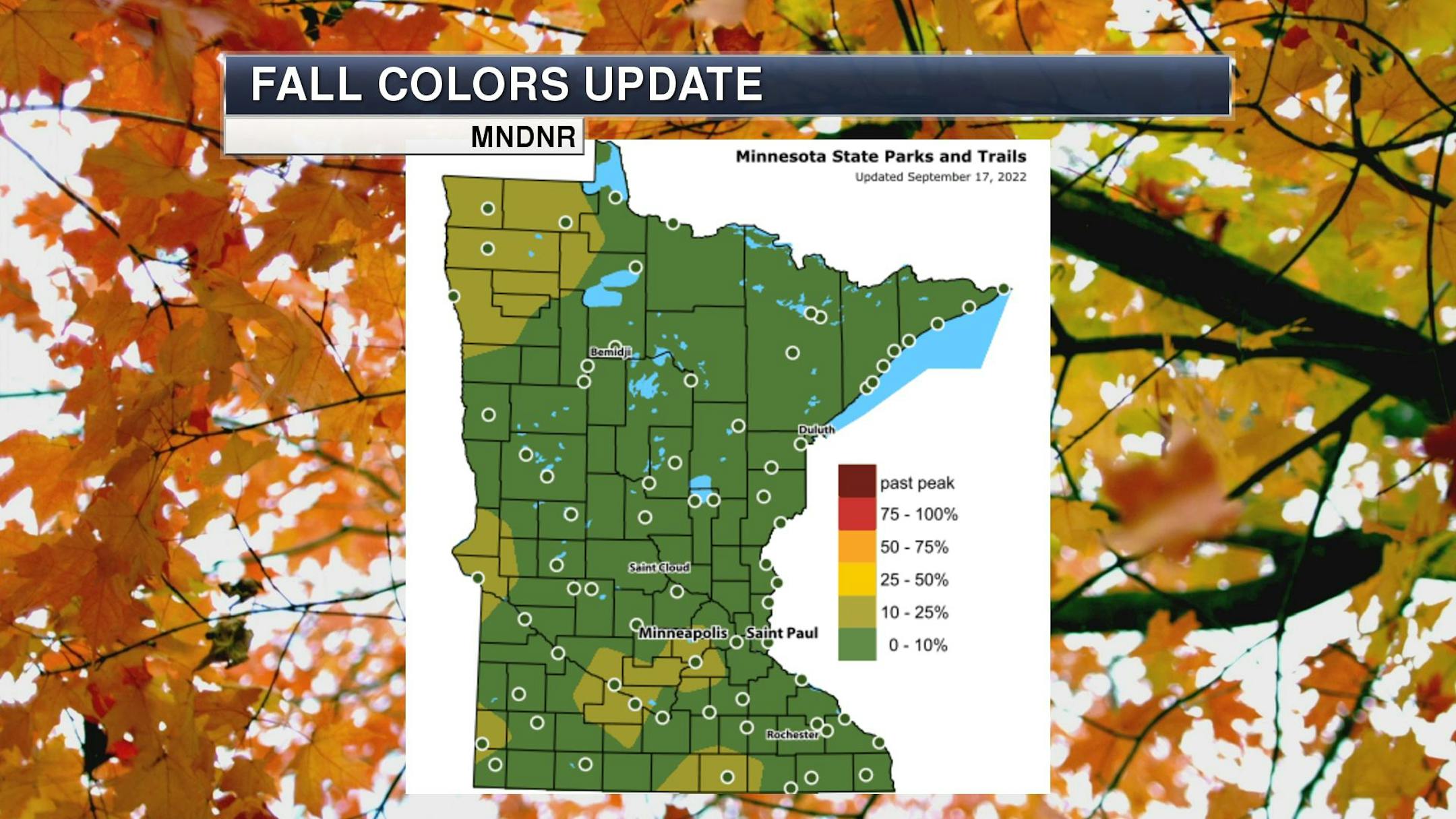
Fall Color Update
It's that time of the year again for fall colors and the MN DNR has their fall color finder up and running. Much of the state is still color free, but there are a few colors popping up here and there.
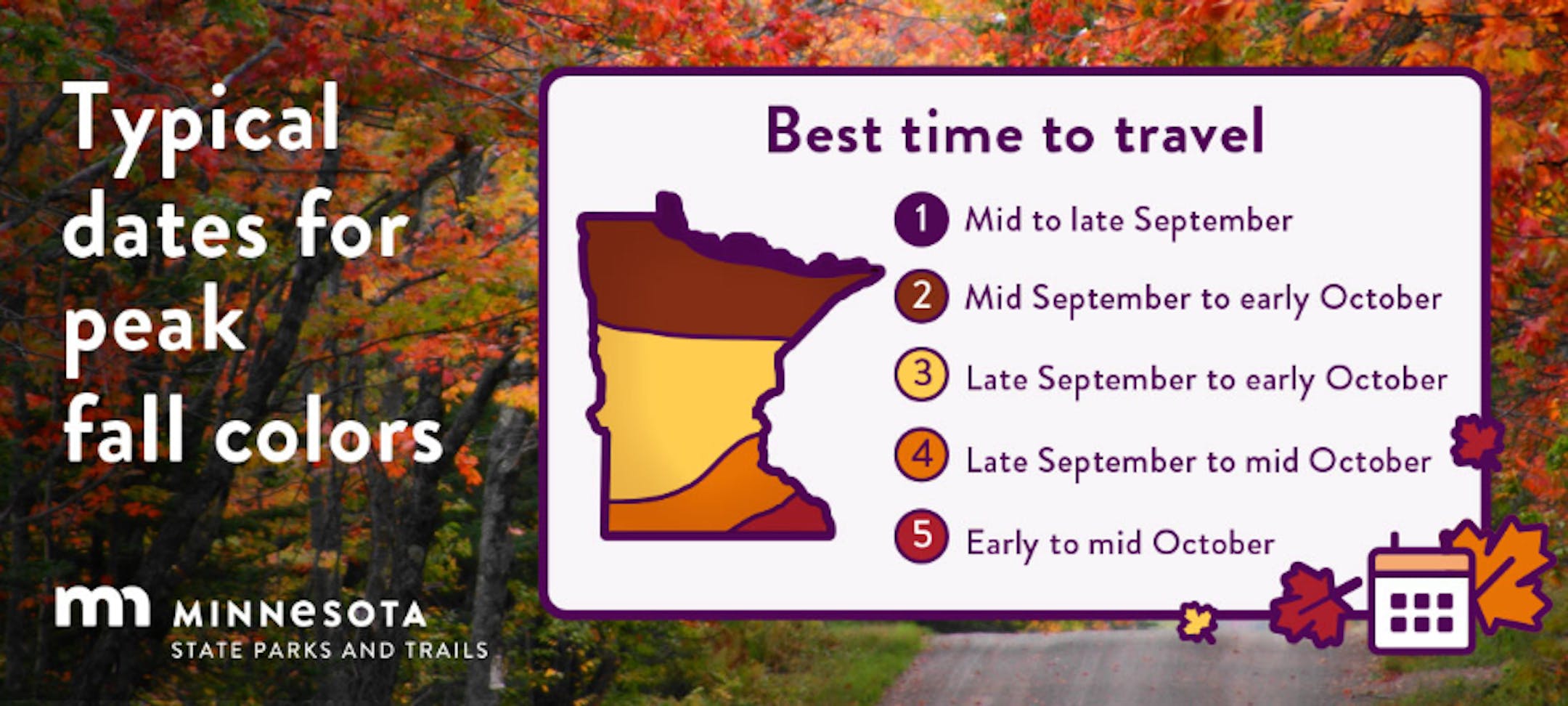
Average Fall Color
The MN DNR has put together a nice graphic that shows typical dates for peak fall color. The northern par of the state starts to peak during the 2nd half of September into early October. Meanwhile, folks in the central part of the state and into the metro typically don't see peak color until the end of September into the middle part of October. It won't be long now - enjoy!
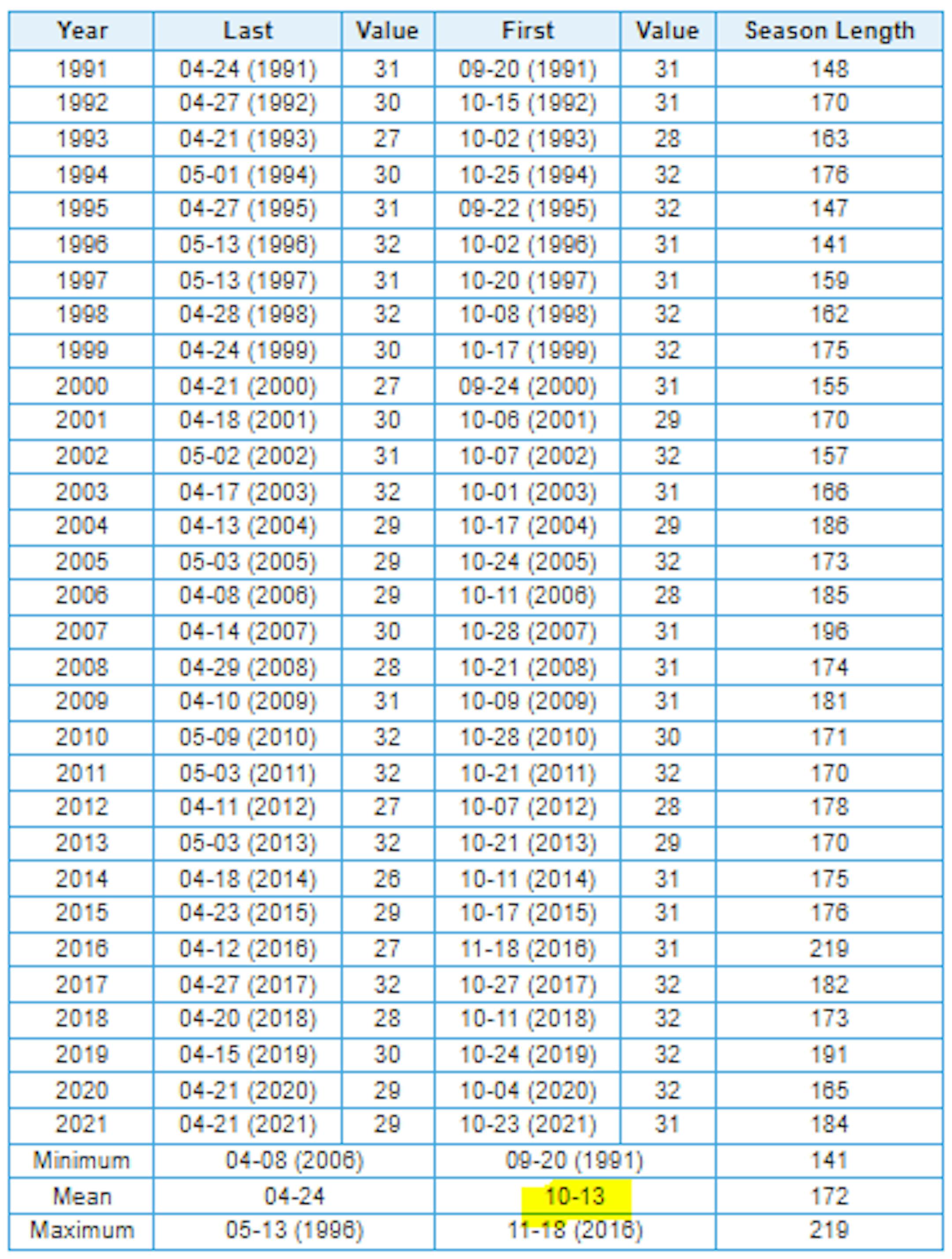
Average First Frost For MSP
Here's the 30 year average for the first frost in Minneapolis, which lands on October 13th. Last year (2021) the first frost was on October 23rd. If you look at the full MSP record, which dates back to 1873, the latest frost was November 18th back in 2016, while the earliest frost was September 3rd back in 1974.
First Measurable Snow at MSP
Here's the average first measurable snowfall (0.01") at MSP over the last 30 years, which lands on November 6th. Last year, MSP had its first measurable snow on November 13th. The last was on December 3rd back in 1928, while the earliest was September 24th in 1985.

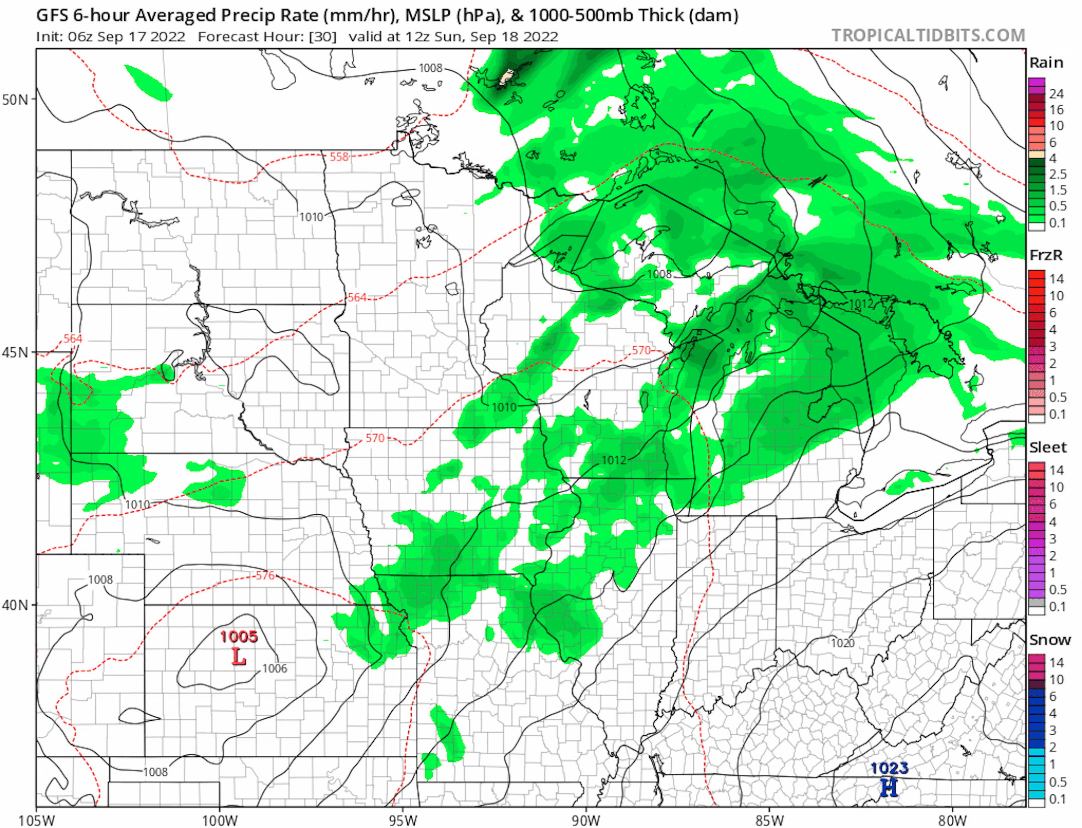
Mix of Sunshine & Spotty T-Storms
Here's the weather outlook from AM Sunday to AM Saturday. Weather conditions could be a little unsettled at times over the next few days, but it won't be too widespread at any point.
Extended Precipitation Outlook
The extended precipitation outlook shows areas of heavier rainfall across parts of the Arrowhead and into Wisconsin. Lighter amounts will be possible farther south and west.


