
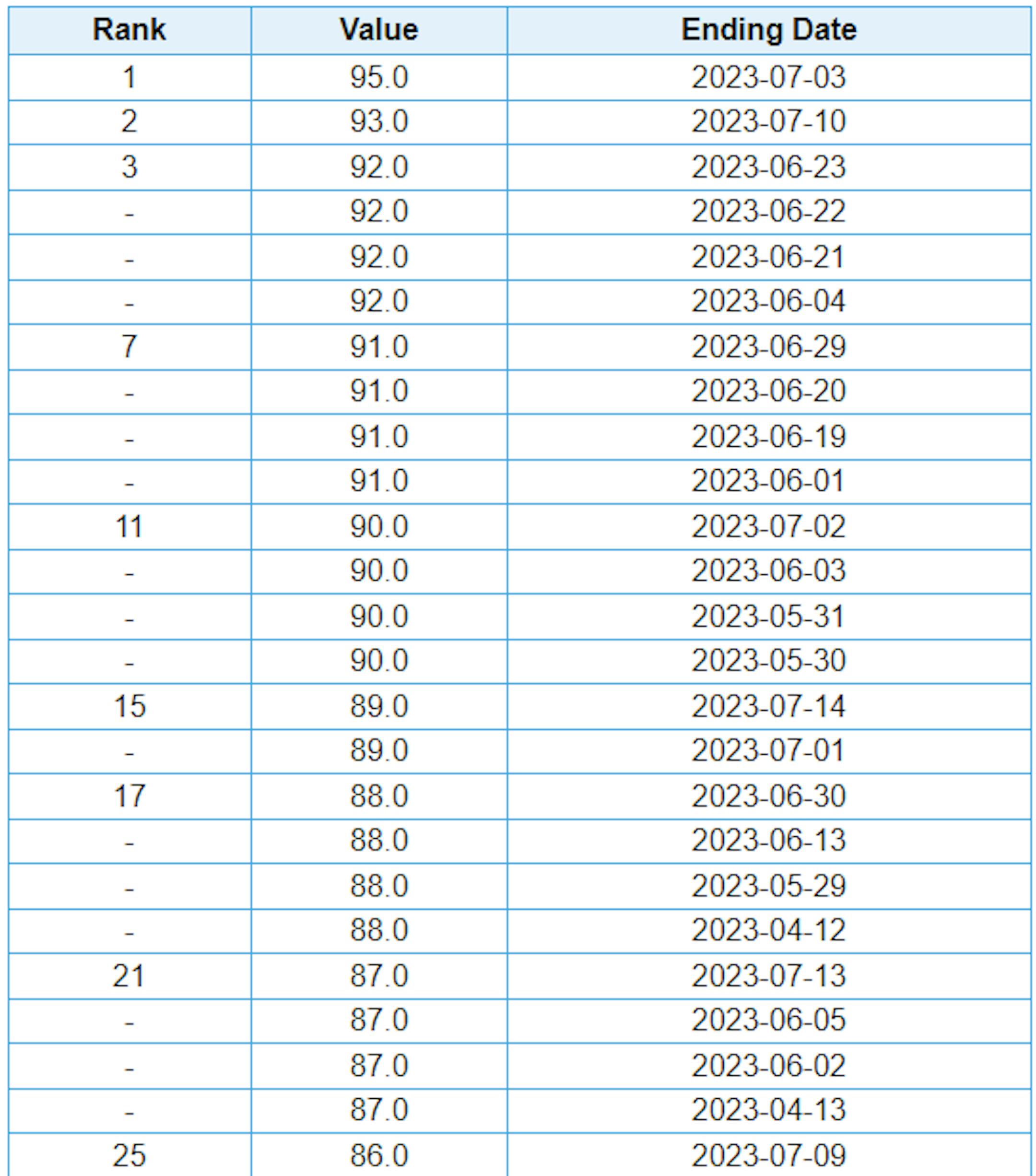
Warmest Days of 2023 So Far
Here are the warmest 25 days of 2023 so far. Note that we've 14s days in the 90s, which is the average number that we typically see in a year. The warmest day was 95F on July 3rd.
Average Number of 90F Days At MSP
Looking at the last 30 years, the average number of 90F days at the MSP Airport is (14). July is the hottest month with an average of (6) 90F days. We've only had (3) days in the 90s this July, but have already had (14) days in the 90s this year. Last year we had (18) days in the 90s and in 2021 there were (27) days in the 90s. The most number of 90F days in any single year was (44) set in 1988.

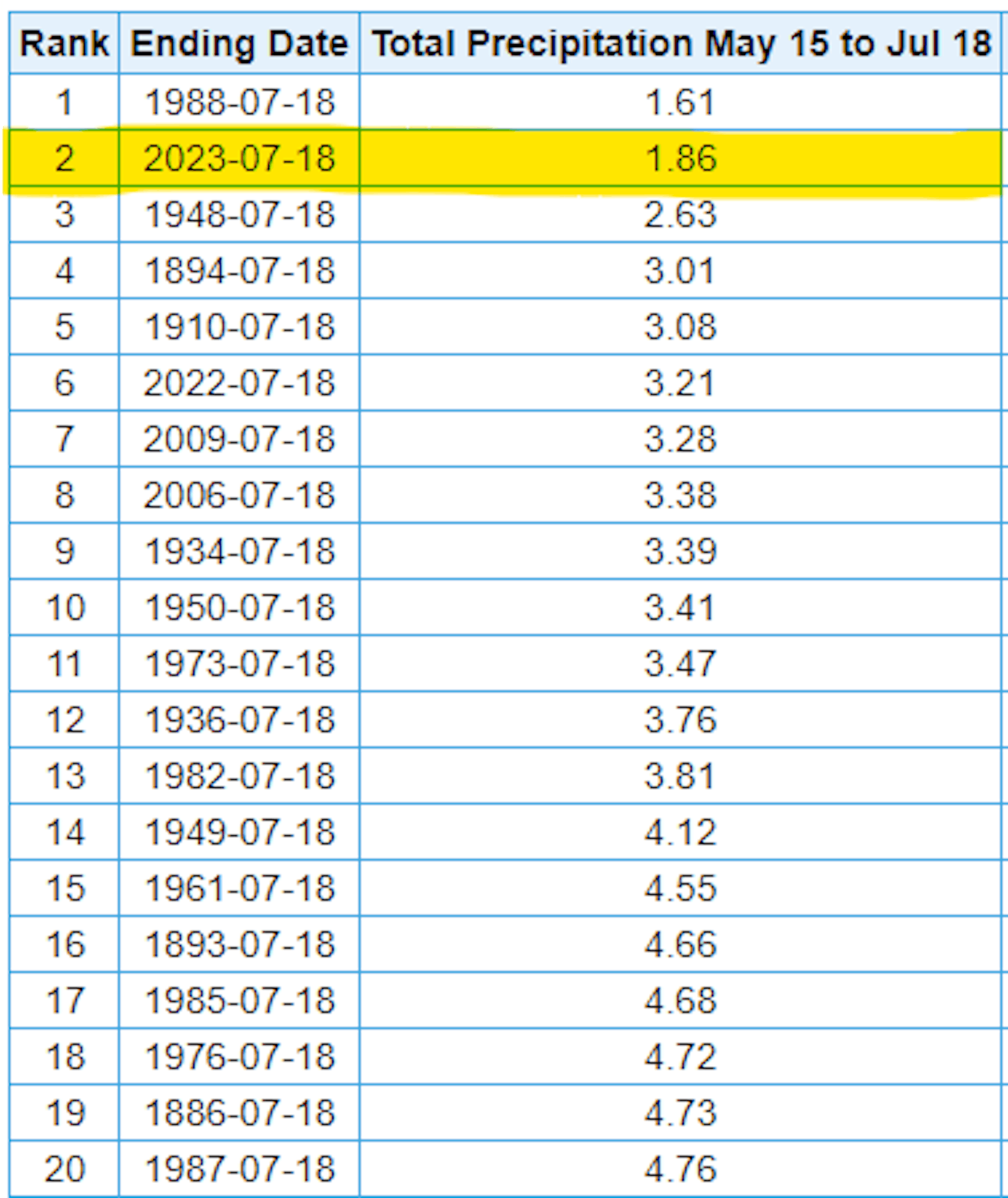
2nd Driest May 15th - July 18th on Record at MSP
It has been an extremely dry stretch of weather over the last couple of months with only 1.86" of rain falling since May 15th. This is the 2nd driest such period on record and not by much. The driest such period was 1.61" set in 1988. Note that last summer was pretty dry too. Last year, the same time period only saw 3.21" of rain, which is the 6th driest period on record.
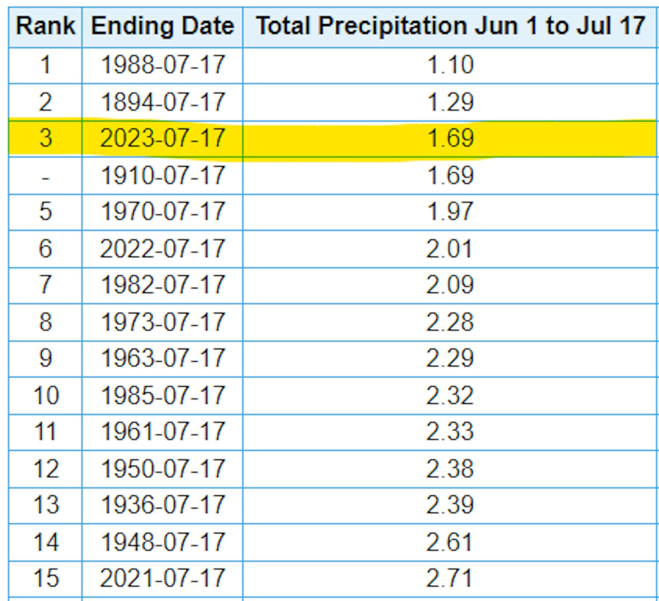
3rd Driest Summer Halfway Point For MSP
The stretch from June 1st to August 30th is known as meteorological summer, which is typically the warmest 3 months on average for the northern hemisphere. This is also the wettest season of the year, averaging nearly 13" of rain. We've now just passed the halfway point of meteorological summer and we've only picked up 1.69" of rain at the MSP Airport, which is tied for the 3rd driest start to any summer on record. The driest such period was back in 1988, when only 1.10" of rain fell.
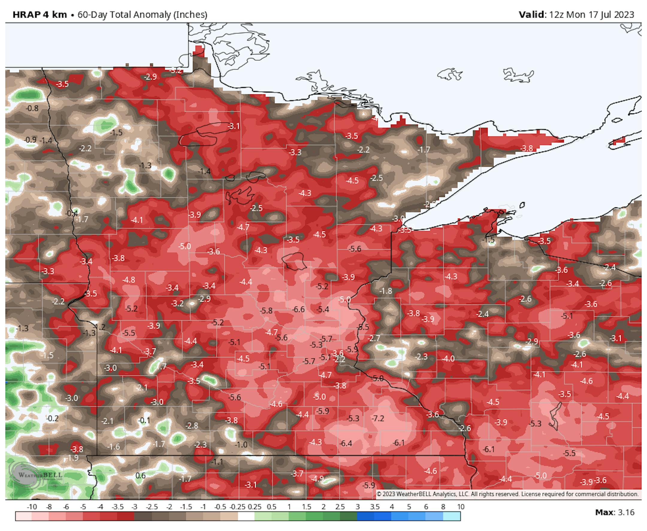
60 Day Precipitation Anomaly
The map below shows the 60 day precipitation anomaly, which indicates that some locations are nearly -3.00" to nearly -7.00" below average (in red/pink) since mid May. Spots in Southwestern and northwestern Minnesota still have a bit of a surplus, but much of the region is well below average precipitation.
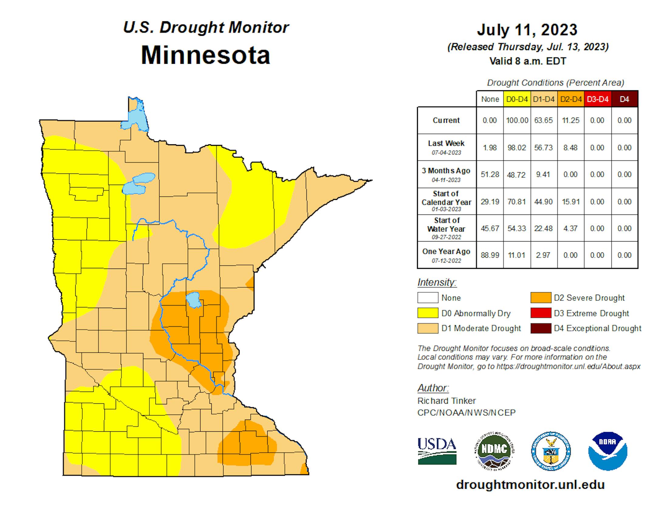
Drought Update
It has been an extremely dry stretch of weather across much of the station over the last several weeks. Only a few locations have seen decent pockets of rain, but the drought is expanding. Severe drought conditions have expanded from nearly 8.5% last week to nearly 11% this week, which encompasses parts of the east Metro. Moderate drought increased from 57% last week to 64% this week. We need rain!
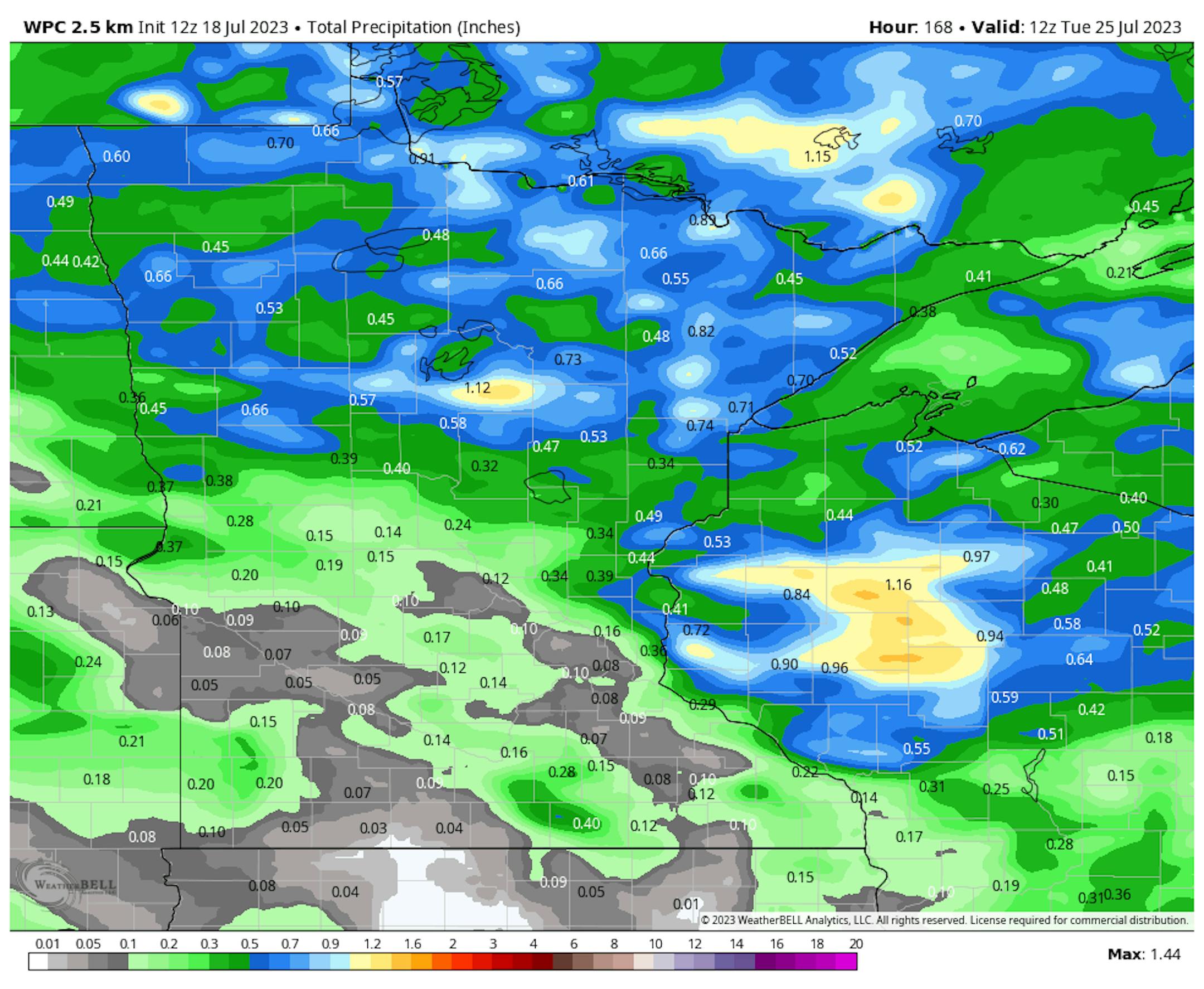
Extended Precipitation Outlook
The extended precipitation outlook through early next week shows a few pockets of heavier rain, mainly across the northern half of the state. Folks across the southern half of the state will stay mainly dry with only a few tenths of an inch of rain here and there.
Severe Risk on Wednesday
According to NOAA's SPC, there is a risk of strong to severe thunderstorms across parts of the region on Wednesday. Large hail will be the primary threat along with strong winds. There could also be an isolated tornado threat as well.


