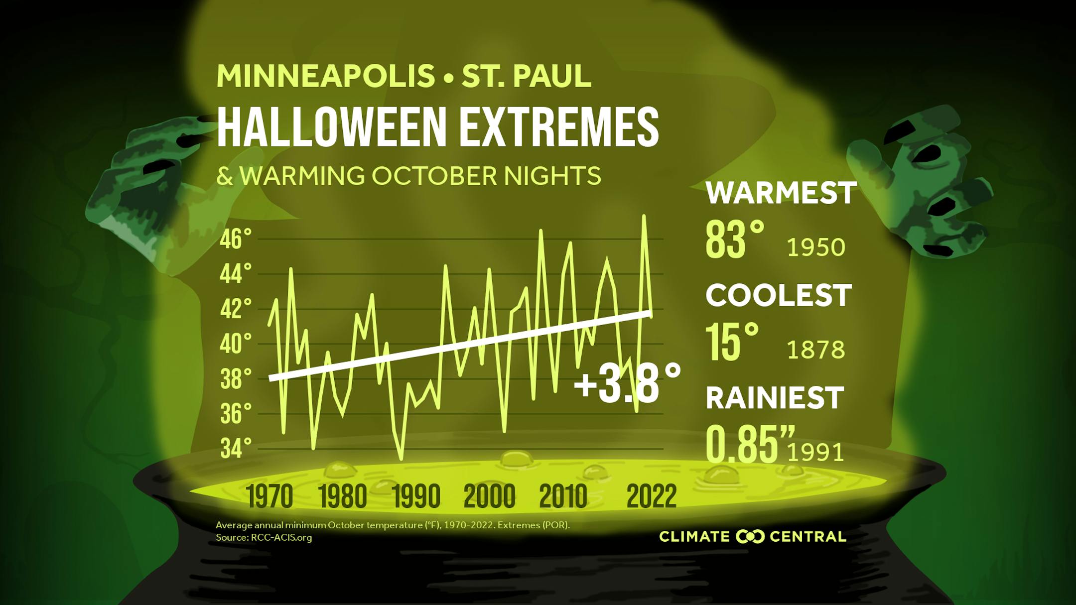
Halloween Extremes & Warming October Nights
Ghosts and ghouls might still haunt the streets for candy, but it seems like Halloween's getting a little cozier rather than spookier! According to a study by Climate Central, it turns out that across the United States, October nights have been getting warmer since 1970. That's right, a whopping 89% of the 244 cities they looked at have felt the heat creeping into their spooky season. It's not just a small change either; the average autumn temperature has risen by almost 3 degrees across the country. Specifically, those eerie October nights have warmed up by about 2.2 degrees on average! And hey, even in Minneapolis, known for its chilly Octobers, the nights have warmed up by a spine-tingling 3.8 degrees since 1970. Seems like the creatures of the night might be trading their capes for lighter clothes as the years go by!
KEY CONCEPTS
- Fall temperatures have warmed by 2.7°F on average across the U.S. since 1970.
- Fall warming can extend allergy and wildfire smoke seasons, and disrupt leaf-peeping.
- Warming trends have also taken the chill out of a fall tradition: trick-or-treating.
- From 1970 to 2022, October nights have warmed by 2.2°F on average across the U.S.
- Of 244 U.S. cities analyzed, 216 (89%) have seen October nights warm up since 1970.
- October nights have warmed by more than 2°F in 153 of the locations analyzed.
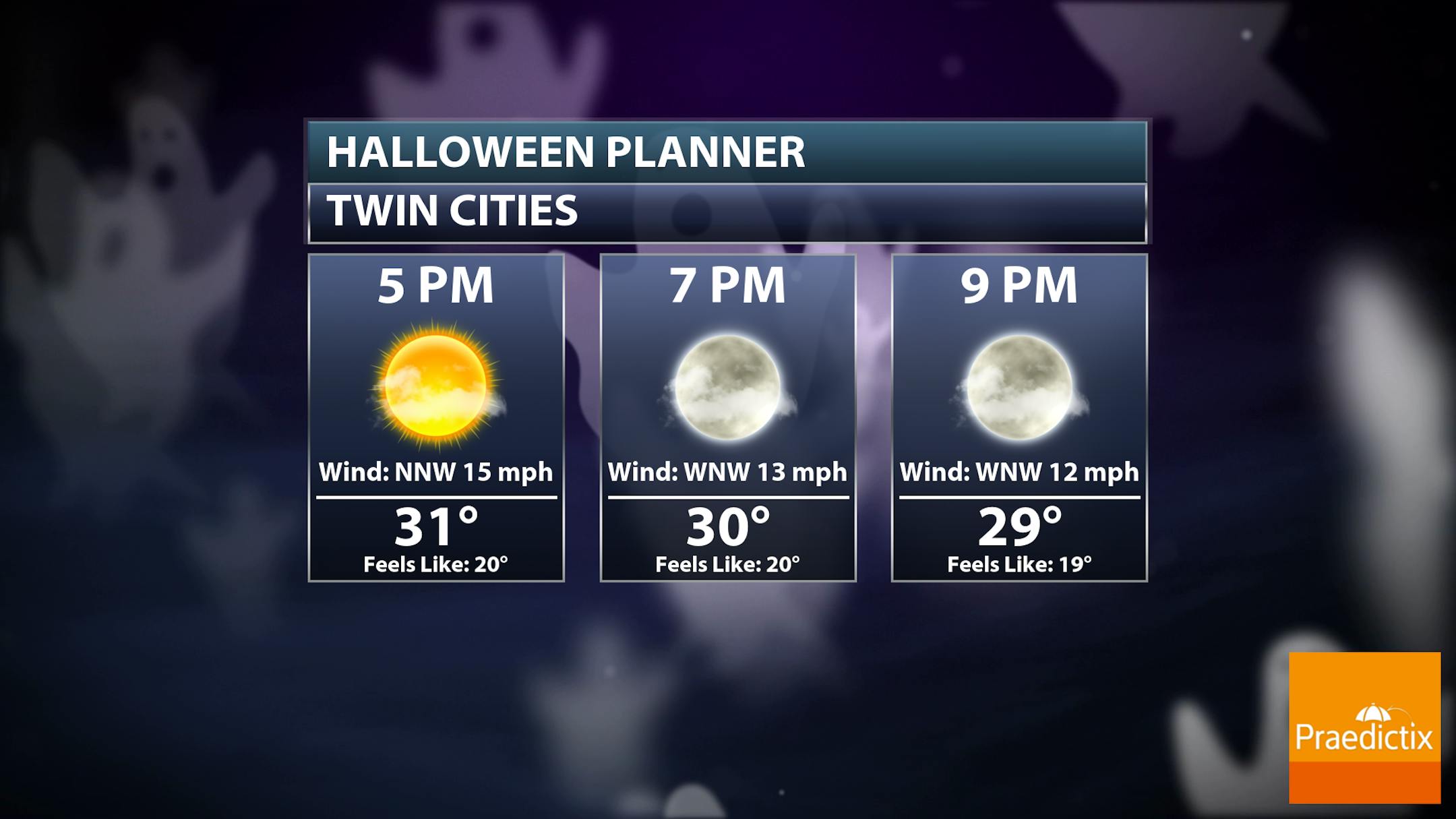
Twin Cities Halloween Outlook
Here's a very early Halloween outlook for the Twin Cities on Tuesday evening. Note that temps will hover around 30F with feels like temps in the 20s thanks to breezy NW winds around 15mph.
Halloween Outlook Next Tuesday
The weather outlook for Halloween Tuesday looks quite chilly with readings only warming into the 20s and 30s across the state. This will be quite a bit below average for this time of the year. There will also be areas of snow and possibly minor accumulations for some.

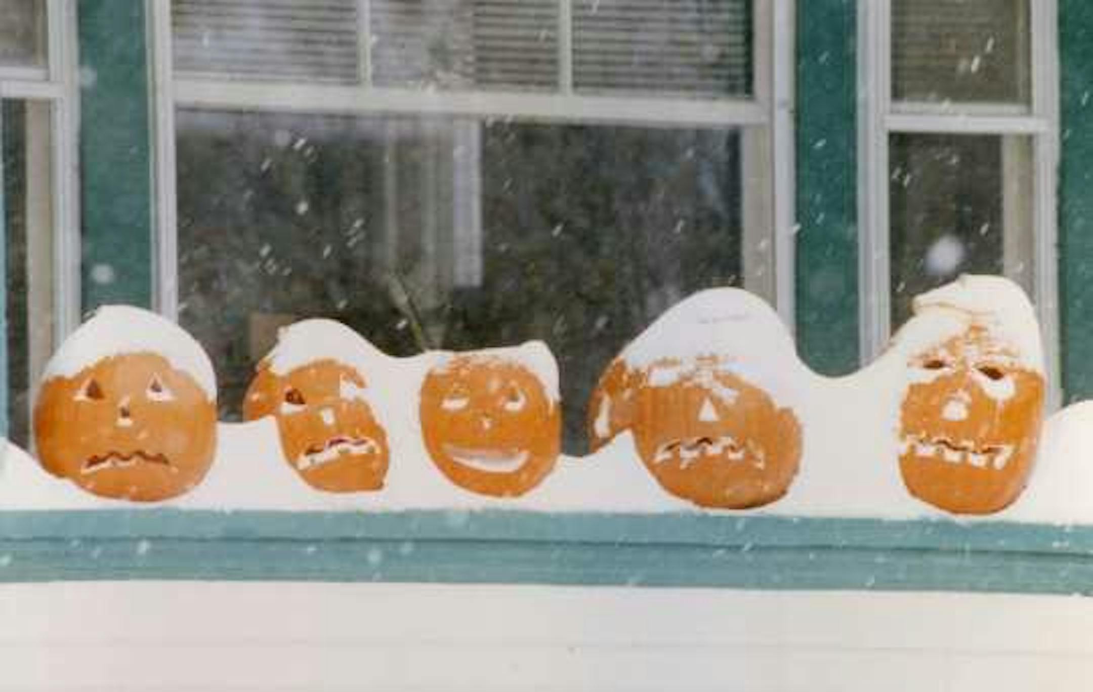
Halloween climatology in the Twin Cities
"Halloween is typically a time of crunchy leaves on the ground, a bit of chill in the air, and lots of candy. High temperatures in the Twin Cities are generally in the 40s and 50s. It is more common for the daily high on Halloween to be in the 60s than in the 30s. 70s tend to be rare, with only eight Halloween high temperatures being 70 degrees or above or about one in eighteen years. The warmest Halloween on record was 83 degrees in 1950, with one of the coldest one year later with a high of 30 in 1951. The coldest Halloween maximum temperature was a bone-chilling 26 degrees back in 1873. The last twenty-five years have had some balmy Halloween afternoons, like the 71-degree F high in 2000. We've had some chilly ones as well, like in 2017, when the temperature never rose above 35 F at MSP. The area has not seen a Halloween washout, with measurable precipitation during the evening, since 1997. Measurable precipitation has occurred on Halloween only 26% of the time in the Twin Cities, or 38 times out of 145 years. The most rain recorded was in 1979 with .78 inches. In 1991 .85 inches of precipitation fell, which was snow. In spite of the 1991 Halloween Blizzard, measurable snow on Halloween is about as rare as getting a full-sized candy bar in your trick-or-treat bag. Since 1872 there's been enough snow to measure only six times: 0.6 in 1884; 0.2 in 1885; 1.4 in 1932; 0.4 in 1954; 0.5 in 1995; and of course 8.2 inches, with the opening round of the Halloween Blizzard in 1991. Thus there has been measurable snow on only 4% of the days."
Heavy Rainfall Since September 23rd
We've had some pretty incredible rainfall across parts of the state since September 23rd. In fact, some locations around the Twin Cities (highlighted in white and blue) have see nearly 10" of rain or more in a little more than 1 month!

Precipitation Outlook
The extended precipitation outlook through next week shows lighter precipitation amounts across the state over the next several days, but some of this could be in the form of snow.