
"2023 Minnesota Fishing Opener"
"Across Minnesota, 2023's ice-out dates ranged about a week to ten days behind the median in general. Here's median dates calculated since 1950. The 2023 Minnesota Governor's Fishing Opener will be in the Greater Mankato Area. The ice out for lakes in the Mankato area for 2023 ranged from April 10-14. Lake ice out was making a steady progress northward during the first week of May. Ice-choked lakes have dogged fishing openers of the past, including as recently as 2013. The 1950 opener was one of the worst known, with iced-over lakes extending to Mille Lacs, Osakis, and the Brainerd Lakes area. That year produced many of the late ice-out records for lakes with long records. Other years with ice on northern lakes include: 1966, 1979, 1996, 2008, and 2009. Minnesota's Fishing Opener weather can be variable in every sense of the word. We have seen hot, cold, wet, dry, stormy and even snowy. With such a large state and so many lakes, we have had years that were seemingly perfect in one area, only to be blustery and miserable in another."

MN Fishing Opener Forecast
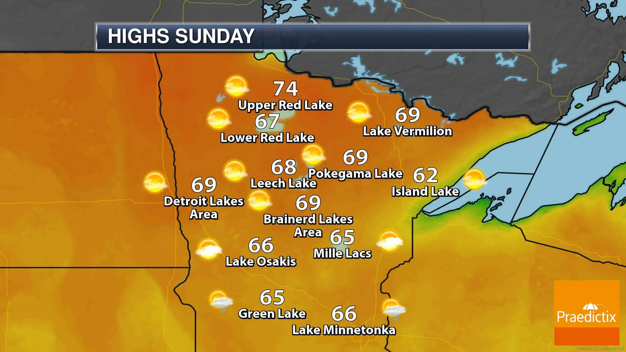
Here's the weather outlook for Saturday's MN Fishing Opener across the northern half of the state. Note that it can still be very chilly at this time of the year and there have been a few years in the past that have had snow falling across the state. This year, we won't have any snow to worry about, but there will be areas of showers and perhaps a few thunderstorms. Sunday could be a little warmer, but it will depend on how much sunshine we can manage. Latest model trends are trying to hold the clouds and showers in place through the day Sunday now too. Stay tuned...
Weather Outlook For Minneapolis on Mother's Day Sunday
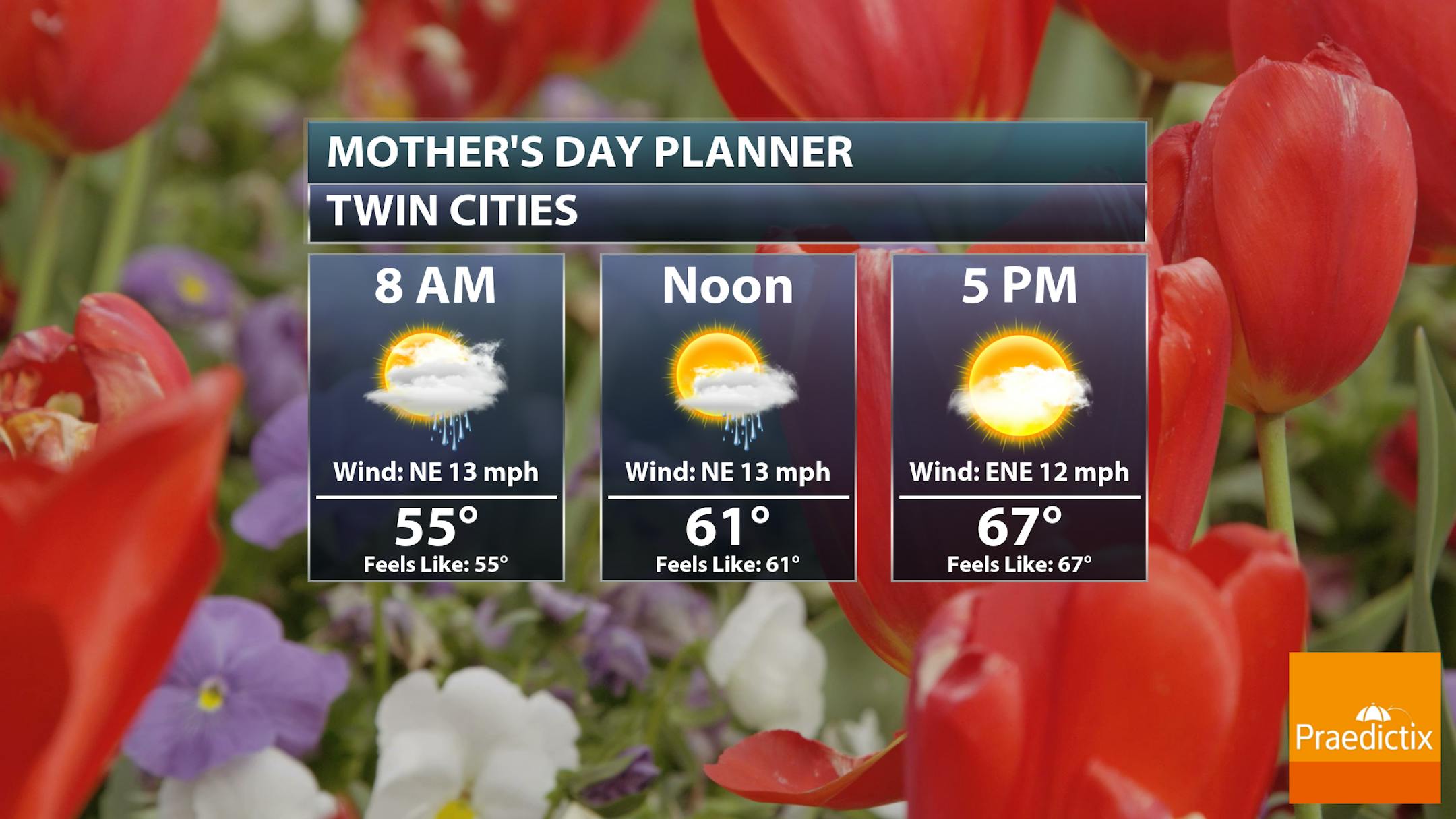
First of all, Happy Mother's Day to all the wonderful moms out there! Sunday looks a little showery through the first half of the day in the Twin Cities with temps warming into the mid/upper 60s. Skies will gradual dry out and perhaps give way to a few peeks of sunshine. However, NE winds will still be a bit breezy.
Weather Outlook Through The Weekend
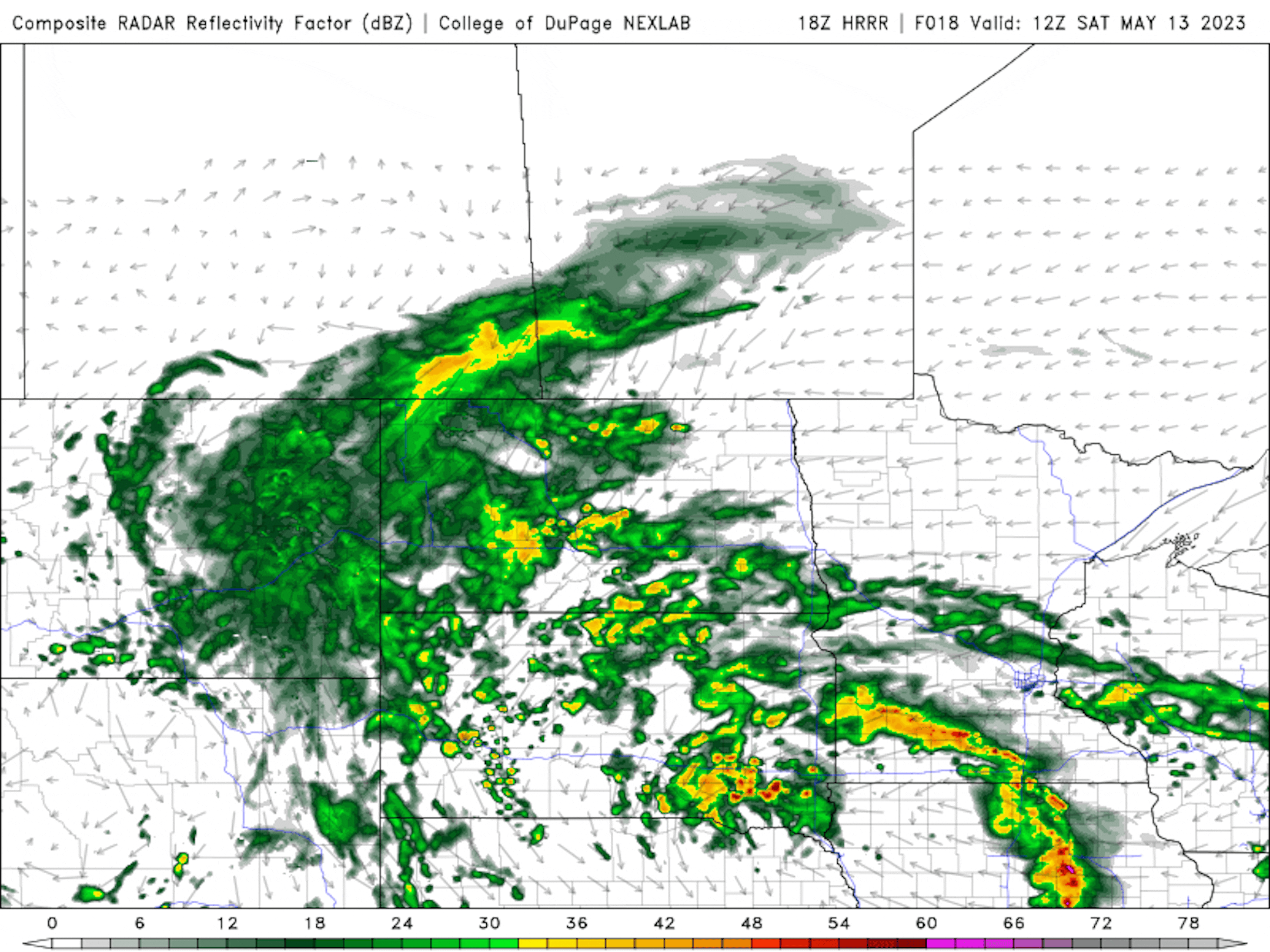
Weather conditions this weekend will certainly be unsettled with the heaviest rainfall amounts across southern MN. Showery weather will impact parts of Central MN at times, but things will improve through the day Sunday. Much of northern MN will stay dry!
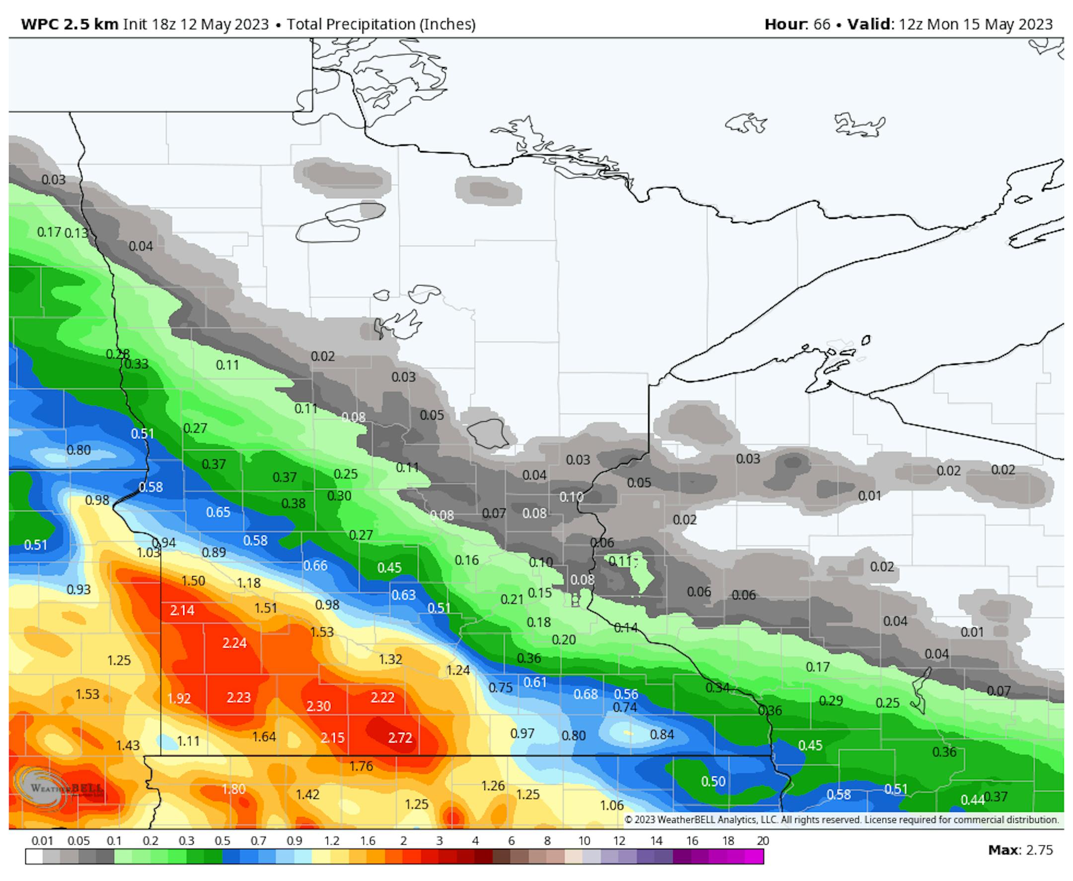
Precipitation Outlook
Here's the total rainfall potential through the weekend, which shows the potential of 1" to 2" of across parts of southern and southwestern MN. Much less rain is expected closer to the Twin Cities with very little if anything at all falling north of I-94!
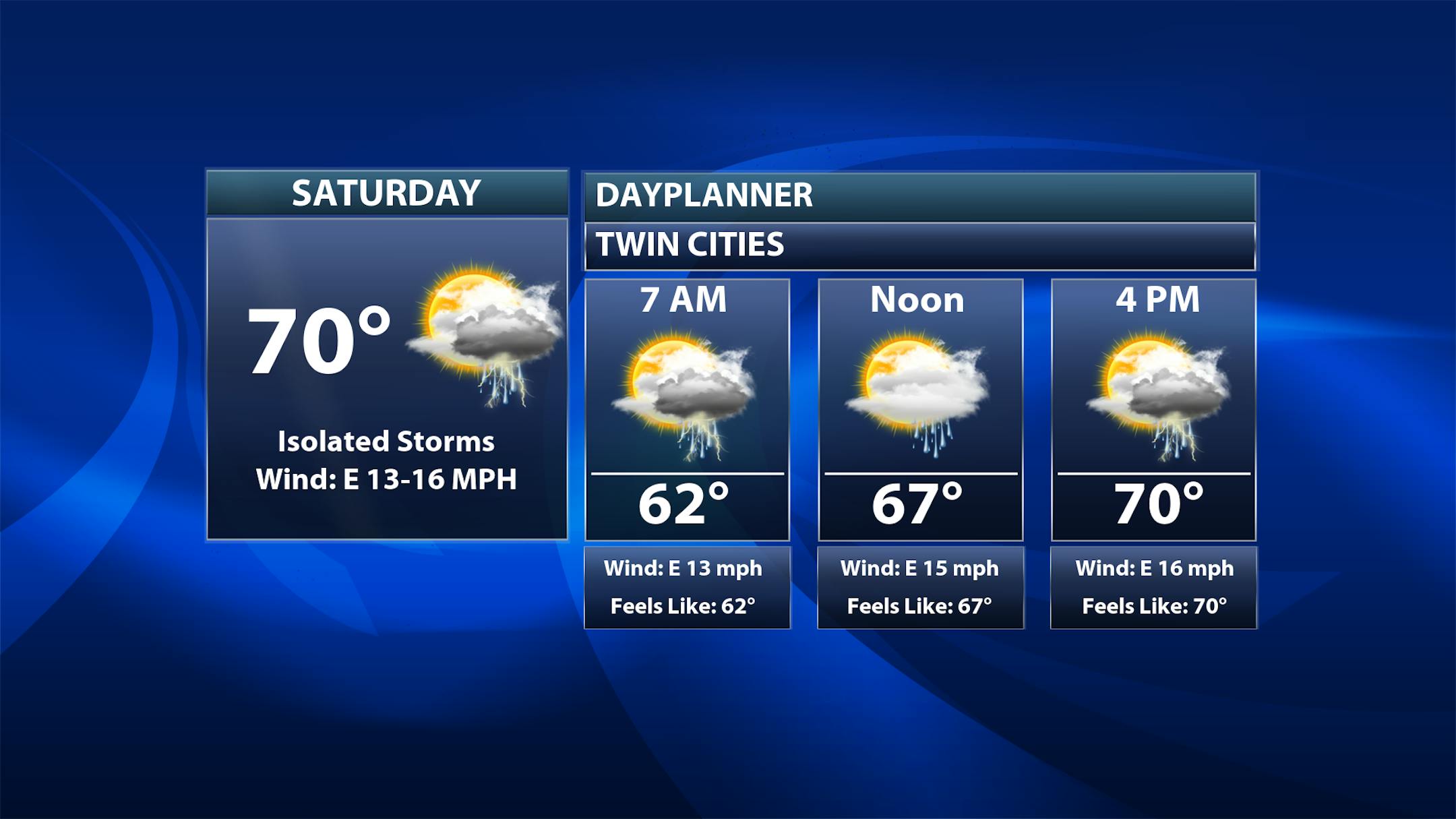
Twin Cities Weather Outlook For Saturday
The weather outlook for the Twin Cities on Saturday, May 13th will feature spotty showers and perhaps a rumble of thunder through the day. Temps will be mild with readings warming to near 70F. Easterly winds will be breezy with gusts up to 20mph or more.
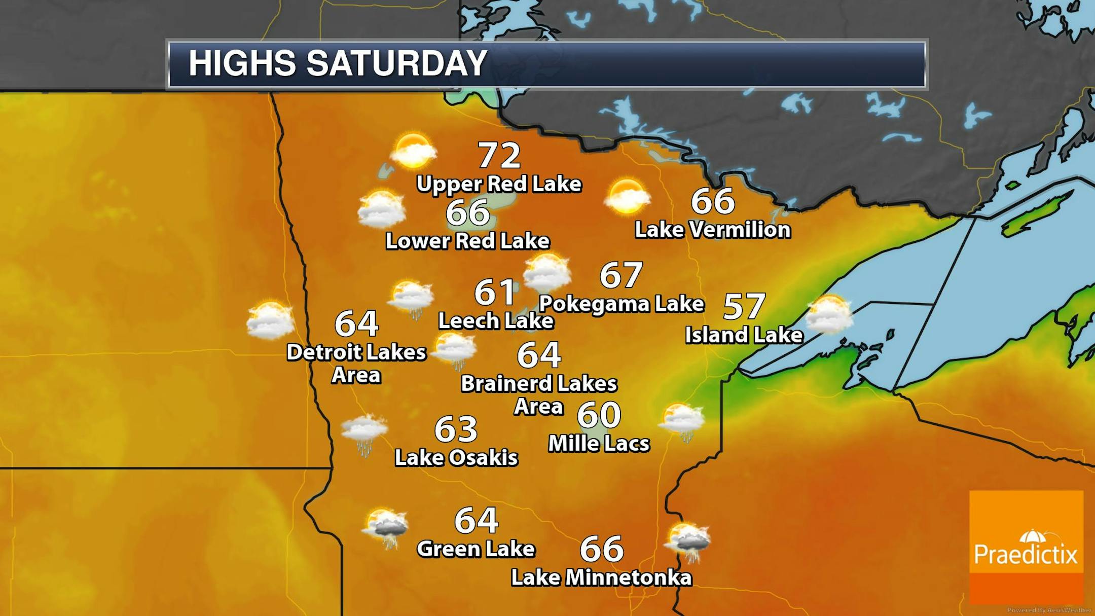
Weather Outlook on Saturday
Temps on Saturday will be fairly close to average across the region with readings warming into the 60s and 70s across the state. Showers and thunderstorms will be possible across the southern half of the state with the heaviest rains falling in the southern and southwestern part of the state.


