

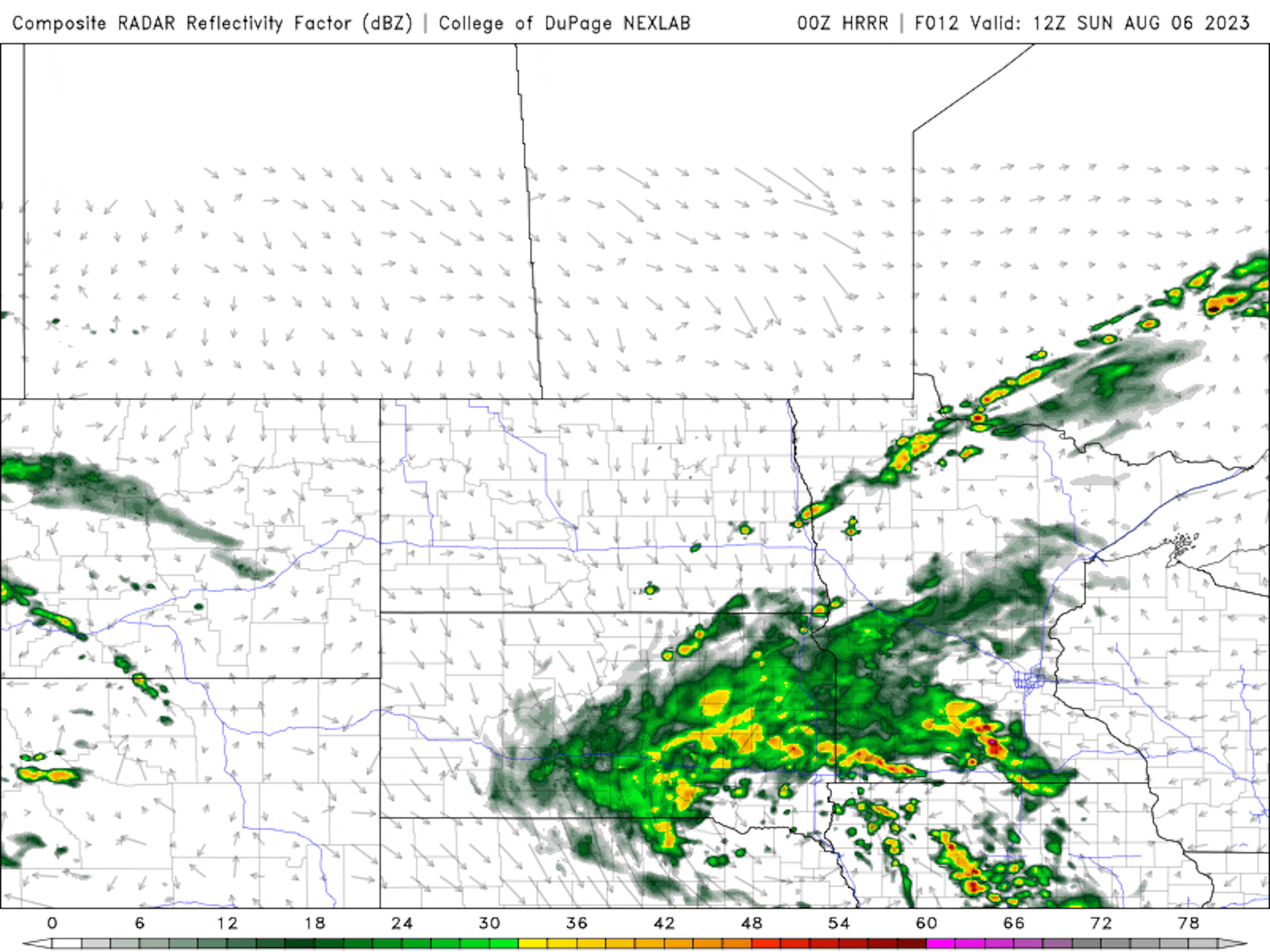
Somewhat Soggy Sunday
The simulated radar from AM Sunday to Sunday night shows scattered showers and storms moving through the region with pockets of locally heavy rainfall, especially across the southern parts of the state. The heaviest rains appear to be south of the Twin Cities. The good news is that we're not expecting anything severe.
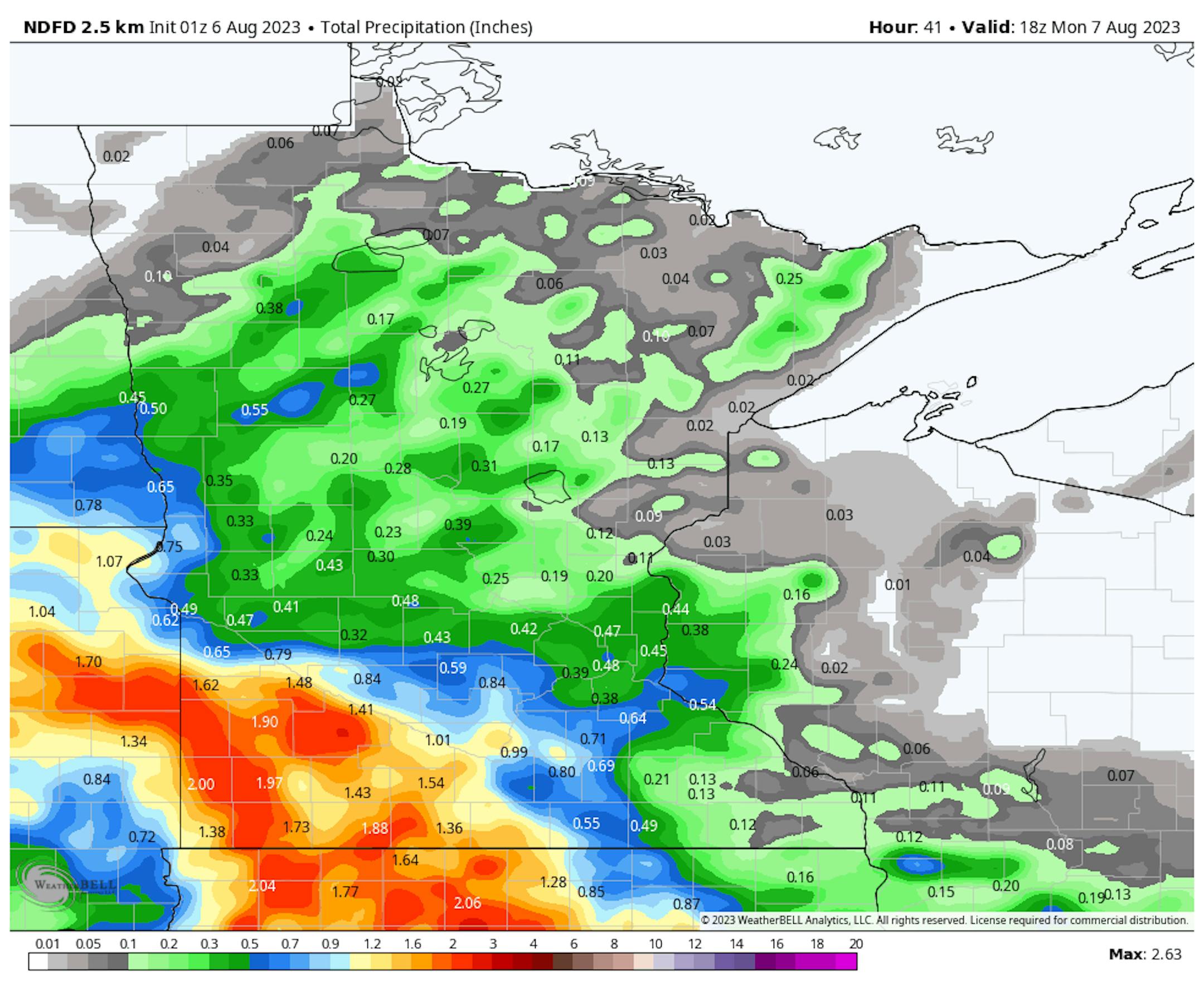
Rainfall Potential Through Early Next Week
Here's the rainfall outlook through early next week, which shows somewhat soggy weather across the southern half of the state. Some of the heaviest rains will be found across the Southwestern corner of the state with some 1" to 2" tallies possible. The Twin Cities appears to be just on the northern fringes of this heavier rain band and may only see a 0.25" to 0.50". Stay tuned...
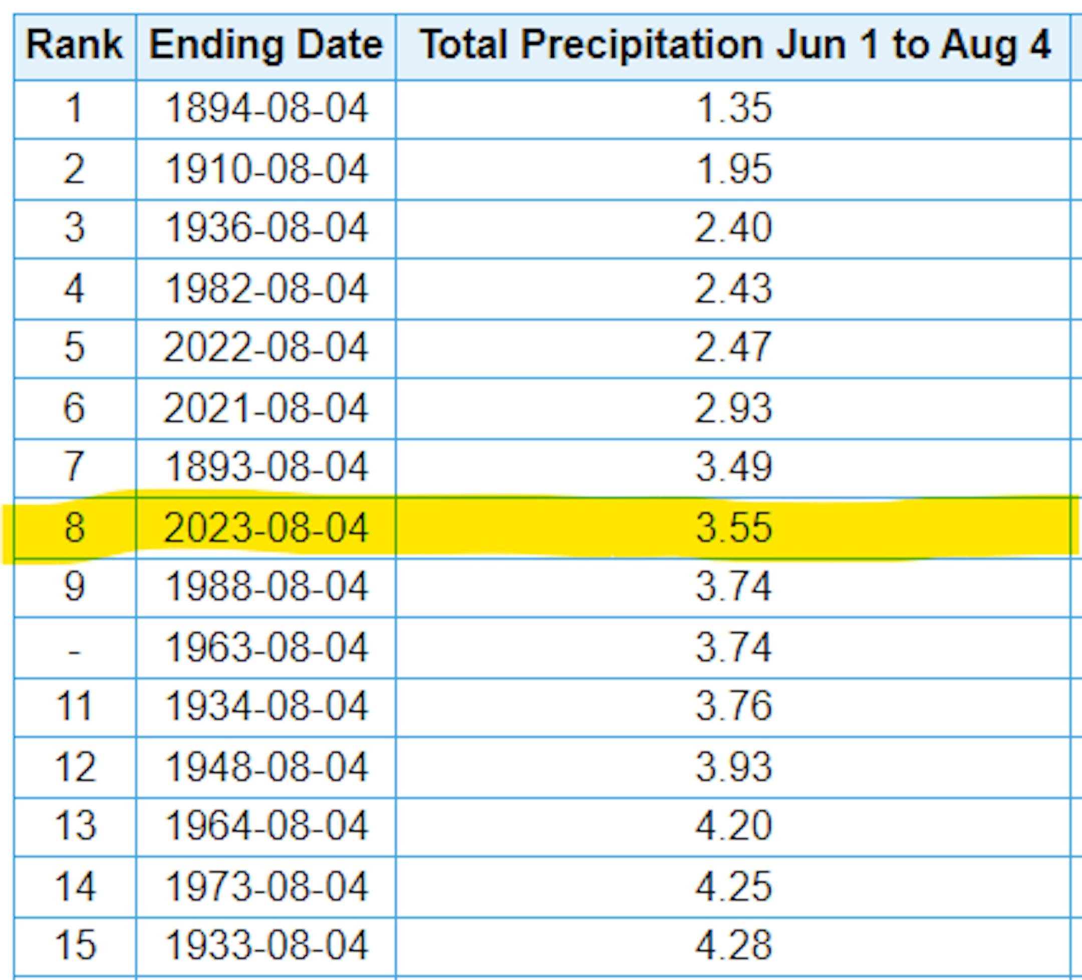
8th Driest Meteorological Summer on Record
It has been very dry across much of the region so far this summer with only 3.55" of rain falling at the MSP Airport since June 1st. That is nearly 5.80" below average and is the 8th driest Meteorological Summer on record with the driest being 1.35" set in 1894. Interestingly, the last two summers (2022 & 2021) were even drier than this one.
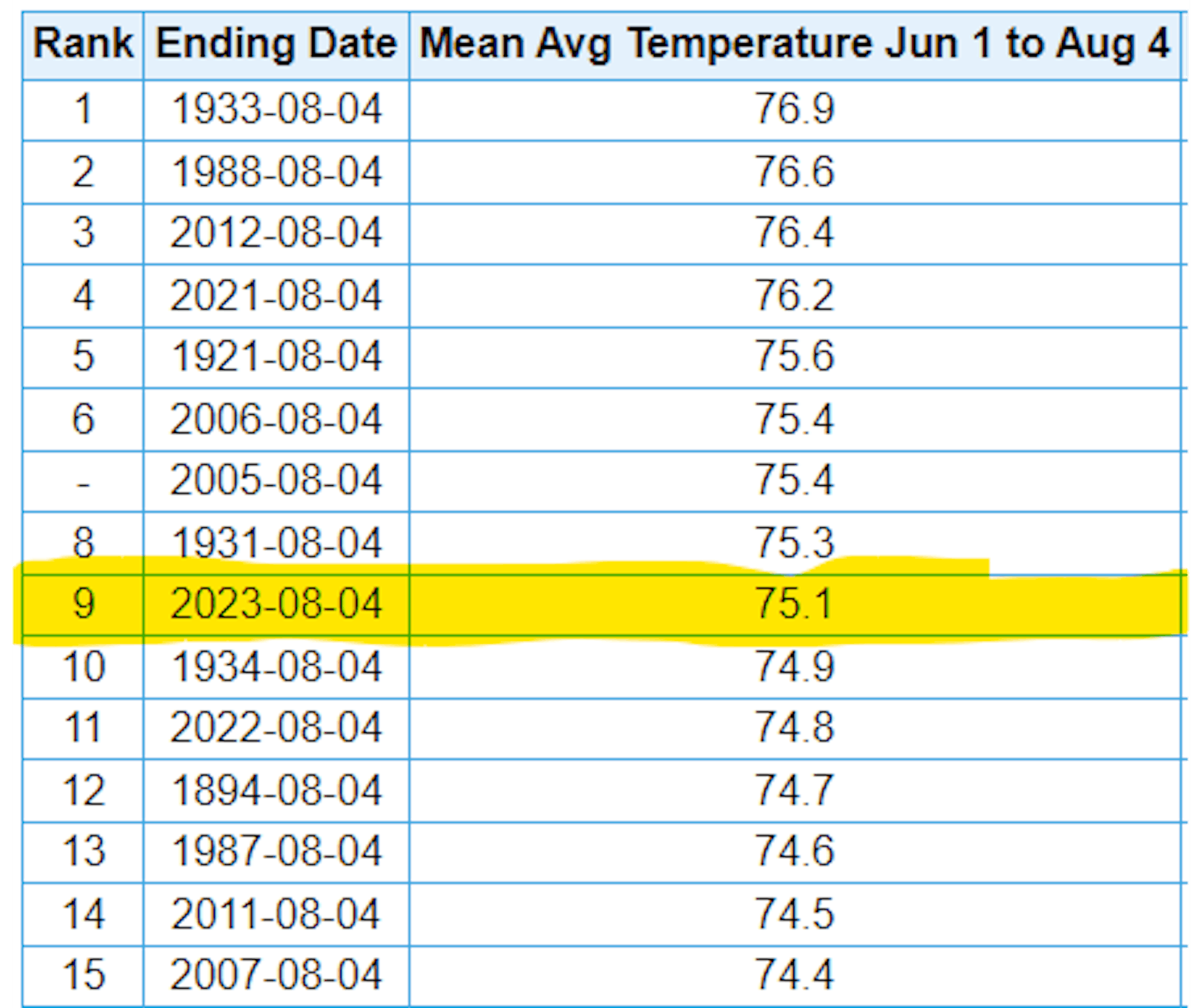
9th Hottest Meteorological Summer on Record
It has also been a hot summer with readings running well above average since June 1st and good enough for the 9th hottest Meteorological Summer on record so far. Note that 2021 was the 4th hottest and 2022 was the 11th hottest From June 1st to August 4th. With that being said, the last 3 summers have been pretty warm and dry.
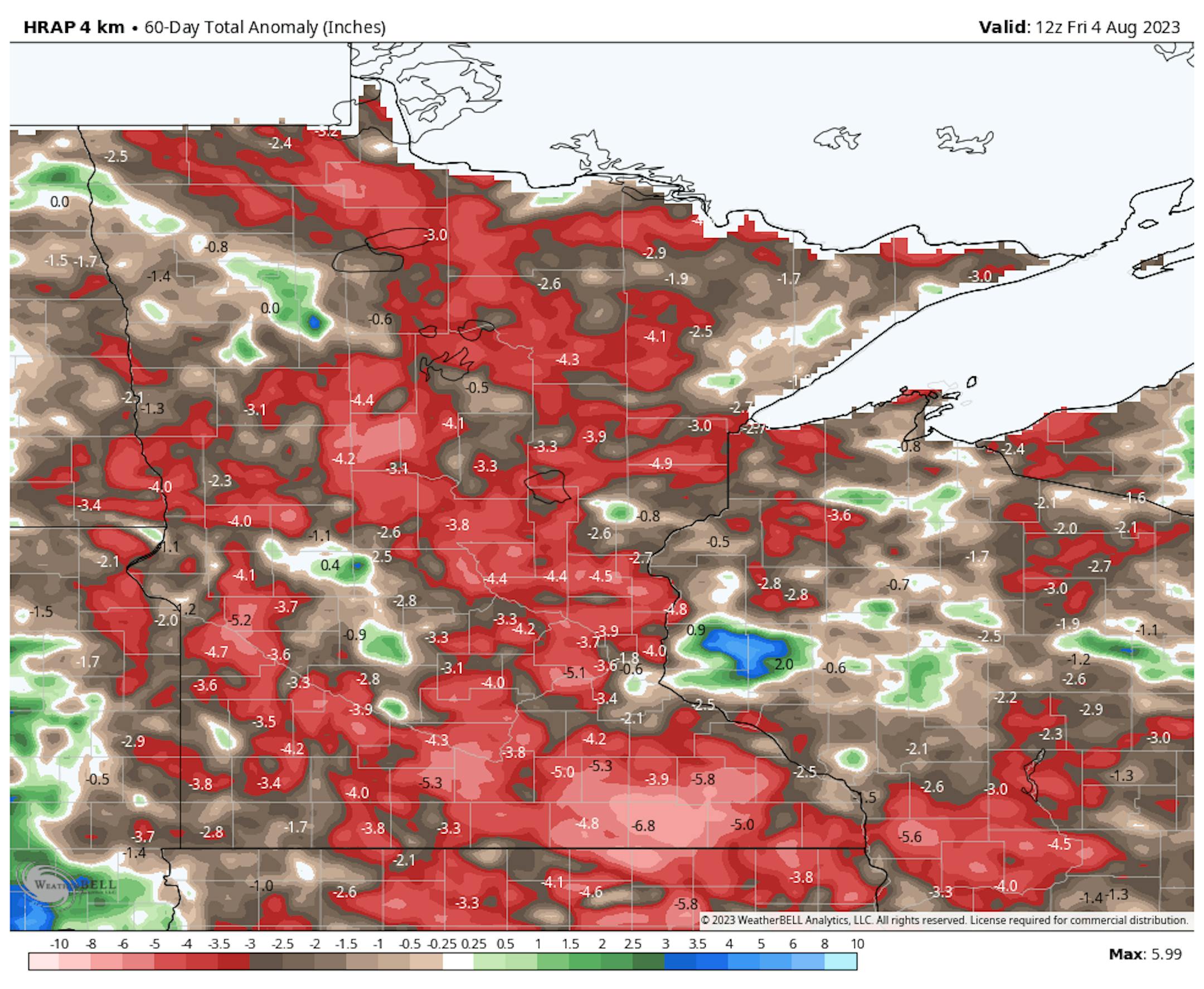
60 Day Precipitation Anomaly
The map below shows the 60 day precipitation anomaly, which indicates that some locations are nearly -3.00" to nearly -7.00" below average (in red/pink) since early June. There are a few locations across the state that have surpluses, but most locations are well below average.
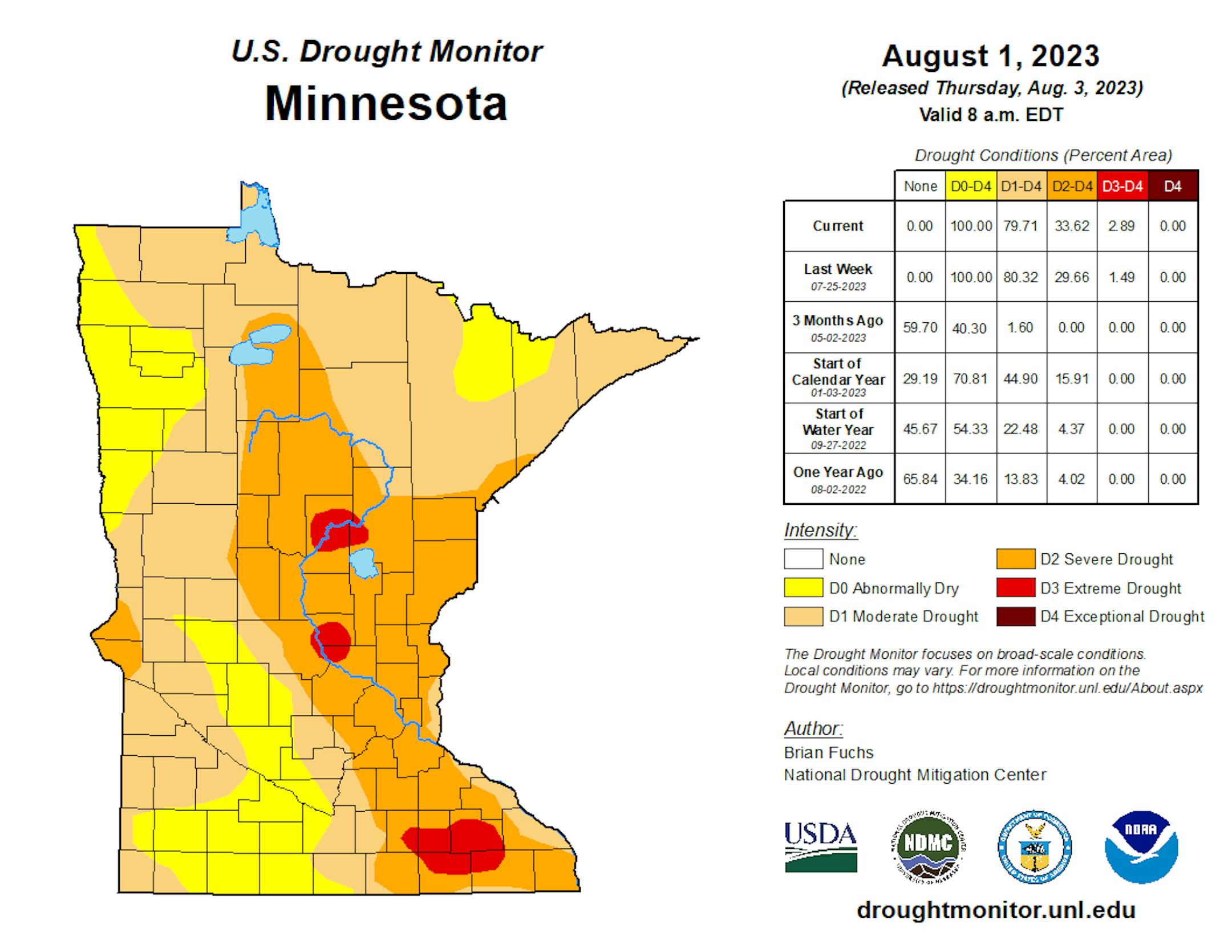
Drought Update
Drought conditions continue to deepen across the region with a few pockets of Extreme Drought showing up (in red). The last time that parts of Minnesota were in an Extreme Drought was back in mid December, nearly 7 months ago.
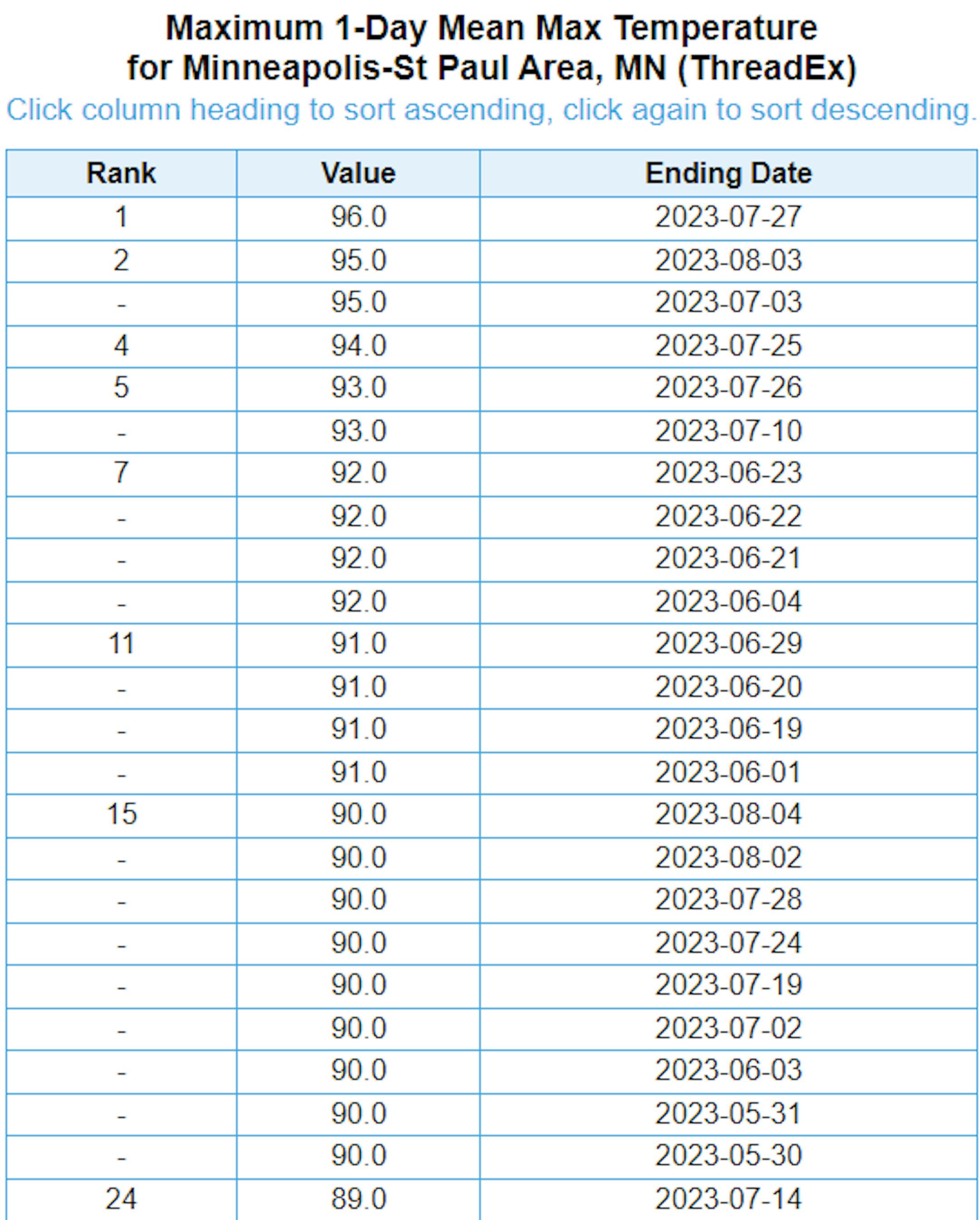
Hottest Days of 2023 So Far
The hottest day of 2023 (so far) was Thursday, July 27th with a high of 96F and heat index values peaking around 105F to 110F. Uffda! There have been (23) 90F days this year. Our average number of 90F days is 14.
Average Number of 90F Days At MSP
Looking at the last 30 years, the average number of 90F days at the MSP Airport is (14). July is the hottest month with an average of (6) 90F days. We've only had (3) days in the 90s this July, but have already had (14) days in the 90s this year. Last year we had (18) days in the 90s and in 2021 there were (27) days in the 90s. The most number of 90F days in any single year was (44) set in 1988.


