
Salvaging A Pretty Nice Holiday Weekend
I've been tracking weather systems for 45 years, but nothing has prepared me for 2021's dueling weather disasters. Our weather models have consistently underestimated the intensity of drought, fires and eastern floods.
Why? Climate-warming greenhouse gases have doubled since preindustrial times, and these man-made gases are flavoring all weather now.
Are too many people living in vulnerable areas? Yes. But Wednesday's 1-in-500 year flooding from Philly to New York City and Texas-size tornadoes in New Jersey are more symptoms of our new reality.
Last night's welcome soaking tapers to showers today, with generous squirts of lukewarm sunshine tomorrow into Labor Day. Highs reach 70s over central and southern Minnesota with 60s up north; pretty close to average for early September.
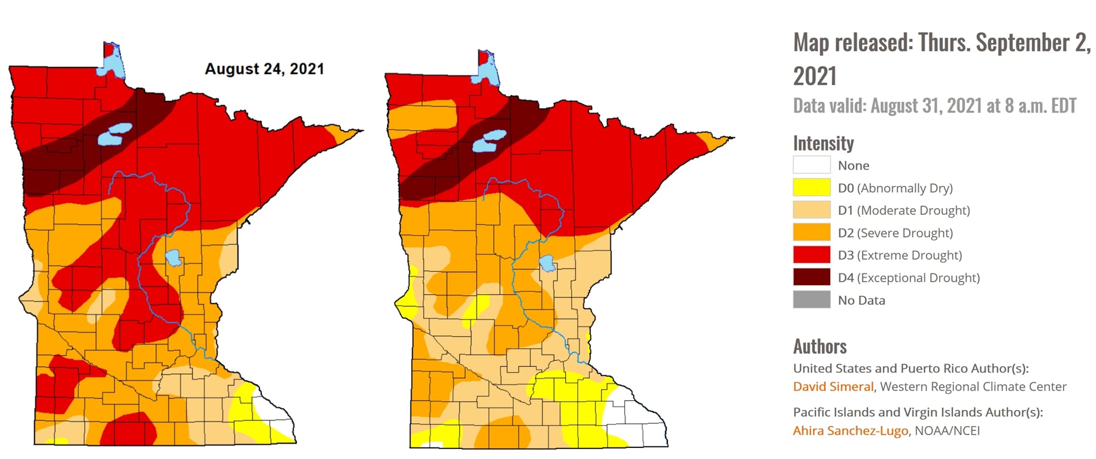
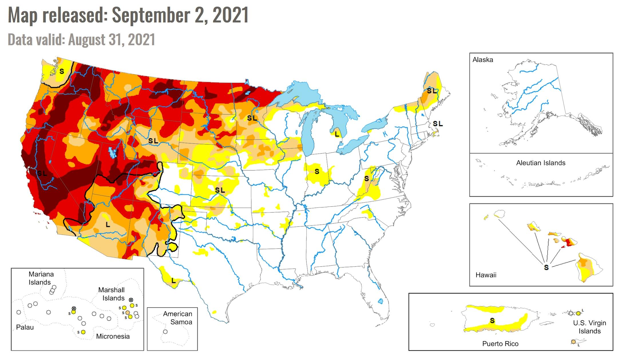
Severe drought has gone from 57 to 37 percent of Minnesota in one week, but the northern third of the state is still in severe to exceptional drought.
Here's hoping for plentiful puddles in the weeks ahead. Fingers crossed.
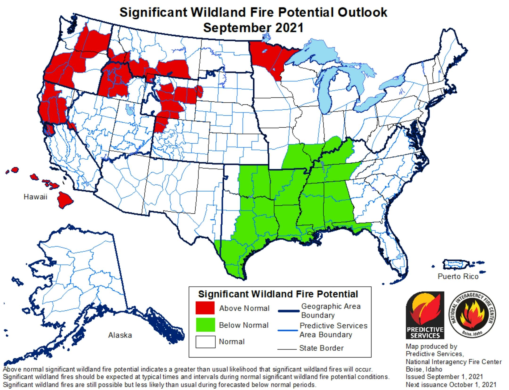
Lingering Wildfire Potential. Details via Wildfire Today: "The forecast for wildland fire potential issued September 1 by the National Interagency Fire Center predicts that the potential for wildfires in Northern California will be above normal September through November. Northern Minnesota and the northwest one-quarter of the country will also be above normal in September. Hawaii and Wyoming could be busy in September and October. The southeast Atlantic coast states may experience above normal fire activity in October and November, but December looks to be pretty average in all 50 states..."


