
Somewhat Soggy With Snow
Here's the weather outlook from 7AM Monday to 7PM Wednesday, which shows our next weather maker moving slowly through the Upper Midwest and Great Lakes Region. Areas of rain mixed with snow will be possible, the heaviest/steadiest stuff will likely fall along the International Border.
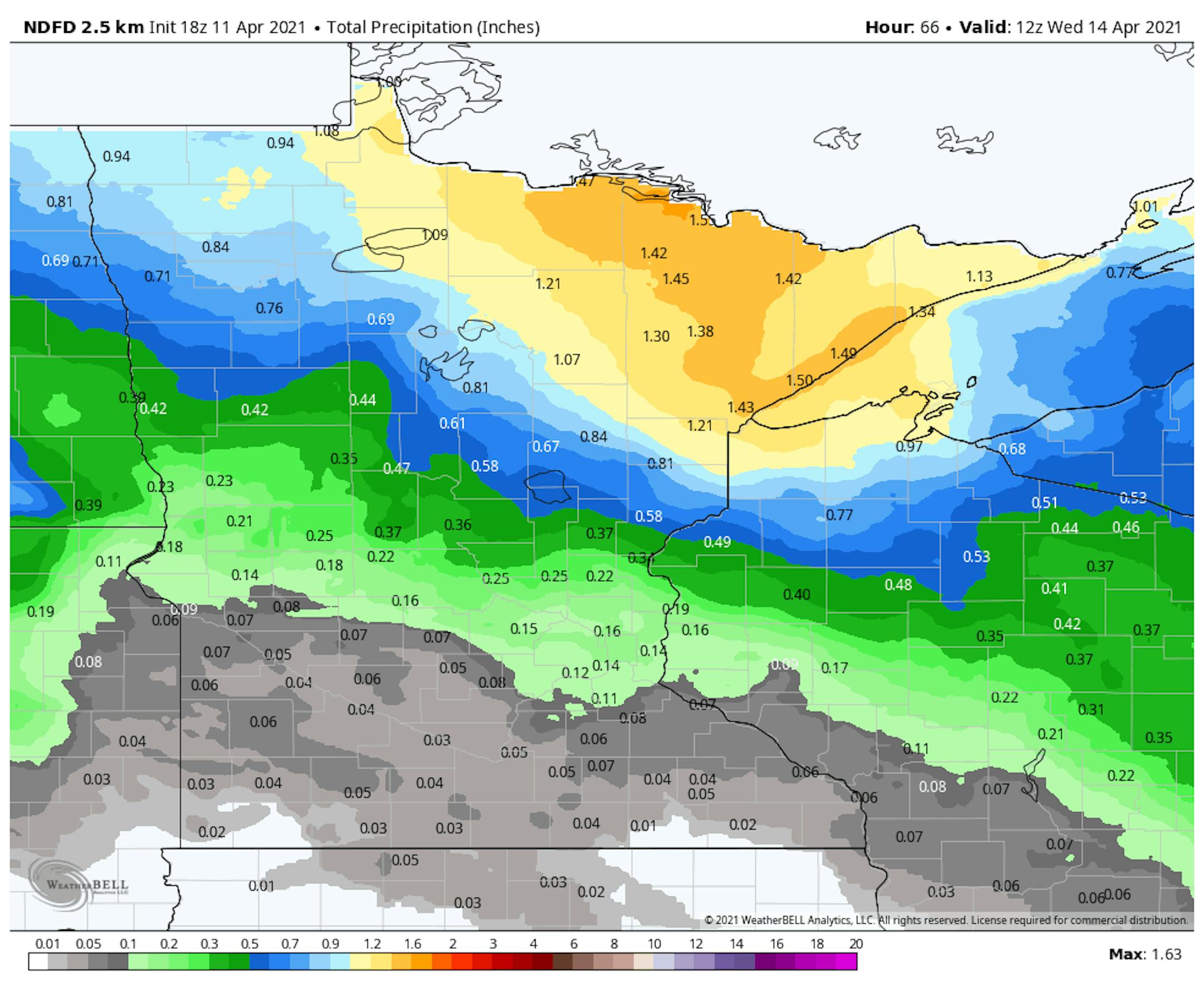
Precipitation Outlook
According to NOAA's NDFD data, the precipitation potential through Wednesday shows the heaviest steadiest stuff across the northern half of the state. Note that there could be some 1"+ tallies in the Arrowhead, while folks in the Twin Cities metro might be luck to get a couple of tenths of an inch.
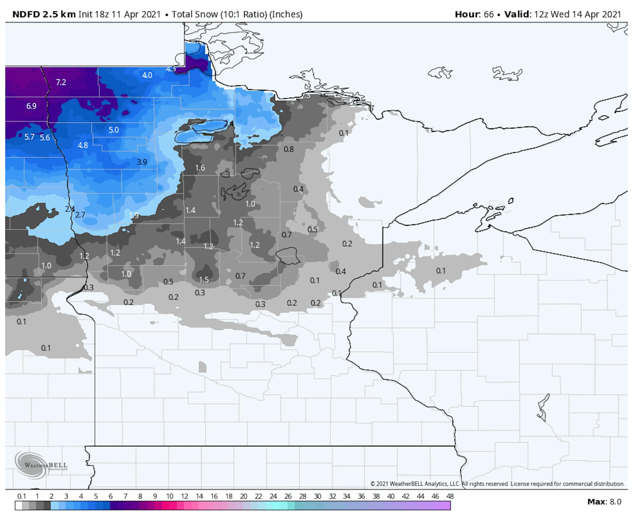
Snowfall Potential Through AM Wednesday
This storm system could bring accumulating snow across parts of the northern half the state. Some of the heaviest tallies could approach 3" to 6" in the northwestern part of the state.
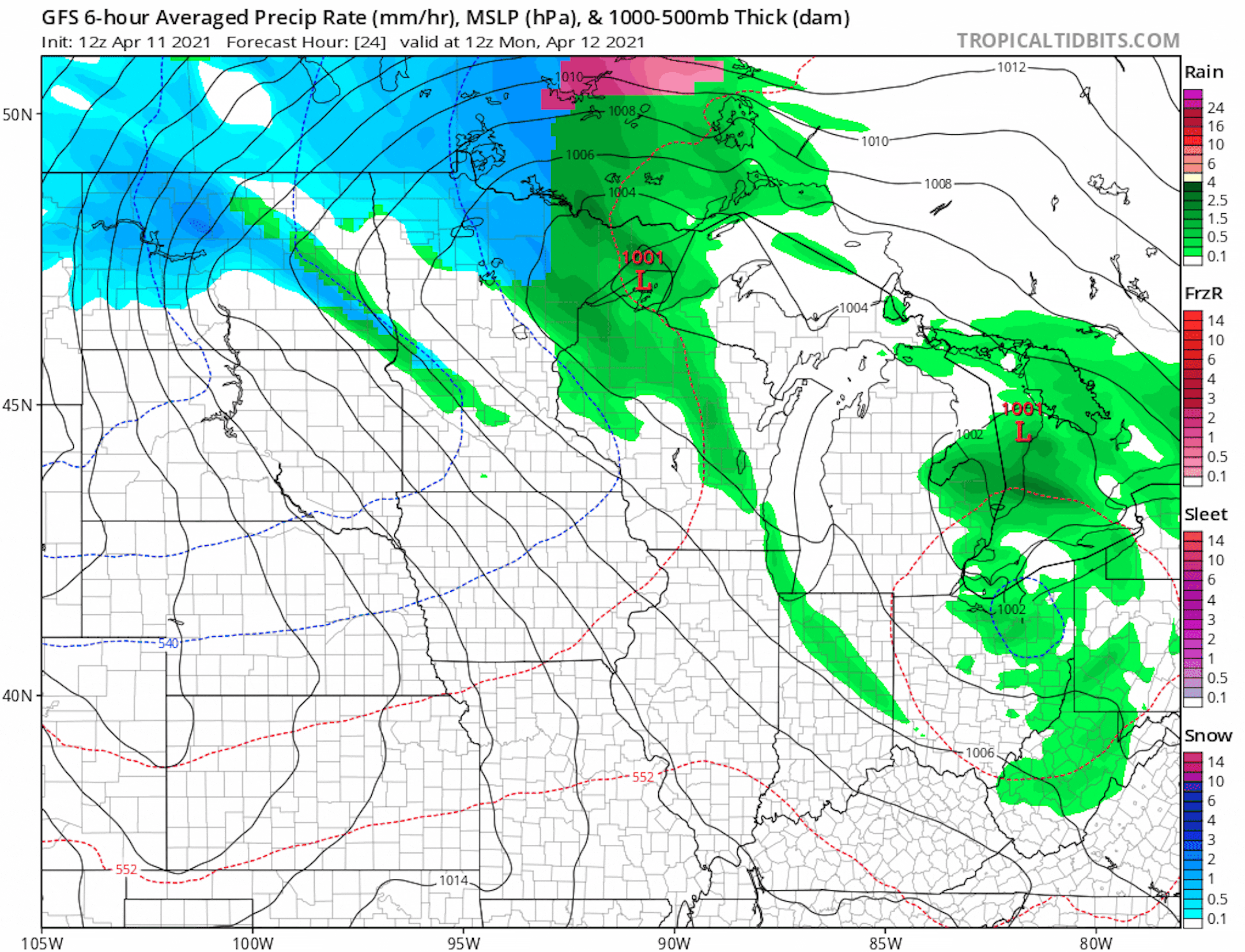
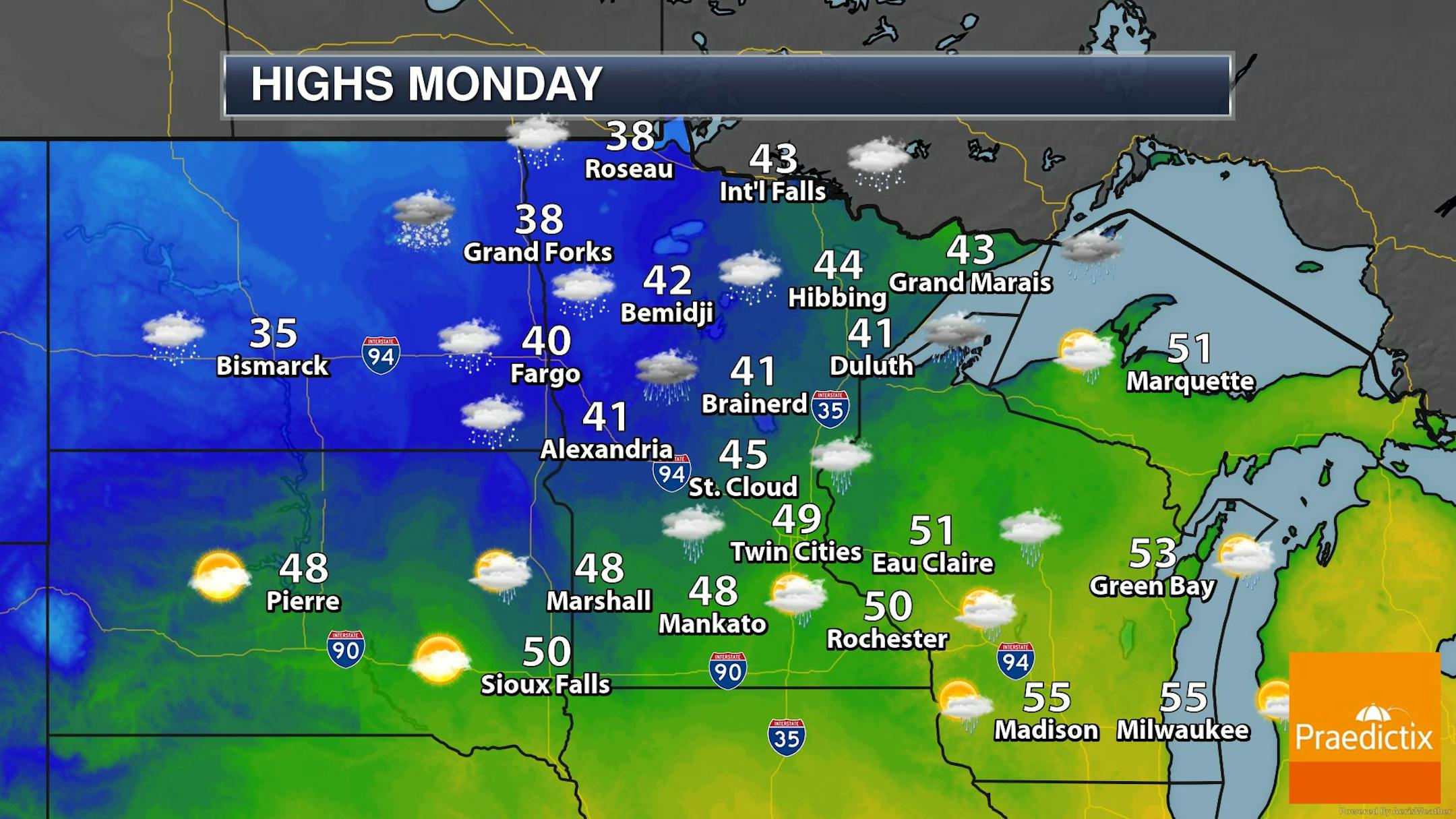
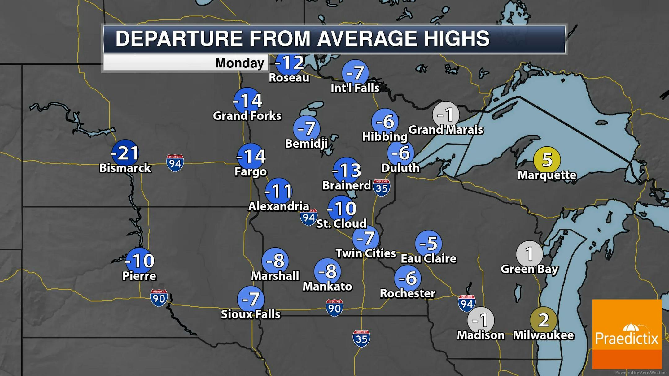
Weather Outlook for Monday
The weather outlook for Monday shows cool and somewhat soggy weather in place across the region. Monday will be a fairly raw and breezy day for mid April with temps running nearly -5F to -15F below average. Light rain will be possible across parts of Central MN, but rain will mix with snow in the northern part of the state.
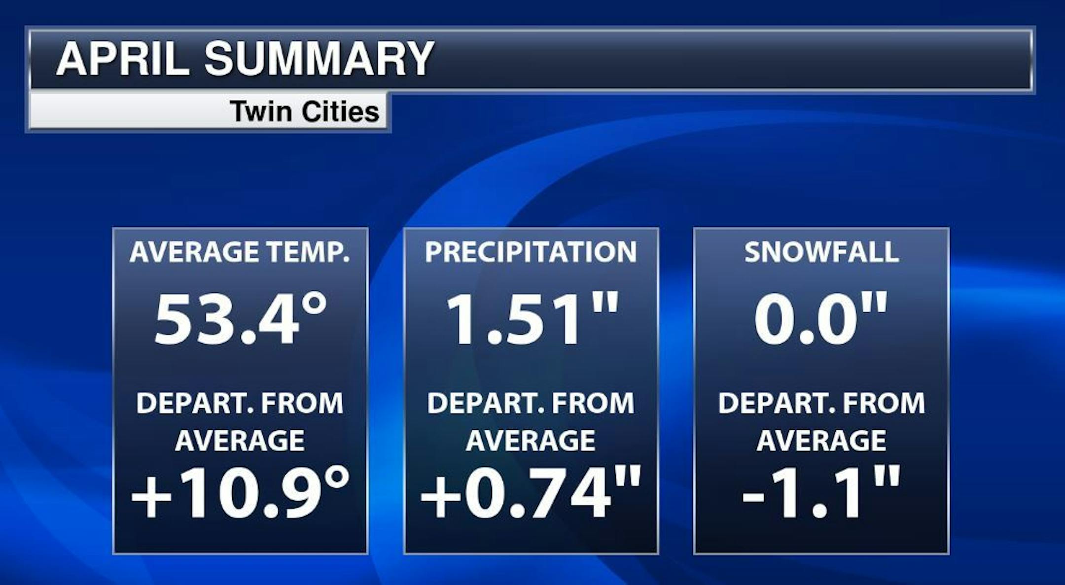
Twin Cities April Summary So Far
Here's the Twin Cities weather summary through the first 10 days of April. Note that temps are running nearly +11F above average, which is the 3rd warmest start to any April on record at MSP. We're also running nearly +0.75" above average in the precipitation department and more than -1" below average in the snowfall department.
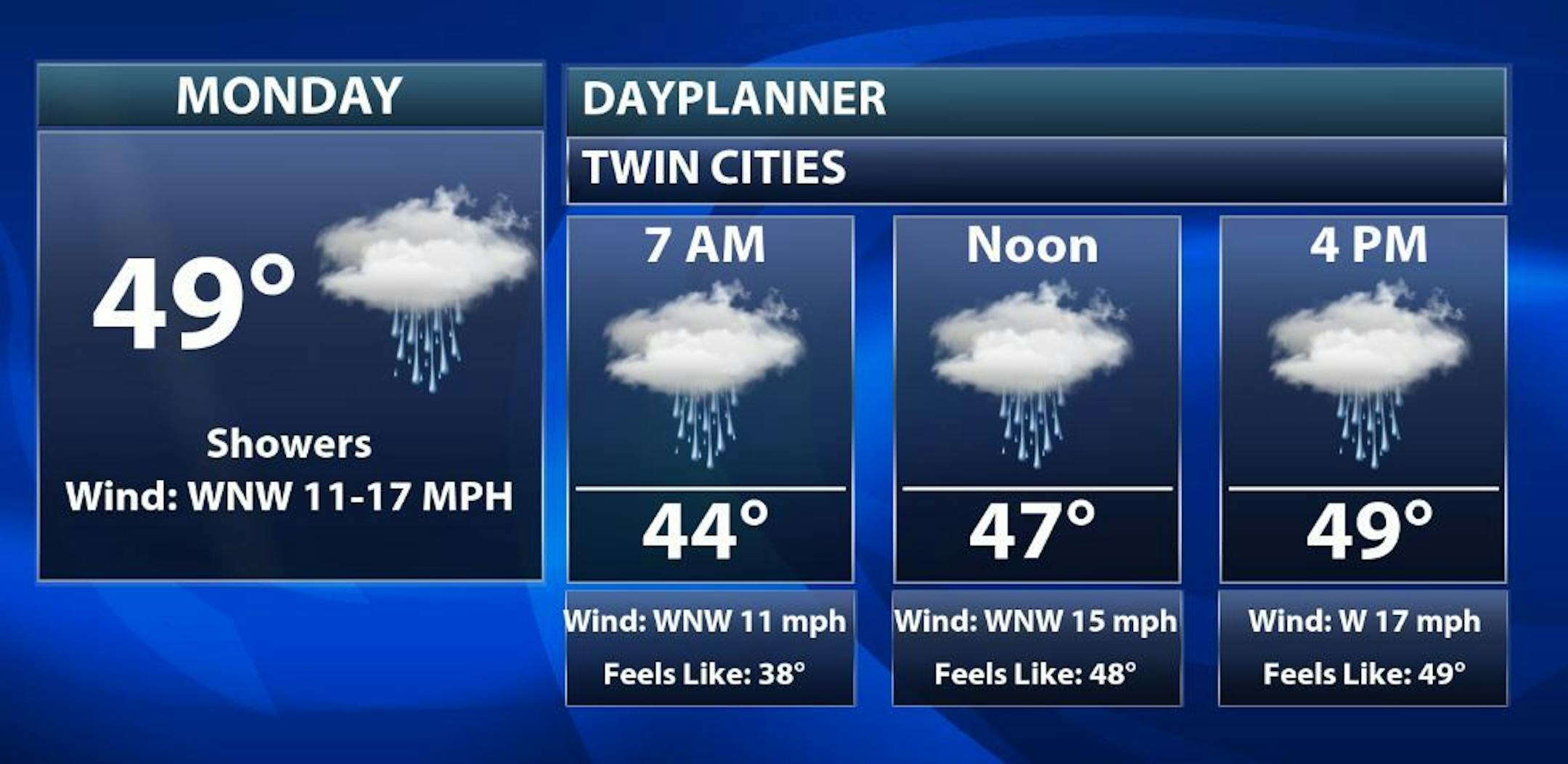
Monday Weather Outlook For Minneapolis
Here's a closer look at our weather conditions for Minneapolis on Monday, which shows cooler than average temps in place through much of the day. Scattered light rain showers will also be possible throughout the day.
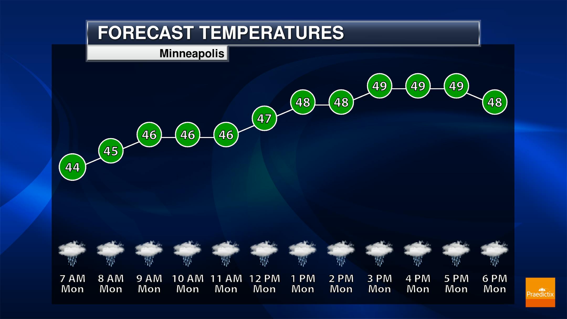
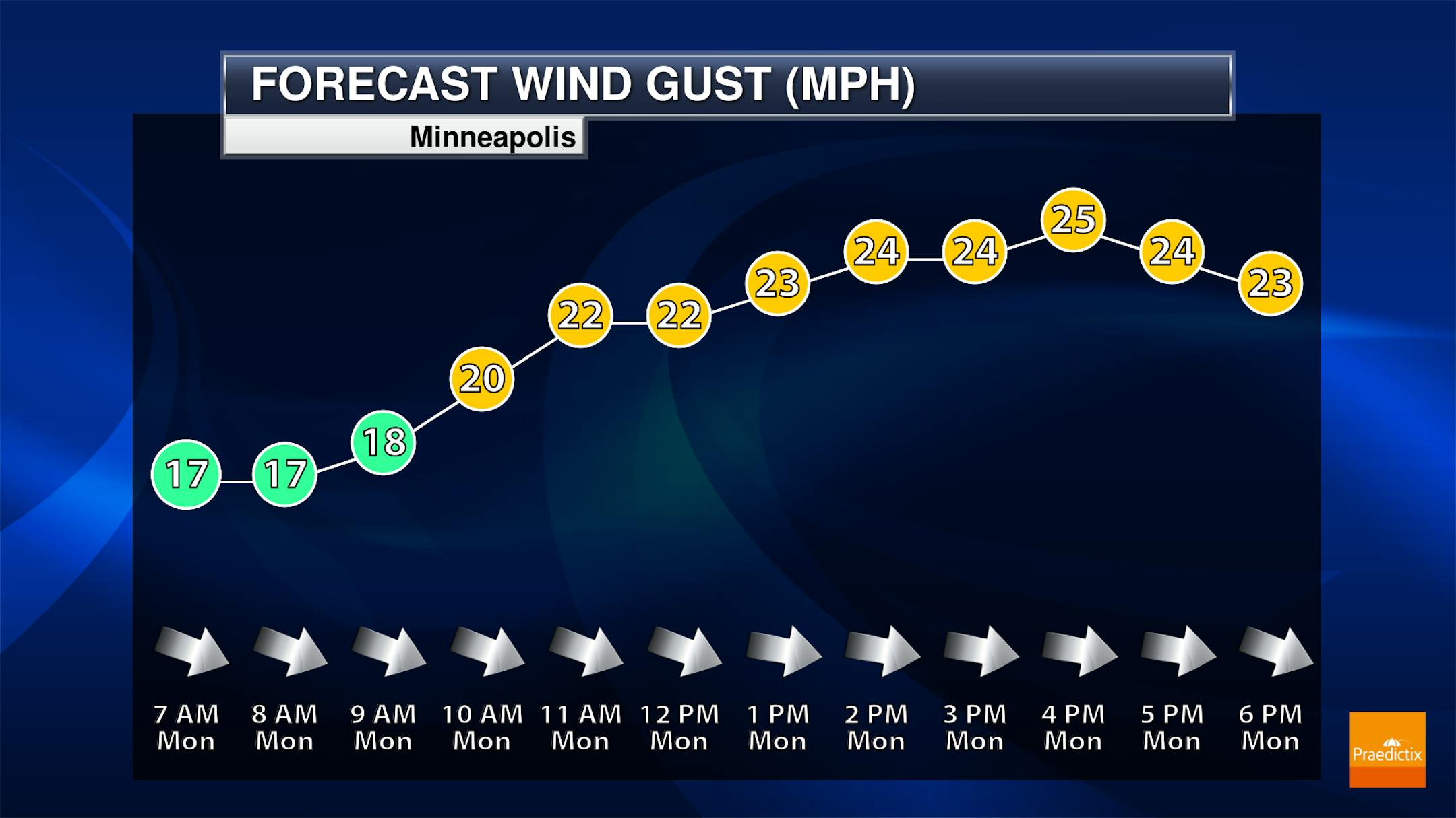
Monday Meteograms
Here are the meteorgrams for Minneapolis on Monday, which show cool and cloudy conditions in place for much of the day. There will also be scattered light rain showers possible, but the steadiest rains should stay north of the metro through much of the day on Monday. West to northwesterly winds will be gusty up to near 20mph to 25mph during the afternoon.
Extended Temperature Outlook
Here's the extended temperature and weather outlook over the next 5 to 7 days. Temps will be quite chilly through the first half of the month with readings nearly -5F to -15F below average for mid April. Areas of rain and snow will be possible through Tuesday before more sunshine slides in Thursday. Weather conditions sour a bit late next week with more rain chances sliding in through the weekend.


