

Spring Has Sprung In A Hurry!
It took a while, but we finally got some much needed spring warmth. Unfortunately, it's coming in a hurry with our first 50F, 60F, 70F and 80F (possibly), all happening within a week or so. Our first 50F came nearly 1 month later than normal, while our first 60F came nearly 2 weeks later than normal. Our first 70F occurred on Monday, which is only a few days, but our first 80F could happen this week and it would be nearly 2 to 3 weeks ahead of schedule... How about that?!

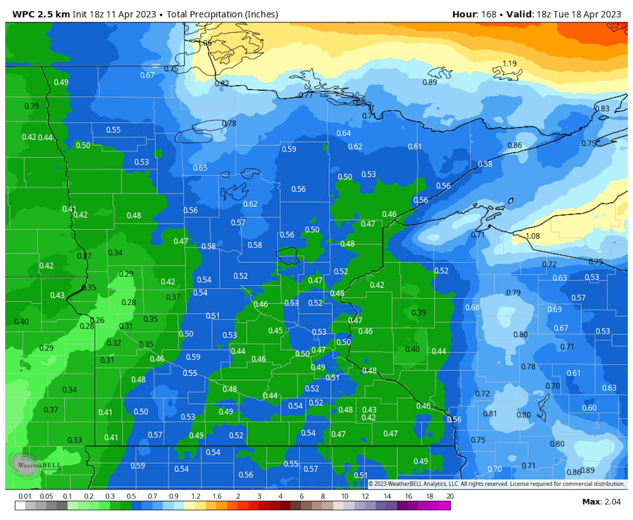
Precipitation Potential
According to NOAA's WPC, the extended precipitation outlook for Minnesota doesn't look as impressive as it did earlier this week, but it looks like we'll still get some decent precipitation. A bigger storm system looks to drift into town late week and into the weekend ahead with some 0.50" liquid tallies, especially across the northern half of the state. Some locations across central and southern Minnesota may even get close to an inch of liquid as well. Stay tuned...
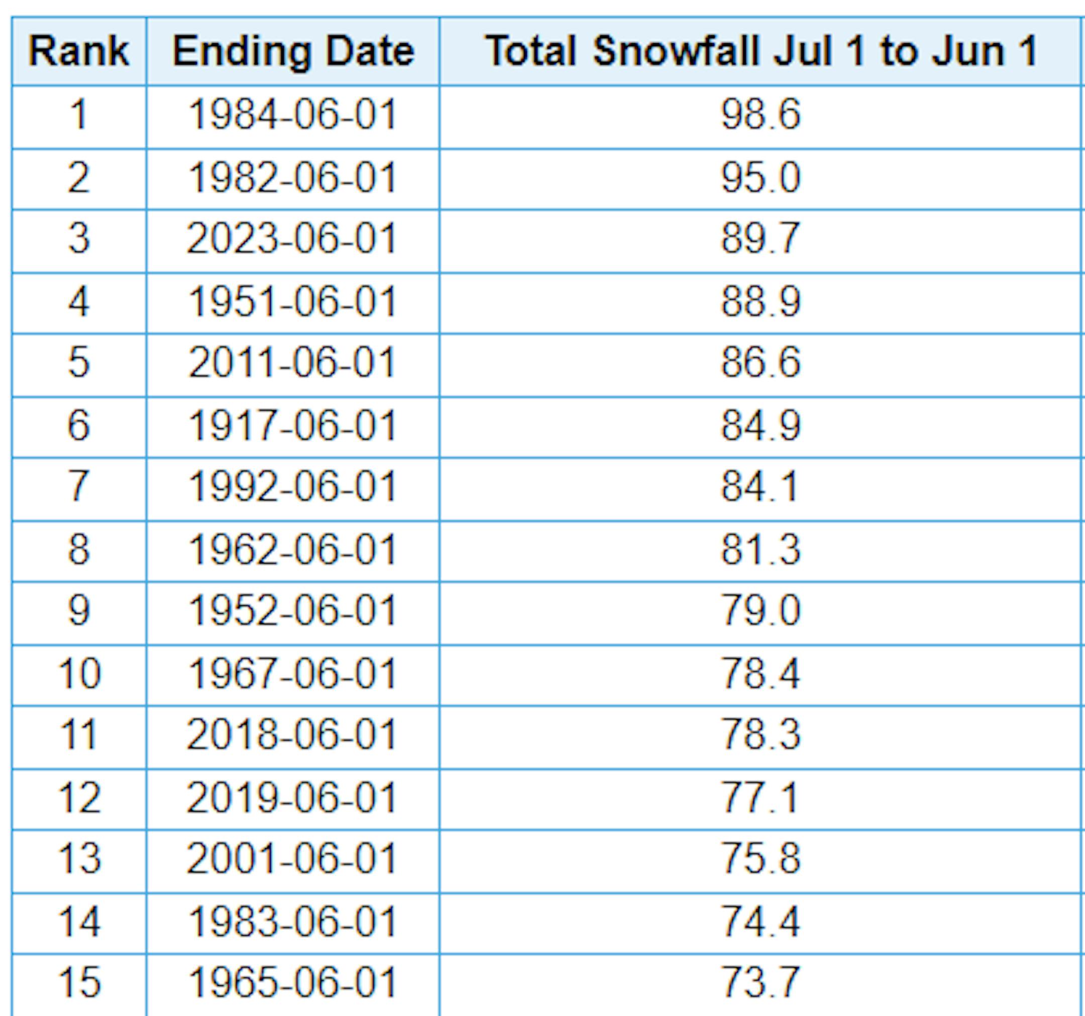
3rd Snowiest Winter on Record
Just a reminder that MSP has seen nearly 90" of snow this season, which is the 3rd snowiest winter season on record. We need 5.4" more get into the 2nd spot and 9" to get into the top spot. If you're wondering, the latest measurable snow (0.1") on record at MSP was on May 24th set in 1925. The snow season isn't quite over just yet... Stay tuned.
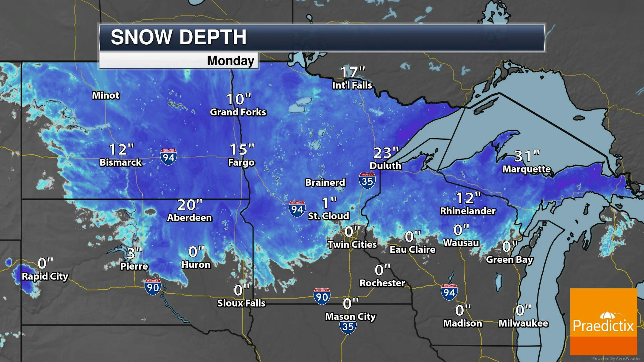
Snow Depth
As of Monday, April 10th, the MSP Airport officially dropped to 0" of snow on the ground. However, there is still quite a bit across the northern half of the state, in Wisconsin and also across the UP of Michigan.
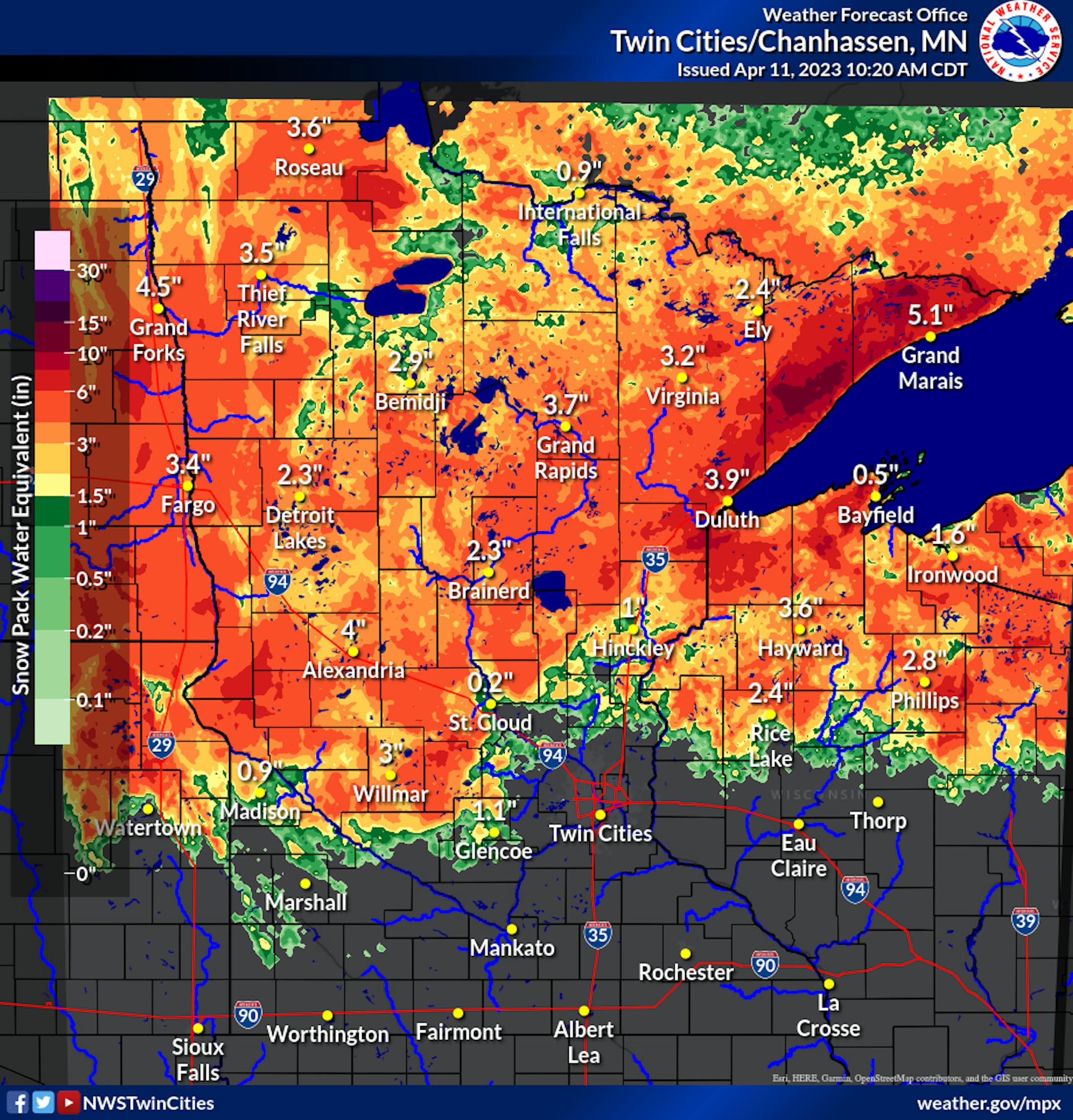
Snow Pack Water Equivalent
According to the National Weather Service, there is still a lot of water locked in the snow pack. SWE stands for Snow Water Equivalent and as you can see in the figure below, several inches of water is locked in the snow pack across much of the state. With much warmer temps in the forecast over the next several days, a lot of water will be entering the river systems with flooding a growing potential over the coming days and weeks.
Flood Outlook
According to the National Weather Service, a number of river gauges around the region will be entering flood stage here over the next few days. Some spots will be at Moderate and even Major flood stage, which could cause issues in a few flood prone communities.

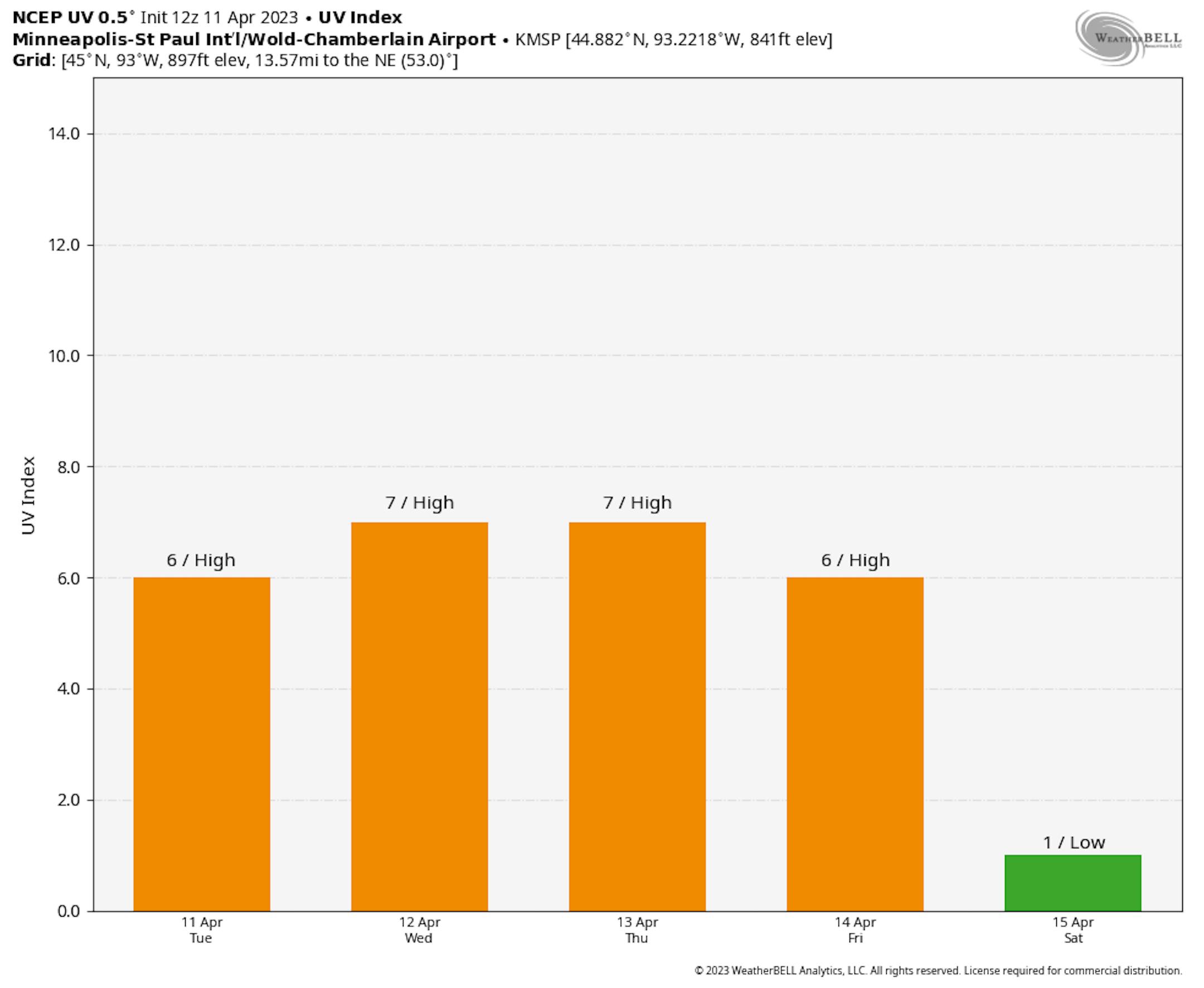
Elevated UV Index
The sun is quite a bit stronger now than it was a few weeks ago and with warmer temps in the forecast, people will likely be wandering outdoors a little more freely this week. With that being said, it'll be important to be sun aware as the UV Index will be at elevated levels this week. Make sure you're taking the proper precautions with your sensitive skin.
Extended Temperature Outlook
The NBM extended temperature outlook for Minneapolis shows a string of 60s and 70s through the week ahead, which will be some of the warmest weather we've seen since October and early November of last fall. Note that on Wednesday, we could see our first 80F reading, which would be the first since October 11th, 2022. Unfortunately, the quick warm up could lead to an increasing flood threat for maybe communities that live by rivers and streams over the coming days and weeks. Temps will take a hit by the weekend and into early next week with readings back in the 40s and 50s, which will be below average for this time of the year.


