
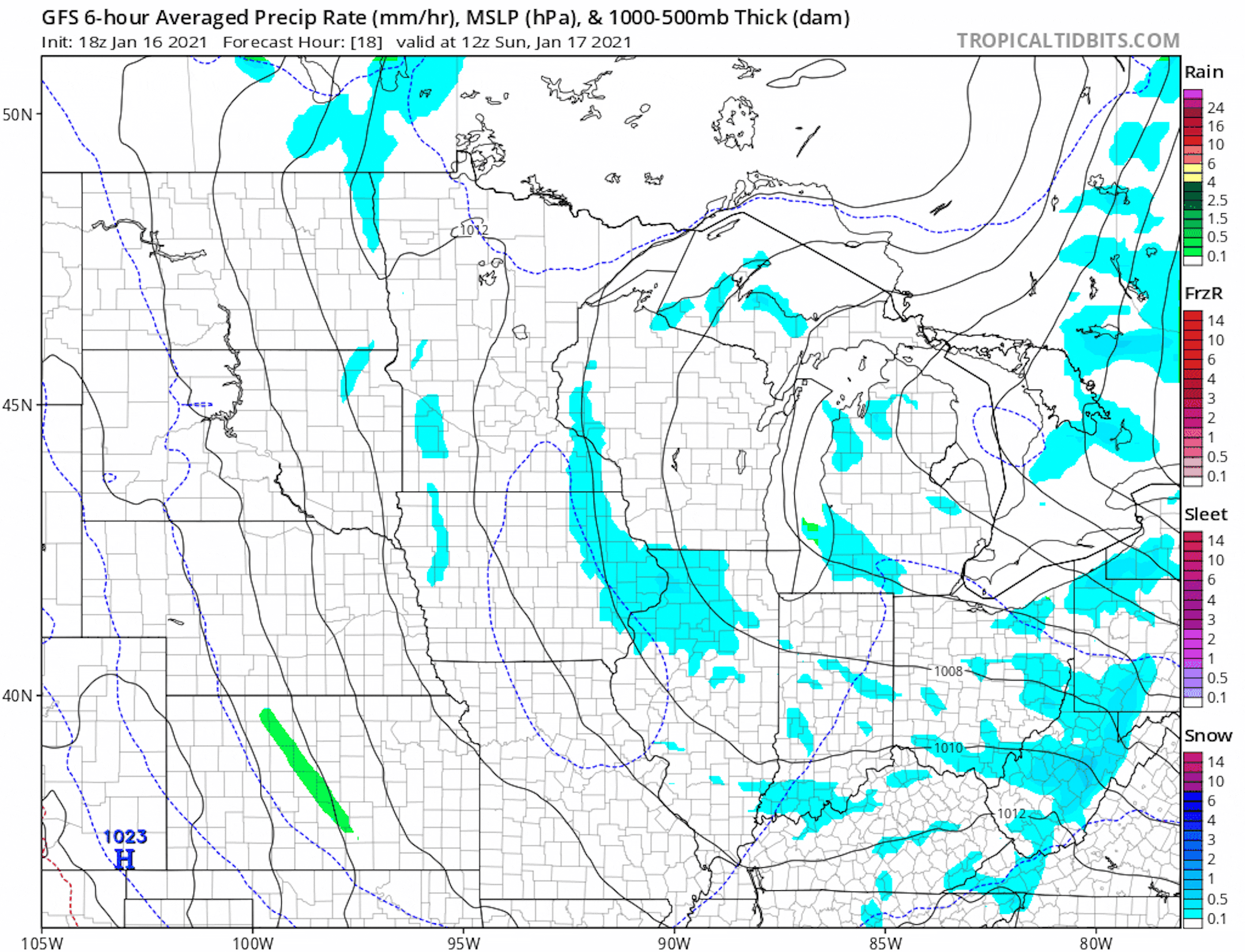
Weather Outlook AM Sunday to AM Tuesday
Here's the weather outlook from AM Sunday to AM Tuesday. While there doesn't appear to be any major snow chances close to home, we do have a chance isolated snow showers and flurries across parts of the region over the next couple/few days.
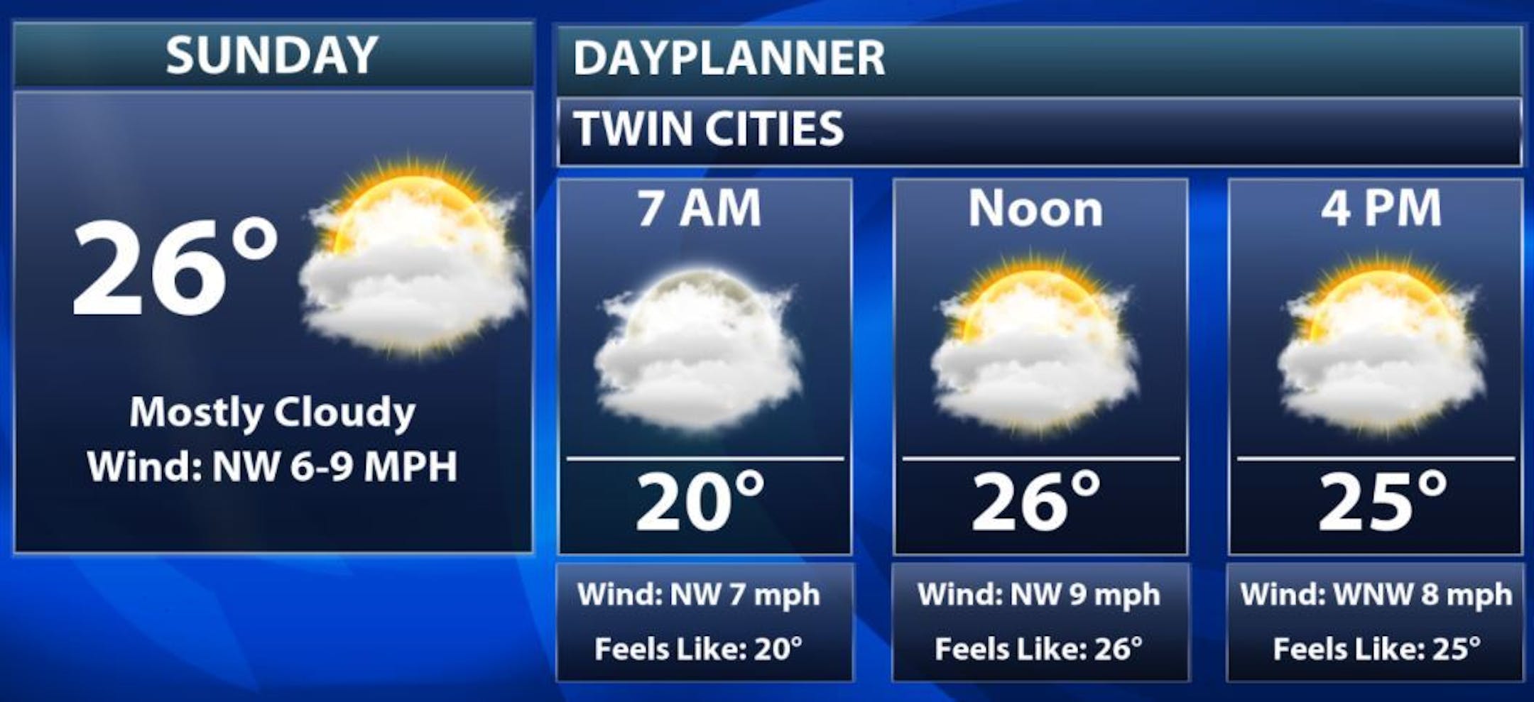
Sunday Weather Outlook for Minneapolis
Here's the weather outlook for Sunday, which shows quiet weather in place throughout much of the day. Mostly cloudy skies will continue with perhaps a few flurries here or there.
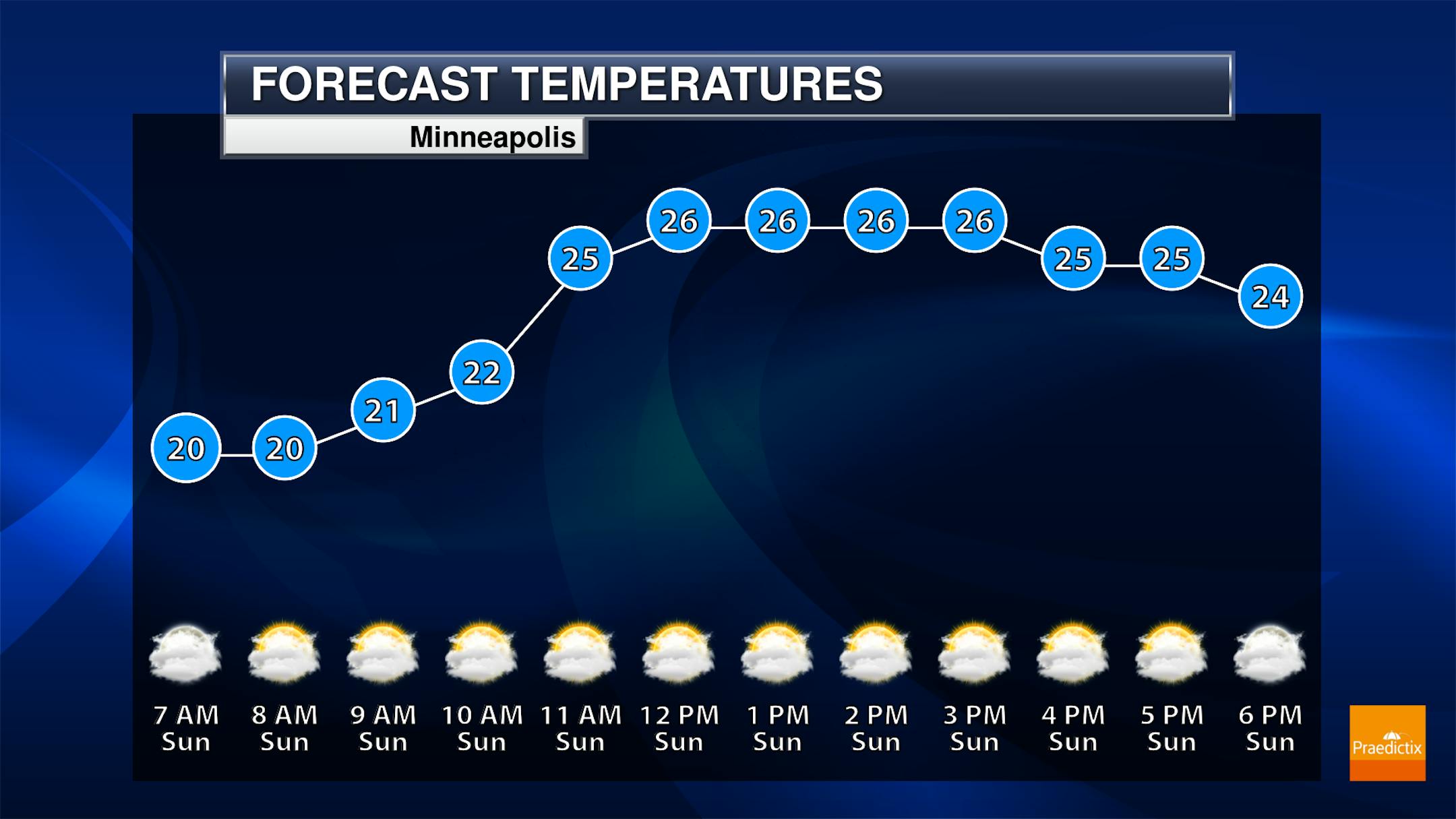
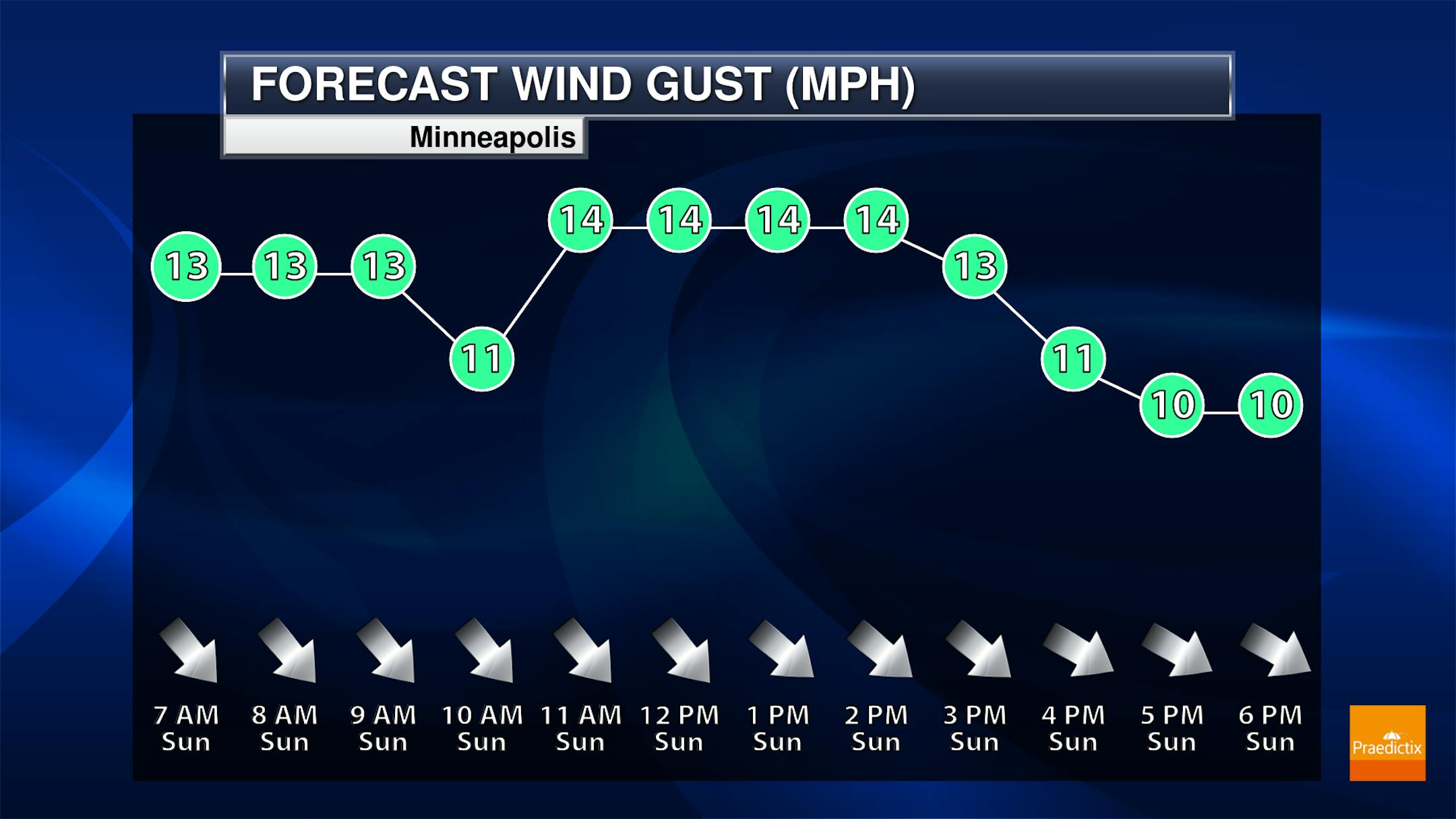
Sunday Meteograms for Minneapolis
Here's a look at the Meteograms for Sunday, which shows temps warming into the mid 20s by the afternoon. Skies will also remain mostly cloudy much of the day with northwesterly winds gusting close to 15mph at times.
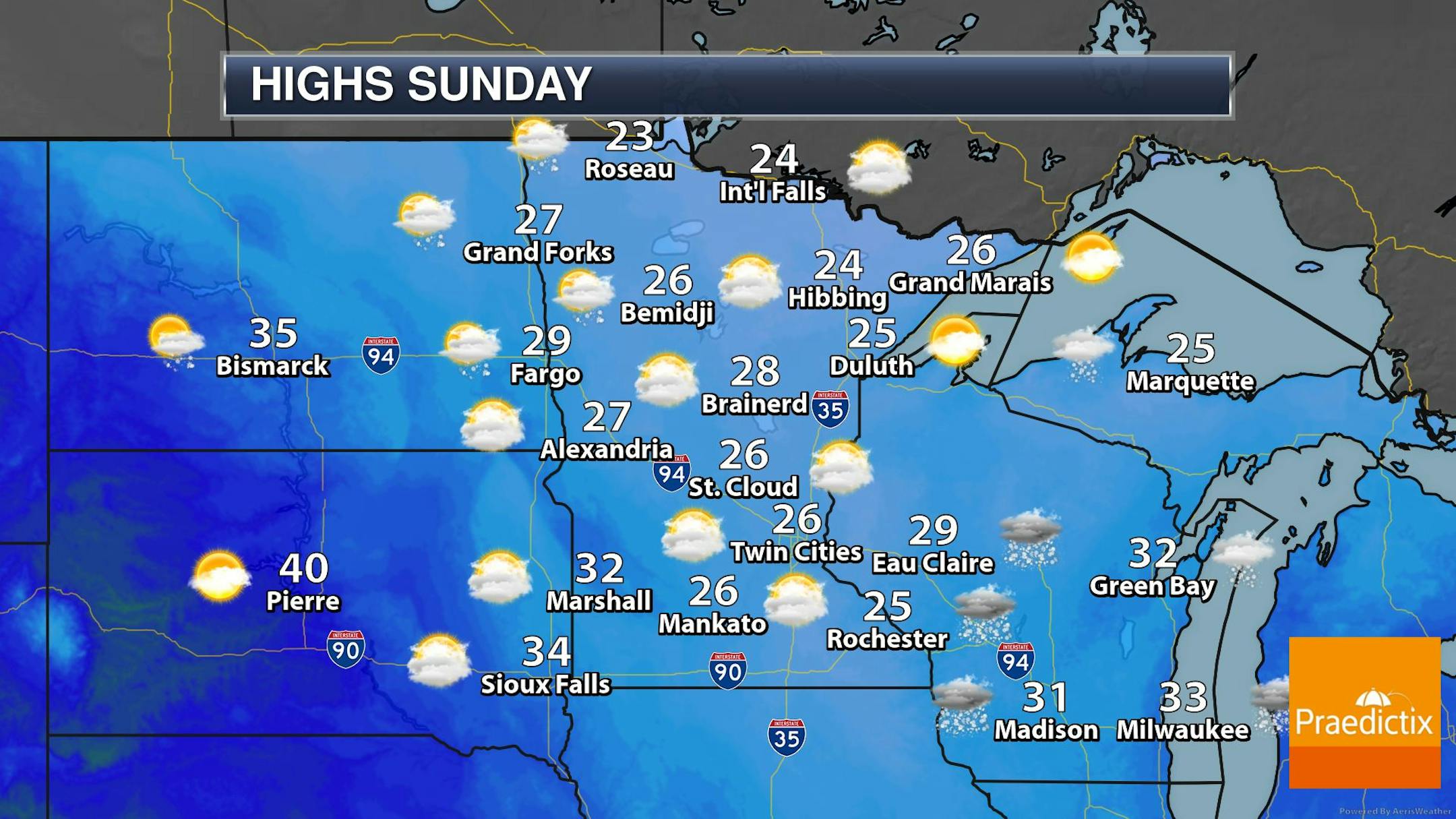
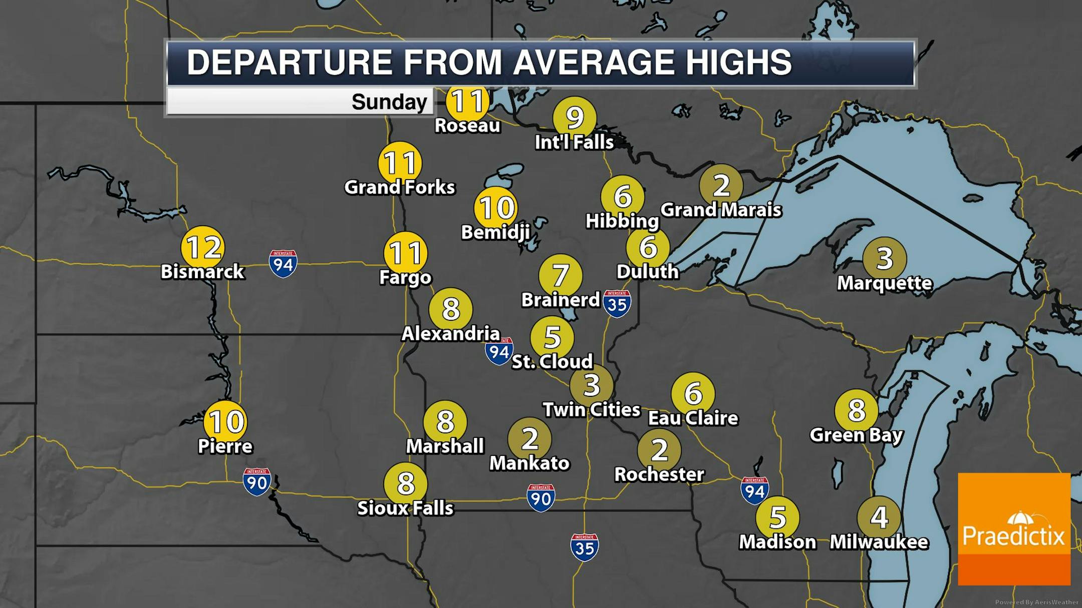
Sunday Weather Outlook
High temps on Sunday will warm into the 20s across much of Minnesota, which will be +5F to +10F above average for this time of the year. There may also be a few light snow showers or flurries across parts of the region.
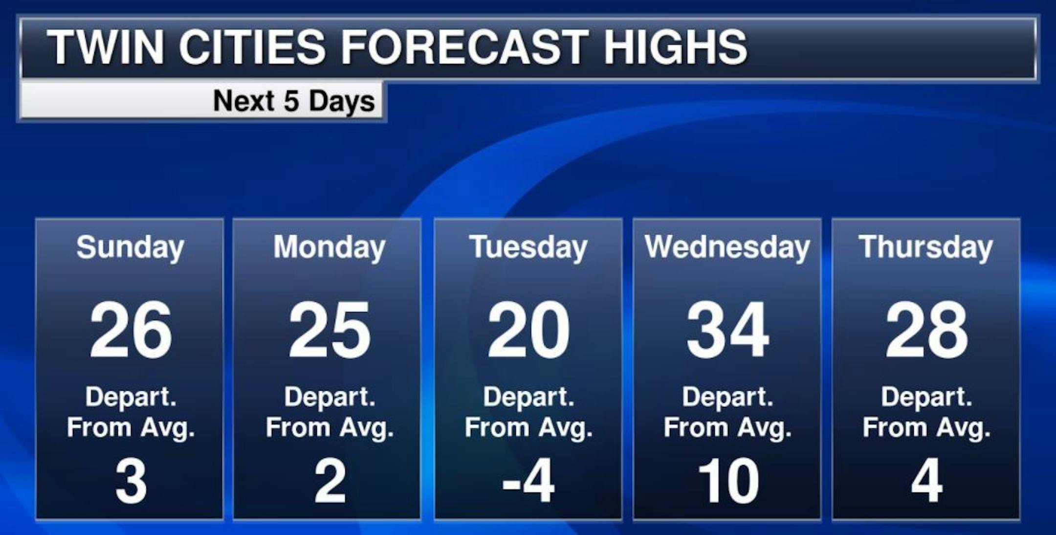
Extended Temperature Outlook For Minneapolis
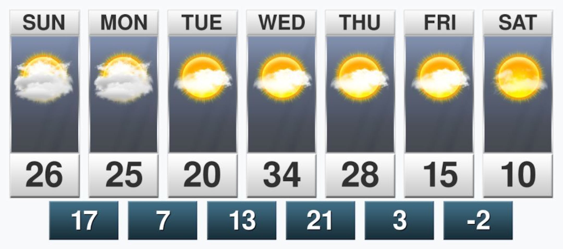
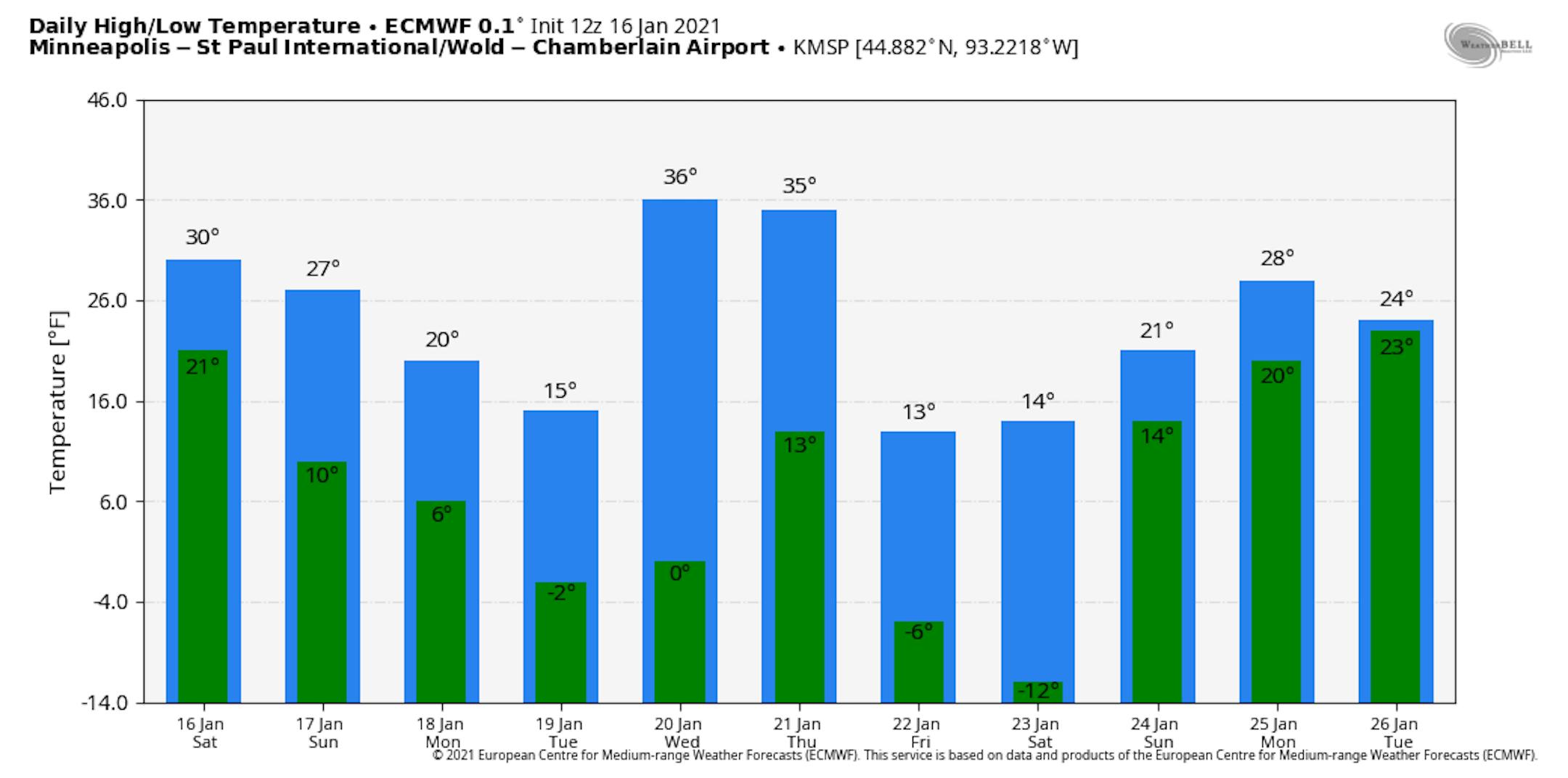
Here's the extended temperature outlook for the Twin Cities, which shows above average temps on Sunday and Monday with temps warming into the mid 20s. Tuesday will be a little cooler with a high that could be below average for a change. The extended outlook suggests even cooler temps by Friday and Saturday with temps only warming into the low/mid teens and overnight lows dipping into the single digits.
Extended Temperature Outlook For Minneapolis
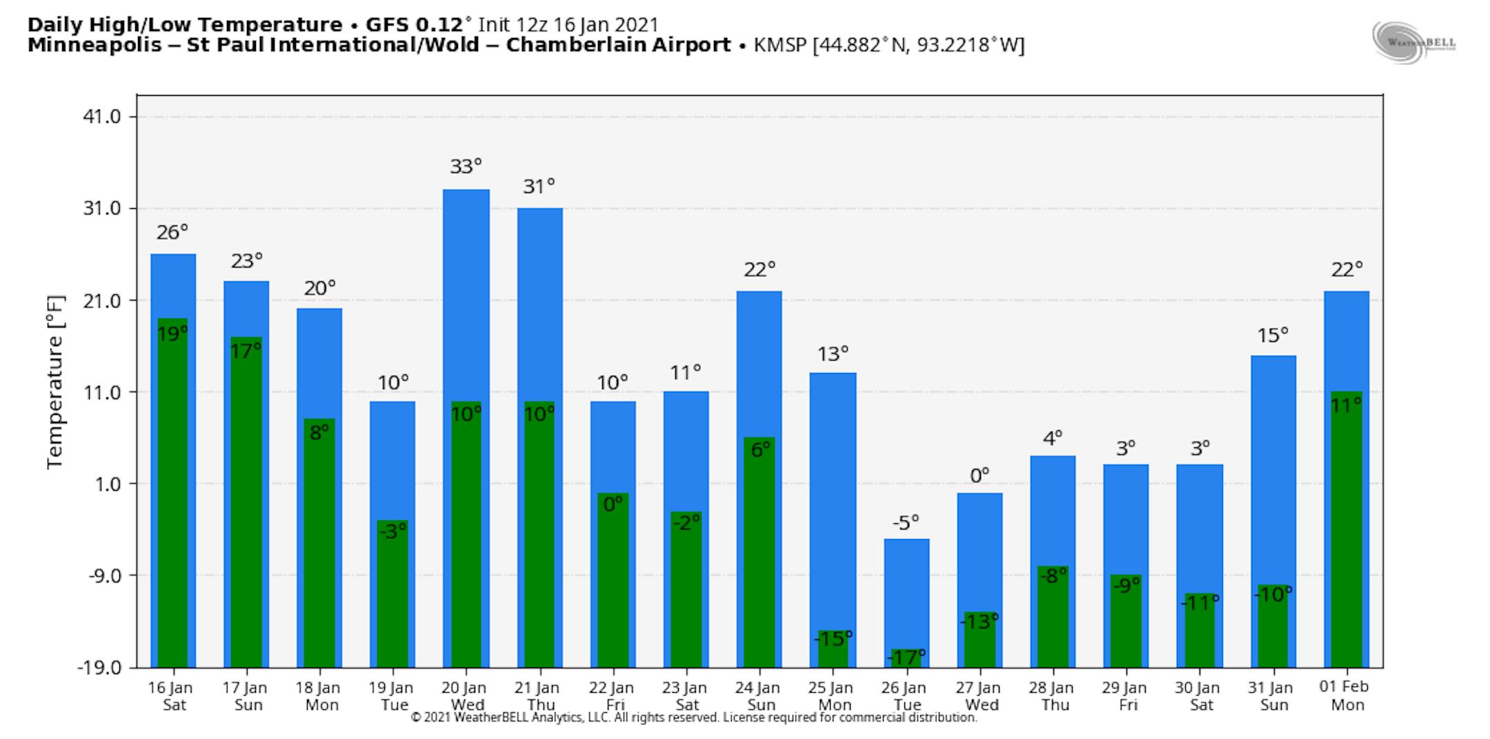
The extended temperature outlook through the end of January shows cooler temps as we head into the 2nd half of the month. The ECMWF doesn't show anything too significant, but according to the GFS, highs may only warm into the single digits during the last few days of the month. Stay tuned.
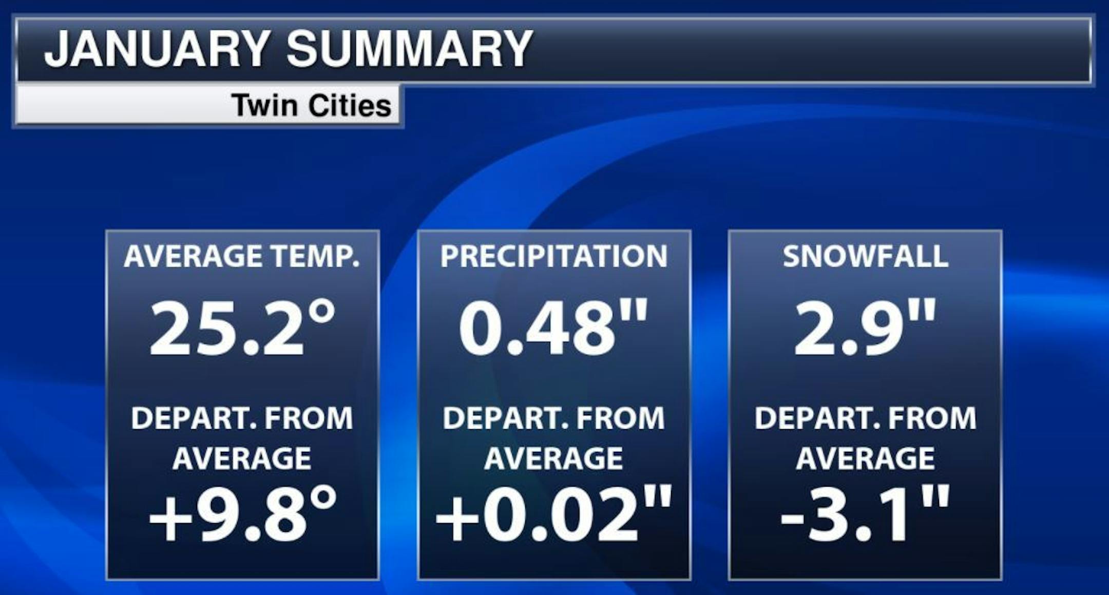
Minneapolis January Summary So Far
Here's a look at the January numbers so far and it certainly has been a mild start to the month. We're nearly +10.0F above average, which is the 6th warmest start to any January on record. Also note that MSP is currently sitting at its 11th warmest Meteorological Winter on record (December 1st - January 16th). We've also only had 2.9" of snow, which is nearly -3" below average for the month.
Snow Depth As of January 16th
As of January 16th, there was still 7" of snow on the ground in the Twin Cities with 9" in Duluth, 10" in International Falls and 13" in Marquette, MI.


