

Record-Breaking Friday
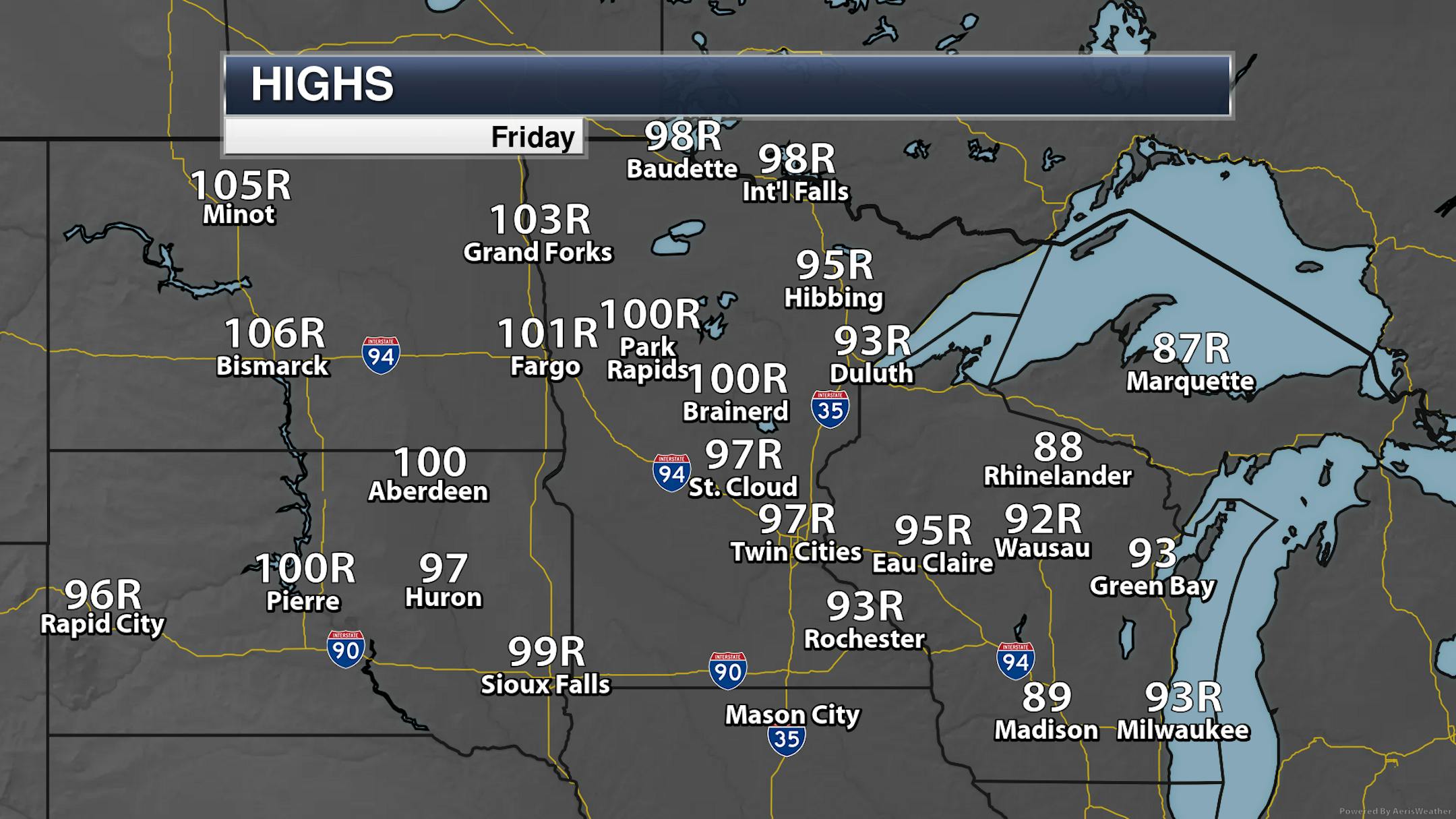
It was a hot one on Friday across the state, with essentially every climate location breaking its record for the day. The high in the Twin Cities made it up to 97F, but it reached 100F in both Park Rapids and Brainerd. The high of 98F in International Falls ties for their tenth warmest high ever recorded. Below are a couple of fascinating stats from NWS Duluth about a 25F degree warm-up in 20 minutes by Lake Superior, as well as from NWS Grand Forks on them hitting 100F for the first time since 1989.
_______________________________________________
Heat Advisory Through Sunday
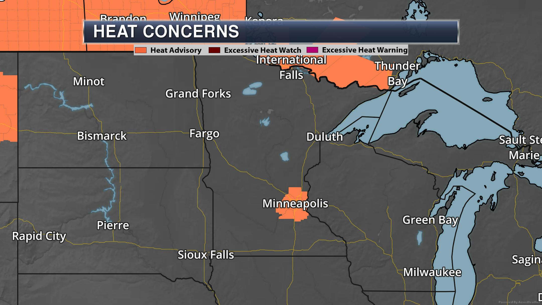
The National Weather Service has issued a Heat Advisory for the metro through 9 PM Sunday as highs are expected to be between 95F and 100F through the weekend. They also mention that, "In addition to the hot afternoon temperatures, lows will remain above 70 this weekend. This is the first heat wave of the year, which is often the most dangerous, since our bodies are not used to the heat yet."
_______________________________________________
More Record Highs Likely Saturday
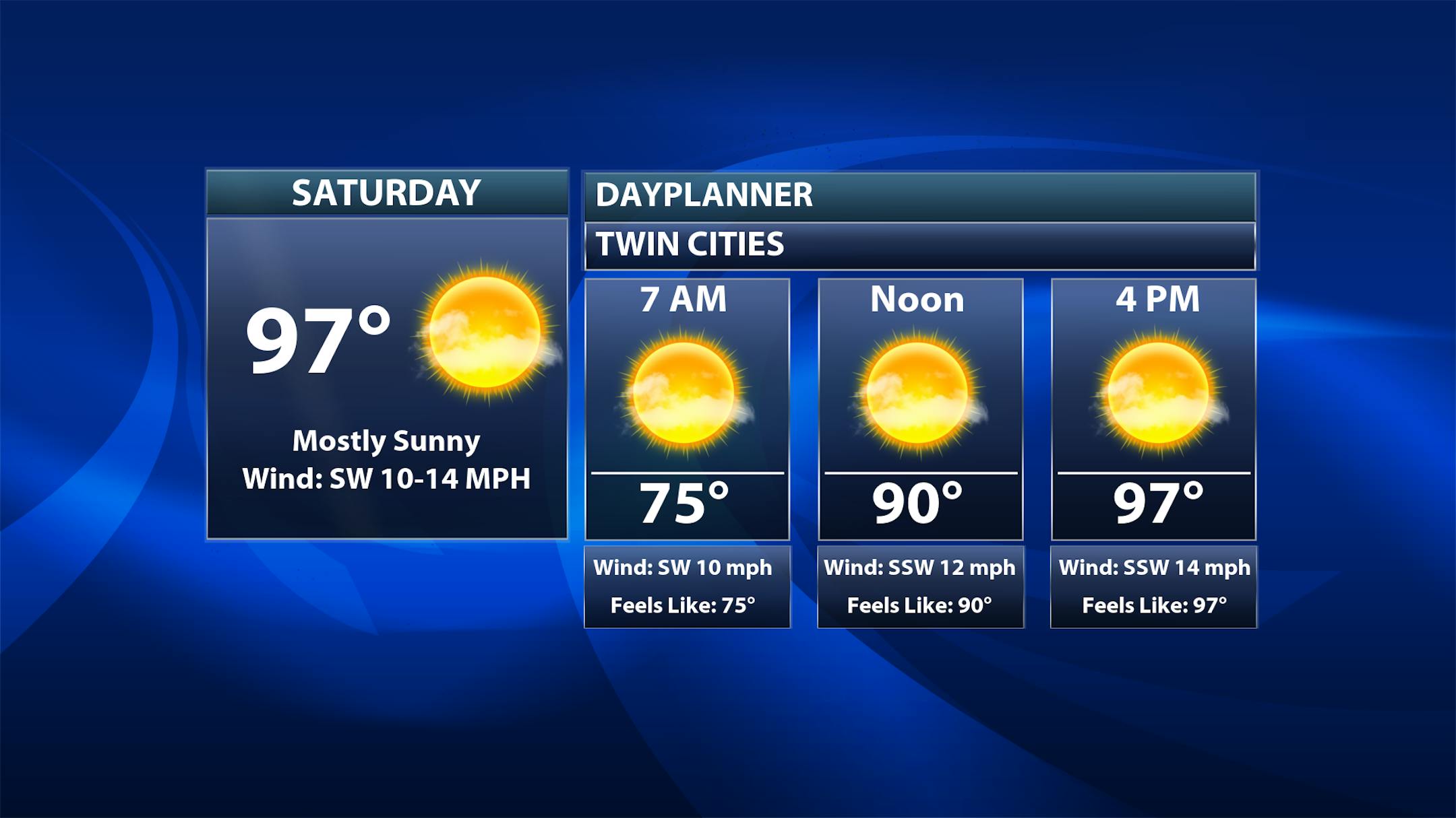
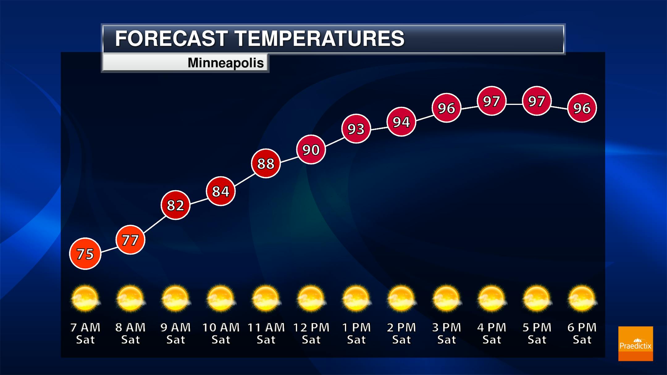
After the record high of 97F on Friday, Saturday looks to break another record - and quite easily, I must add. Temperatures will start off steamy in the low to mid-70s, climbing to the mid/upper 90s for highs. The record for the day in the Twin Cities is an easily attainable 92F. Another mainly sunny day is expected. Winds will be a bit breezier than Friday, with south-southwest gusts to 25 mph possible.
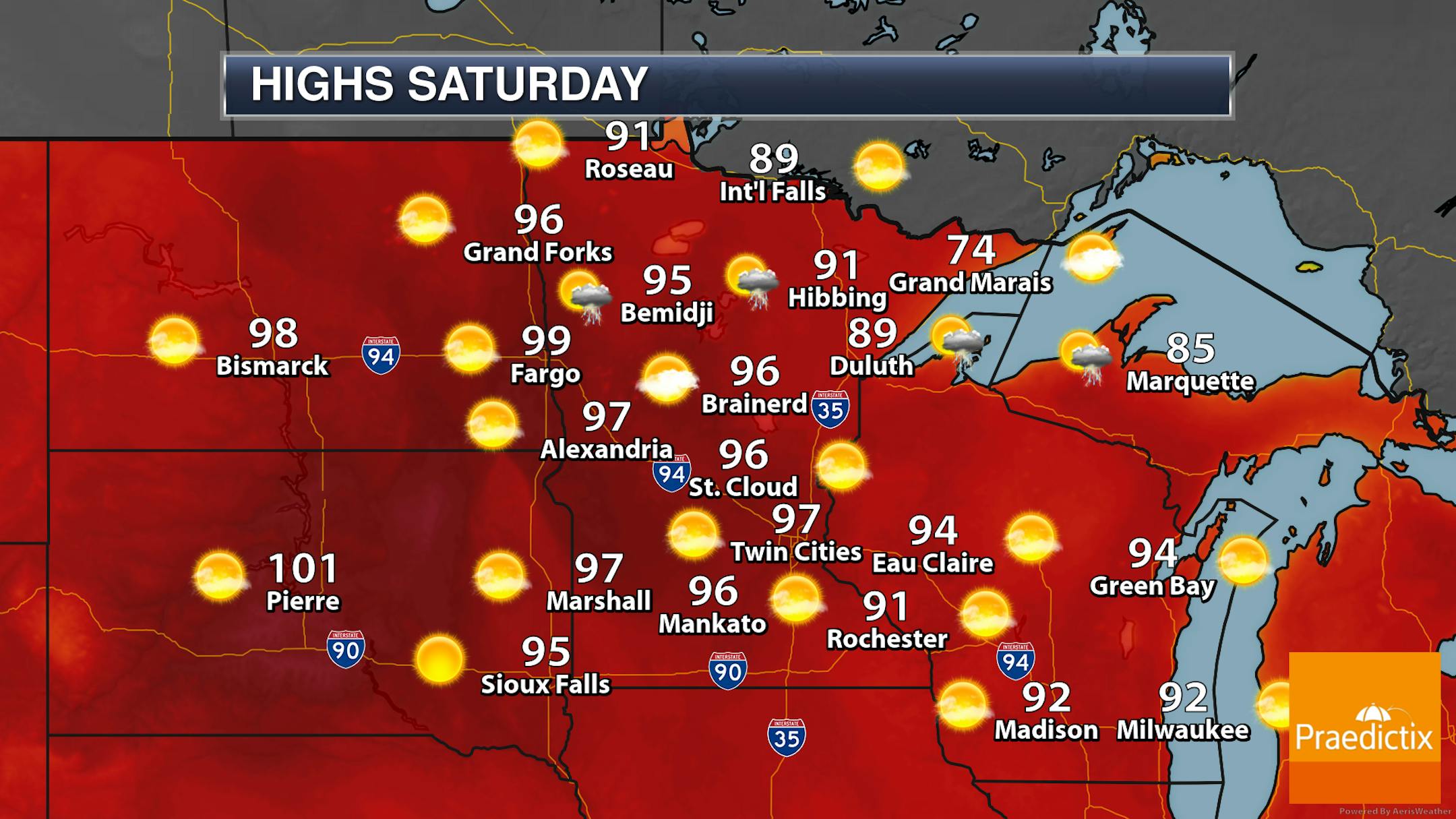
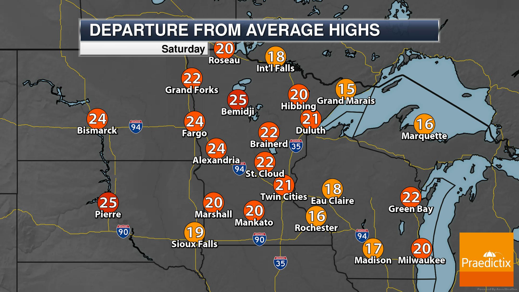
Many areas of the state will climb to the upper 80s or the 90s on Saturday, a good 20-25F degrees above average, under the sunny skies. A few isolated storms will be possible across portions of northern Minnesota during the early morning and Saturday Night timeframes.
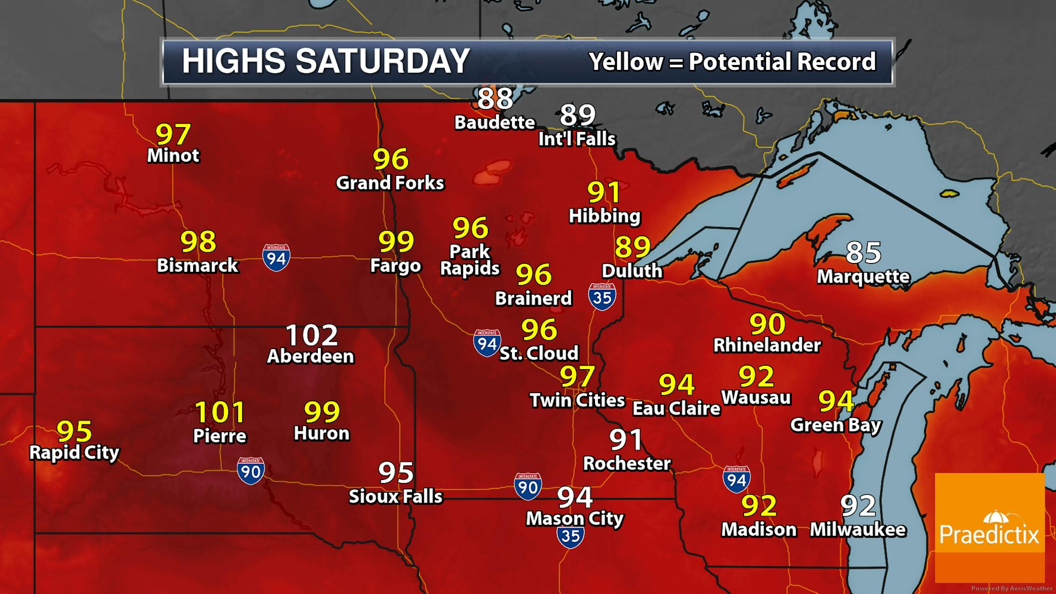
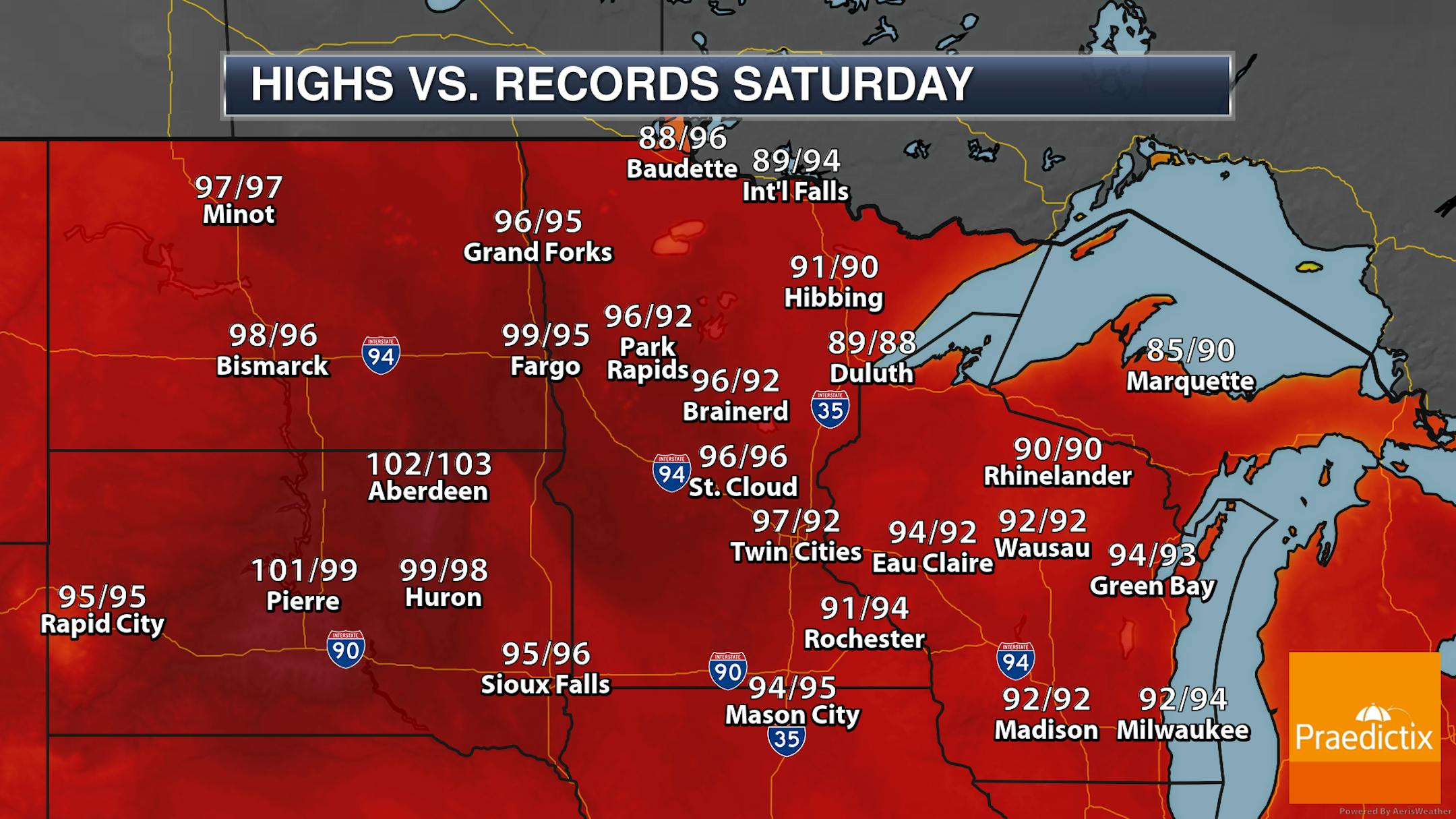
Saturday will be a record-breaking day for highs across the state, as many NWS climate locations look to tie or break the record for the day.
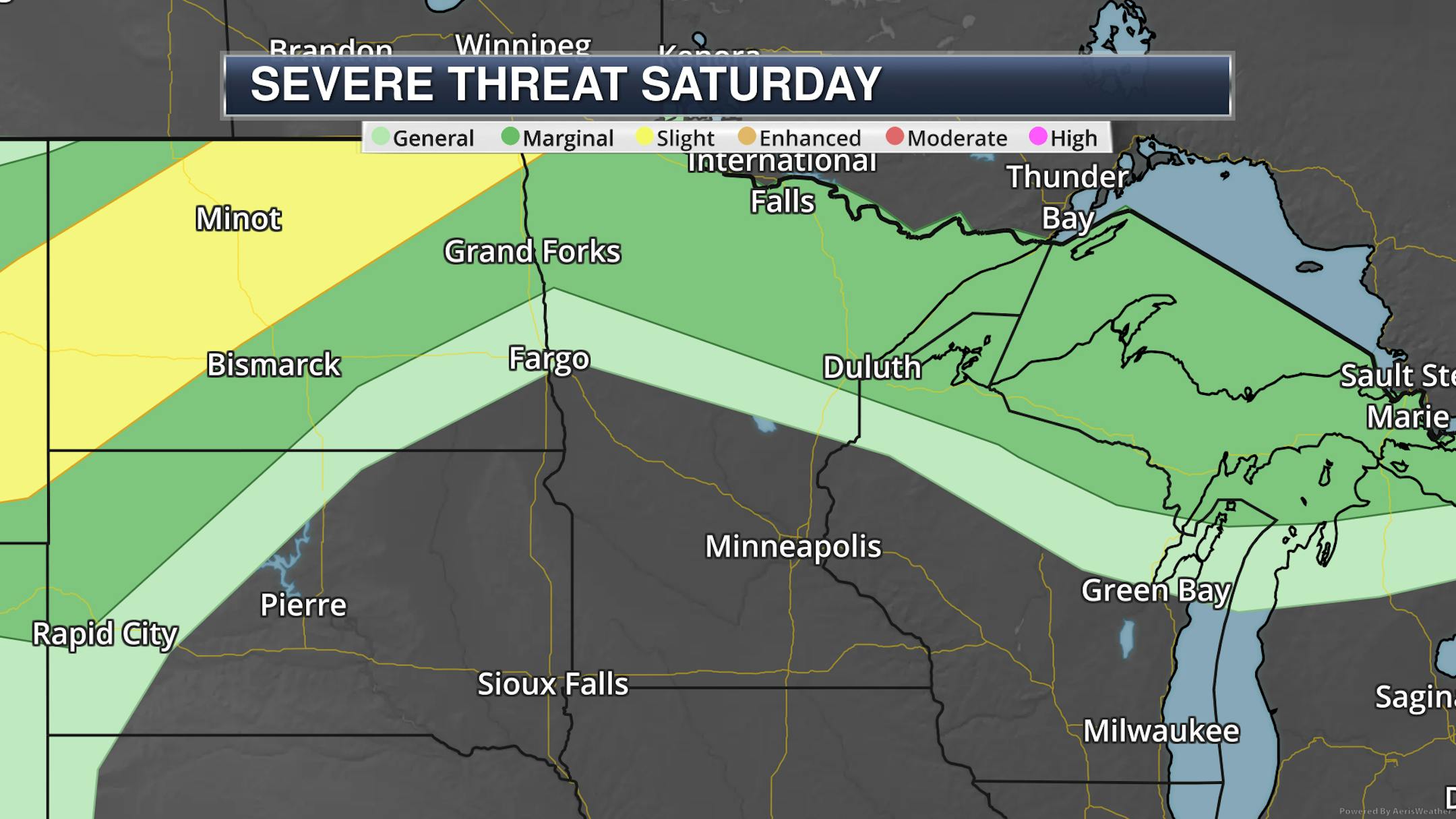
A few of those storms across northern Minnesota Saturday into Saturday Night could be on the strong side with a Marginal Risk of severe weather in place. Large hail and damaging winds will be the main threats.


