
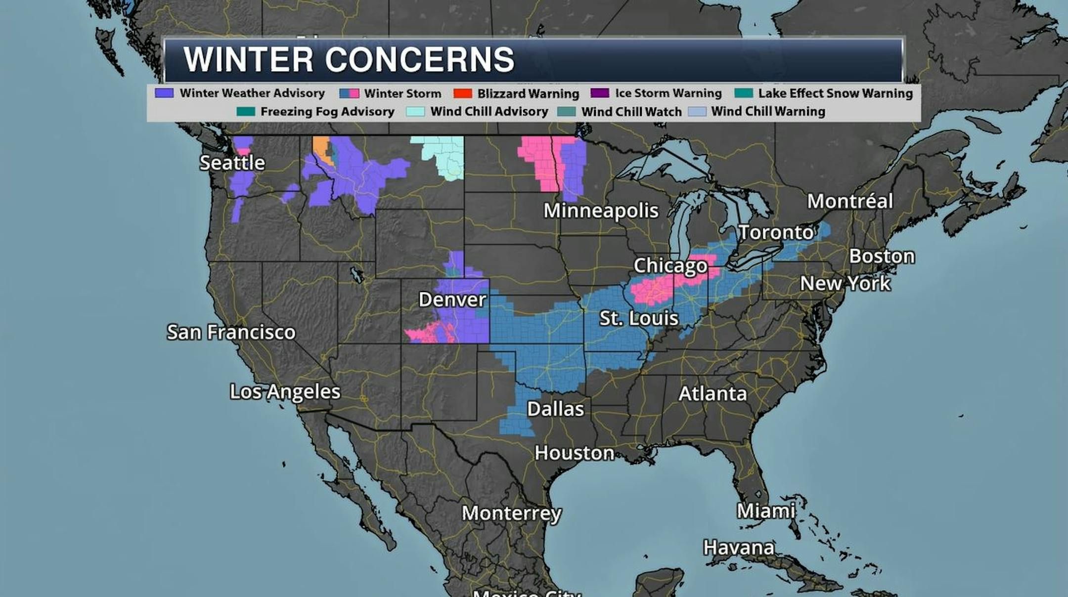
Major Winter Storm in the Central US
Take a look at the winter weather alerts that stretch from the Front Range of the Rockies and Texas all the way to Detroit and the Eastern Great Lakes. This will be a long duration event that could bring significant amounts of snow and ice to portions of the Central US from Tuesday into Friday. There will also be strong winds, which could create power outages and severe travel impacts.
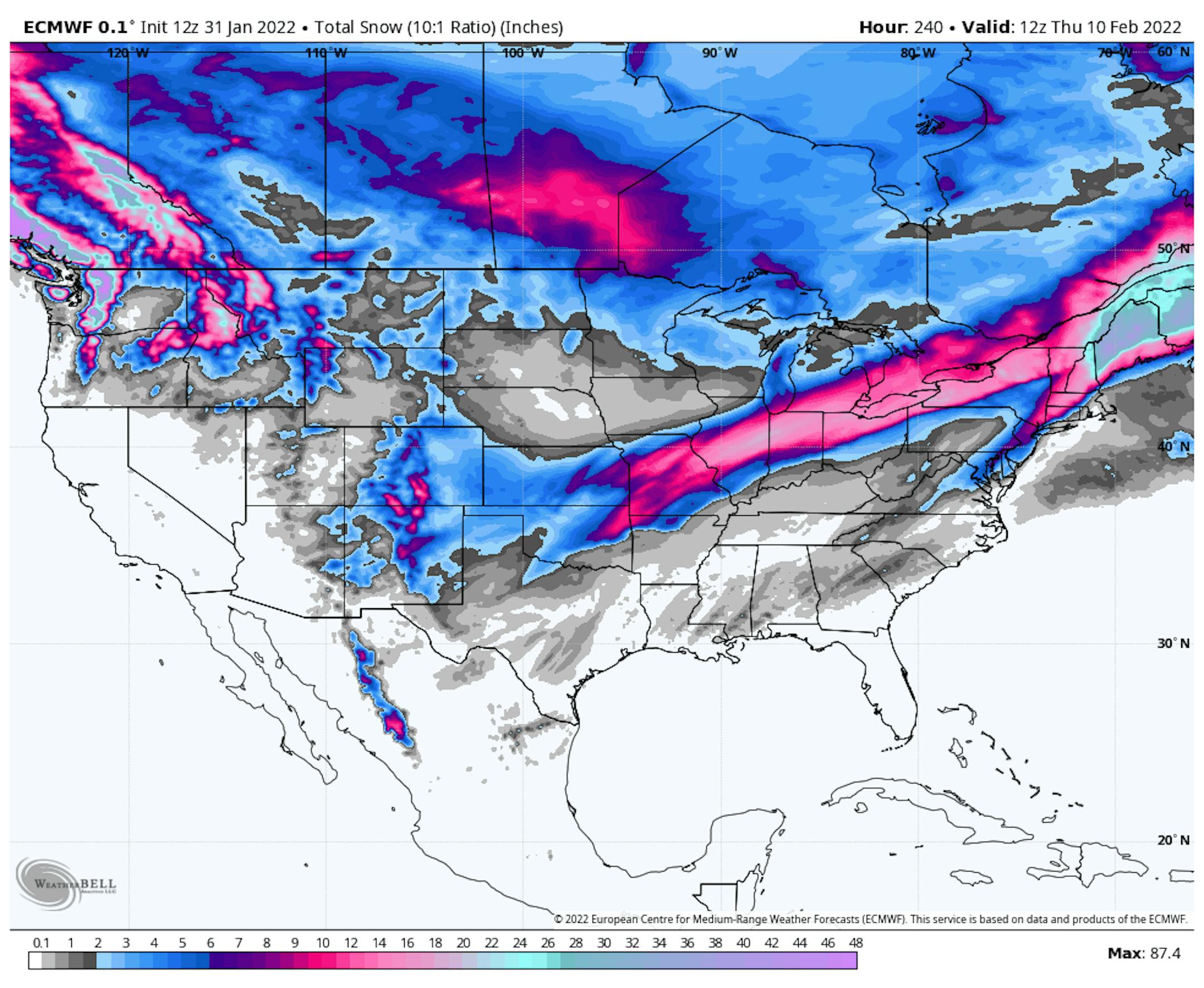
Snowfall Potential
Here's the extended snowfall outlook through the week and weekend ahead. Note the heavy swath of snow from the Central US to the Northeast. Some of the heaviest snow could easily exceed 6" from the Middle Mississippi Valley to parts of the Ohio Valley and Great Lakes Region and even into the Northern New England States. Keep in mind that there will significant travel disruptions in these areas as the storm unfolds over the coming days.
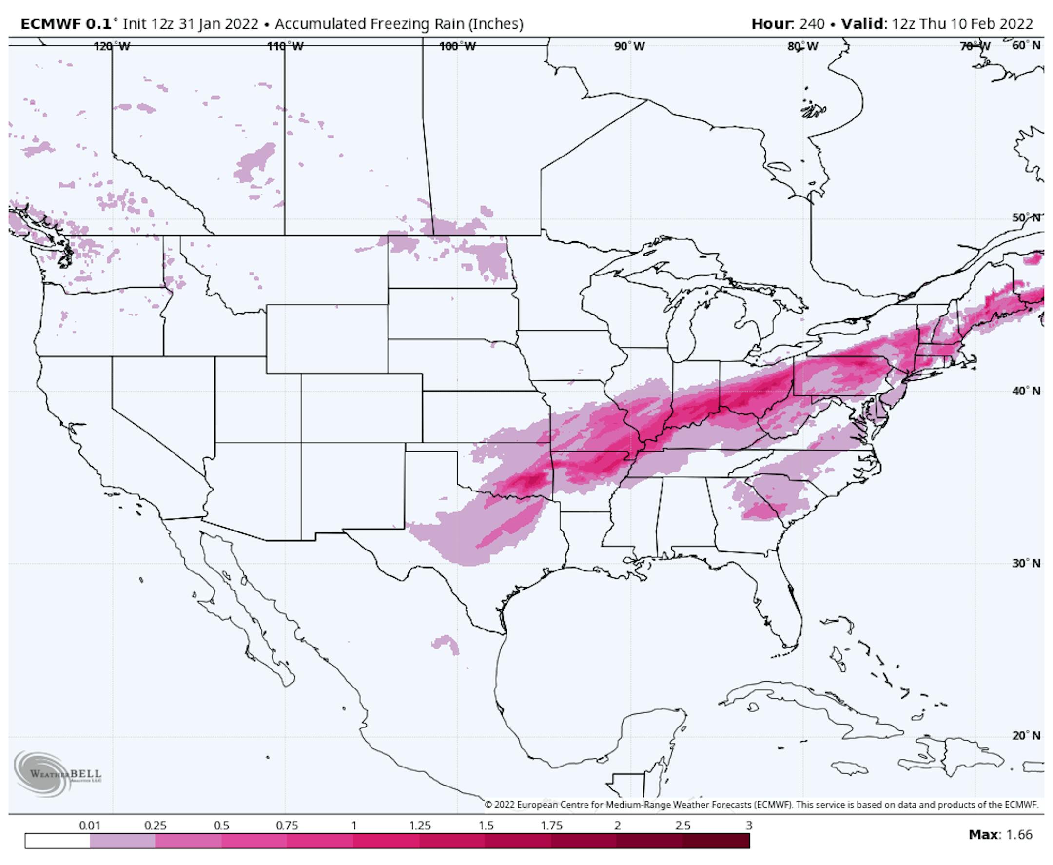
Extended Freezing Rain/Sleet Potential
Here's the freezing rain and sleet potential through the week, which shows areas of icing from Texas to the Northern New England States. Not only will the icing potential cause very slick roads, but there could also be power outages if icing and wind gusts become significant enough.
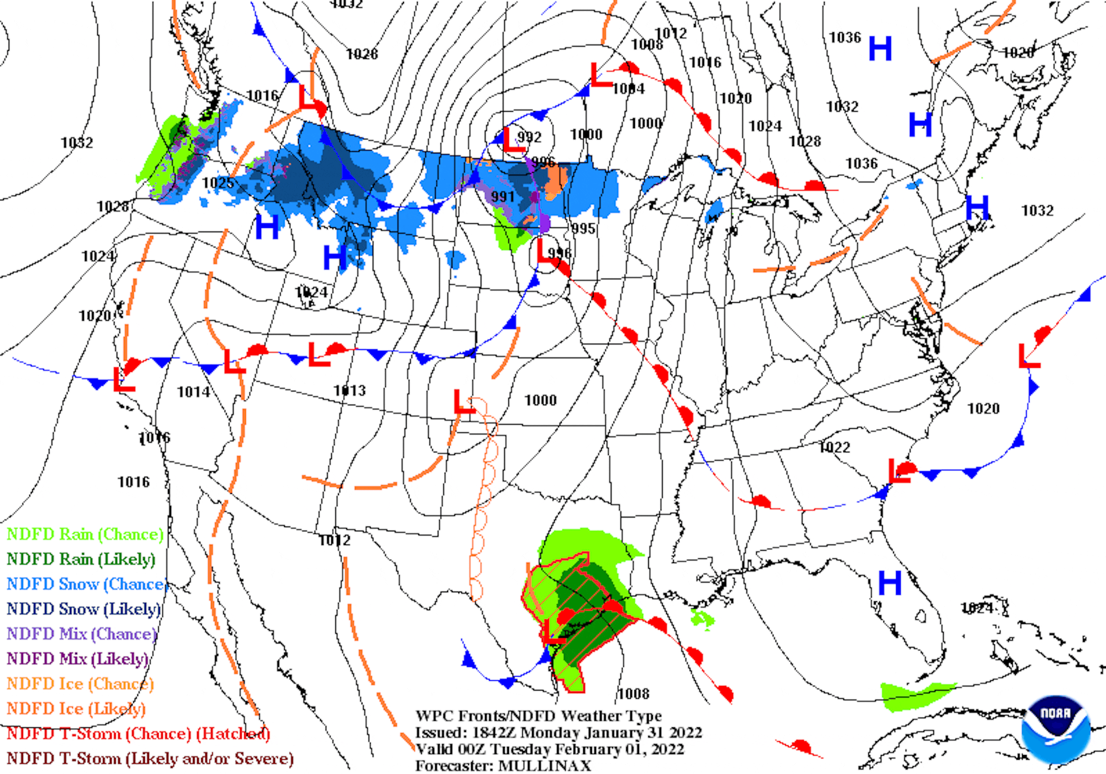
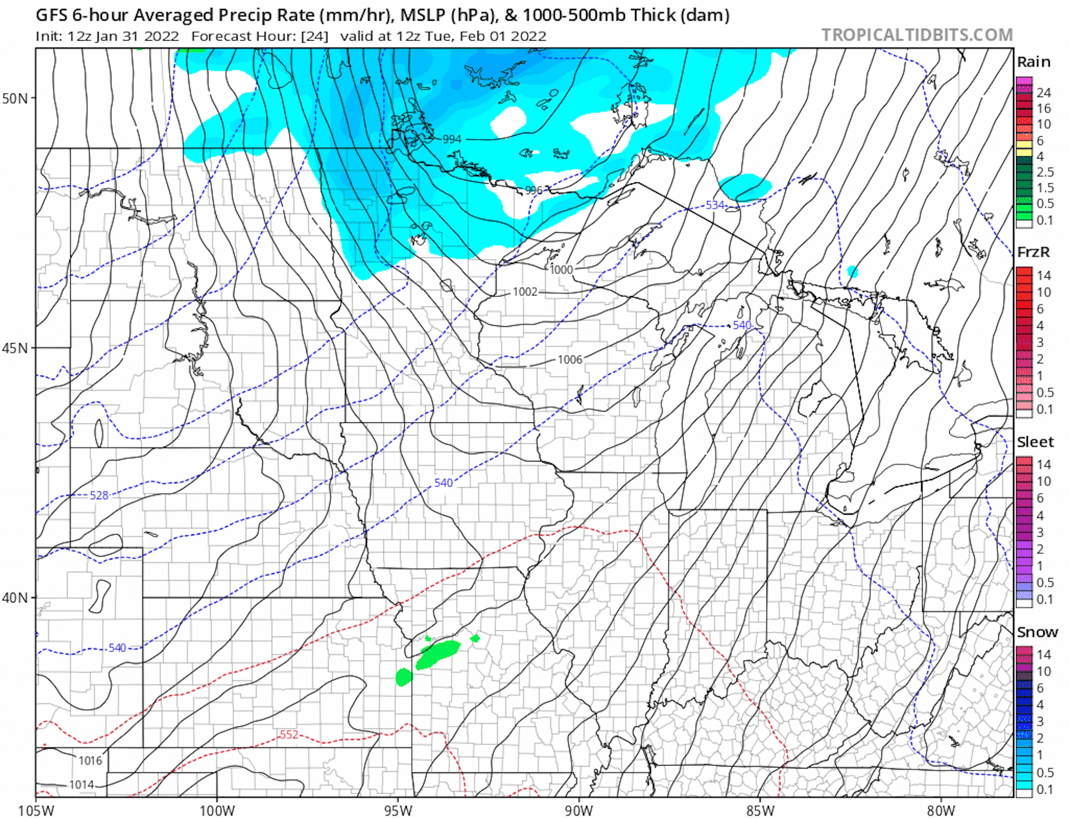
National Weather Outlook
The national weather outlook through the middle part of the week shows a very large area of precipitation developing across the Central US around midweek. Heavy rain and thunderstorms will be possible in the Southern US with flood concerns for some. There will also be enough cold air in place for heavy snow and icing to take shape across the Front Range of the Rockies and into the Southern Plains all the way to the Northeast through the end of the week. This will likely be a large and disruptive storm system for many over the first several days of February.
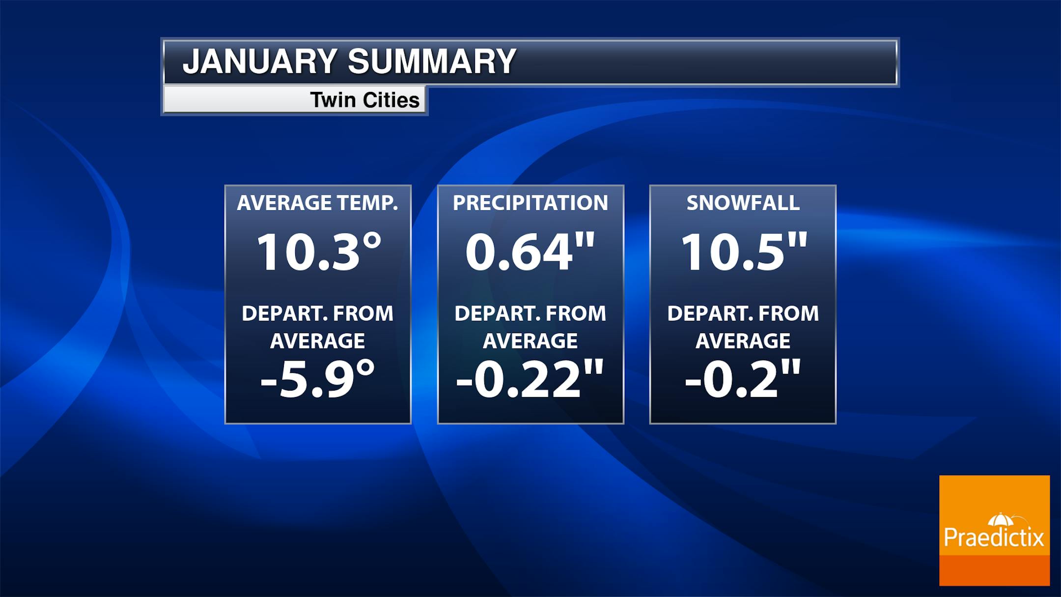
Minneapolis January Stats
Here are the January stats for Minneapolis. Note that the average temperature for Minneapolis was nearly -6F below average, but snowfall was actually pretty close to average. Interestingly, January is typically our 2nd snowiest month of the year behind December, which averages almost 12".
Windy Tuesday & Much Colder 2nd Half of Week
Here's the weather outlook closer to home through the end of next week. An area of low pressure will scoot along the international border midweek with areas of light snow across northern MN. Winds will quickly switch to the NW with much colder temps in place on Wednesday and through the rest of the week.
Snow Depth
The latest snow depth reports show a fairly decent base across the region. The Metro was reporting around 7" as of Monday morning, but has you head north, there are some double digit reports. According to the MN DNR Snowmobile and cross-country ski trails are generally reported to be in good to very good conditions across the northern half of the state. Trails in the southern half of the state are reported to poor condition with little to now snow on the ground there.


