

Listen and subscribe to our podcast: Via Apple Podcasts | Spotify | Stitcher
Arguably nothing defines Minnesota more than its borders. Minnesota as we know it would not exist without them.
So it's no surprise that readers frequently submit questions on this topic to Curious Minnesota, the Star Tribune's reader-powered reporting project. They have asked about the face-like outline of the eastern border, the chimney-shaped Northwest Angle near Canada and broader topics like the question behind this story: "How did Minnesota get its shape on the map?"
The Minnesota we're used to might seem to have been inevitable. But had history gone otherwise, it could have been a wider state stretching into present-day South Dakota, with big chunk bitten out by Wisconsin. Each of the state's four borders is a separate tale.
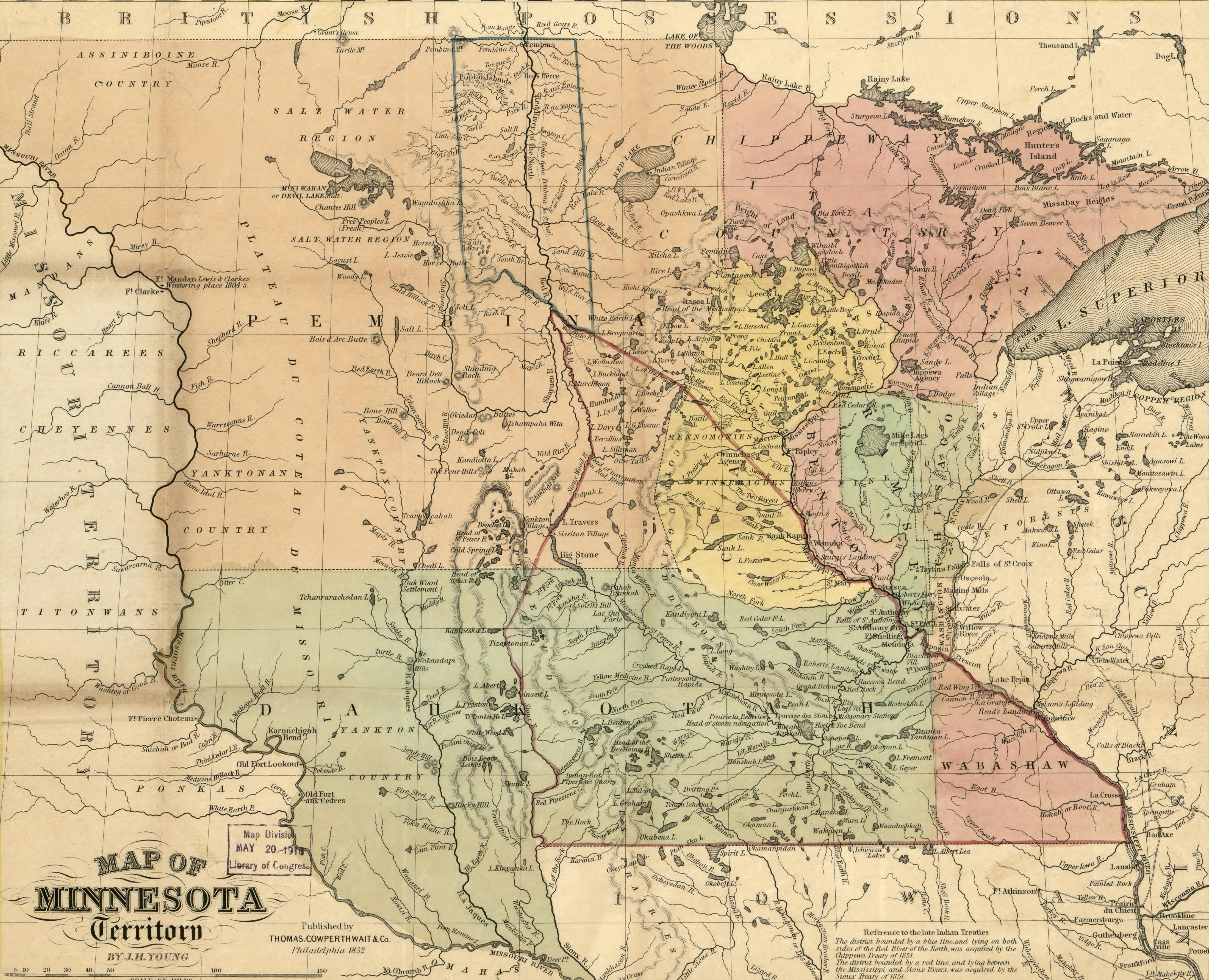
Eastern border
The state's northeastern border in the Arrowhead region would appear to be its simplest, since it is shaped by Lake Superior. But the actual border is 54 miles from shore, where it meets the borders of Michigan and Wisconsin.
The three states share the lake due to an 1830s dispute between Michigan and Ohio over some prime agricultural land, according to historian William E. Lass, author of "Shaping the North Star State: A History of Minnesota's Boundaries." Ohio won, but as a consolation prize Michigan's borders were extended into lakes Huron, Michigan and Superior. The water beyond those boundaries later became part of Minnesota and Wisconsin.
Closer to the Twin Cities, St. Paul residents nearly became Packers fans. Before the creation of the Minnesota Territory in 1849, the Wisconsin Territory extended to the Mississippi River.
