
Summer Solstice 2023: The First Day of Summer
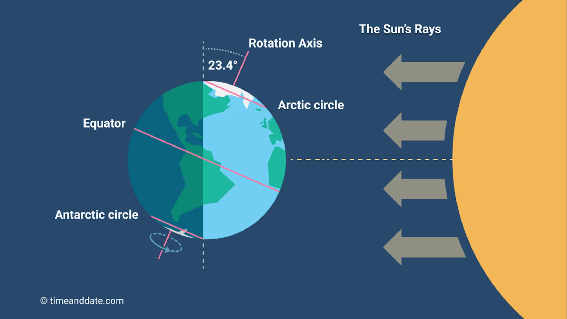
"Everything You Should Know About the Longest Day of the Year Summer begins with the solstice on Wednesday, June 21, 2023 marking the astronomical first day of summer in the Northern Hemisphere. What exactly IS the solstice? Is it really the longest day of the year? Welcome the solstice with some interesting facts and folklore. The June Solstice In the Northern Hemisphere, the June solstice (aka summer solstice) occurs when the Sun travels along its northernmost path in the sky. This marks the astronomical start of summer in the northern half of the globe. (In the Southern Hemisphere, it's the opposite: the June solstice marks the astronomical start of winter when the Sun is at its lowest point in the sky.) When is the Summer Solstice? The June solstice occurs on Wednesday, June 21, 2023, at 9:58 A.M. CDT. This solstice marks the official beginning of summer in the Northern Hemisphere, occurring when Earth arrives at the point in its orbit where the North Pole is at its maximum tilt (about 23.5 degrees) toward the Sun, resulting in the longest day and shortest night of the calendar year. (By longest "day," we mean the longest period of sunlight hours.) On the day of the June solstice, the Northern Hemisphere receives sunlight at the most direct angle of the year. In the Southern Hemisphere, the June solstice marks the beginning of winter."
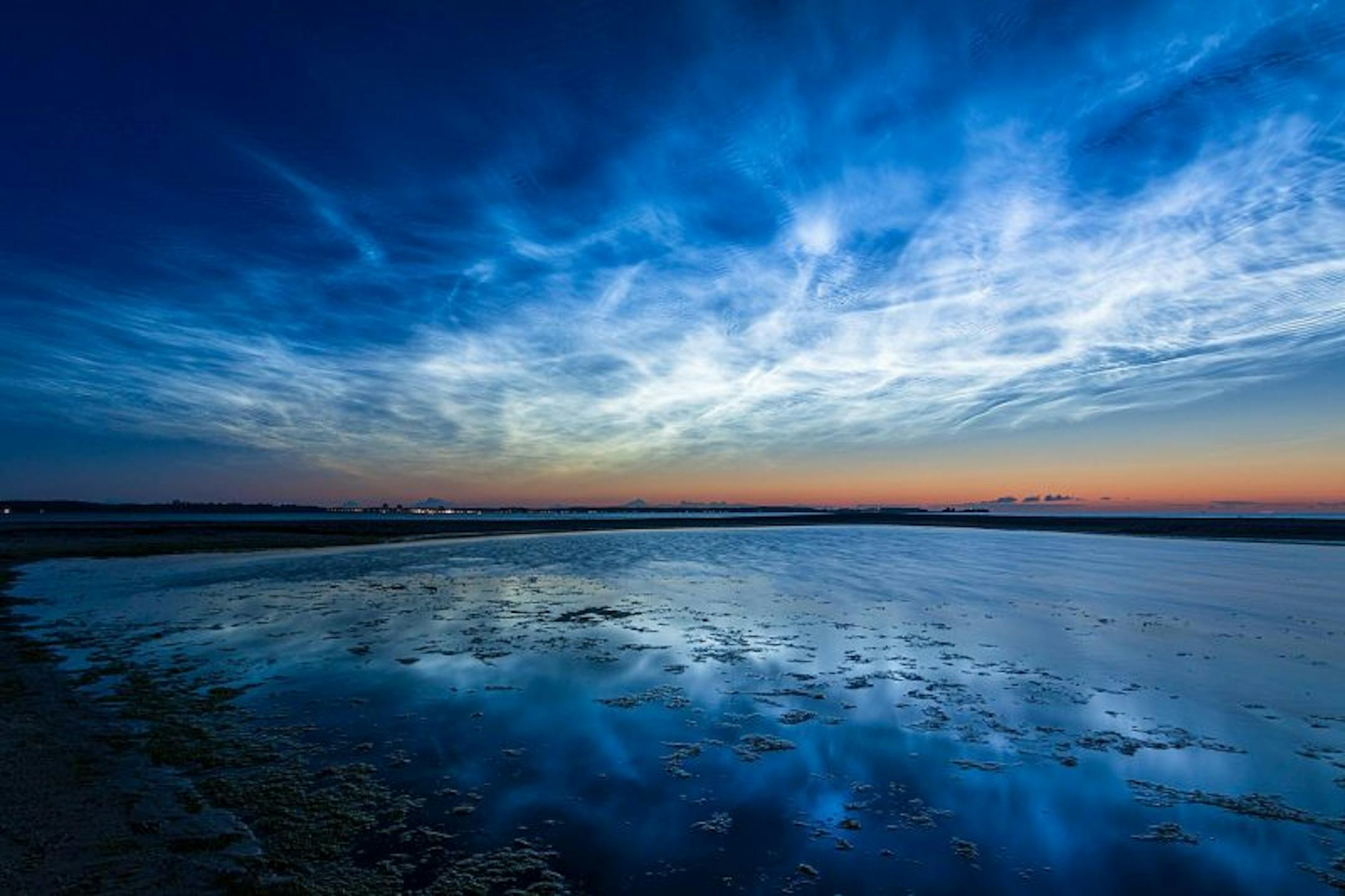
Noctilucent clouds: The season starts now!
"Noctilucent cloud season has begun! Normally, in late May or June, people at higher latitudes on the globe begin reporting these ethereal, electric-blue clouds after nightfall. The first batch of reports began this year on June 4, 2023. See the first night-shining clouds of the season below. What are noctilucent clouds? Noctilucent clouds, or night-shining clouds, are thin clouds high up in Earth's atmosphere – the mesosphere – as much as 50 miles (80 km) above Earth's surface. Scientists think they're made of ice crystals that form on fine dust particles from meteors. They can only form when temperatures are incredibly low and when there's water available to form ice crystals. So, why do these clouds – which require such cold temperatures – form in the summer? It's because of the dynamics of the atmosphere. In fact, you actually get the coldest temperatures of the year near the poles in summer at that height in the mesosphere."
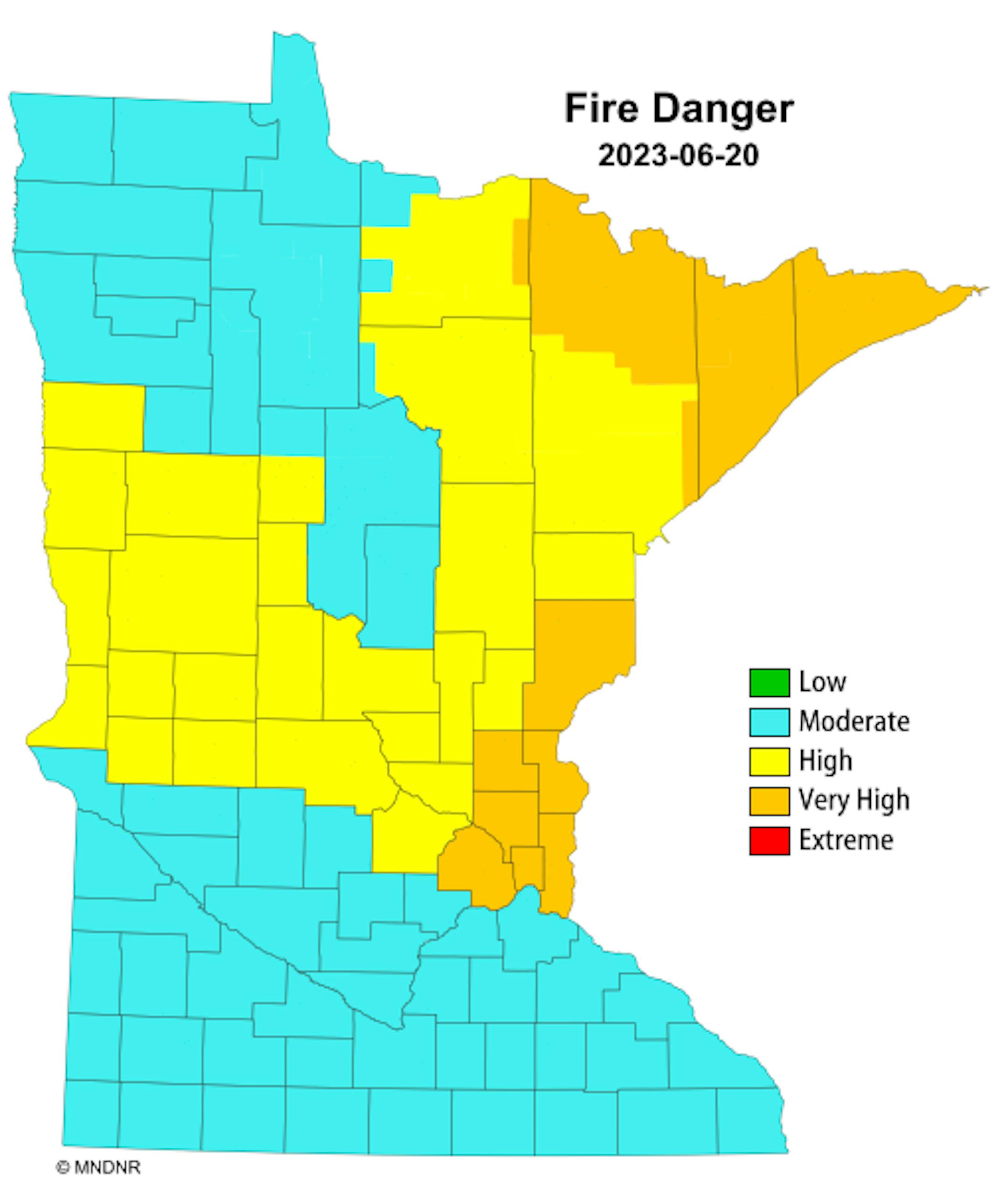
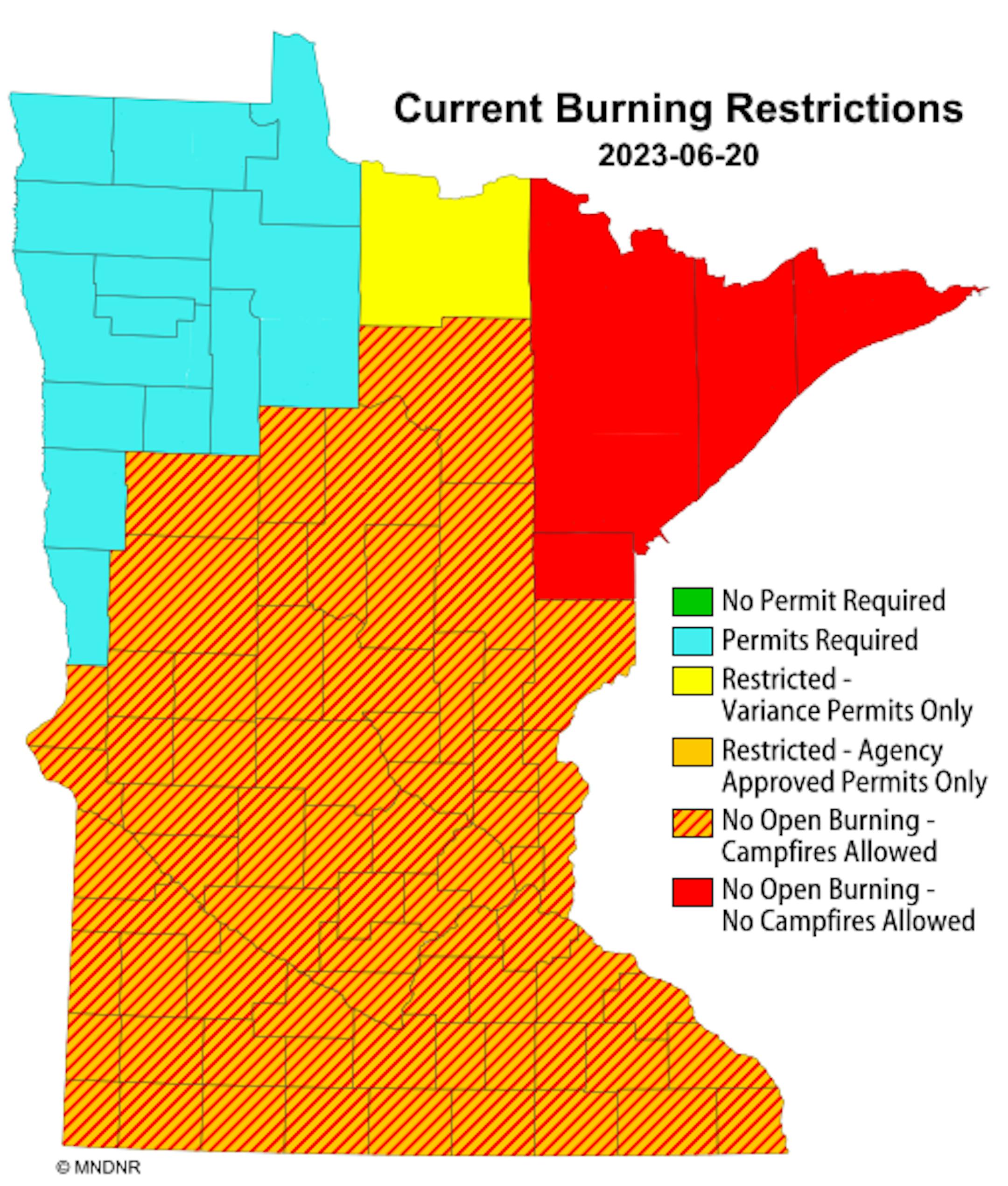
Fire Danger Map
Thanks to several days of hot and extremely dry weather, the fire danger across parts of the state are High to Very High, which includes the Twin Cities. Very High fire danger includes the Northeastern Tip of the state, where fire restrictions are in place, meaning no open fires or campfires.
Drought Update
It has been an extremely dry stretch of weather across much of the station over the last several weeks. Only a few locations have seen decent pockets of rain, but the drought is expanding and getting worse. Severe drought conditions have popped up across parts of central Minnesota with moderate drought now in place across parts of the Twin Cities.

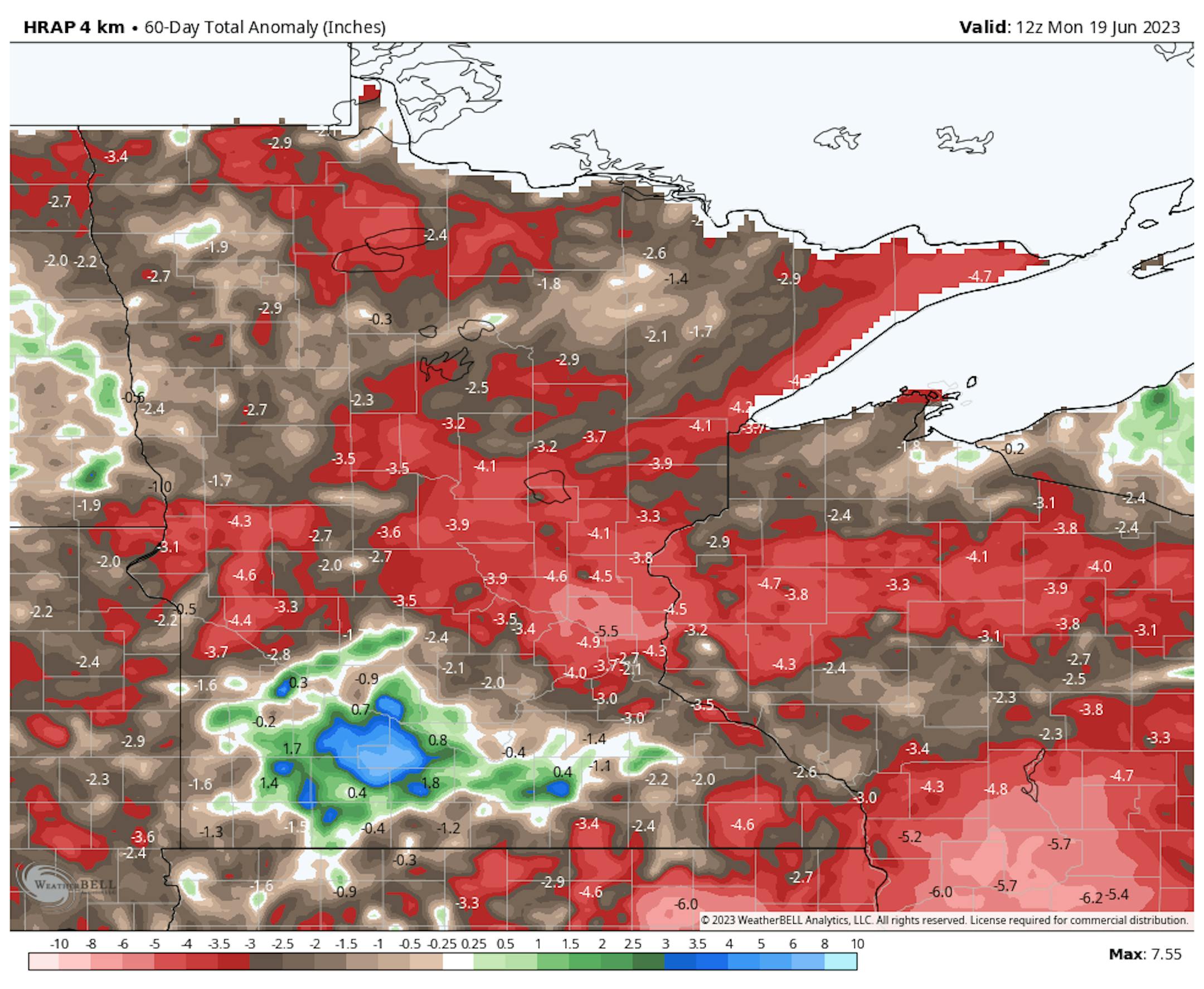
60 Day Precipitation Anomaly
The map below shows the 60 day precipitation anomaly, which indicates that some locations are nearly -3.00" to nearly -5.00" below average (in red) since mid May. This is where drought conditions are expanding.
2nd Driest May 1st - June 20th on Record at MSP
There has only been 1.72" of rain at the MSP Airport since May 1st, which is the 2nd driest May 1st - June 20th on record. The driest such stretch was back in 1910, when only 1.47" of rain fell.


