

Winter Remains On Indefinite Pause
Have you noticed that most disaster movies start out with people ignoring warnings from scientists? I have a respect for science - and faith in something more. God gave us experts.
This Thanksgiving season I'm grateful for family, friends and facts. I don't take democracy, free speech or freedom of the press for granted.
And a special shout-out to 2020's biggest heroes: our frontline healthcare workers. They all deserve medals, and our enduring gratitude for being steadfast on the front lines of this pandemic.
It's late November and I'm staring out at a green lawn and unraked leaves. My driveway stakes are mocking me again.
The pattern favors big storms for the southern and eastern USA, but a dry and mild Pacific
breeze should keep blowing into Minnesota, keeping us in the 40s much of the first week of December.
Dr. Mark Seeley predicts a relatively toasty, dry start to winter, followed by colder and snowier from January on. That sounds about right to me. Lately our winters have been all or nothing, and this one may be no exception.
Enjoy our ration of sunshine - and upper 40s on Saturday!
Map credit above: Praedictix and AerisWeather.
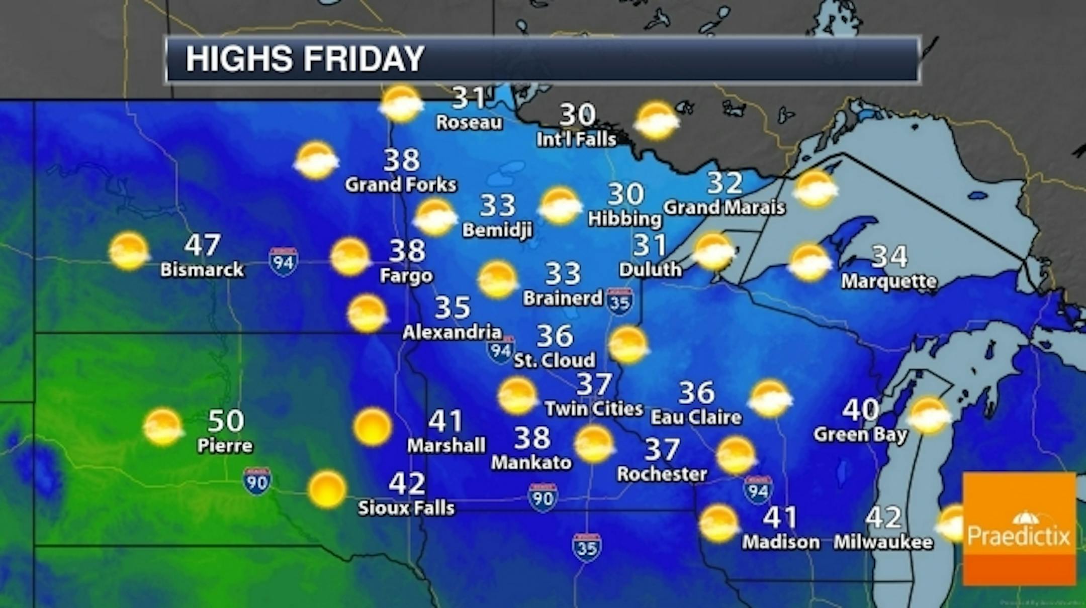
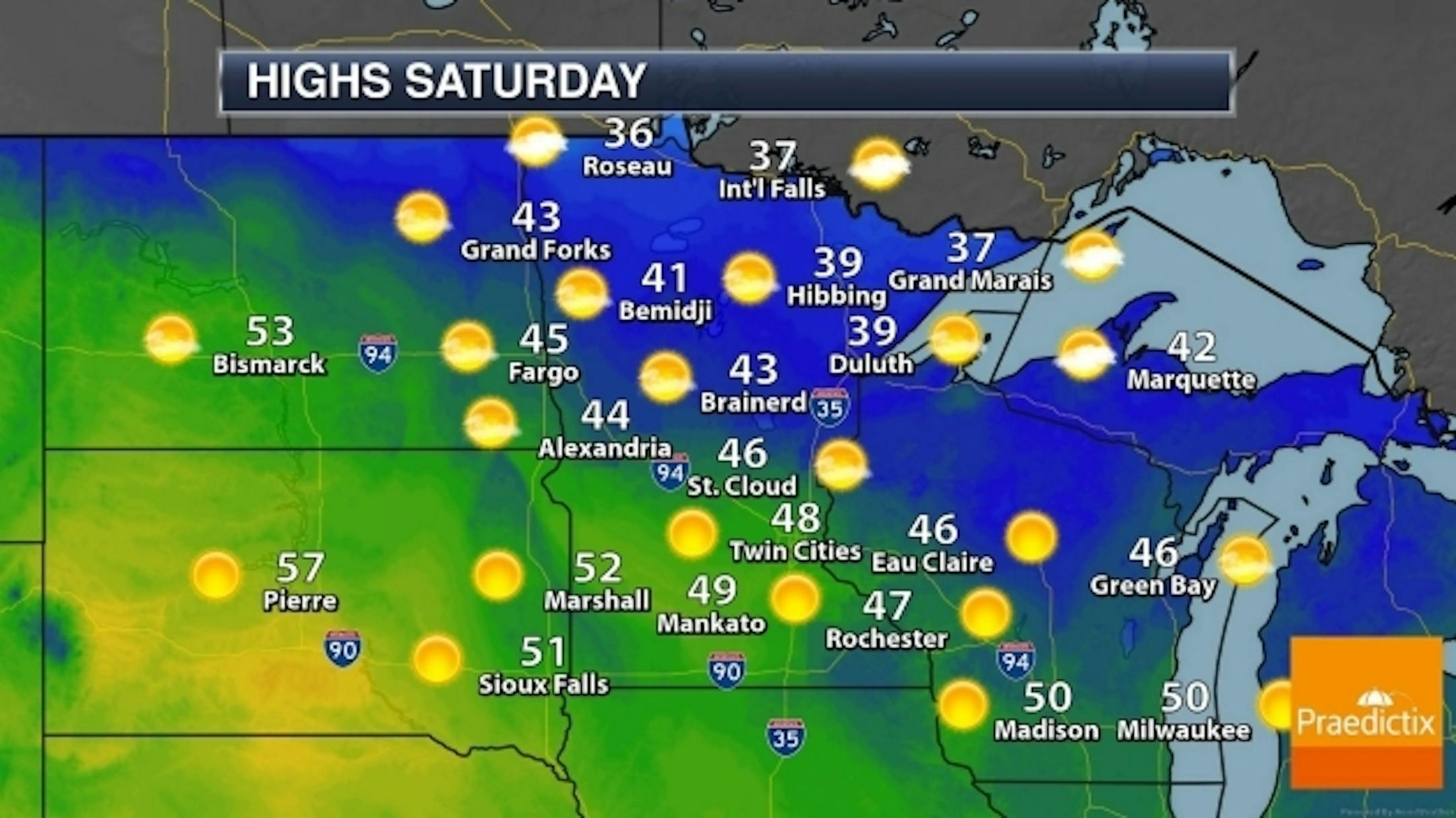
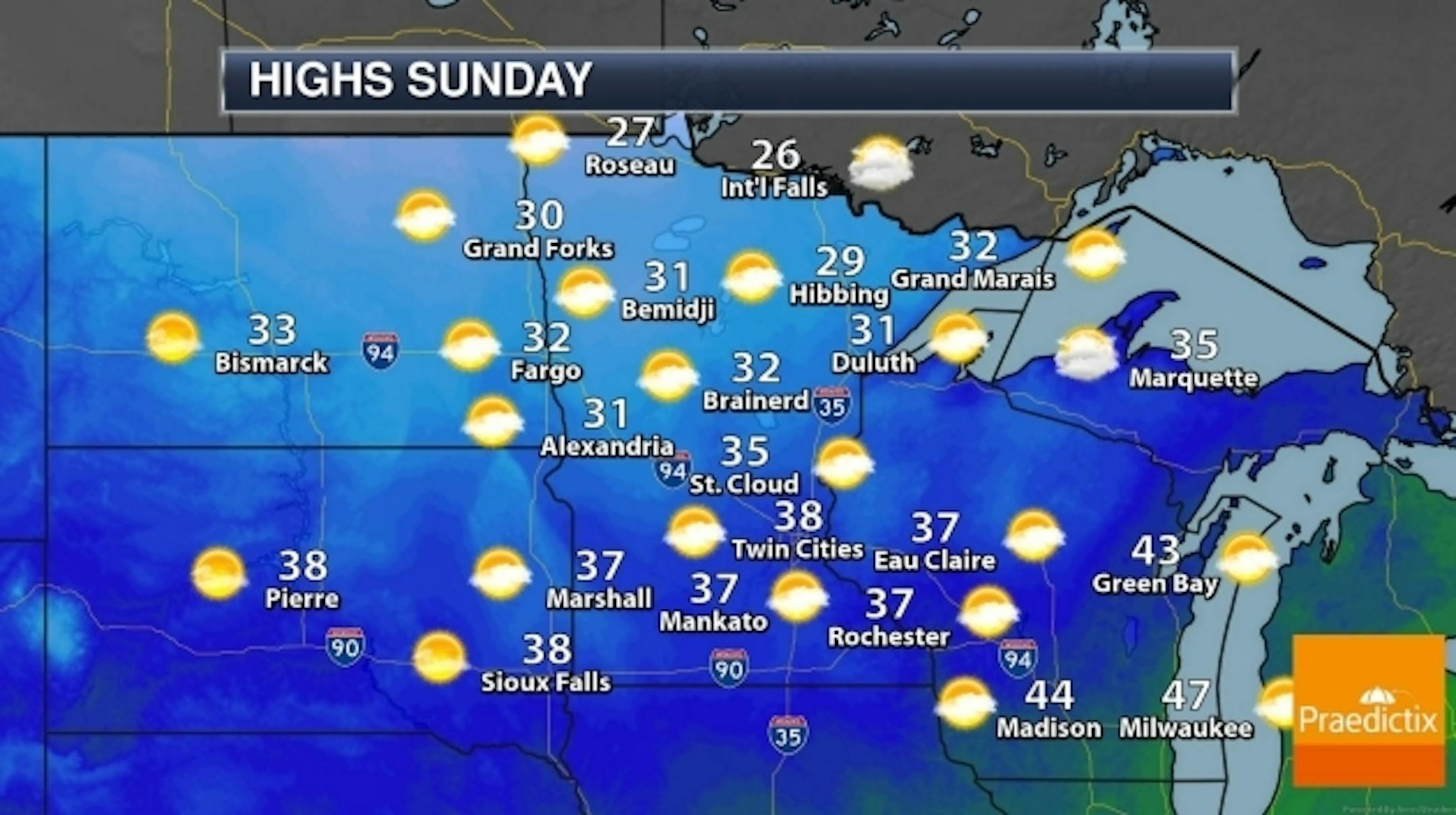
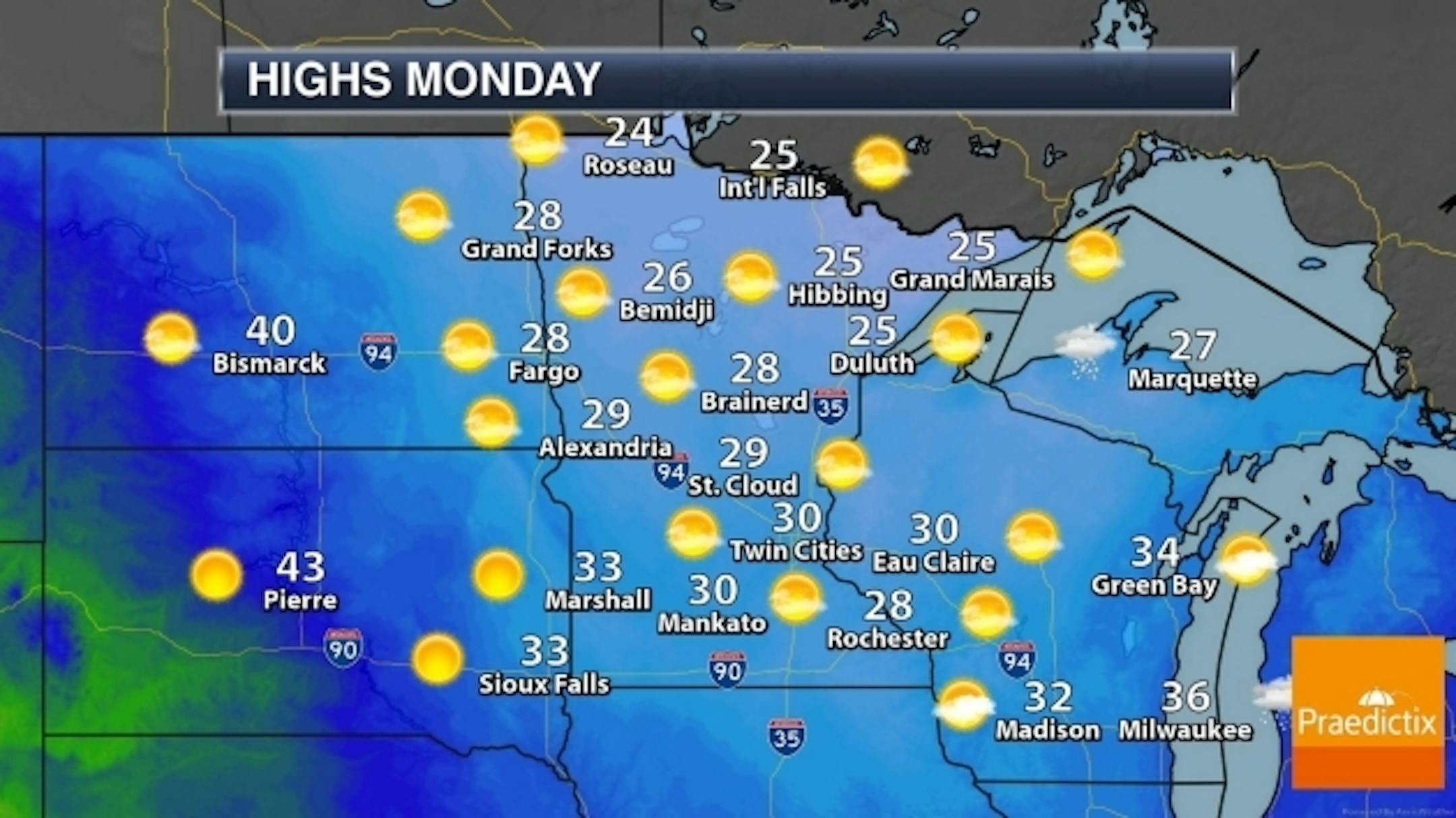
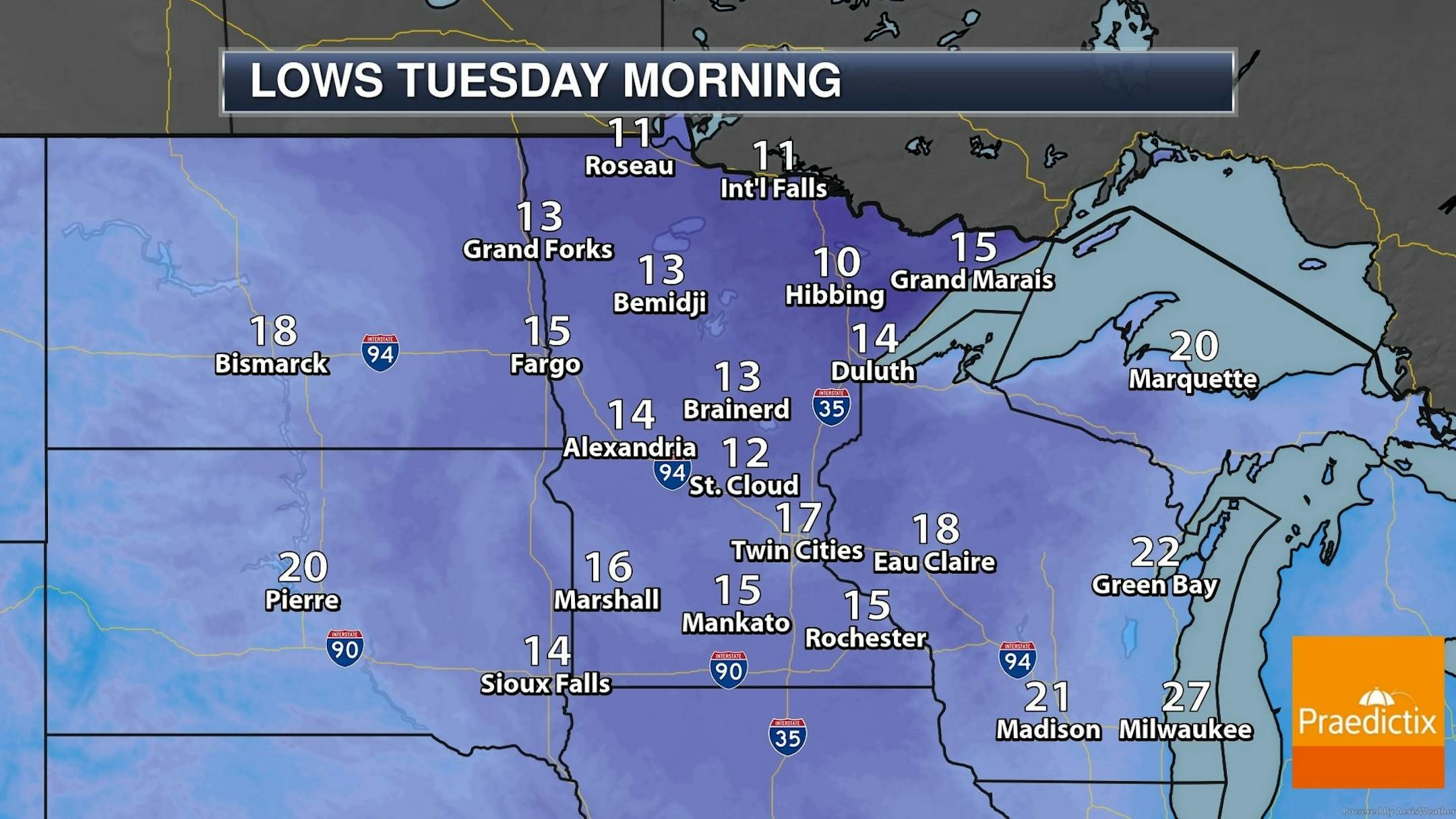
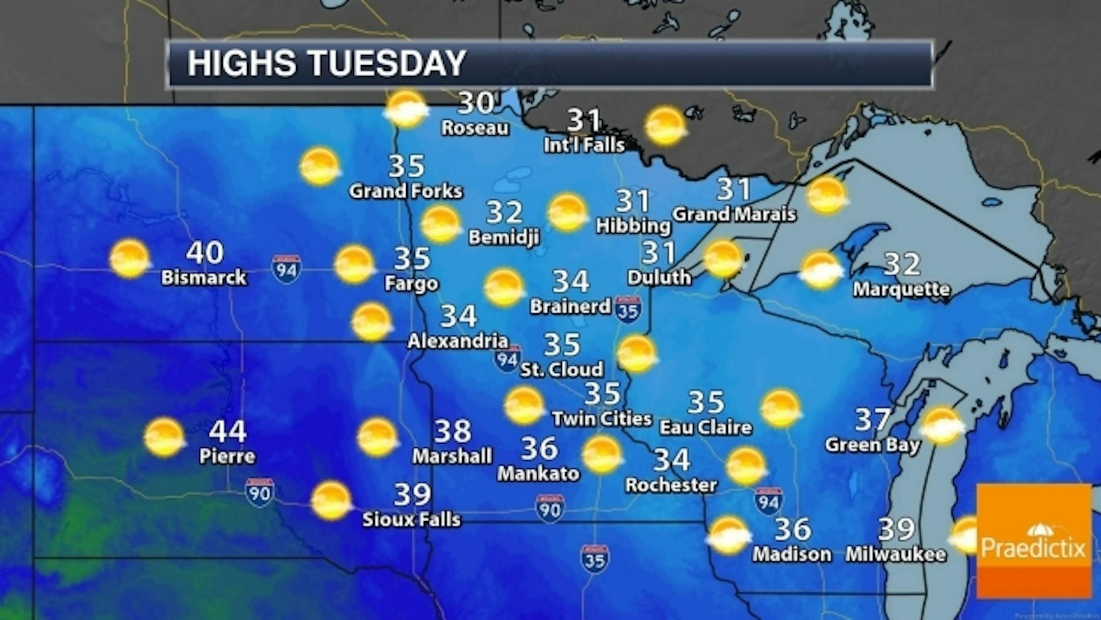
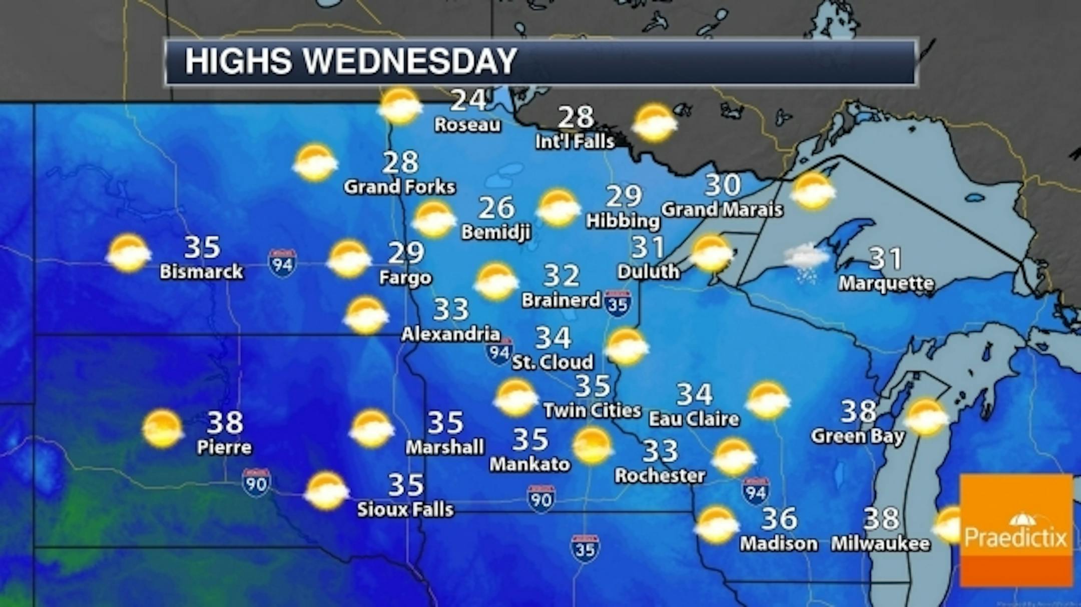
Mellow Saturday, Then Colder Early Next Week. If it's any consolation every cool/cold front brings a higher probability of actually seeing the sun. Saturday temperatures may run 10-15F above average before we cool down early next week, but temperatures run close to average from midweek on. Map sequence: Praedictix and AerisWeather.
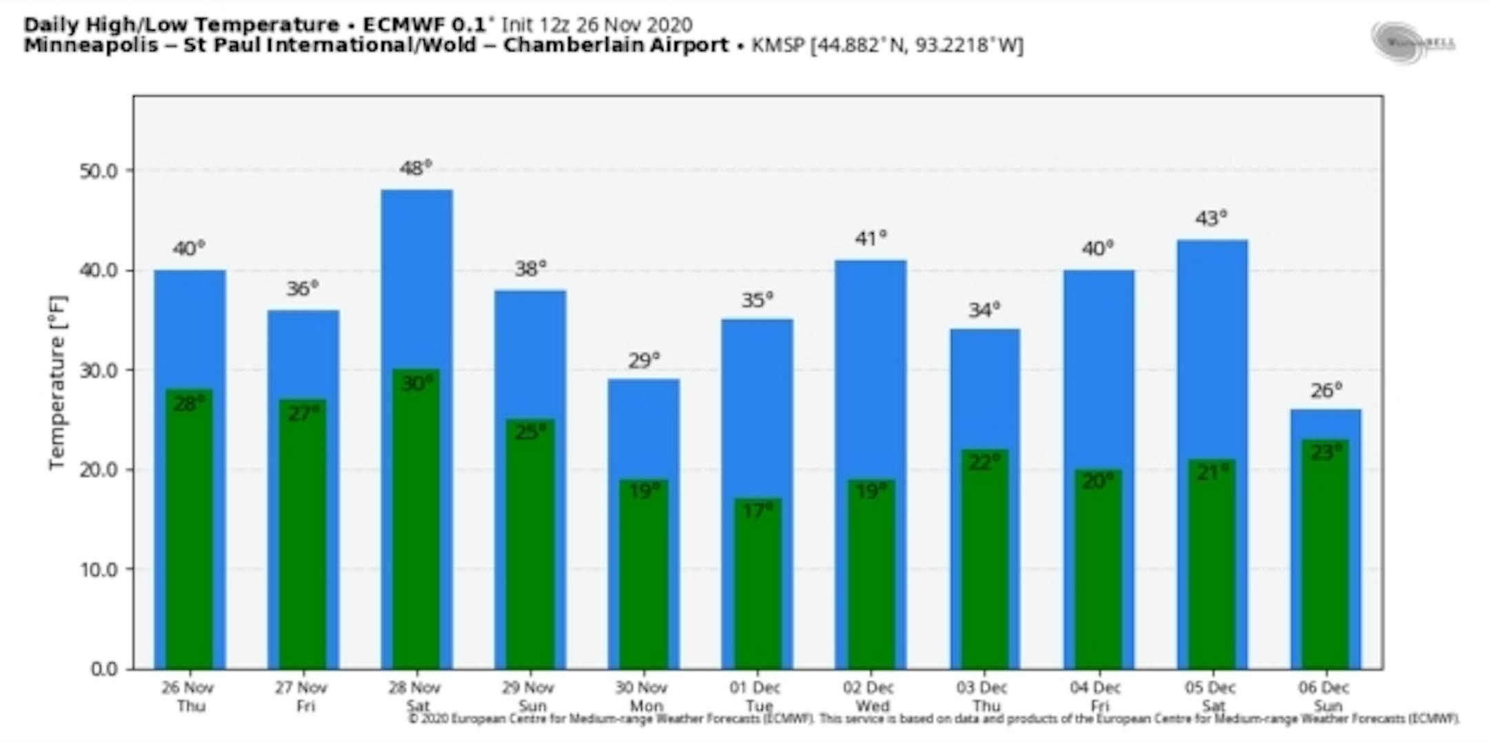
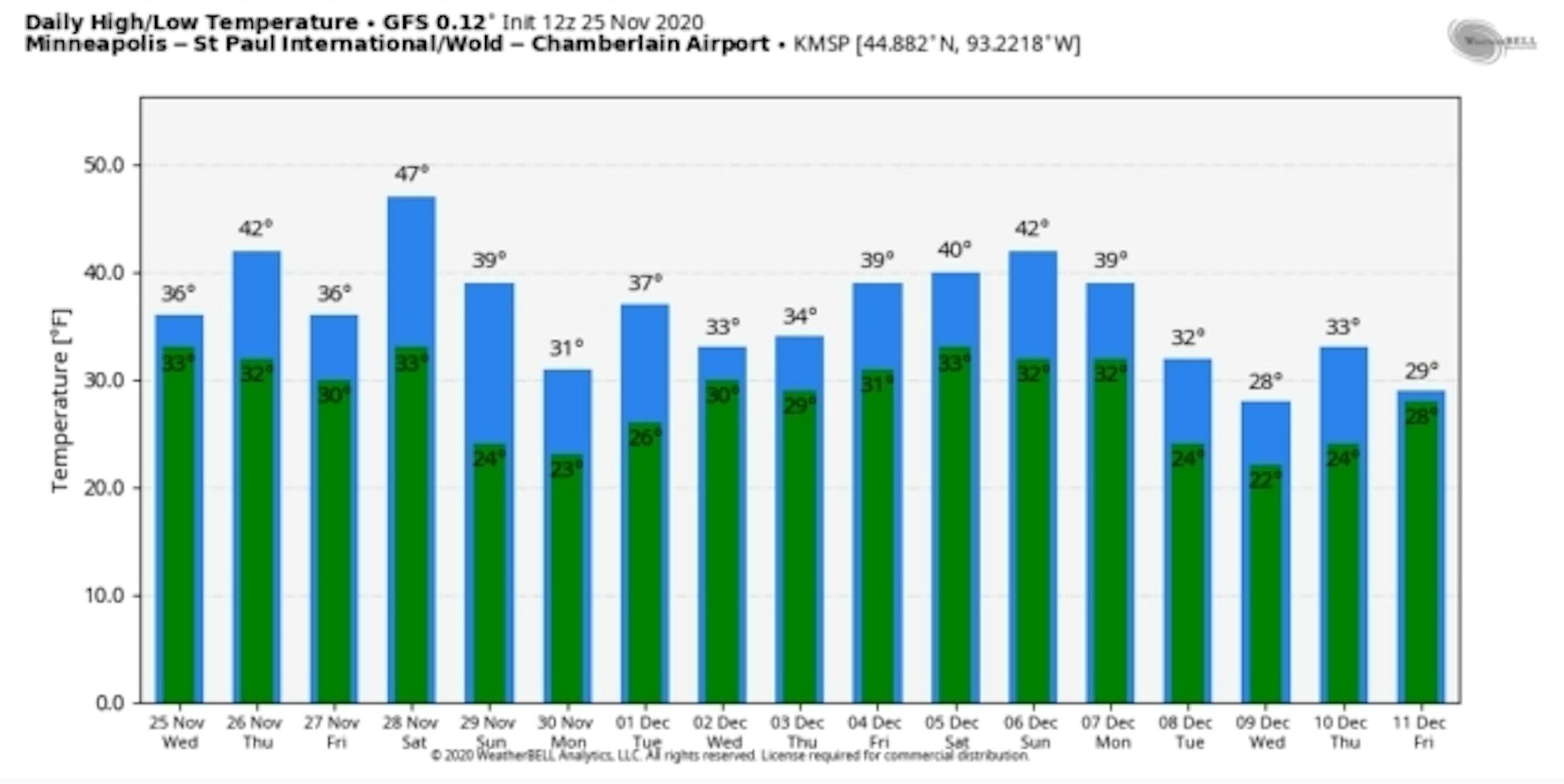
40s First Week of December. Both ECMWF (above) and GFS (below) suggest temperatures running above average for much of early December, as a milder Pacific wind flow aloft dominates our pattern. I still don't see anything particularly polar into mid-December. Graphics: WeatherBell.


