
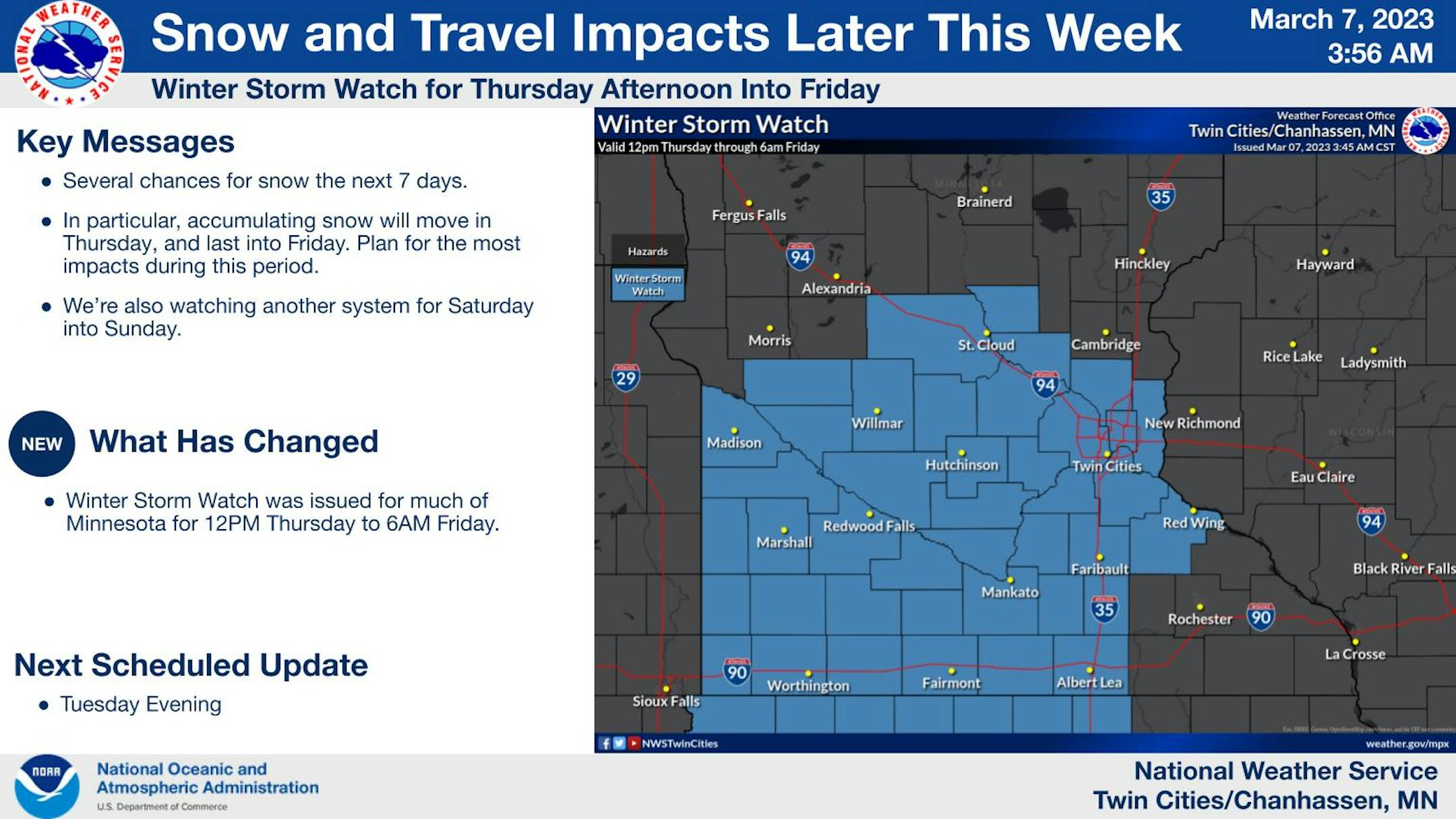
Winter Storm Watch - More Snow On The Way!
A Winter Storm Watch has been issued for Thursday afternoon through Friday morning as snow accumulations of 4-8 inches are expected during that time.
WINTER STORM WATCH IN EFFECT FROM THURSDAY AFTERNOON THROUGH FRIDAY MORNING
WHAT... Heavy snow possible. Total snow accumulations of 4 to 8 inches possible.
WHERE... Portions of central, east central, south central, southeast, southwest and west central Minnesota.
WHEN... From Thursday afternoon through Friday morning
IMPACTS... Travel could be very difficult. Patchy blowing snow could significantly reduce visibility. The hazardous conditions could impact the Thursday evening and Friday morning commutes.
ADDITIONAL DETAILS... Snow will steadily accumulate, and snowfall rates in excess of 1 inch/hr are currently not expected.Travel could be very difficult. Patchy blowing snow could significantly reduce visibility. The hazardous conditions could impact the Thursday evening and Friday morning commutes.
13th Snowiest Season on Record at MSP Airport
The MSP Airport picked up 3.3" of snow Sunday night into Monday, which puts the seasonal snow total at 74.7" and good enough for the 13th snowiest season on record!


