Storms From Tuesday
Strong to severe thunderstorms rumbled across parts of southern Minnesota on Tuesday with several large hail reports. The largest reports came out of Springfield and Sleepy Eye, where some tennis ball size hail was reported!

Drought Denting Rains
Tuesday also saw heavy rainfall across parts of southern Minnesota, where some 1" plus tallies came in. This won't end the drought across the area, but it will certainly help continue to dent the drought.

More Rain on the Way
The extended precipitation outlook through the weekend shows another batch of additional heavy rainfall that could approach 1" to 3" or more in spots.

Extended Weather Outlook
Here's the simulated radar from AM Wednesday to PM Thursday, which shows another batch of heavier rains developing across the southeastern part of the state. Meanwhile, areas of snow will be possible farther North with some slushy accumulations possible as well.

Snowfall Potential?
As this late week storm system takes shape, we'll see some slushy accumulations develop across the northern part of the state. There could be a wet coating to a couple of inches in some areas across the far northwestern part of the state.

90 Day Precipitation Anomaly
Thanks to some recent heavy rains parts of the state are now in a surplus over the last 90 days. Some of the biggest surpluses are showing up in blue in pockets across parts of central Minnesota, including the Twin Cities and into western Wisconsin. It has been a very soggy last 4 weeks.

Drought Update
Recent heavy rains have helped the drought situation quite a bit in spots across the state. With that being said, we're still in a drought across much of the state with nearly 5% under an extreme drought, which improved since last week. We should see additional improvement after this weeks rain, but we won't see that show up in the drought maps until next week. Stay tuned...

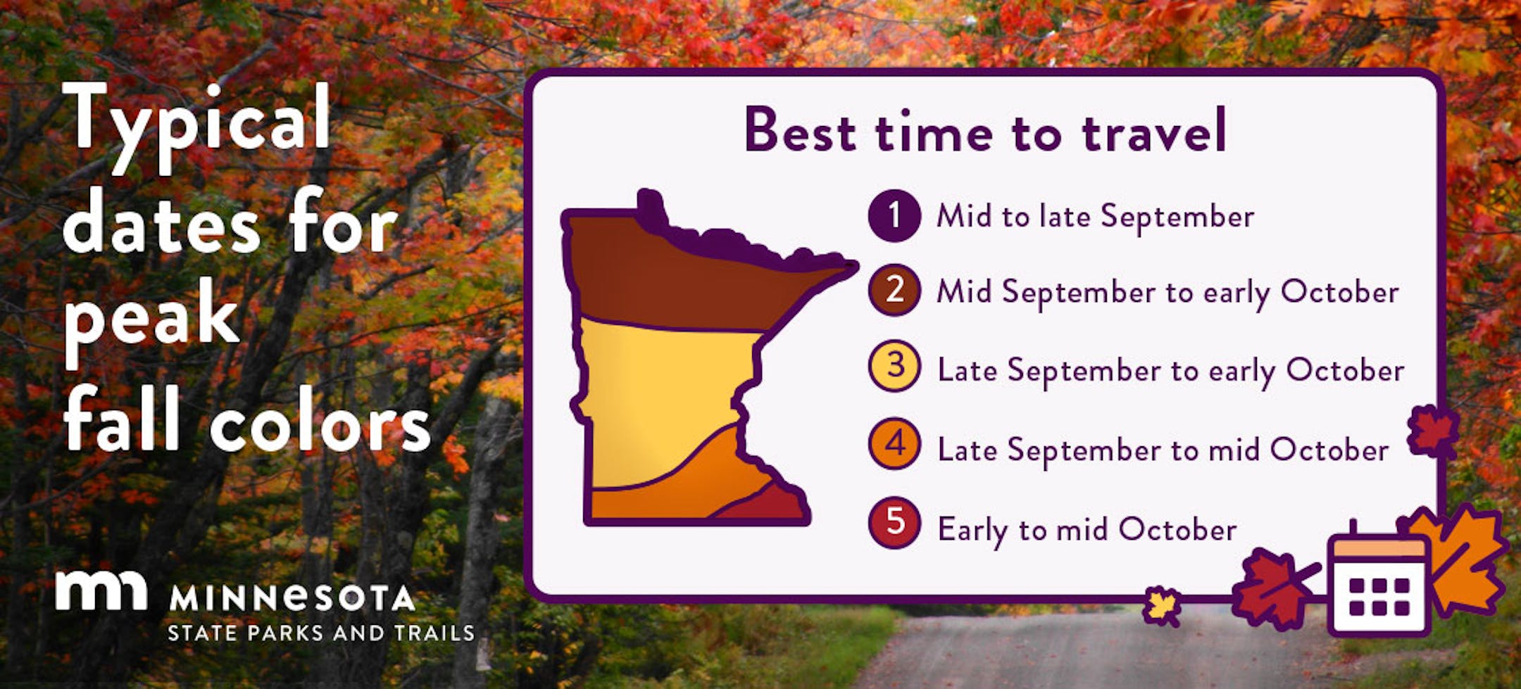
Fall Color Update
Here's a picture from Mai Xiong Thao & the MN DNR Website at Afton State Park. Fall colors look well underway there and are peaking or past peak across much of the northern half of Minnesota.