
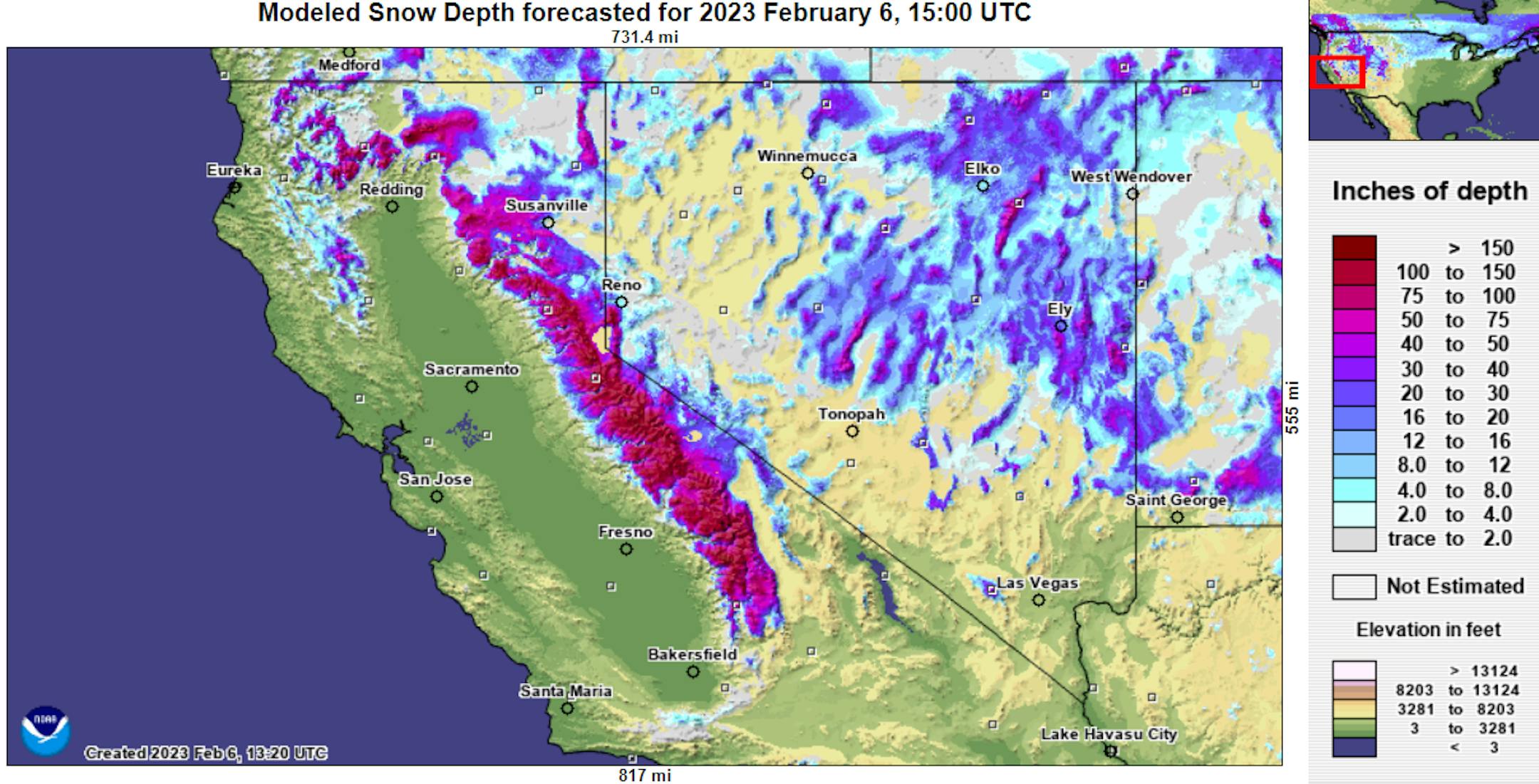
"California's Snowpack Nearly 200% Above Average for Early February"
"Last month's series of winter storms dropped a lot of snow across the state's mountain ranges. But there could be dry conditions to come. State officials say California's snowpack is the highest it's been in decades for early February, the Los Angeles Times reported. The California Department of Water Resources conducted the second manual snowpack survey of 2023 yesterday at Phillips Station near Lake Tahoe. Officials found 85.5 inches of snow depth. That's 193% above average for the snow depth for the location for this time of year, according to a statement from the Department. Last month, Water Resources officials found 55.5 inches of snow depth. The impressive pileup of snow is thanks to a series of atmospheric rivers, which from late December to mid-January brought one winter storm after another to the arid state. The abundance of snow is a promising sign for easing drought, as about 30% of the state's water needs come from the snowpack, according to the Department of Water Resources. As all that snow melts, it fills nearby rivers, lakes, and reservoirs."
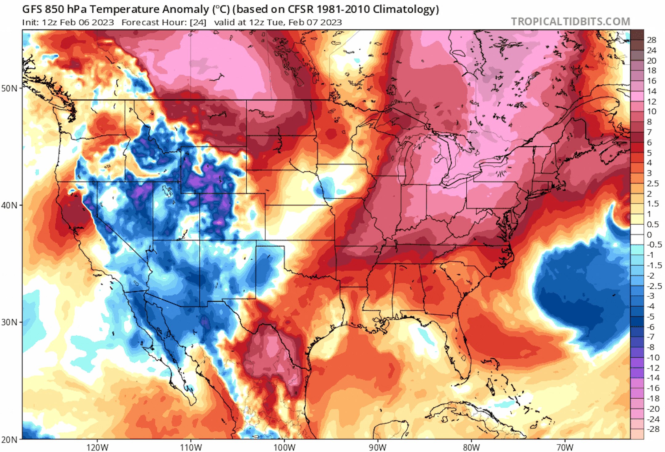
Still Cold This Week, But Much Warmer This Weekend
The 850mb temperature anomaly through next weekend shows milder temperatures continuing across much of the eastern two-thirds of the nation. There will be a brief cool snap later this week, but milder temps look to return this weekend.
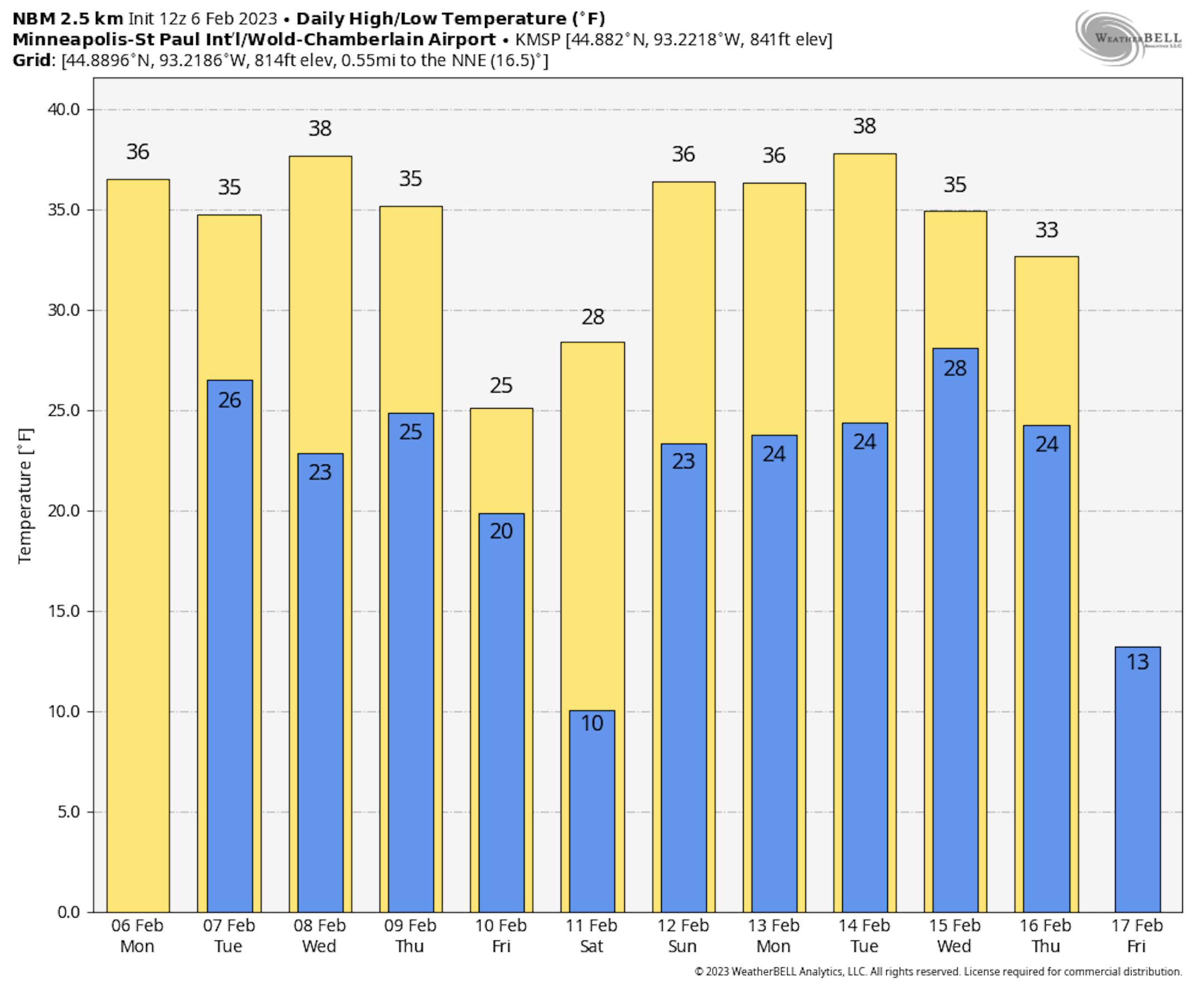
Extended Temperature Outlook
The NBM extended temperature outlook for Minneapolis shows mild weather in place over the next several days. Highs will warm into the 30s and possibly near 40F a few times through mid month. However, there will be a brief cool stint later this week with highs back to if not slightly below average.
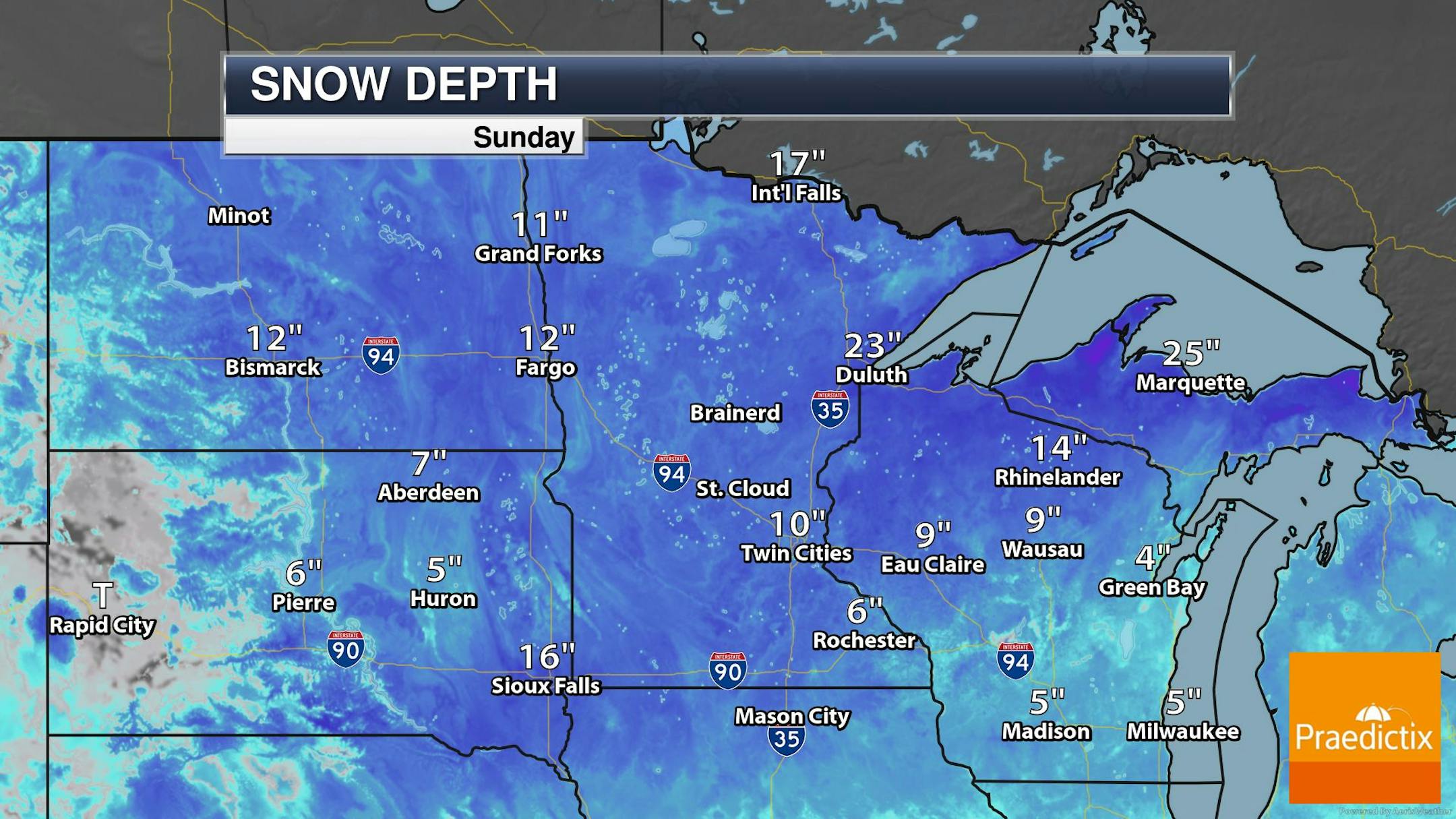
Snow Depth
As of Sunday, February 5th, the MSP Airport still had 10" of snow on the ground. Meanwhile, there's nearly 2ft of snow on the ground in Duluth, across northern Wisconsin and the UP of Michigan. Meanwhile, nearly 1.5ft of snow is on the ground in International Falls. With several days of warmer weather on the horizon, our snow pack will take a bit of a hit, so get out there and enjoy while it's still around.
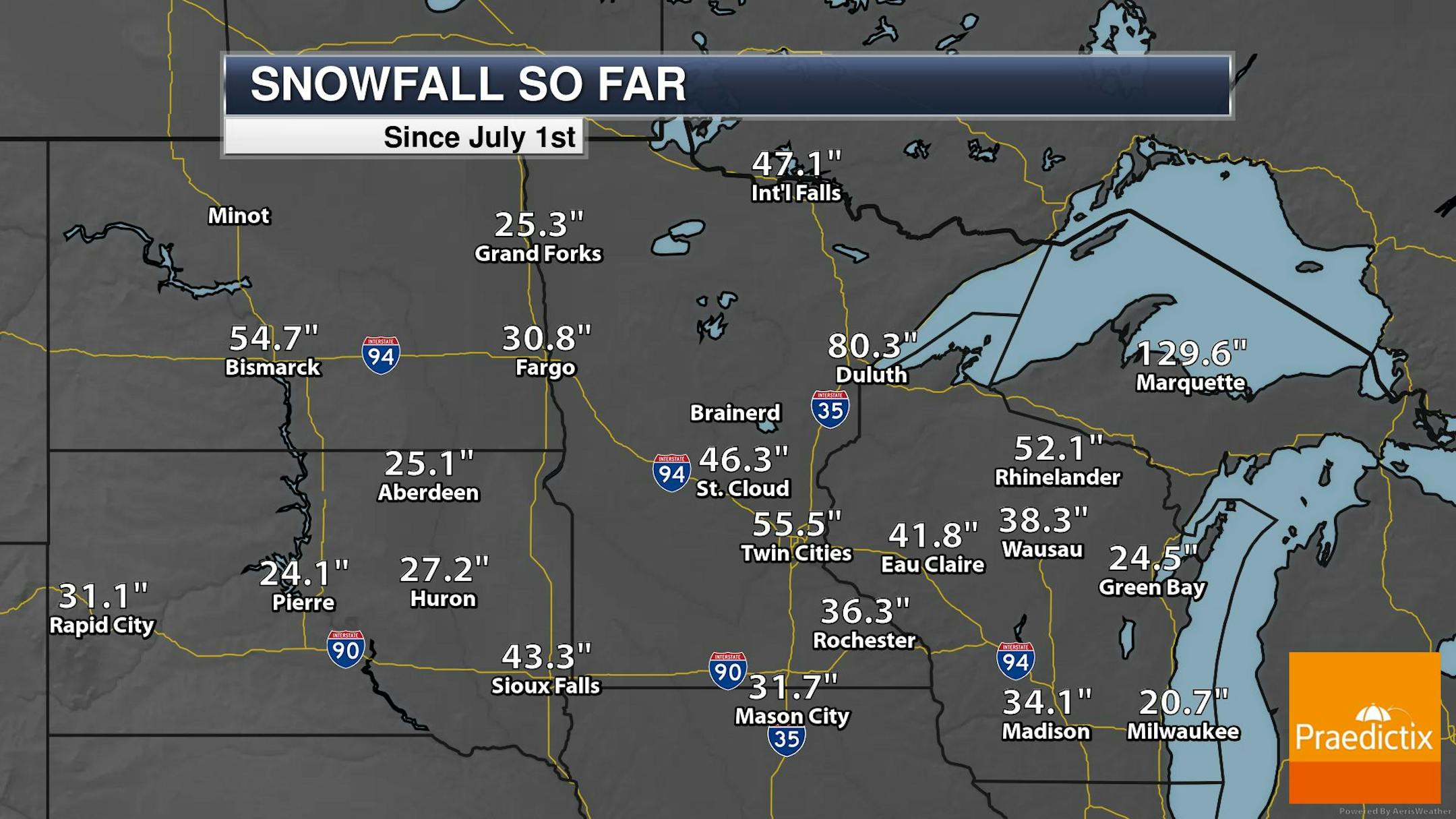
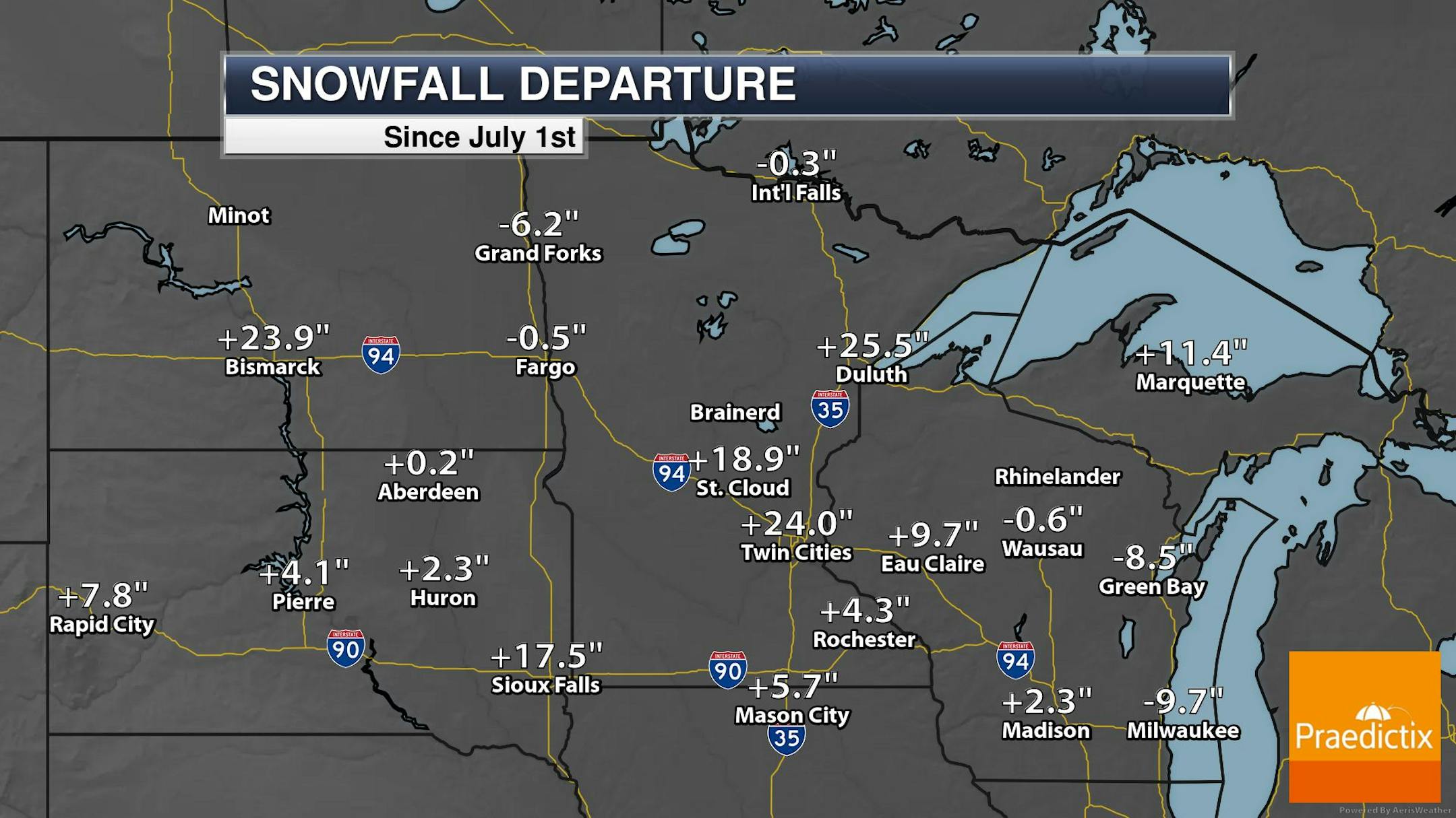
Seasonal Snowfall
Taking a look at snowfall since July 1st, many locations have seen above average amounts so far this season, but folks from near Sioux Falls to the Twin Cities and towards Duluth are nearly 20" to 30" above average this month. 55.5" of snow has fallen at the MSP Airport, which is the 6th snowiest start to any season on record.
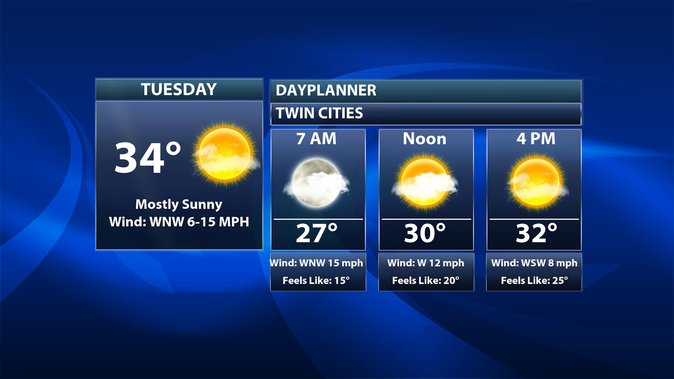
Twin Cities Weather Outlook For Tuesday
The weather outlook for the Twin Cities on Tuesday, February 7th shows a high temp approaching the mid 30s, which will be nearly +5F to +10F above average for this time of the year. Skies will be sunnier with breezy WNW winds during the first part of the day.
Weather Outlook on Tuesday
Temps across the region on Tuesday will warm into the 20s and 30s, which will be nearly +5F to +10F above average for this time of the year. We will also see a mix of clouds and sun through the day.


