

Air Quality Alert From Friday Evening Through Midday Sunday
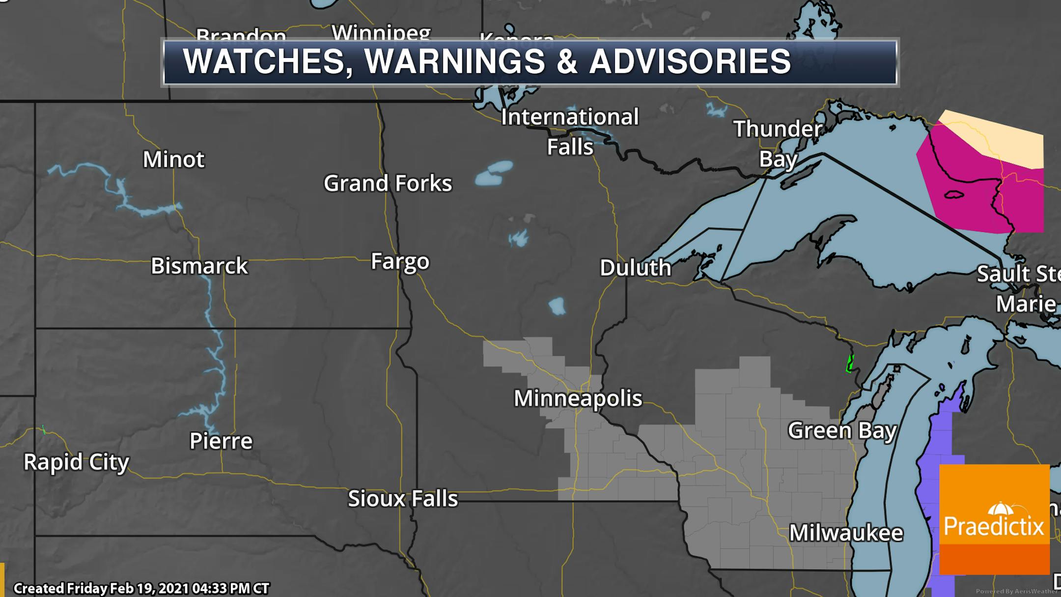
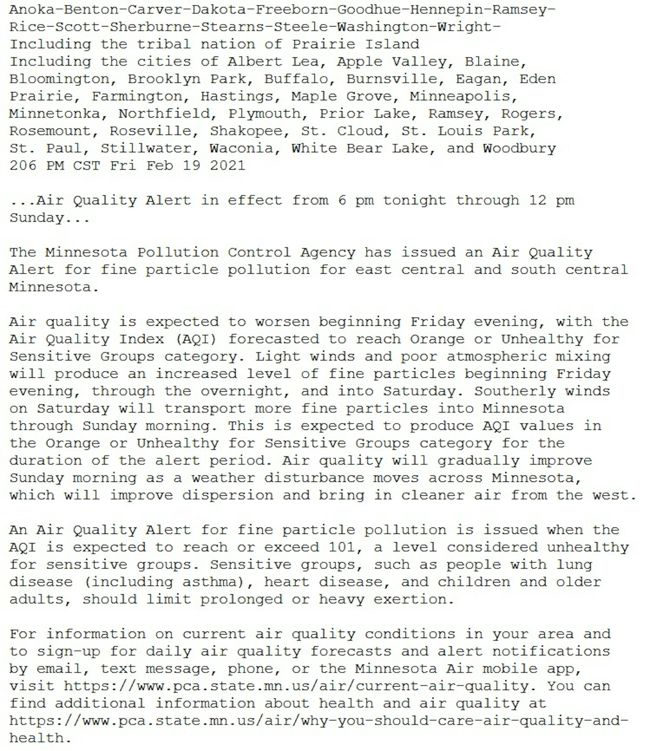
The air quality is expected to decrease across portions of southern Minnesota and Wisconsin as we head through Friday Night, lasting into the weekend. Across southern Minnesota - including the Twin Cities, St. Cloud, and Rochester, the Air Quality Alert is in place from 6 PM Friday through Noon Sunday. In southern Wisconsin, the Air Quality Alert is in place through 3 PM Sunday. Below is the text of the Air Quality Alert for the Twin Cities:
_______________________________________________
Weekend Outlook
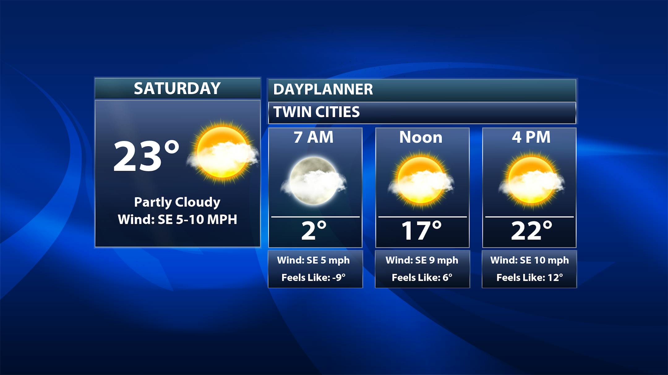
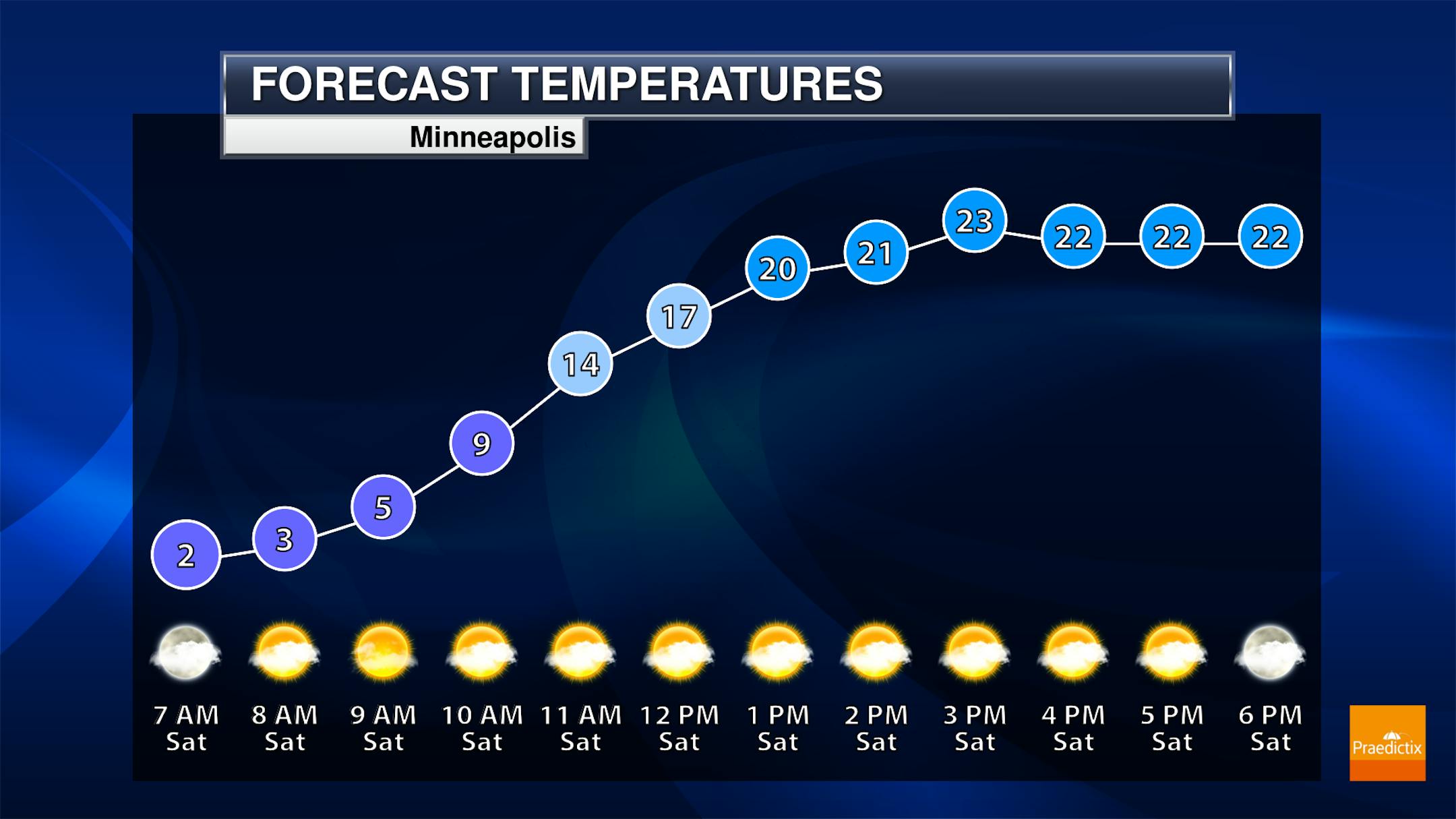
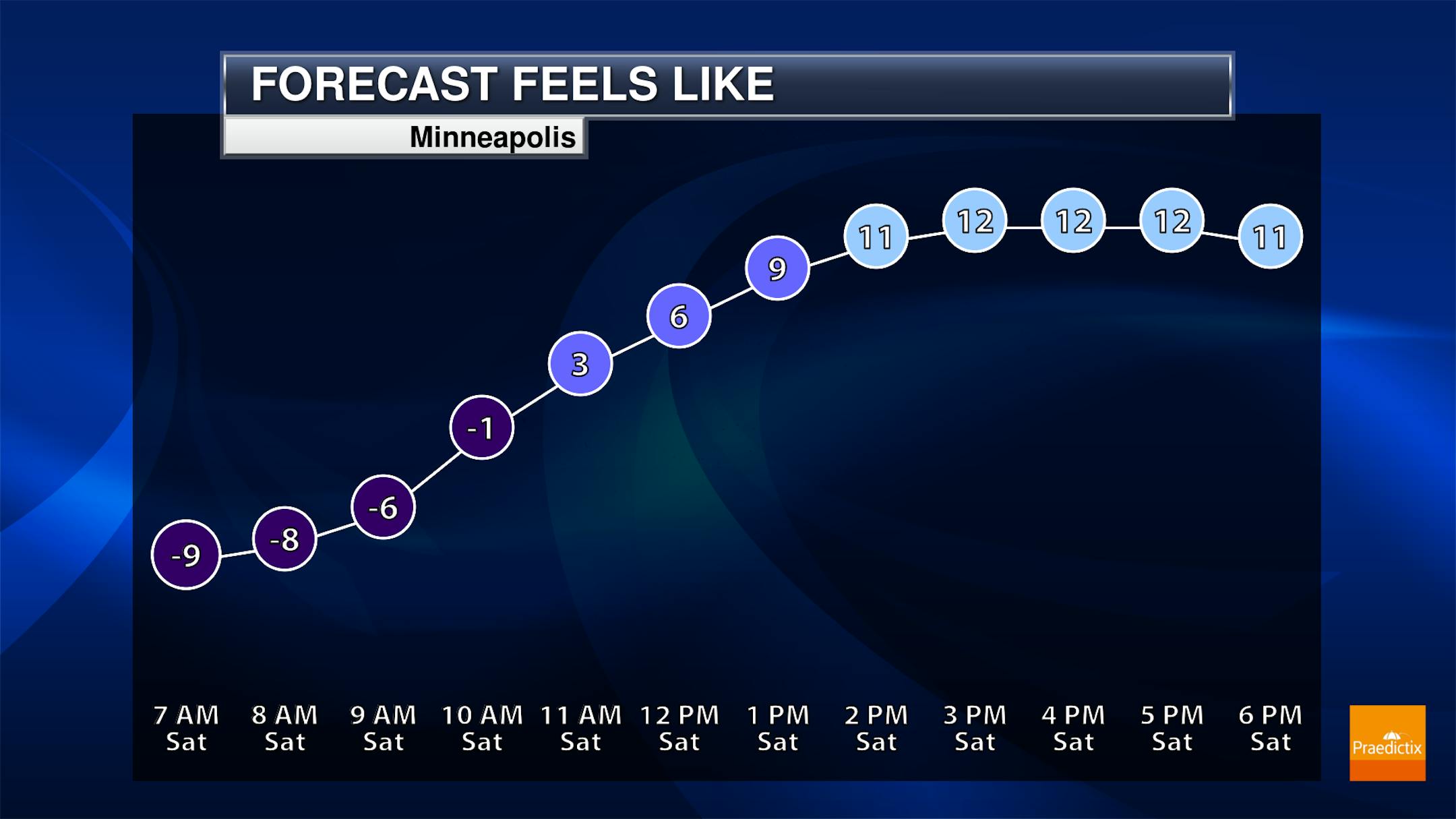
It'll be another chilly start on Saturday here in the Twin Cities, but highs look to climb into the low to mid-20s for the afternoon hours under fairly sunny skies. It'll still feel like the teens in the afternoon when you factor in winds up to around 10 mph.
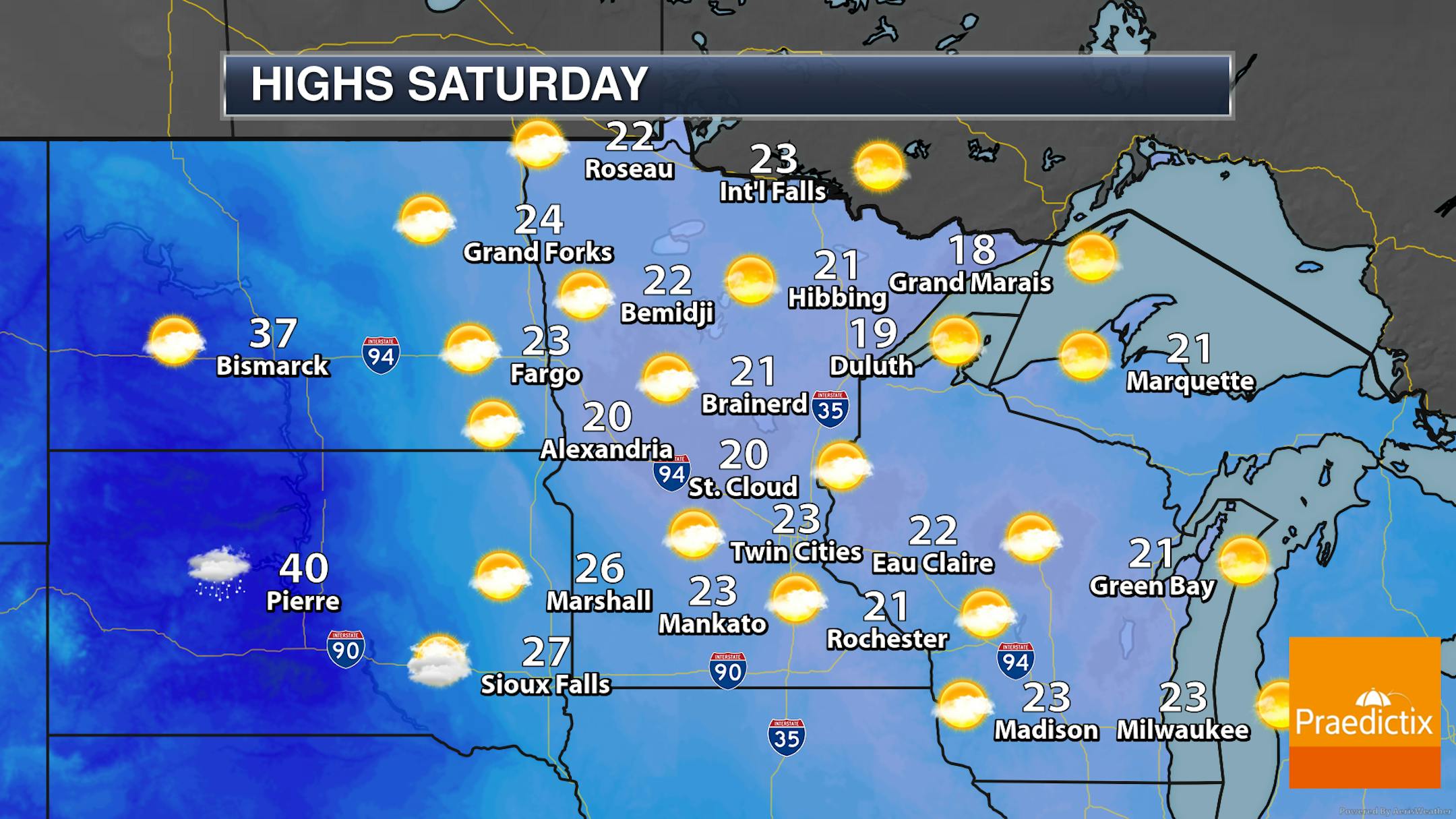
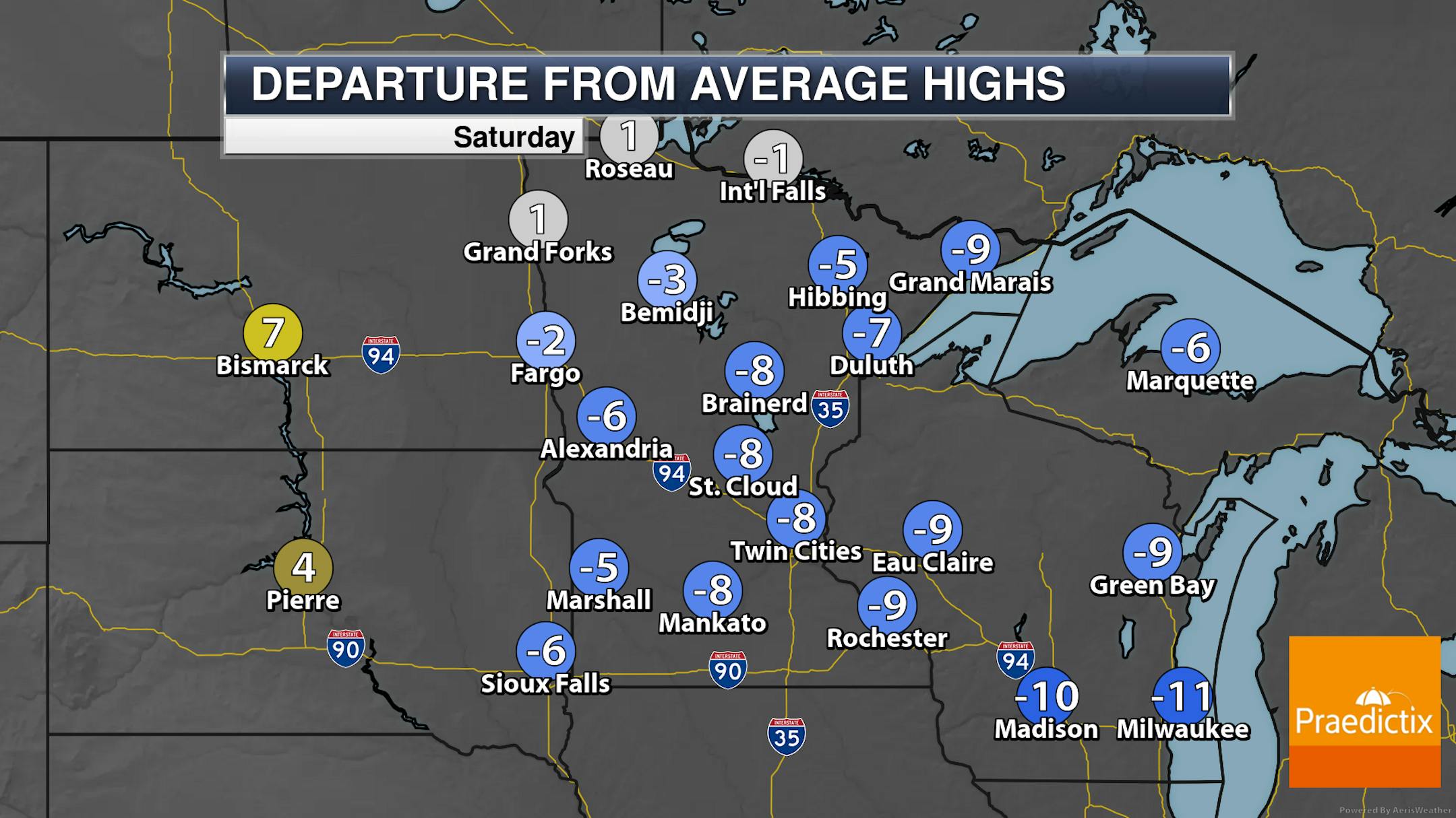
Looking statewide Saturday, we should see fairly sunny skies across the state with temperatures warming into the 20s. Highs will still be up to 10F degrees below average across most of the state but will be right around average up in far northern Minnesota.
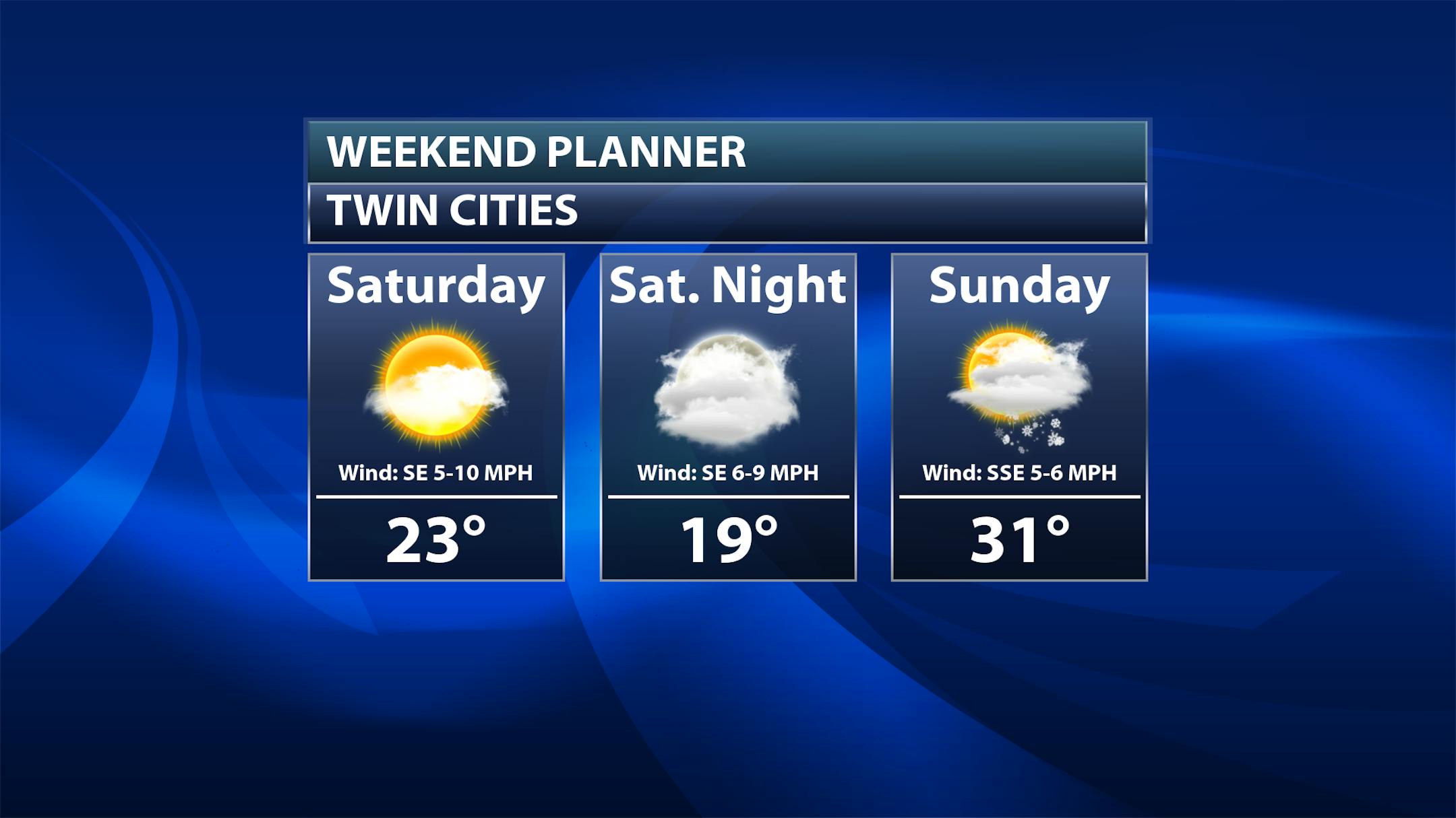
As we look at the full weekend, we will see warmer temperatures in place as we head into Sunday, with highs expected to reach the low 30s in the Twin Cities. We will also be watching a system that will help to bring some light snow across southern and eastern portions of the state on Sunday.
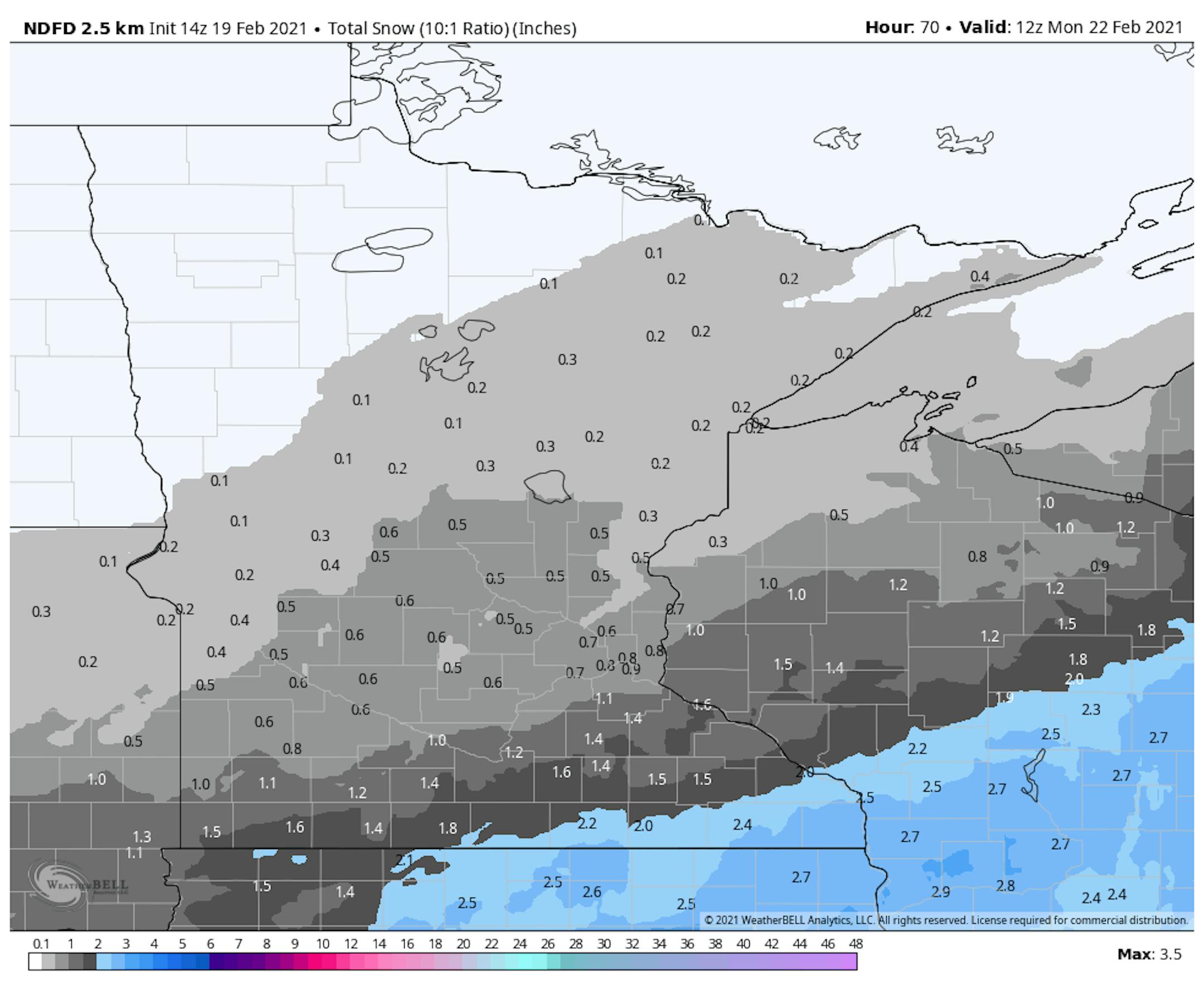
Snowfall tallies are expected to be fairly light across central and northern Minnesota, with up to an inch expected for the metro. The heaviest totals will be in southeastern Minnesota, where up to 2.5" of snow will be possible.
_______________________________________________
40s Next Week!
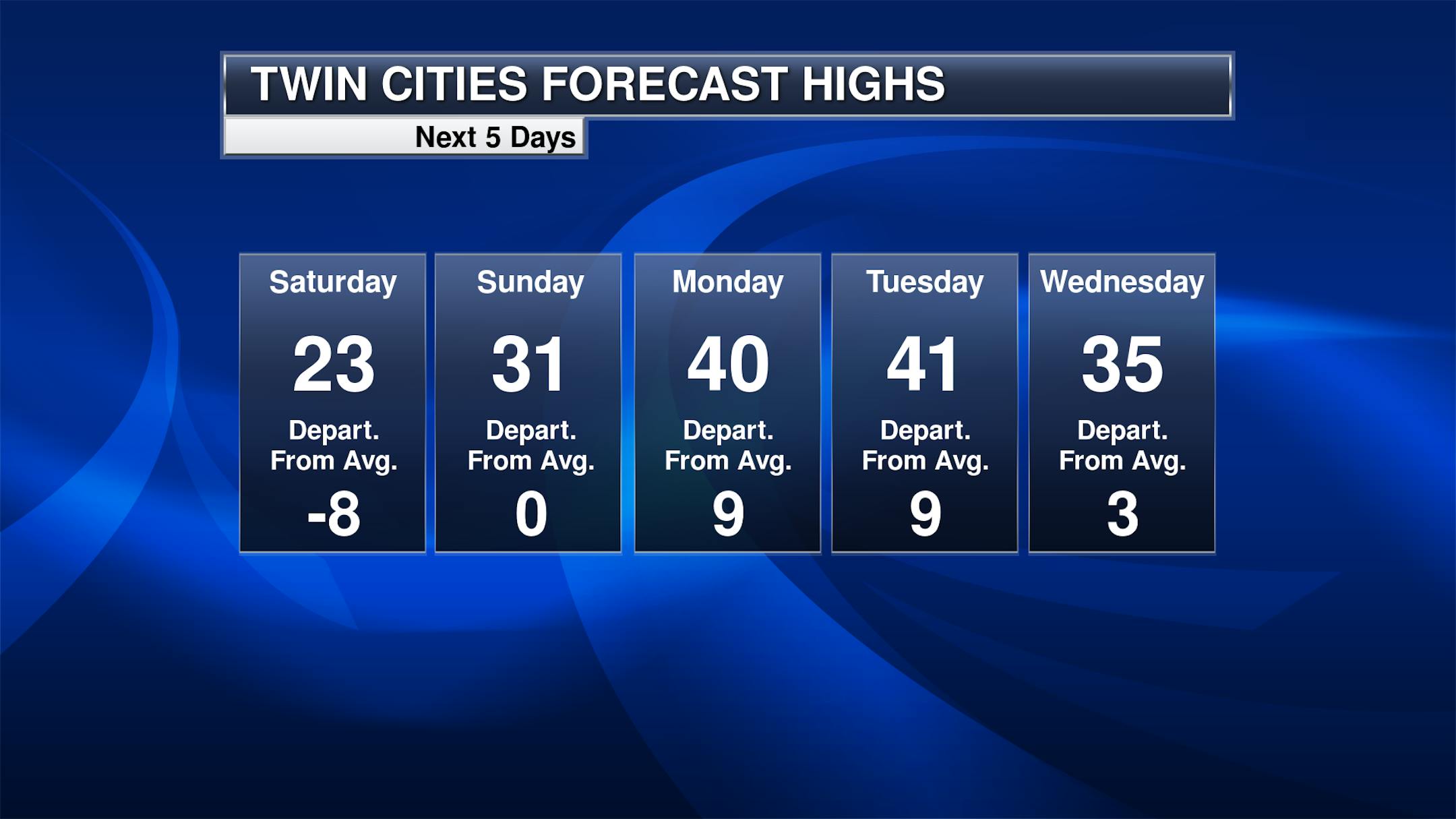
And we'll be even warmer as we head into early next week, with highs expected to reach the low 40s! I wouldn't be surprised to see some fog next week with the melting snow pack across the region. Temperatures will slightly cool heading into the middle of the week, but it's still going to feel A LOT nicer than the past couple of weeks!


