
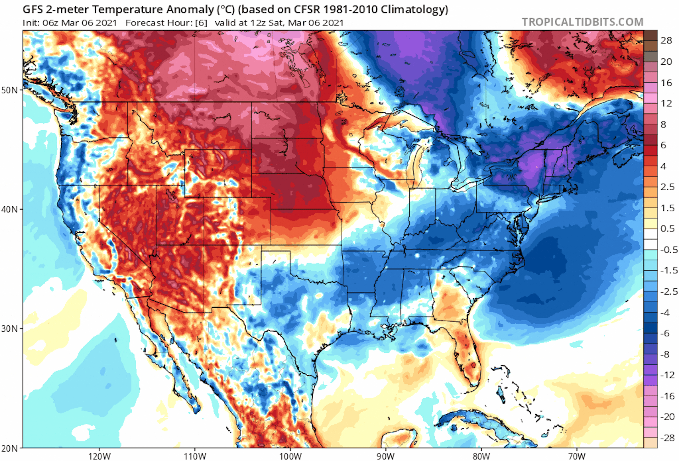
Record Warmth Ahead!
I don't know about you, but I've got a serious case of Spring Fever! Temps are running WELL above average across much of the Central US with record warmth possible for some across the Upper Midwest over the next several days. Our warmest day arrives Tuesday with highs warming to record levels, even in the Twin Cities!
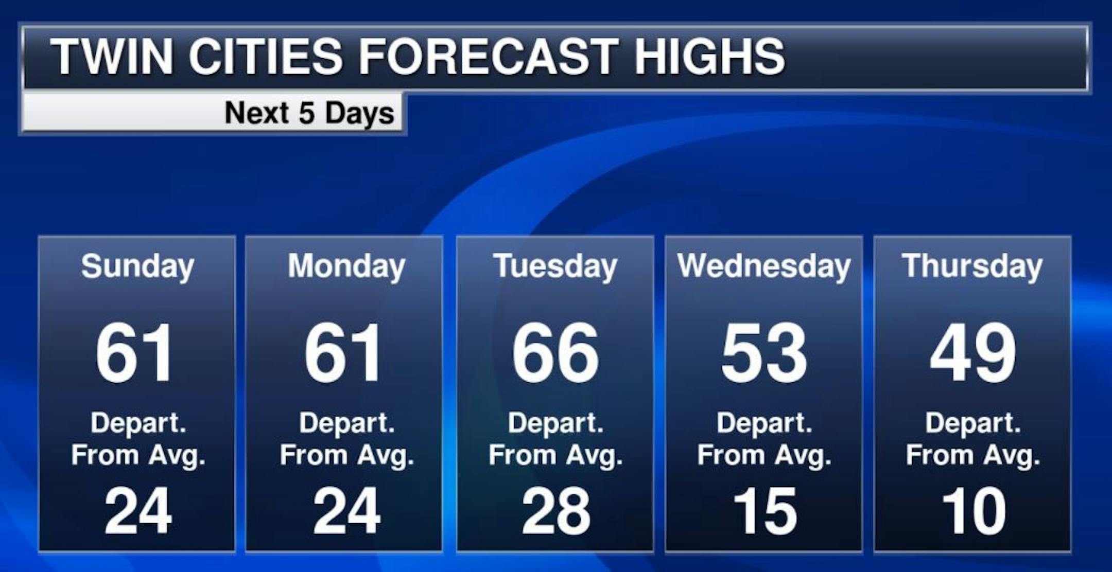
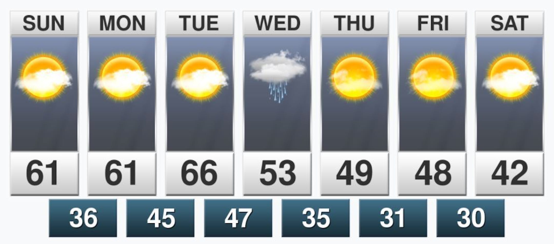
Extended Temperature Outlook
Here's the extended temperature and weather outlook over the next 5 to 7 days. Highs Sunday, Monday & Tuesday will likely reach the 60s, which will be the first time since November 9th, 2020 when we hit 66F. There will be records across much of the region on Tuesday with a forecast high of 66F in the metro. Keep in mind that the record for the metro on Tuesday, March 9th is is 61F, which was set in 1879. A cool front will pass through the region on Wednesday with temps falling a touch into the 40s later in the week, but that will still be above average for this time of the year.
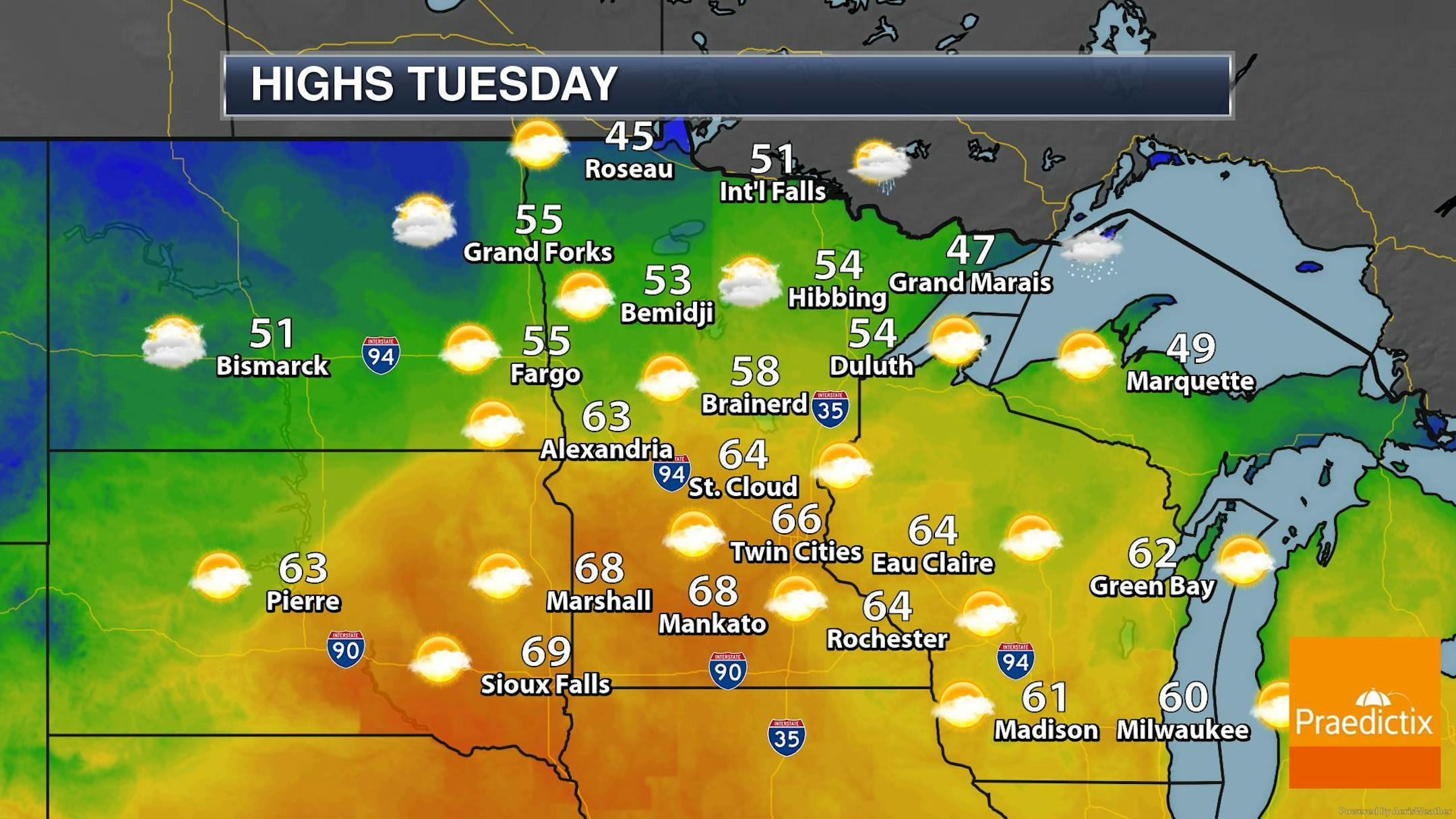
Record Warmth Tuesday
Highs on Tuesday will be VERY warm. In fact, many locations will likely reach record levels from the Dakotas, to Minnesota and into Wisconsin. If the forecast holds, I wouldn't doubt to see a few 70s on the map across parts of SW Minnesota! Stay tuned.
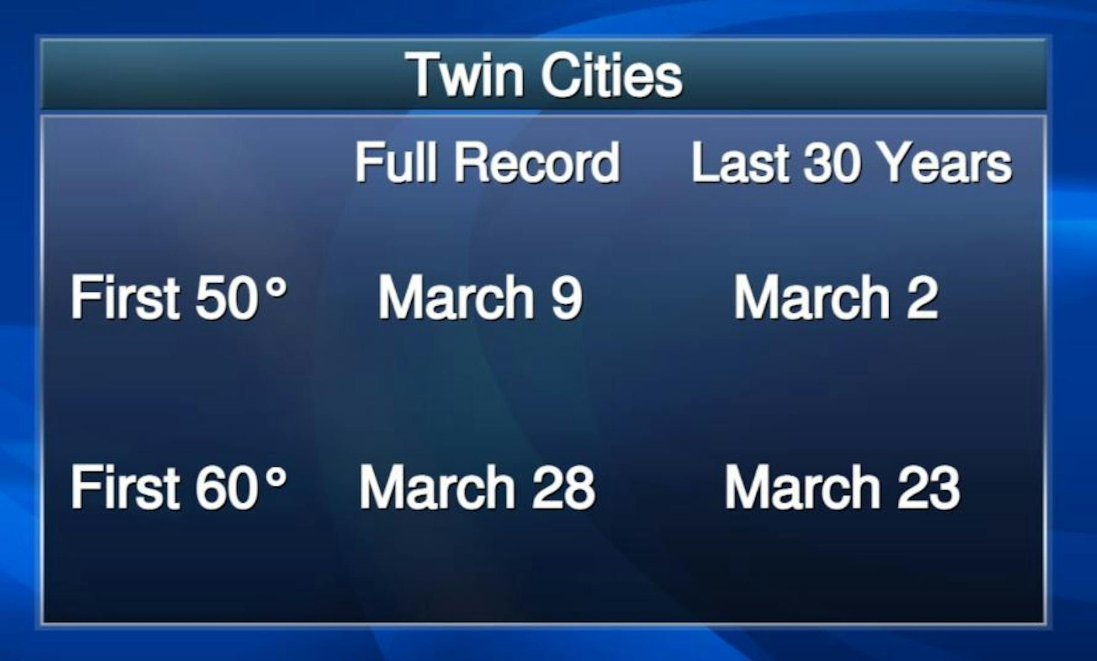
Average First 50F & 60F at MSP
On Wednesday, March 3rd, the MSP Airport hit 50F for the first time this season. Interestingly, that's pretty close to the 30-year average, which typically happens on March 2nd. When you look at the full record, which dates back to the mid/late 1800s, the first 50F typically occurs around Marcy 9th. Our first 60F high over the last 30 years typically happens around the last week of March.
Countdown to Spring (Vernal Equinox)
Saturday, March 20th @ 4:37AM
the worst of winter's wrath is generally behind us during the month of March, but it still can be snowy at times. In fact, MSP typically sees around 9" of snow during this month, but more impressively, we gain more than 3 minutes of daylight each day during the month and if you do the math, we gain about an extra 1.5 hour of daylight through the month! The sunset on March 1st is around 6PM, but by the end of the month (and thanks to the time change on March 14th) our sunset on March 31st is at 7:40PM! The official start to spring (Vernal Equinox) is on Saturday, March 20th at 4:37AM this year.

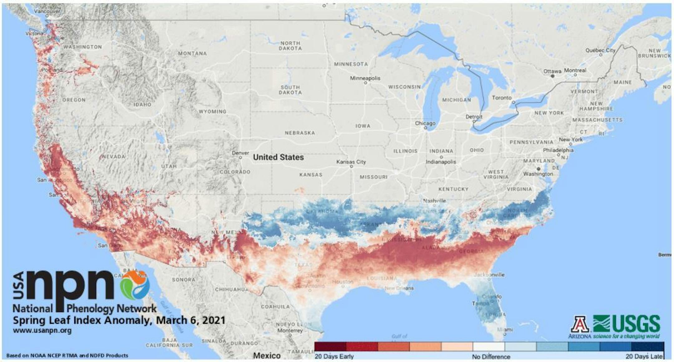
Status of Spring - Spring Leaf Index Anomaly
"How do you know when spring has begun? Is it the appearance of the first tiny leaves on the trees, or the first crocus plants peeping through the snow? The First Leaf and First Bloom Indices are synthetic measures of these early season events in plants, based on recent temperature conditions. These models allow us to track the progression of spring onset across the country. Spring leaf out has arrived in southern states. Spring arrived on time to one week late in Florida and southern Texas, was one-two weeks early in the middle and northern part of Southeast states, and has since slowed and is a few days late in Georgia and the Carolinas. Spring is days to weeks early in parts of the Southwest and West coast."
Snowpack Melting Fast
Here's a look at the snowpack as of Friday, March 5th. Note that there was only a Trace measured at the MSP Airport. Note that we've melted nearly 8" of snow since February 23rd in the Twin Cities. Meanwhile, there's still a good foot plus across parts of NE Minnesota, northern Wisconsin and across the U.P. of Michigan!


