

Fall Color Tracker
According to the MN DNR, much of the state is already experiencing minor changes in the fall color. Keep in mind that much of the summer was hot and dry, so some of the trees are a bit stressed and could be prematurely changing. With that being said, we are getting closer to that time of the year. See the latest update from the MN DNR HERE:

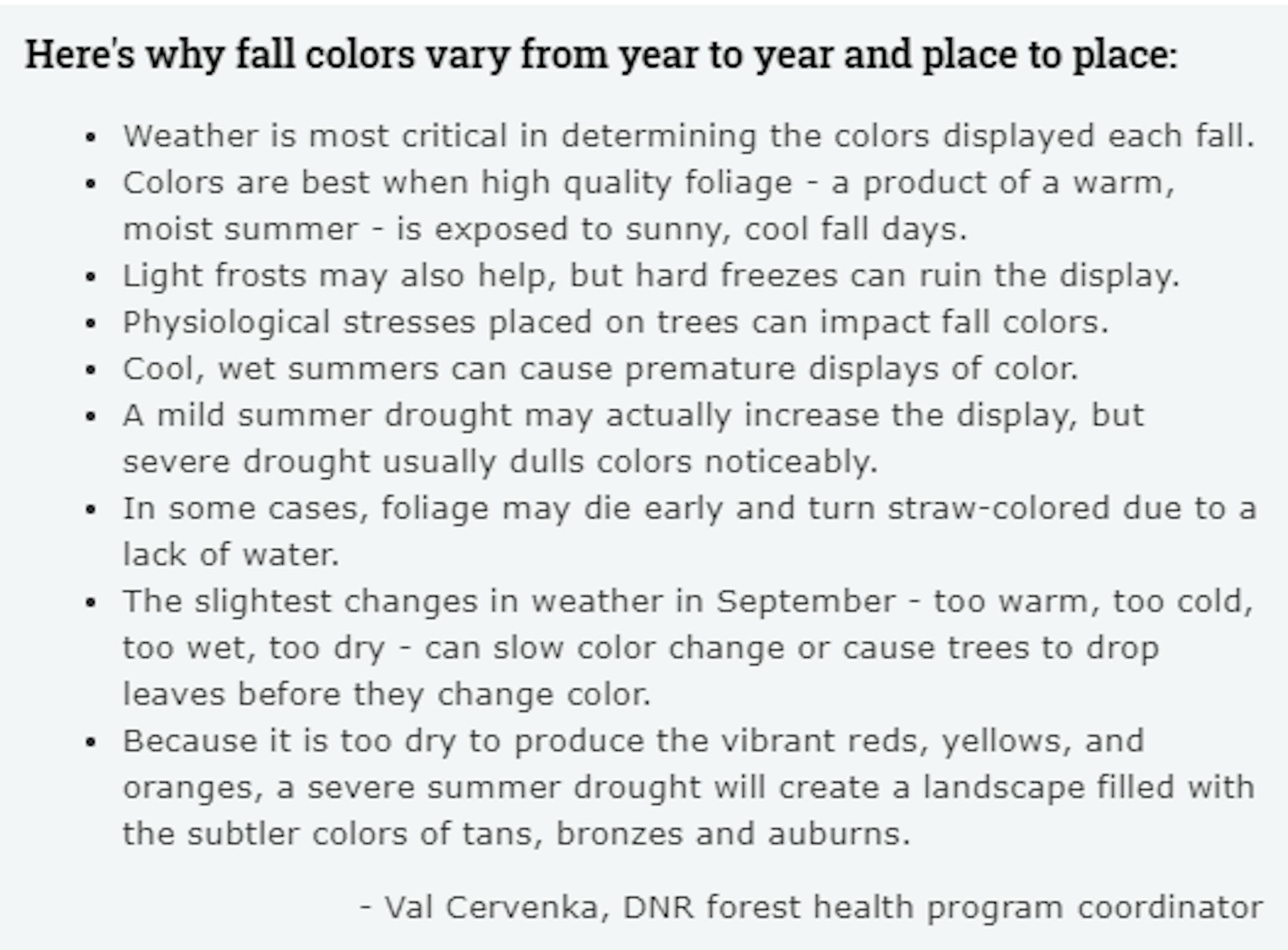
Fall Color Depends on Weather
Ever wonder why some years, fall color is so vibrant vs some years, fall color tends to be a bit more dull? Val Cervenka, Coordinator from the DNR Forest Health Program, shares how the weather can play a roll in those fall colors. Due to the hot and dry summer that most of experienced, it is likely that fall foliage could be less impressive this year with more tans, bronzes and auburns.
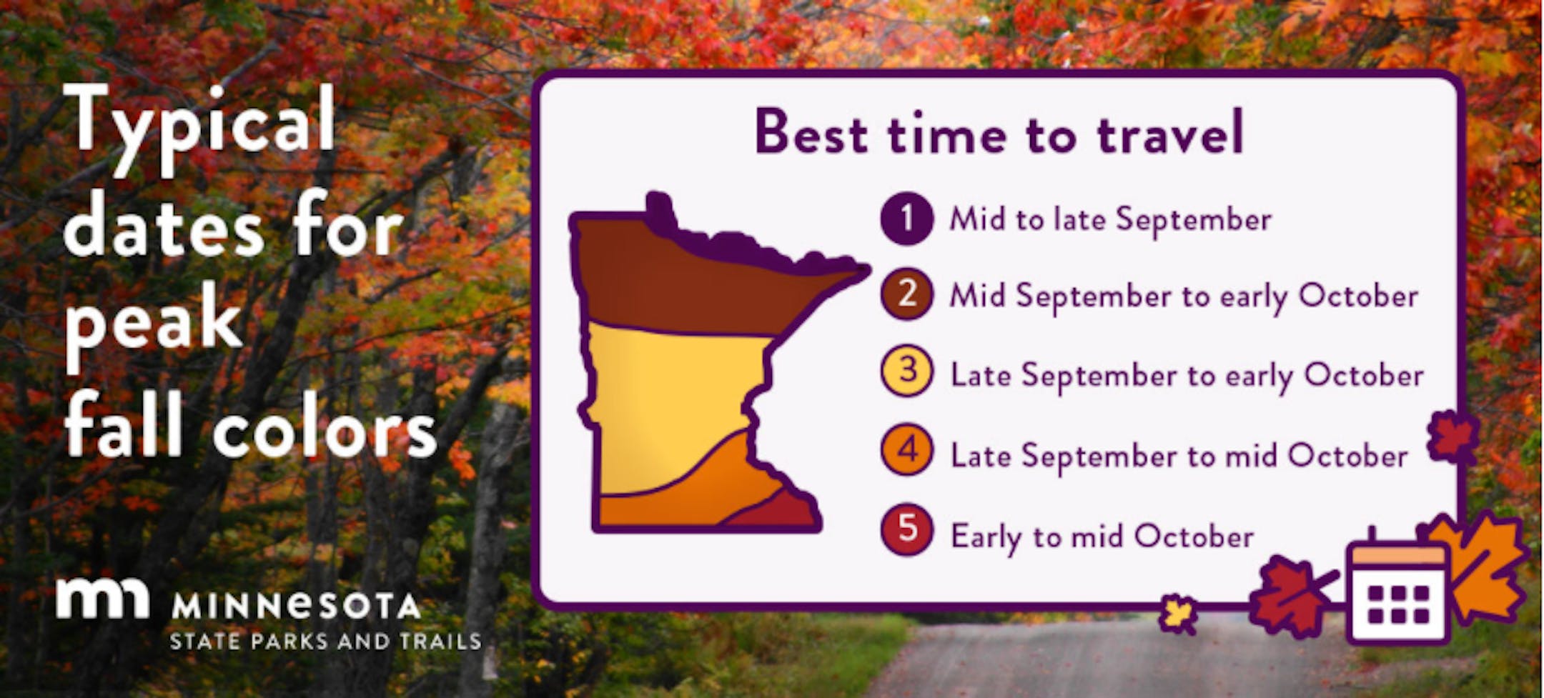
Typical Peak Dates For Fall Color
According to the MN DNR, fall colors typically start to peak across the northern part of the state in mid/late September. Peak color typically arrives in central and southern Minnesota late September and into early/mid October. Note that over the next several weeks, you'll notice some big changes in the landscape as we head deeper into fall.
Active Tropics Continue
Keep in mind that the peak of the Atlantic Hurricane season is on September 10th and things are still quite active in the Atlantic basin now. Along with Odette, NOAA's NHC is tracking 2 other waves, 1 of which have a high probability of tropical formation over the next 2 days.

Minnesota Drought Update
According to the latest drought update from the US Drought Monitor, drought continues to slightly improve across the state. From last week to this week, there were slight improvements in the D3 (extreme) and D4 (exceptional) categories. The worst of the drought still remains across the northern tier of the state with moderate to severe drought across much of the Twin Cities metro.

Precipitation Departure From Average Since Jan. 1st
Despite picking up some much needed rainfall at the end of August and into early September, many locations are still several inches below average since January 1st. Some of the biggest deficits are still across the northern half of the state, where Exceptional Drought conditions are in place. The Twin Cities is still -3.80" below average and at its 63rd driest January 1st to September 17th on record. International Falls is nearly -7.50" below average and at its 11th driest start to any year on record.

Precipitation Potential Through Tuesday
Good new for folks across northern Minnesota that have a bigger drought concern, the extended forecast through Tuesday of next week suggests some healthy tallies of 1" to 2" or more.

Simulated Radar From AM Sunday to PM Tuesday
Here's the simulated radar from AM Sunday to PM Tuesday. After a very warm and windy Sunday, scattered showers and thunderstorms will develop, some of which could be a little on the vigorous side with locally heavy rainfall.


