
Remembering October 2020
1 year ago this month, the Twin Cities experienced its snowiest October on record with 9.3" of snow falling at the MSP Airport. The month started on a mild note with highs topping out at 80F on the 6th and 9th, but quickly took a turn during the 2nd half of the month. By October 18th high temps only warmed into the 30s and by the 20th, 7.9" of snow at the MSP Airport, which was the 2nd snowiest October day on record at the MSP Airport. The snowiest October day was on Halloween 1991 when 8.2" of snow fell.

October 2020 - Snowiest October on Record at MSP
The list below shows the top 20 snowiest Octobers on record at the MSP Airport. Note that last October 2020, we picked up 9.3", which was the snowiest on record, even beating the 8.2" that fell on Halloween in 1991.

Daily Weather Data For October 2020
Here is a more comprehensive chart of daily weather data for October 2020. Note that highs reach 80F two times on the 6th and 9th, but fell into the 30s by the 18th. On the 20th, MSP picked up 7.9" of snow, another 0.8" on the 23rd and another 0.4" on the 25th for a grand total of 9.3" for the month! The coldest temp recorded was 16F on the 27th, which tied for the 8th coldest temp ever recorded during the month of October. The coldest temp was 10F set on October 30th, 1925.

Nearing Peak Color at McCarthy Beach State Park

MN Fall Color Tracker
According to the MN DNR, much of the state is already experiencing minor changes in the fall color. Keep in mind that much of the summer was hot and dry, so some of the color won't be as vibrant this year. With that being said, there are already spots across the northern part of the state that are at peak color right now! See the latest update from the MN DNR HERE:

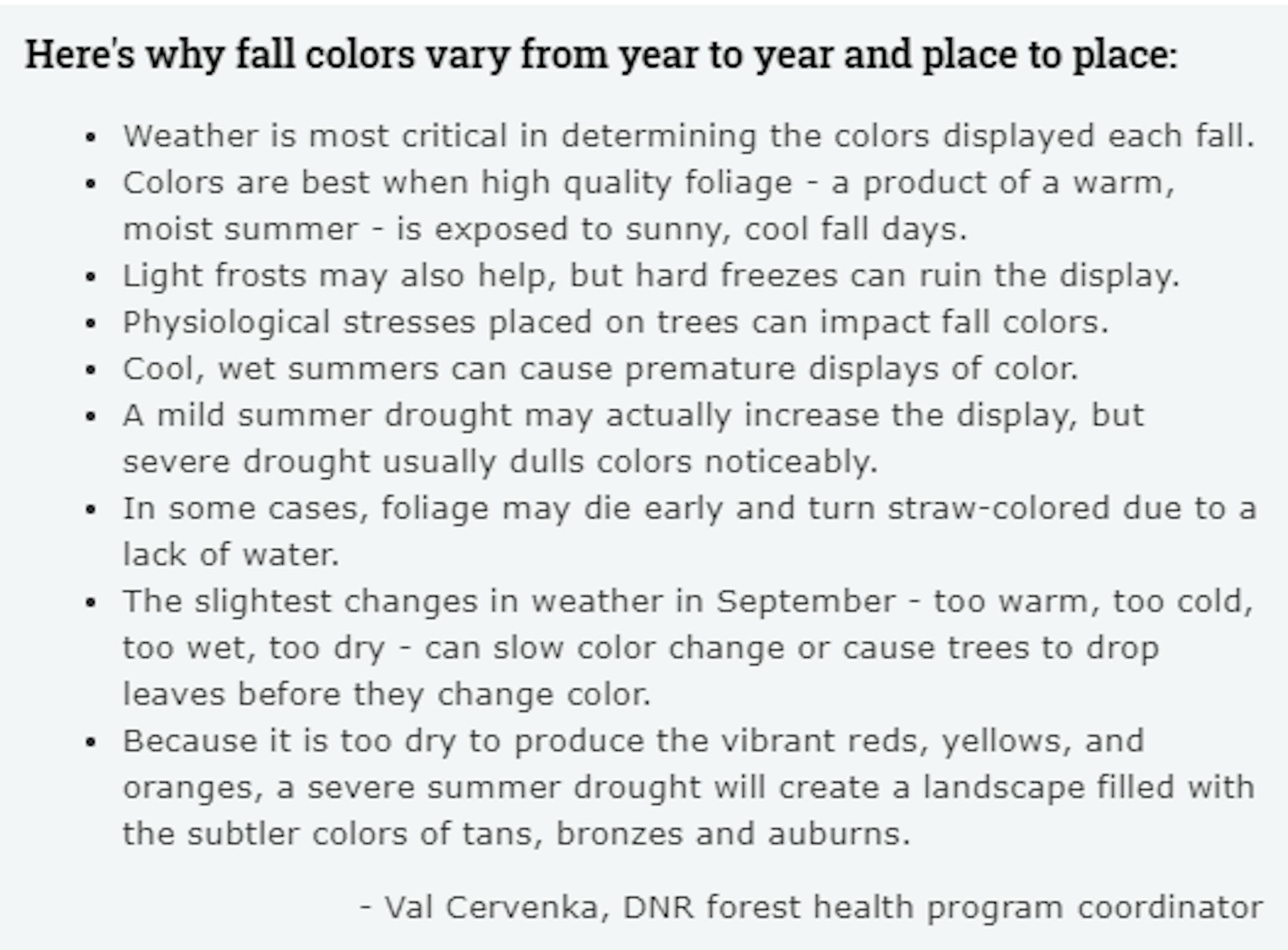
Fall Color Depends on Weather
Ever wonder why some years, fall color is so vibrant vs some years, fall color tends to be a bit more dull? Val Cervenka, Coordinator from the DNR Forest Health Program, shares how the weather can play a roll in those fall colors. Due to the hot and dry summer that most of experienced, it is likely that fall foliage could be less impressive this year with more tans, bronzes and auburns.
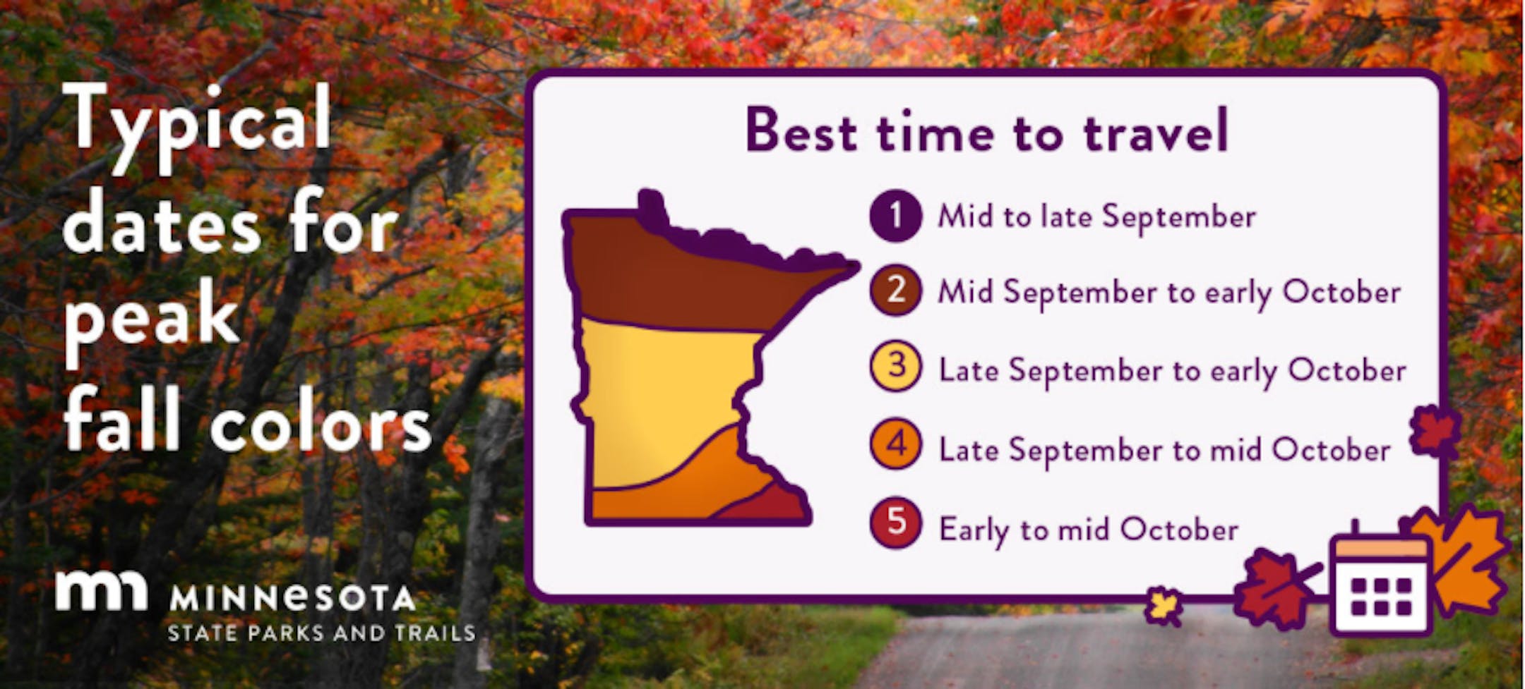
Typical Peak Dates For Fall Color
According to the MN DNR, fall colors typically start to peak across the northern part of the state in mid/late September. Peak color typically arrives in central and southern Minnesota late September and into early/mid October. Note that over the next several weeks, you'll notice some big changes in the landscape as we head deeper into fall.
Simulated Radar From AM Monday to PM Friday
The simulated radar from AM Monday to PM Friday across the Midwest shows fairly quiet conditions much of the week ahead. There could be a few showers late in the week closer to home, but it appears that we'll be settling in for another stretch of mostly dry and sunny weather over the next several days.

Drought Update For Minnesota
According to the US Drought Monitor, nearly 24% of the state is still considered to be in an extreme drought, those locations are located in the northern part of the state. Nearly 50% of the state is still under a severe drought (again, mainly up north) and about 76% percent of the state is in a moderate drought, which includes the Twin Cities.


