
Extreme Fire Danger Today
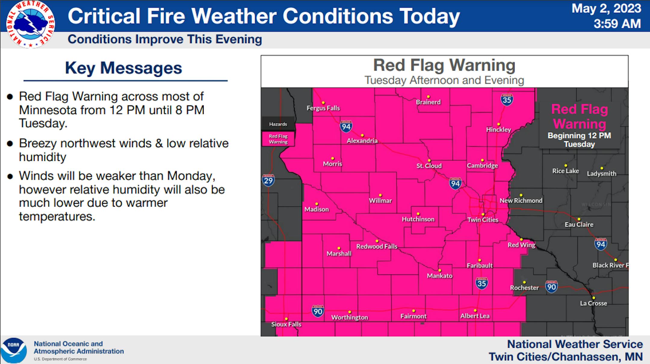
RED FLAG WARNING IN EFFECT FROM NOON TODAY TO 8 PM CDT THIS EVENING FOR MUCH OF MINNESOTA DUE TO GUSTY WINDS AND LOW HUMIDITY
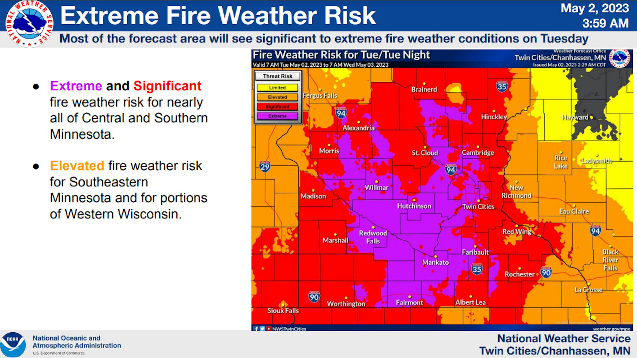
Steady northwest winds with gusts near 30 mph are expected again today with humidities dropping to between 15 and 25 percent. Some humidities in the lower teens are possible. Critical fire weather conditions are expected and any fires that form will have the ability to spread quickly. The National Weather Service in Twin Cities/Chanhassen has issued a Red Flag Warning, which is in effect from noon today to 8 PM CDT this evening. The Fire Weather Watch is no longer in effect.
AFFECTED AREA...All of central and south central Minnesota.
WIND...Northwest 20 to 25 mph with gusts near 30 mph.
HUMIDITY...15 to 25 percent. Even lower humidities are possible.
IMPACTS...Any fires that develop will likely spread rapidly. Outdoor burning is not recommended.
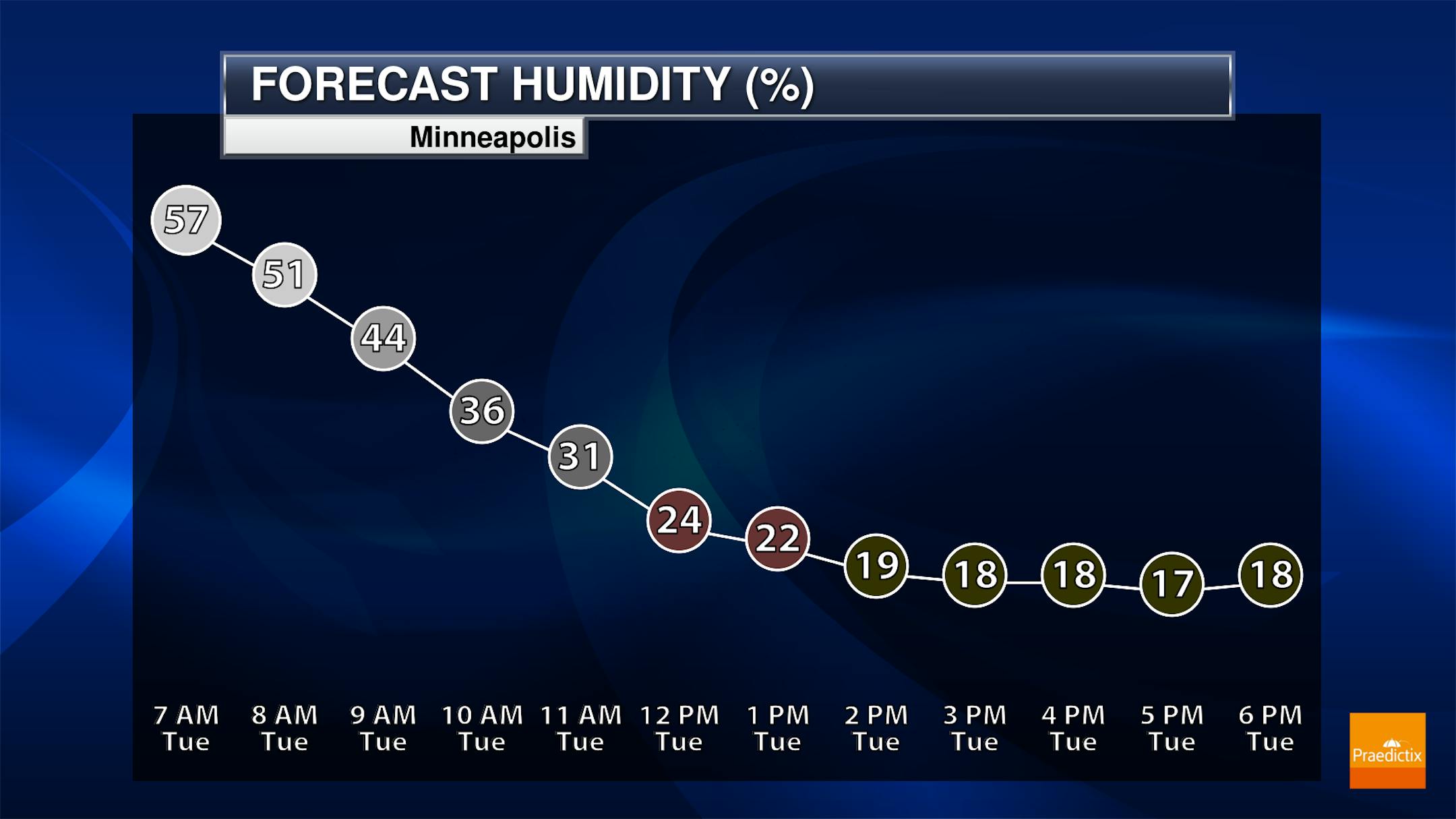
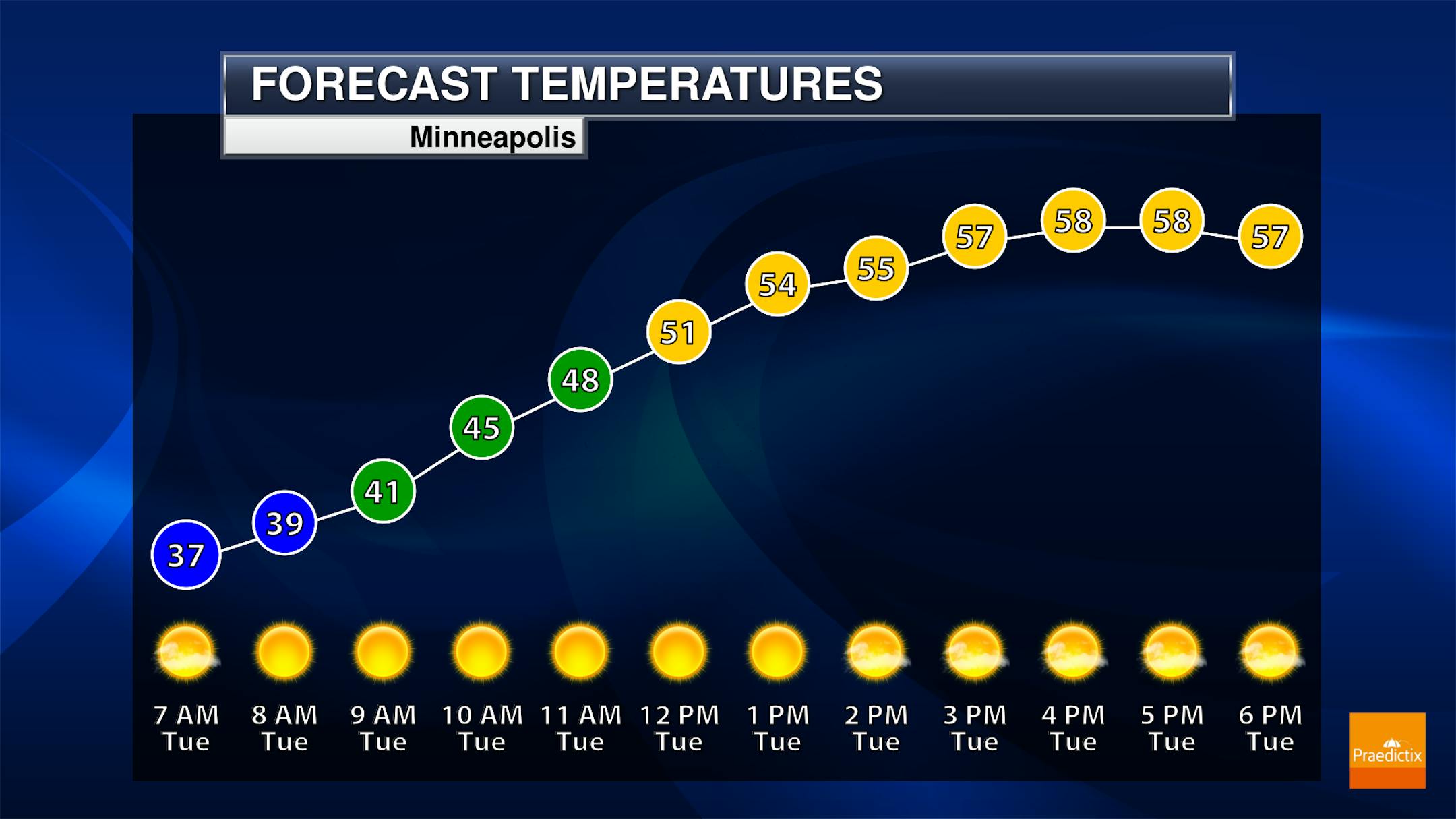
Meteograms For Minneapolis
The hourly weather forecast for Tuesday will be windy with dry and mild temps. This will create extremely high fire concerns across the region today. Note that if wildfires do start, they could quickly spread and get out of control.

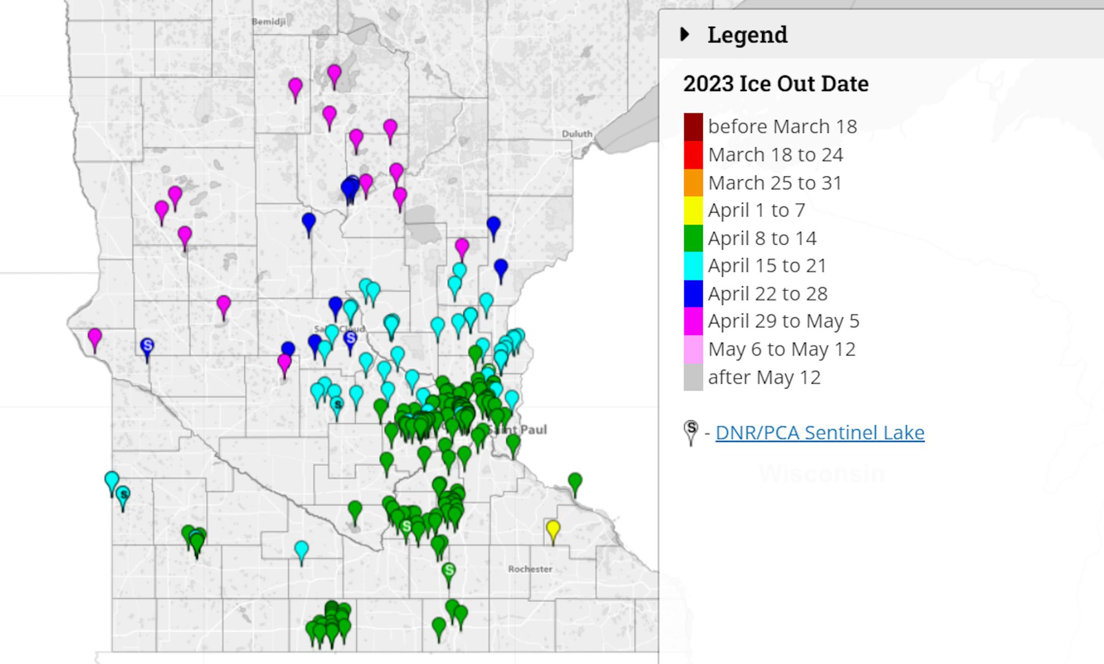
Ice Outs
According to the MN DNR, Lake Minnetonka is officially ICE OUT!! It happened on Wednesday, April 19th, which is a just about a week later than average. The earliest ice out was on March 11th, 1878, while the latest ice out was on May 5th, 2018. Ice outs will continue to creep north over the next several days and weeks. Many of the larger lakes in central and northern Minnesota have yet to go ice out, but it won't be long now...
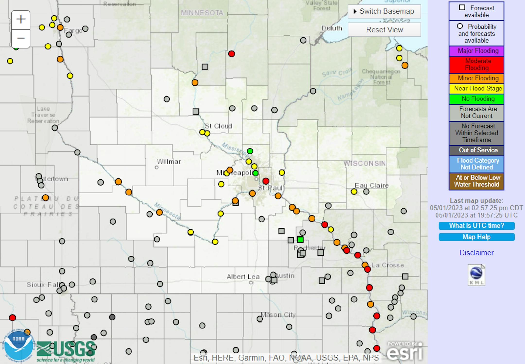
Flood Outlook
According to the National Weather Service, out of 160 river gauges on the map below, 30 are currently in flood stage and still could be over the next several days. The good news is that many rivers have crested close to home with river levels dropping through the weekend and into early next week.
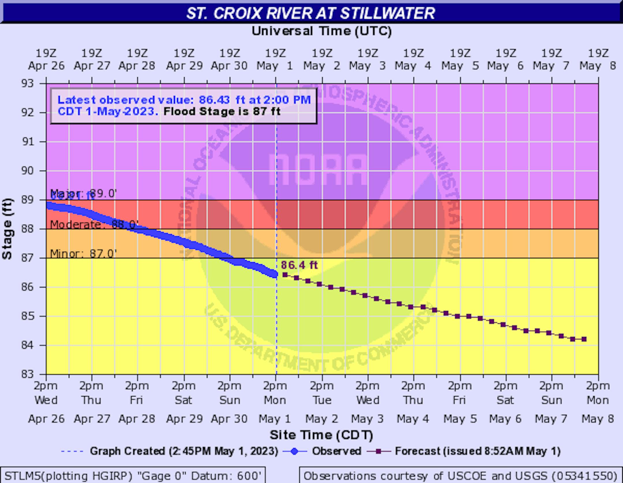
Flood Waters Receding in Stillwater
Here's the river forecast for the St. Croix River at Stillwater. Major flooding has ended after reaching a crest of 89.26ft earlier this week, which is the 7th highest crest on record there. We'll still be dealing with minor flooding through the weekend and most of next week, but the worst appears to be over for this spring.
Flood Waters Receding Along The Mississippi at St. Paul
The Mississippi River at St. Paul will still be dealing with Major flooding through the weekend, but it appears the crest of 18.24ft earlier this week will be the high point of this spring season. That mark is the 11th highest on record. As we head into next week, we'll still be dealing with moderate and minor flooding, but water levels will be receding.


