Dust From Colorado & Kansas Showed Up in Duluth
Thanks to the National Weather Service Duluth for the picture below. After checking the rain gauge on Thursday, they noticed that the accumulated liquid inside the gauge was cloudy. Wednesday's storm system was so intense that Dust Storms developed across the Central Plains and got pulled up into upper Midwest and eventually showed up in Duluth. Crazy!

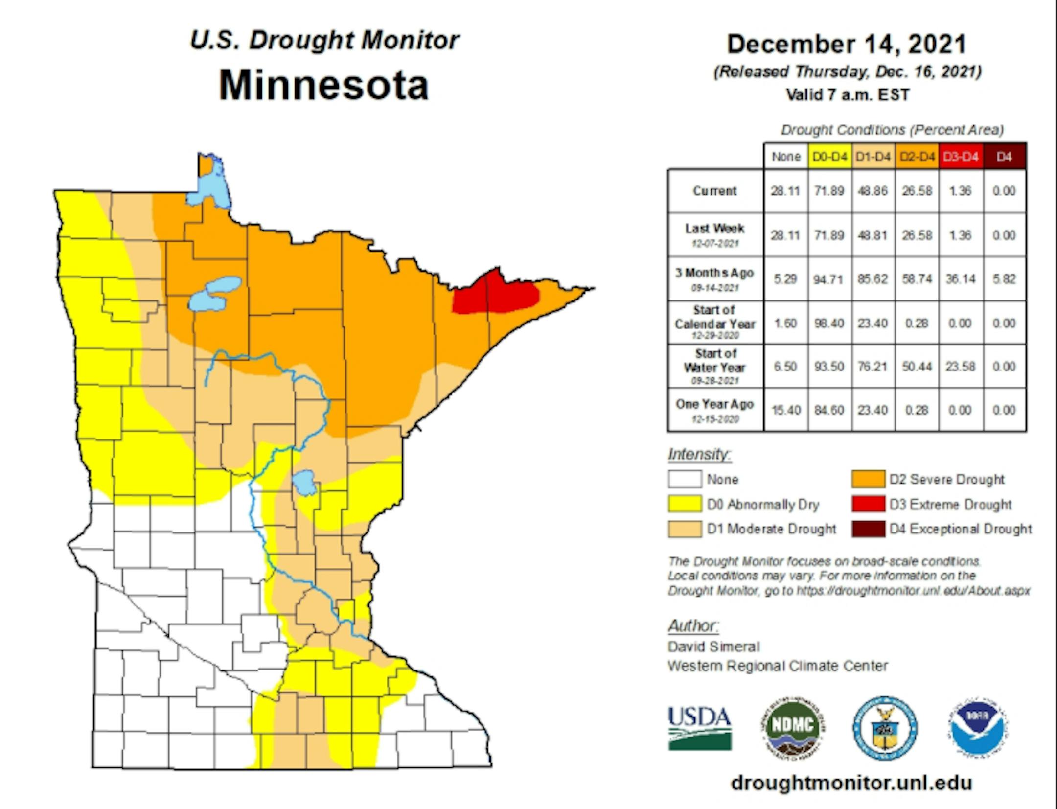
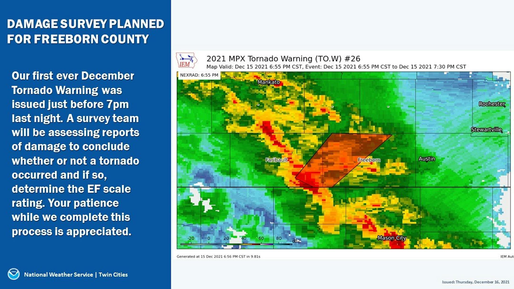
First Minnesota Tornado Ever On Record In December
According to the National Weather Service in the Twin Cities & La Cross, there were confirmed tornadoes in Minnesota, which makes it the first tornado ever recorded in the state during the month of December. Here is more information regarding the tornado near Hartland MN. Note that there was another confirmed tornado in Stanley WI. More information will be available after the surveys are complete.
"Storm Survey Update: Survey team in Hartland MN confirms damage there was produced by a tornado. Survey is still ongoing to determine rating/strength, path length and path width. Additional details will be provided later today or this evening."
"Storm Survey Update: Survey team in Stanley WI confirms damage there was produced by a tornado. Survey is still ongoing to determine rating/strength, path length and path width. Additional details will be provided later today or this evening."
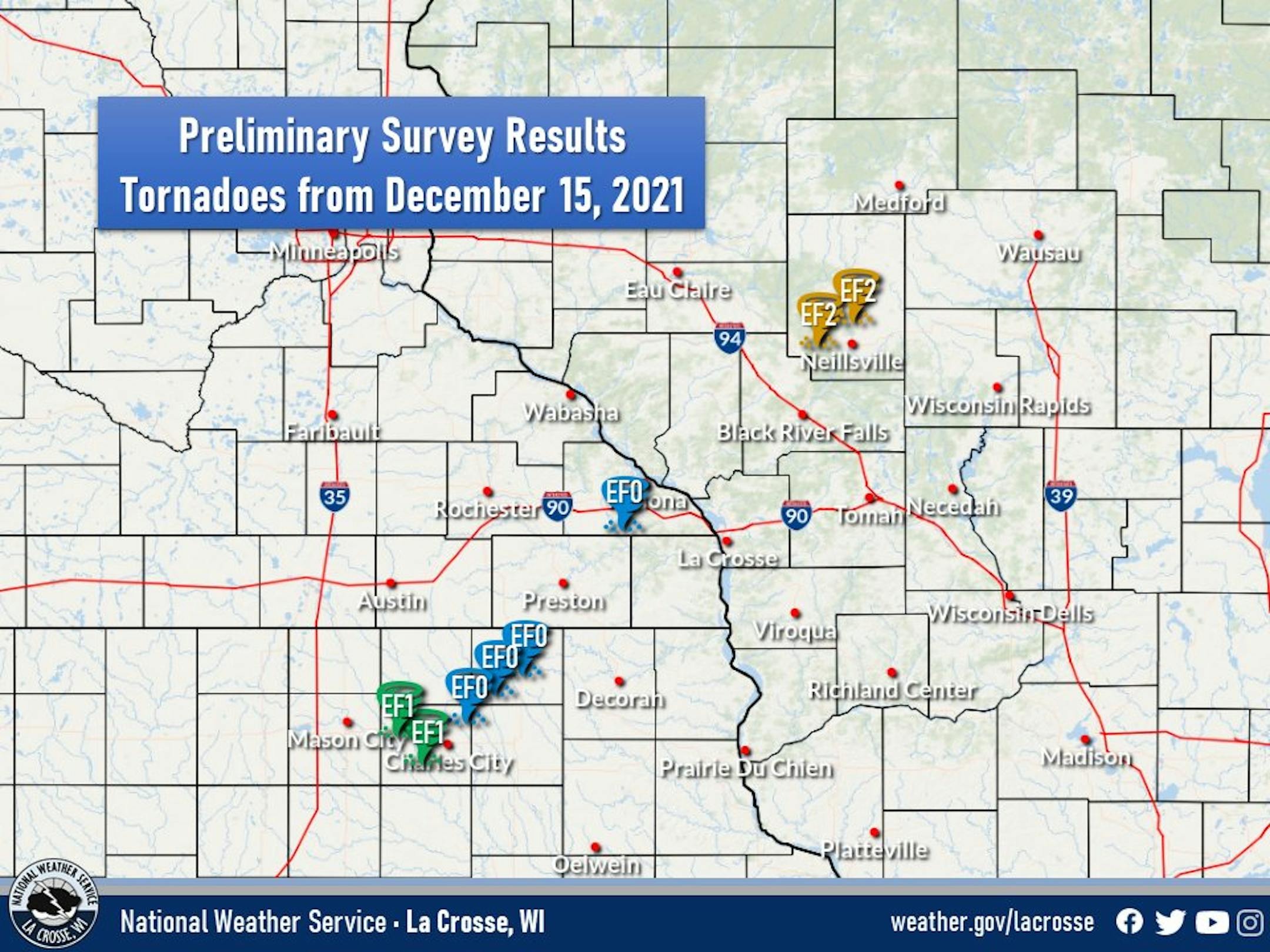
Tornado Update From NWS La Crosse, WI
"Here are the preliminary tornado survey results from our teams today - surveying the damage from Wednesday evening storms. So far 8 tornadoes - 2 EF2s, 2 EF1s, and 4 EF0s. These are preliminary results and may be adjusted as more information becomes available."
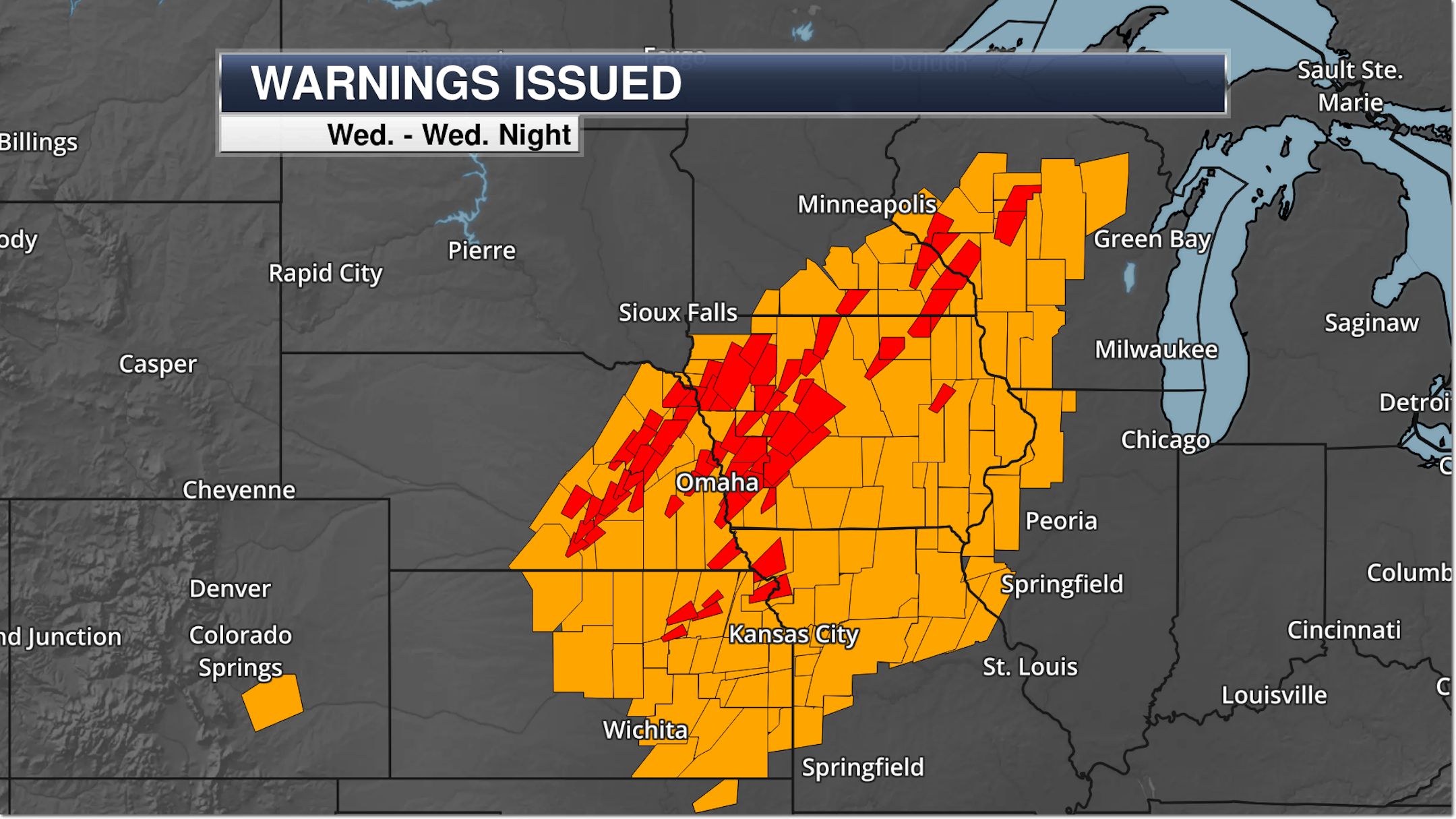
Warnings Issued on December 15th
Here's a look at all the severe thunderstorm warnings & tornado warnings that were issued on December 15th. Incredibly, there were 118 total severe thunderstorm warnings and 71 tornado warnings, which included parts of SE Minnesota for the first time ever during the month of December!!
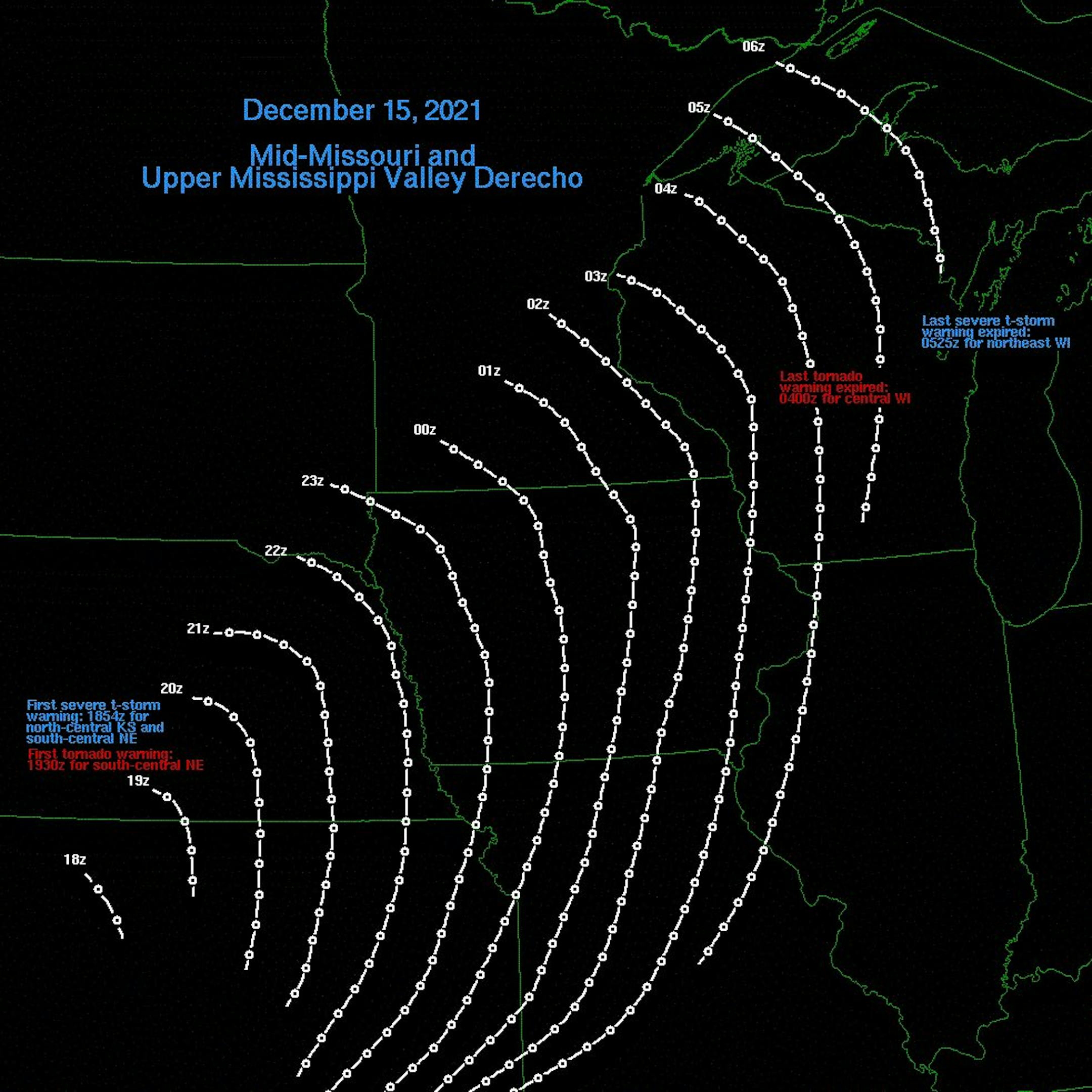
December 15th Derecho
"Quick graphic with the position of the 15 Dec 2021 derecho. First and last severe/tornado warnings are noted. The derecho traveled roughly 660 miles in 10.5 hours, giving an average forward motion of 63 mph. That's faster than some interstate speed limits in Iowa."
Most Significant (75+mph) Wind Gusts in a Day Since at Least 2004*
"According to @NWSSPC Wednesday (12/15) set the record for the most number of hurricane force (75+ mph) thunderstorm wind gusts in a day (55, and counting) since 2004. The previous record was from August 10, 2020 with 53."