
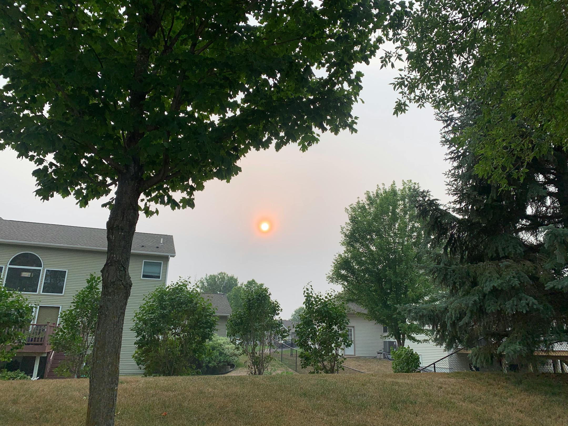
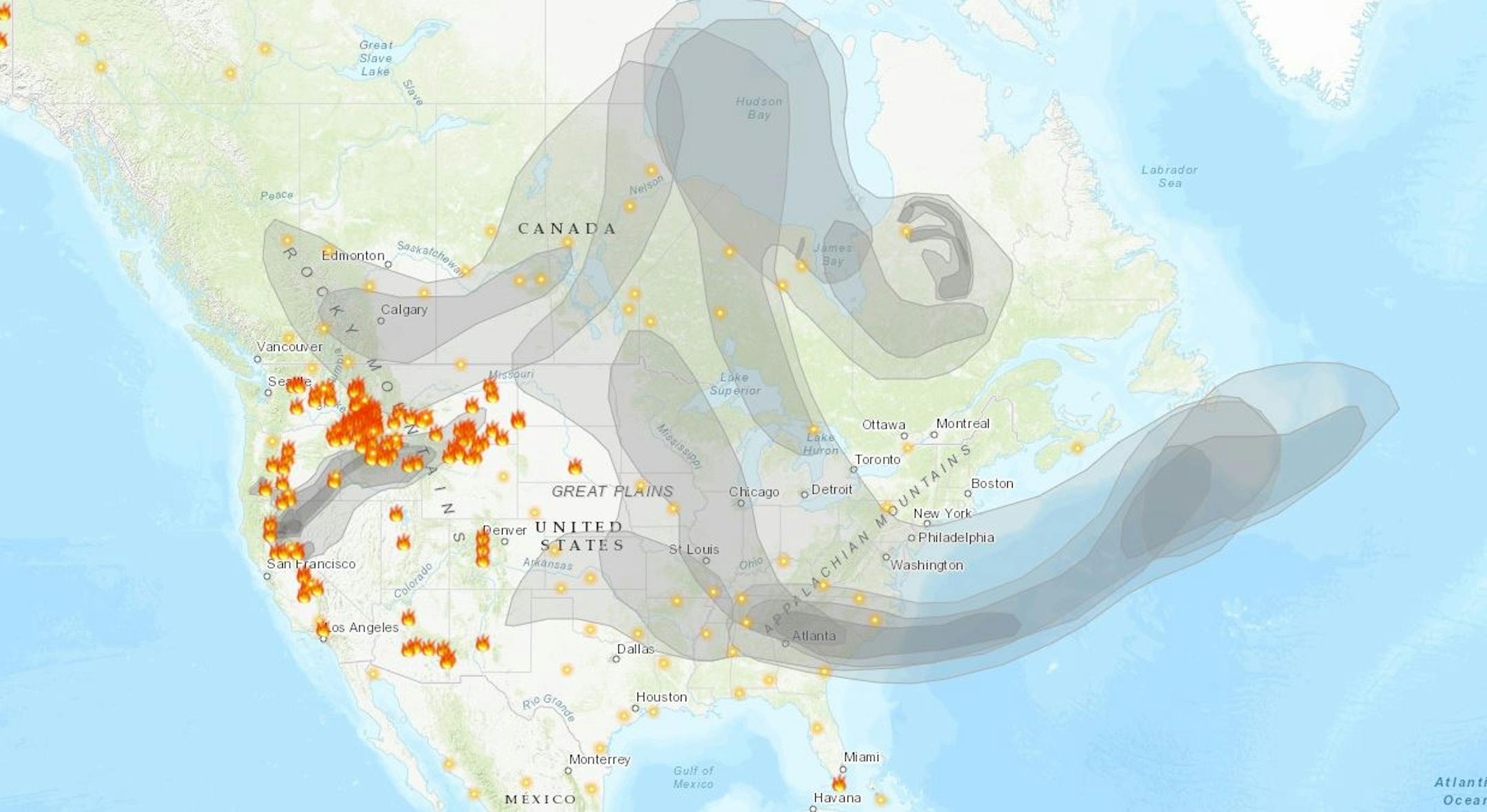
Large Wildfires & Smoke From Friday
The map below shows several large wildfires burning in the Western US and across Canada. Hazy skies and unhealthy air qualities continue in many locations downwind of these fires. Note that dense smoke has made it all the way to the East Coast and even into the Western Atlantic.
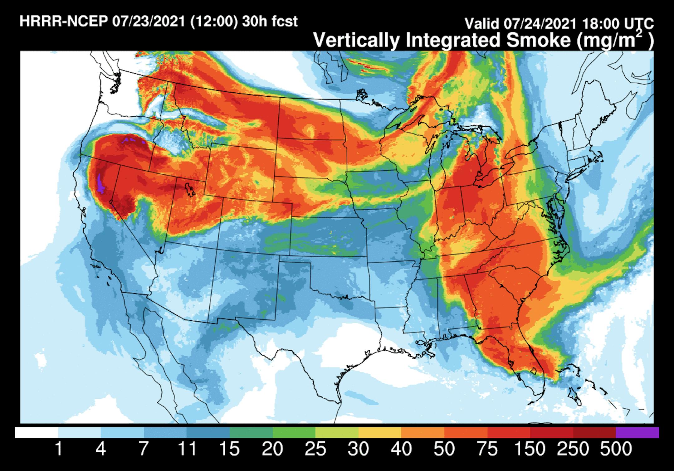
Smoky Skies Midday Saturday
According to NOAA's HRRR weather model, the smoke analysis for midday Saturday shows more widespread smoke across the northern tier of the nation, including Minnesota. Skies will likely remain hazy with the potential of unhealthy air qualities in some locations. Interesting to see wildfire smoke as far south as Florida.
Minnesota Drought Update
According to the US Drought Monitor, nearly 20% of the state is now considered to be in an Extreme Drought, which is up from the 4% last week. Keep in mind that this is the first time any part of MN has seen Extreme Drought since April of 2013. 72% of the state is in a Severe Drought, which is up from the nearly 52% from late week. Moderate drought covers much of the Twin cities.

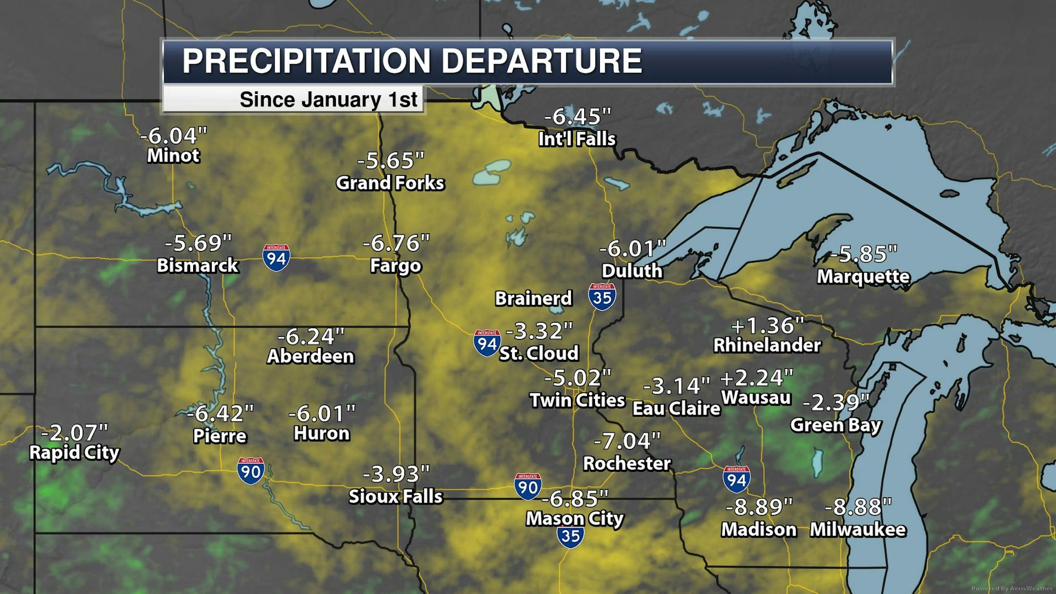
Precipitation Departure From Average Since Jan. 1st
It has been a warm and dry year so far with precipitation running well below average across much of the region. Here's the precipitation from average since January 1st, which shows several locations running several inches below average. The Twin Cities is nearly -5.00" below average precipitation since the beginning of the year, which is the 28th driest start to any year on record. Milwaukee is nearly -9.00" below average, which is the 3rd driest start to any year on record.
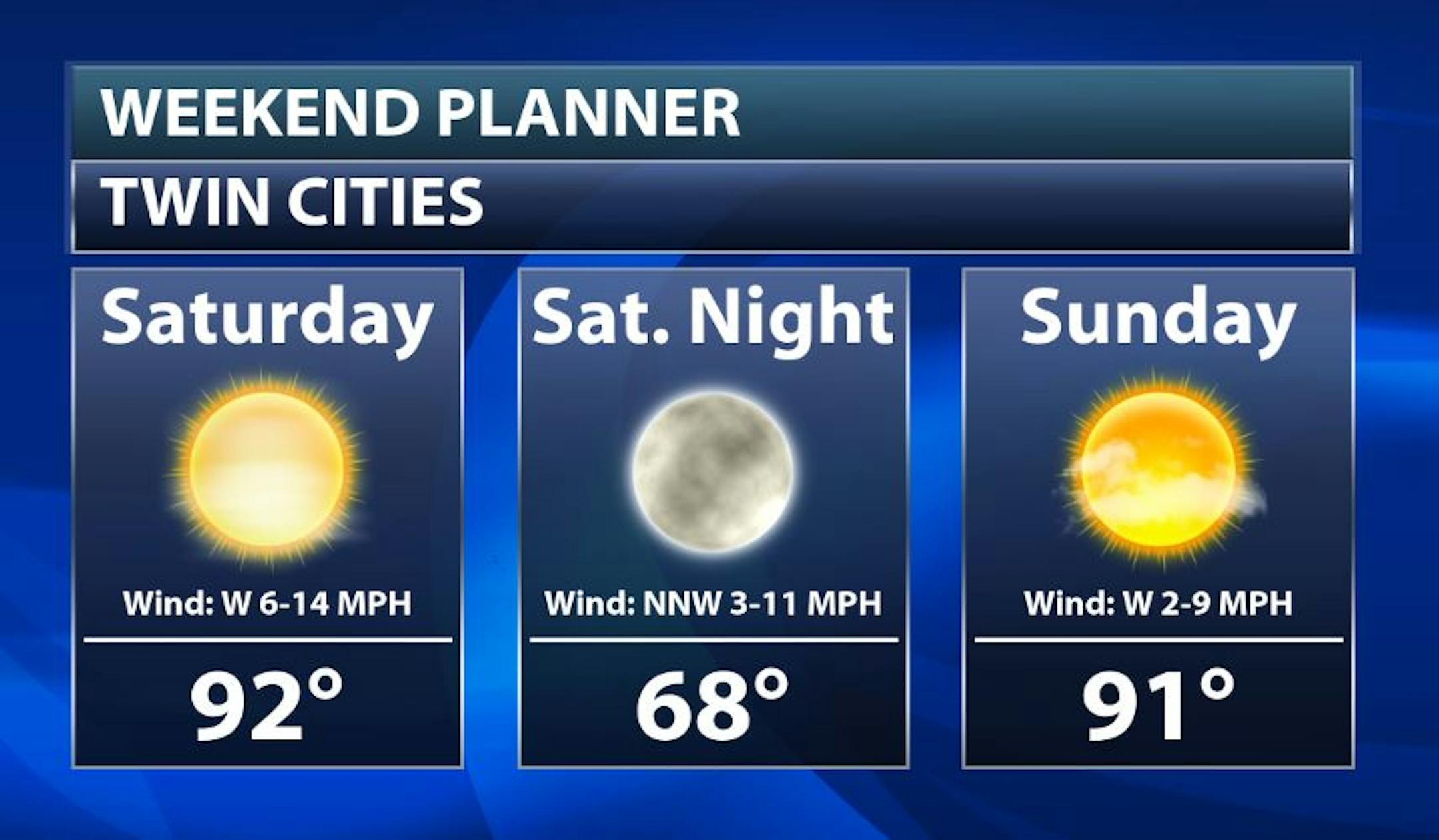
Twin Cities Weekend Outlook
Here's the weather outlook for the weekend, which shows warm, dry and hazy conditions in place both Saturday and Sunday. Interesting to note that some of the models are suggesting a slight chance of late day showers/storms on Sunday. Stay tuned.
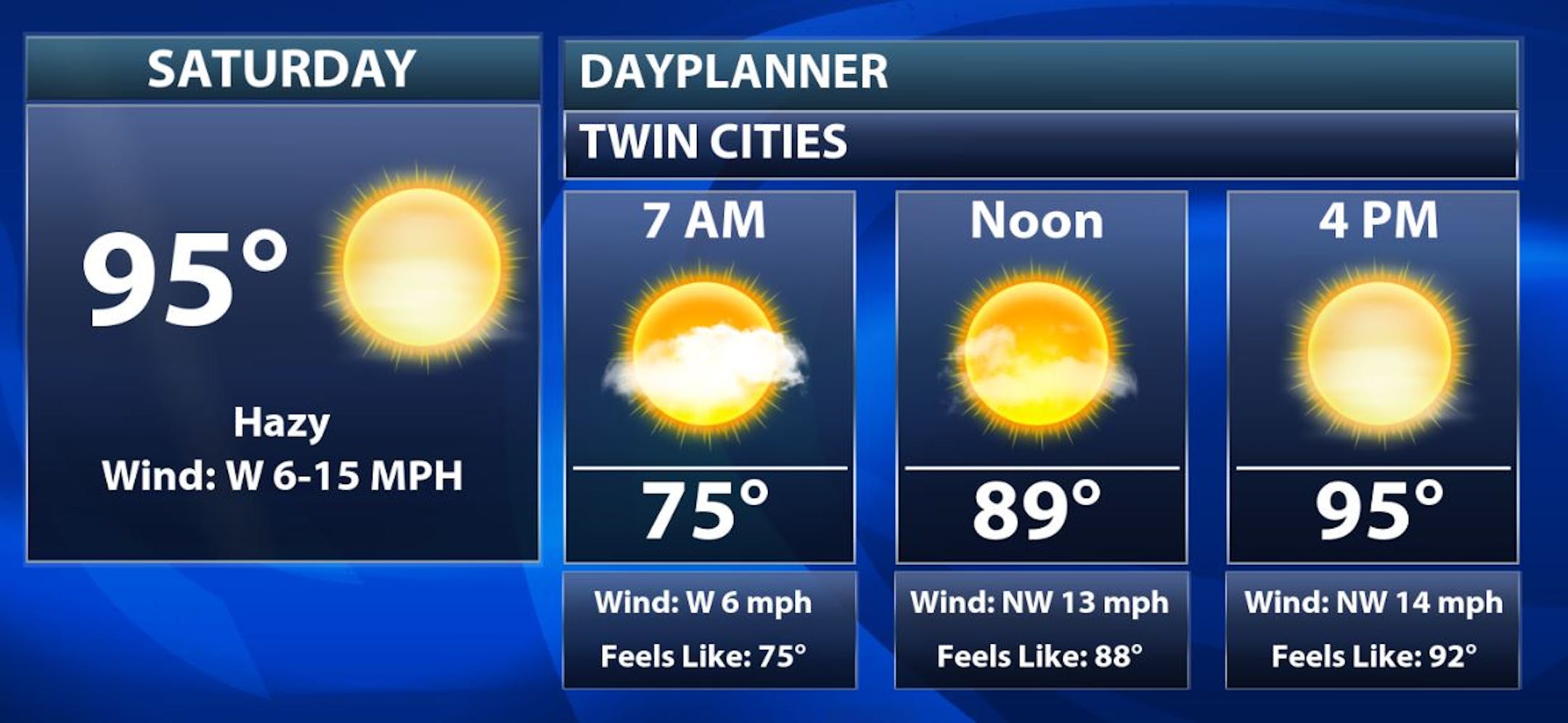
Saturday Weather Outlook
The weather outlook for the Twin Cities on Saturday shows hot, dry and hazy weather conditions in place through much of the day. It might be a little soggy early in the day after overnight thunderstorms, but dewpoints will fall dramatically late in the day, so it won't be as humid as it was on Friday.
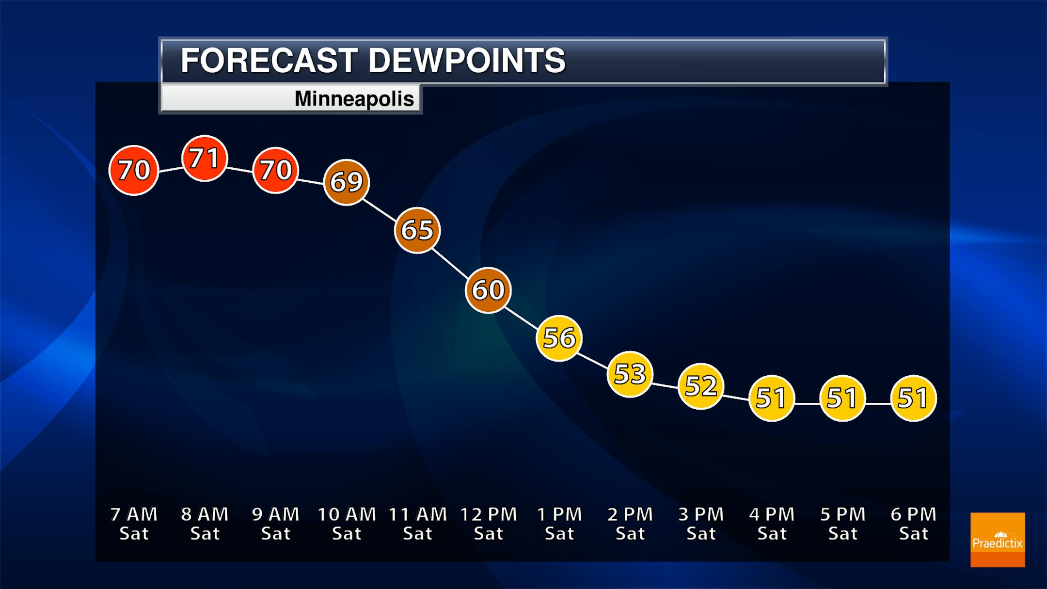
Falling Dewpoints on Saturday
Friday was a very sticky day with dewpoints in the 70s, which is considered to be Tropical. Note that dewpoints will fall nearly 20 degrees by the afternoon, which means that there will be nearly half as much water in the atmosphere by the afternoon than there was in the morning.
Minneapolis Meteograms
The meteograms for Minneapolis on Saturday will be warm once again with temps warming from the mid 70s in the morning to the low/mid 90s by the afternoon. Hazy/smoky skies will be in place once again with wind gusts approaching 25mph out of the NW in the afternoon.


