
Minneapolis has undergone a tremendous amount of urban growth in the past seven years. And, for all the complaints constructive-criticism that exists (head-nod to streets.mn), it should be noted that Minneapolis has truly transformed into a better, more dynamic urban place.
Google Streetview has opened up its archives (dating back to 2007 in the Twin Cities) and we can see the transformations at the ground level. While Streetview doesn't completely capture the change, it's a good place to start.
Here's a look at a few of Minneapolis' success stories.
Washington Avenue through the University of Minnesota campus, has made the most drastic change; from a road choked with cars to a pedestrian-friendly transit mall. What were once small buildings are now six-story apartment buildings.
Next, is the Mill City District on 2nd near the Guthire Theater. If you could rewind time to 2005, this would look even more drastic. I use to tailgate for Minnesota Twins games on what is now Gold Medal Park. At that time, it was an open surface asphalt parking lot littered with broken beer bottles.
Uptown may have had the greatest population increase. It has successfully transformed industry land and under-utilized empty space into apartments along the Greenway.
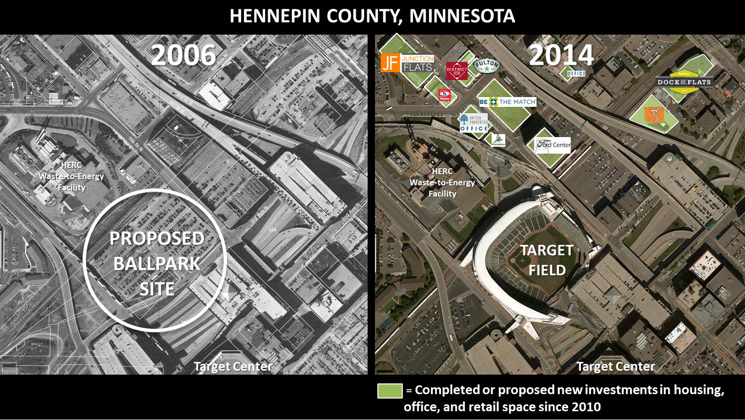
You don't have to look far to see other urban transformations, such as Park & Portland, University Avenue, Central Ave in NE, North Loop, and behind Target Field. It's good to see Minneapolis is moving in the right direction …
