
Twin Cities Weather Outlook This Weekend
Looking into the 3rd weekend of June, the Twin Cities has the potential to see some much needed rain, but unfortunately it'll come during the PM hours of Saturday into Sunday. It won't be a washout, but you may want to have a plan B if you're outside and skies darken to the southwest and west; and certainly if you hear any thunder.

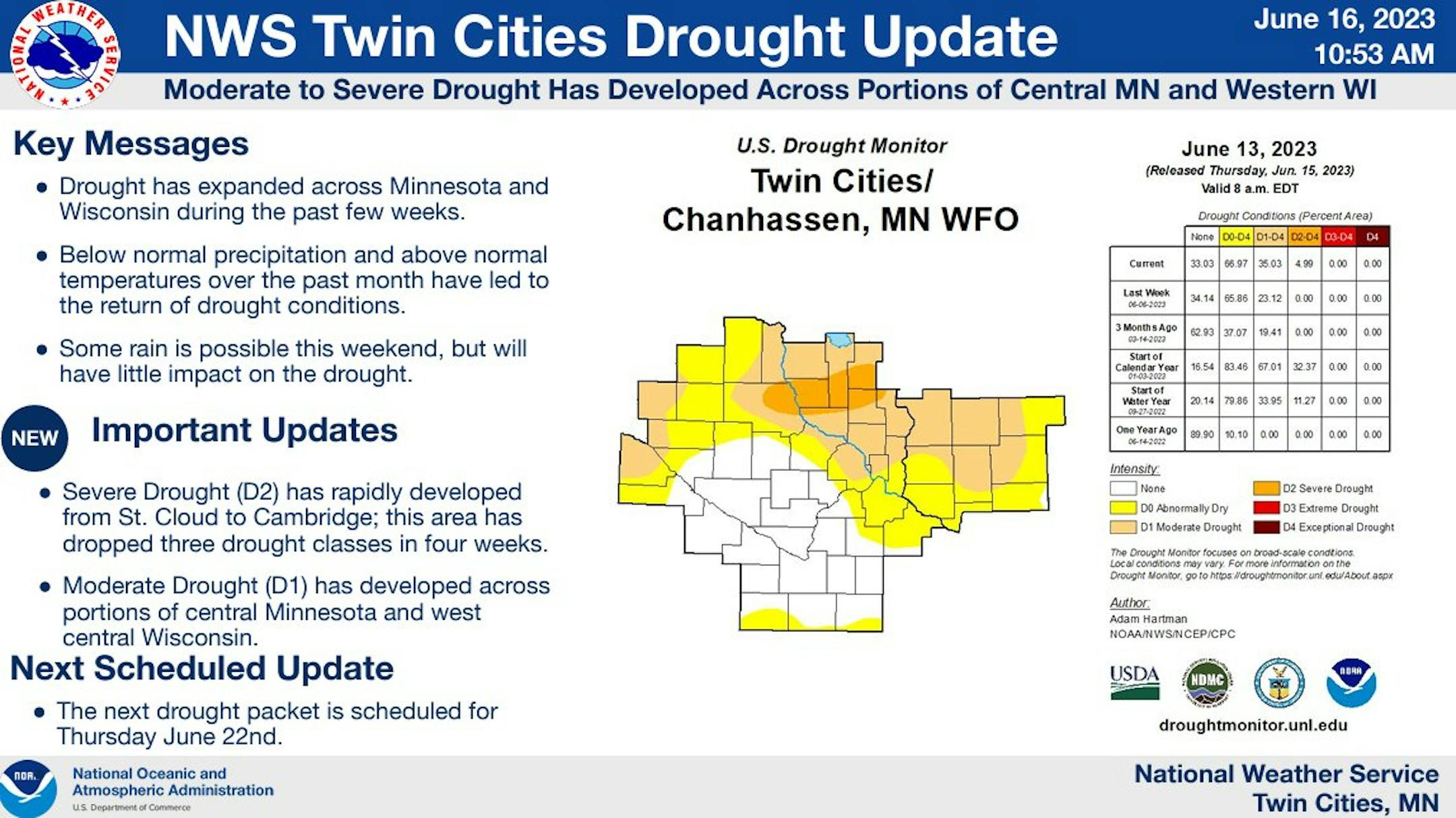
Drought Update
It has been an extremely dry stretch of weather across much of the station over the last several weeks. Only a few locations have seen decent pockets of rain, but the drought is expanding and getting works.
Driest May 15st - June 16th On Record
According to NOAA's NWS, this is the driest May 15st through June 16th on record with only 0.26" of rain falling at the MSP Airport. We should be picking up nearly an inch of rain every week, but we've rarely had any substantial anywhere. It's definitely dry out there and it's getting worse.

30 Day Precipitation Anomaly
The map below shows the 30 day precipitation anomaly, which indicates that some locations in red are nearly -3.00" or more below average since mid May. This is where drought conditions are expanding... We could use some rain and buckets-loads at that!

Simulated Radar Through Midday Sunday
Here's the weather outlook through midday Sunday, which shows a weak disturbance moving into the Upper Midwest with spotty showers and thunderstorms both PM Saturday and Sunday. Severe weather concerns remain low with only pockets of rain expected through the weekend. It'll be enough to wet a few lawns and gardens, but not the widespread soaking we need.

Extended Precipitation Outlook
The extended rainfall outlook through the weekend shows pockets of decent rainfall here and there west of the Twin Cities Metro. Some locations could see up to an inch or more, but again, it'll be pretty isolated.

Twin Cities Weather Outlook For Saturday
The weather outlook for the Twin Cities on Saturday, June 17th shows sunny and dry weather conditions through the first half of the day with temps warming into the mid 80s. Spotty showers and storms will like develop west of the metro in the afternoon and move into the Twin Cities late afternoon and evening.


