

Brief Pause in the Summer Heat
Temps over the last several days have at or below average a majority of the last full week of July last week. 3 of the days we had daytime highs below 80F, which felt quite nice after a very warm middle part of the month.

Hotter & Drier Than Average July at MSP
Through the first 28 days of the month, Minnesota was the 22nd warmest and 19th driest July on record in Minneapolis. Temps have been running nearly +2F above average and precipitation has been nearly -2.50" below average.

11th Warmest Summer on Record
Since June 1st, the average temperature in the Twin Cities has been the 11th warmest on record. Note that last summer (through July 28th) it had been the 7th driest and 2nd warmest summer on record.

4th Driest Summer on Record at MSP
Prior to July 29th, here's how much rain has fallen across the region so far this summer (since June 1st). Note that the Twin Cities has seen only 2.30", which is nearly 6 inches below average and is the 4th driest starts to any Summer on record!

Mostly Dry Summer So Far
Many locations around the region are seeing precipitation deficits this summer so far. Minneapolis has the biggest deficit, nearly 6 inches below average for the summer. Meanwhile, Pierre, SD is nearly 3.5 inches above average precipitation for the summer so far.


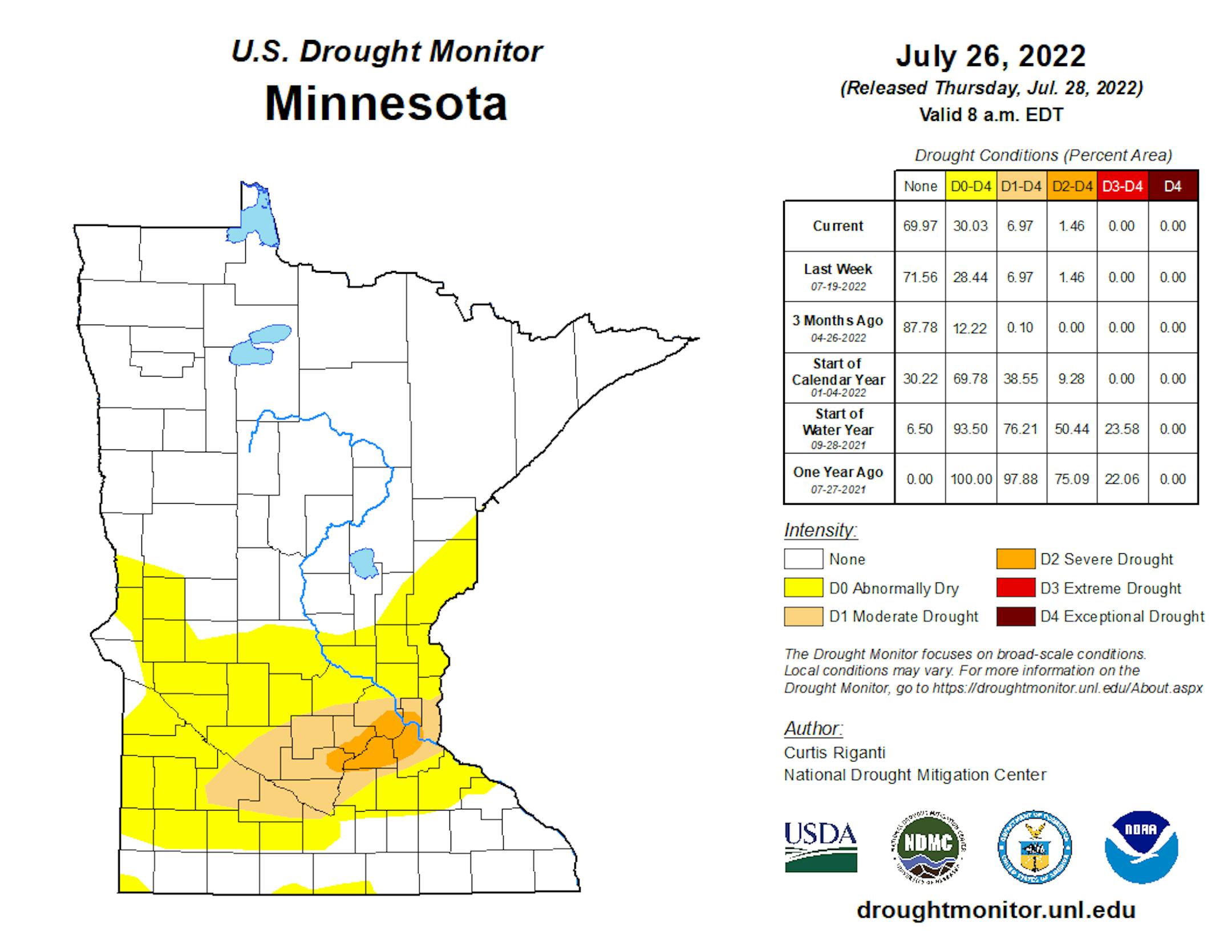
Minnesota Drought Update
Here's the latest drought update across Minnesota. Thanks to mostly dry weather over the last few weeks, parts of Central Minnesota, including the Twin Cities, are now under severe and moderate drought conditions.
Severe Threat Sunday
"A frontal boundary will move across Minnesota Sunday afternoon and evening. A marginal risk of severe storms will be possible along this front."

Weather Outlook Ahead
Here's the weather outlook from AM Saturday to PM Monday. A weak storm system will slide through the region late weekend with a few showers and storms, some of which could be a little on the vigorous side across the northern half of Minnesota PM Sunday.


