

Drought Relief The Past Week
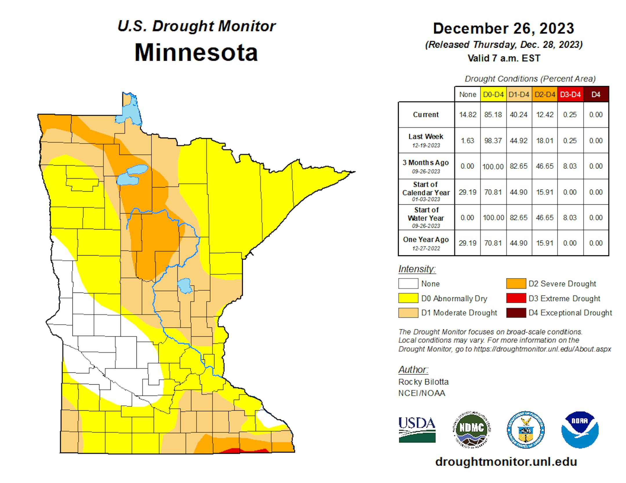
The good news about the rain we saw earlier this week across the state: some drought relief! While we still have 0.25% of the state under D3 Extreme Drought (down in far southeastern Minnesota), we saw weekly decreases in the D0-D2 drought categories - decreasing by 13.19% for D0 Abnormally Dry, 4.68% for D1 Moderate Drought, and 5.59% for D2 Severe Drought.
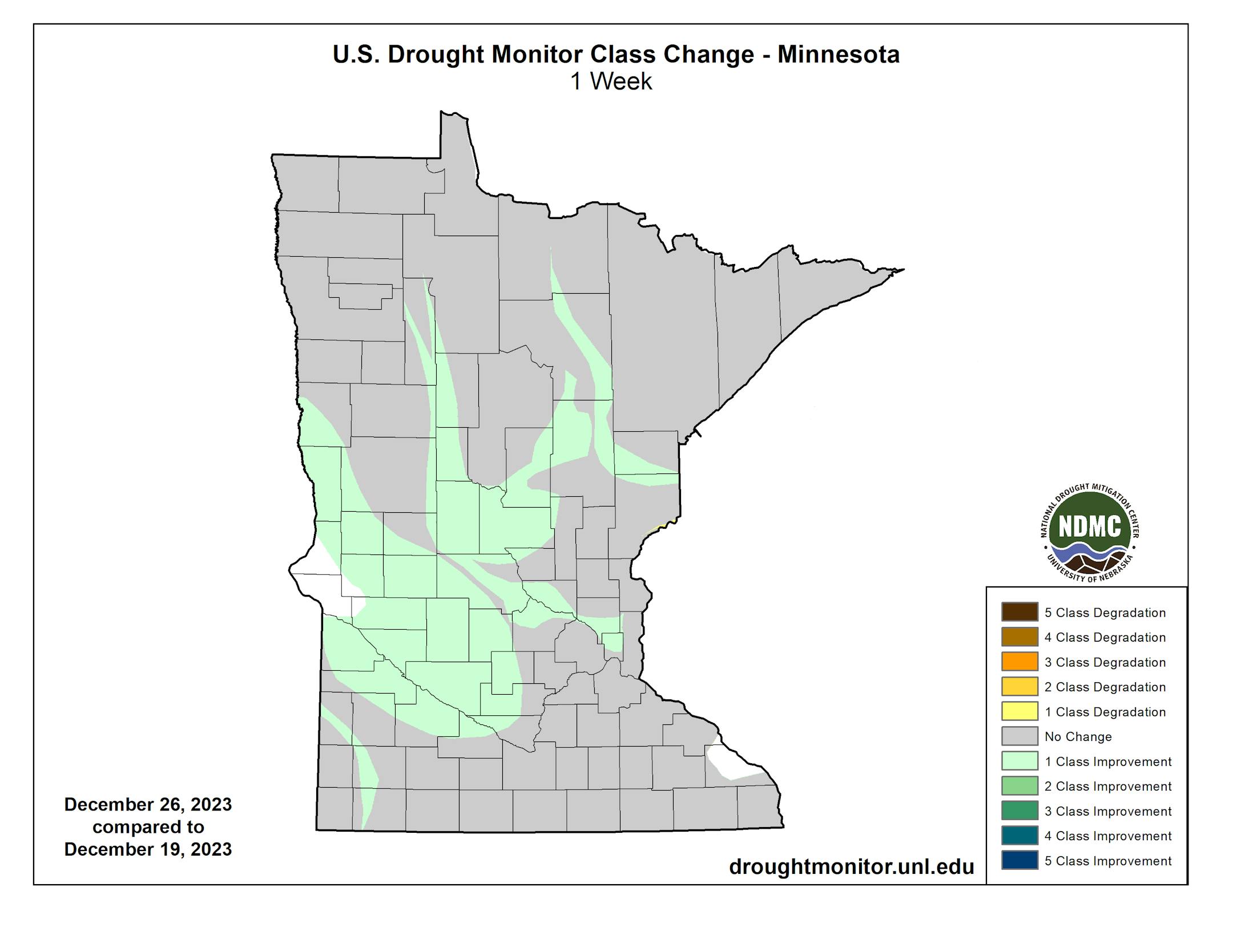
Here's a look at where we did see that improvement in the drought situation over the past week. A lot of it occurred across central Minnesota, which saw some of the heaviest precipitation over the seven-day period that went into the Drought Monitor update (which has a data cutoff of 7 AM Tuesday).
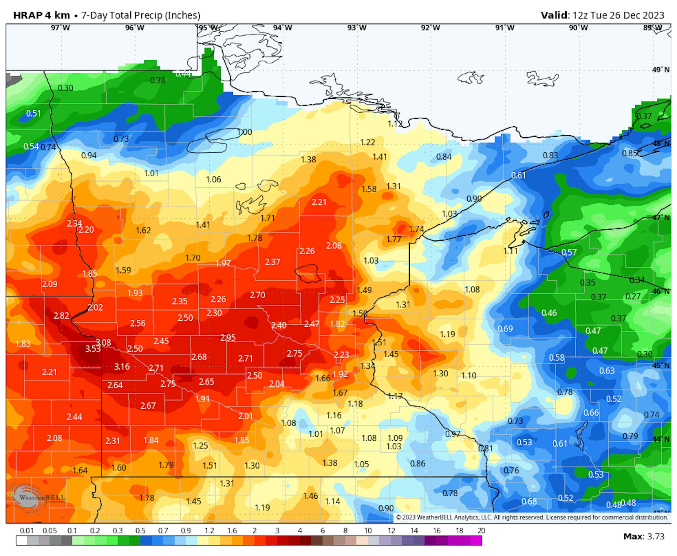
Many of these areas across central Minnesota saw 1.5-3" of liquid over the seven days ending Tuesday morning, with a lot of that occurring around Christmas.
_______________________________________________
Warm, Wet, Not-So-Snowy December
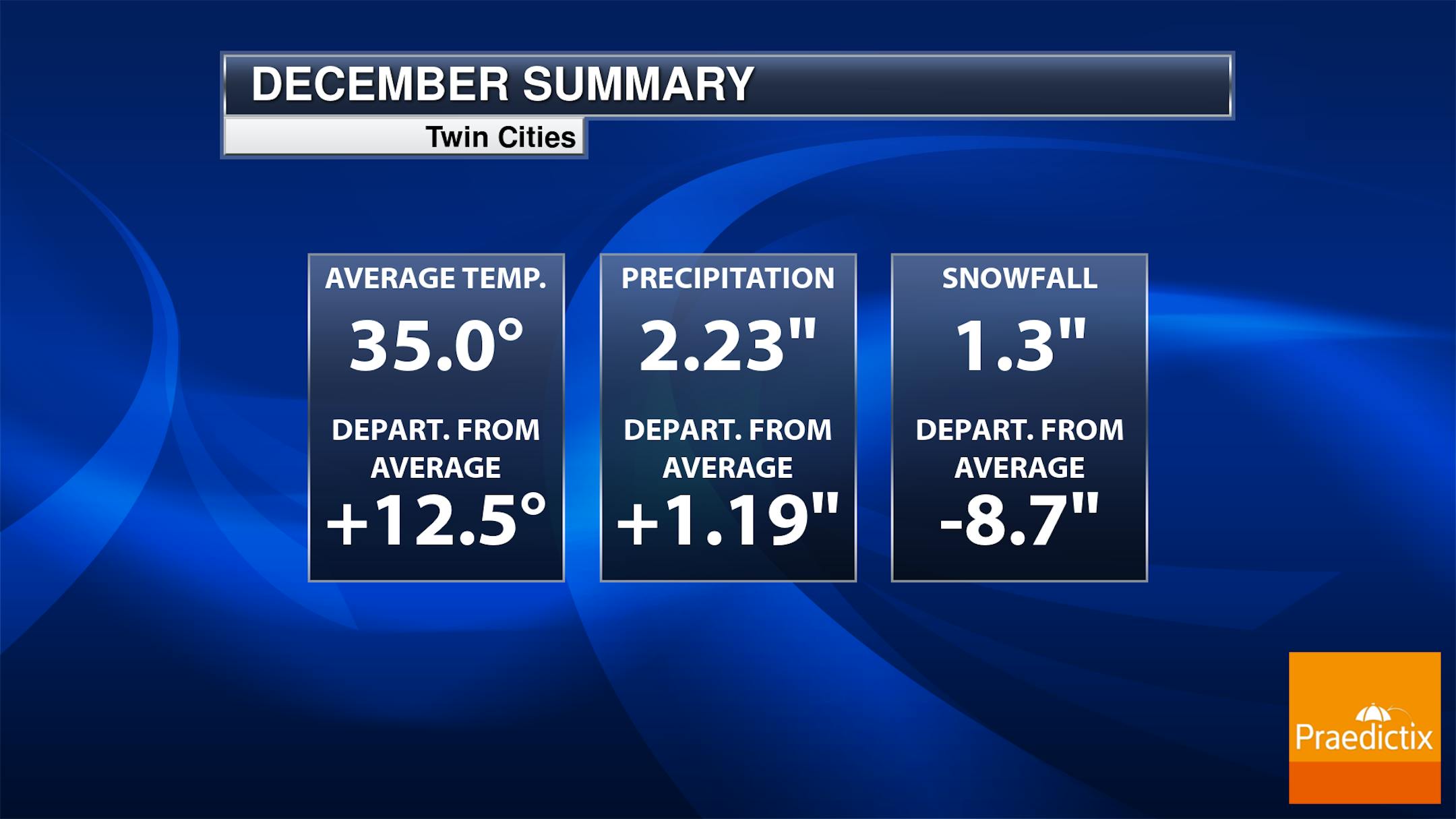
It's been a weird December, with warm temperatures, rainy weather, and not a lot of snow. We are on track to see the warmest December on record as temperatures at/above average are expected to continue through the end of the month. In the precipitation department, we're currently sitting at the 12th overall wettest December on record. If we saw no more snow, it would be the 8th least snowiest December on record.
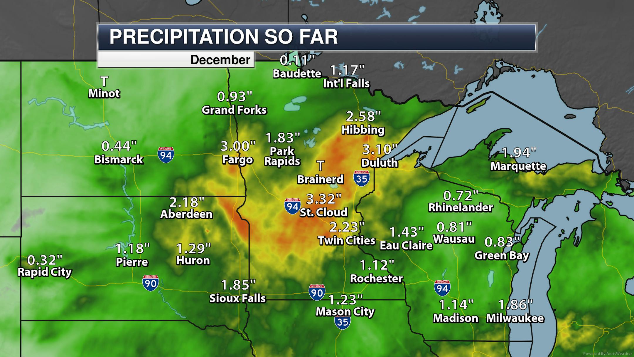
Looking at precipitation, this December will be the wettest on record in St. Cloud. Meanwhile, Duluth is sitting at its overall 7th wettest December.
_______________________________________________
Sunnier Skies For Friday
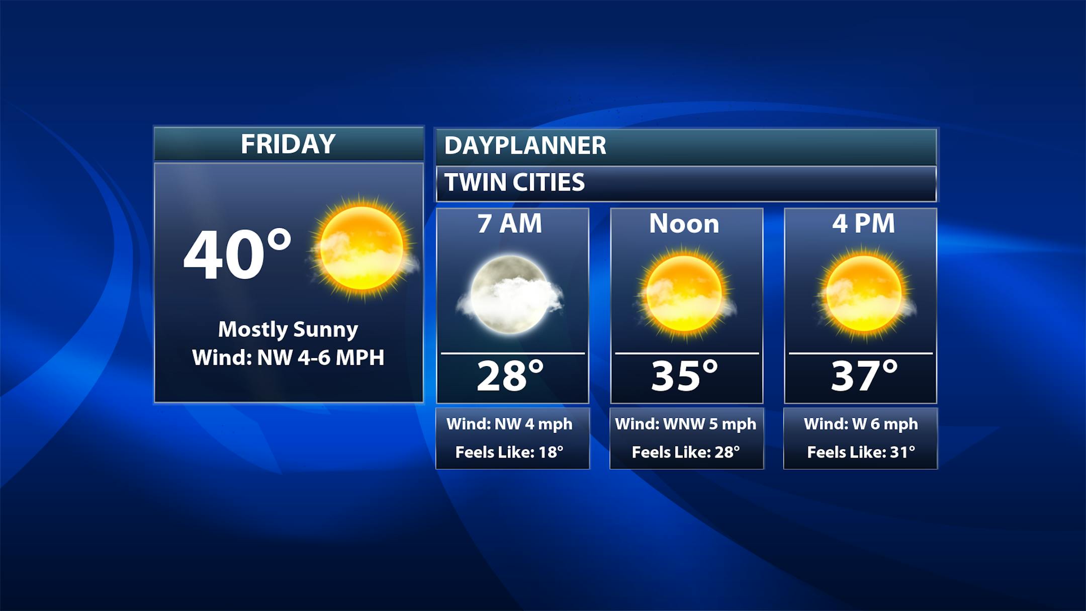
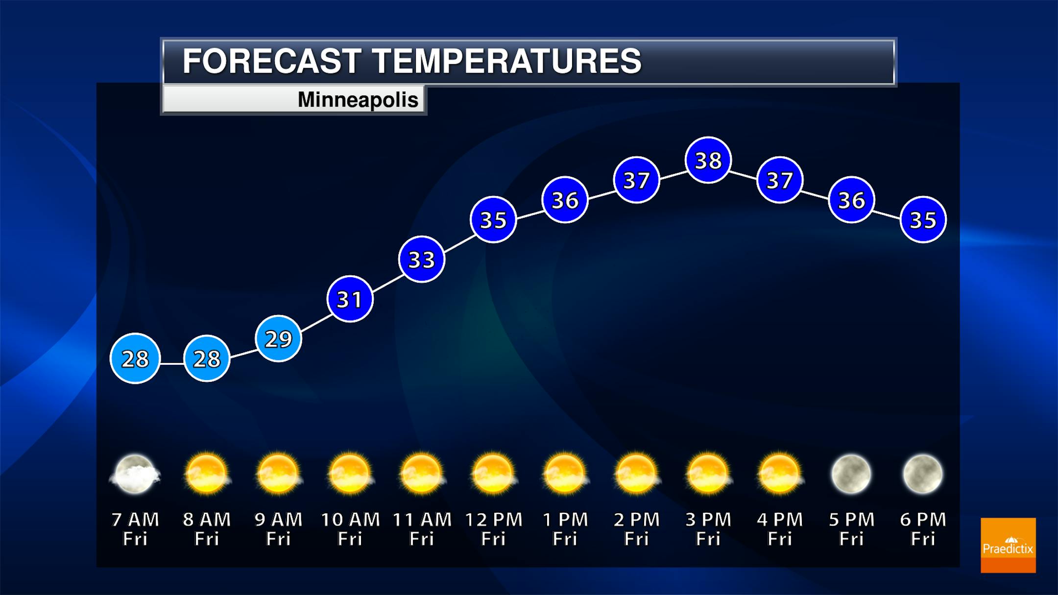
A nice, quiet Friday will be in place for any travel across the metro with sunny skies. While morning temperatures will start in the upper 20s, highs look to climb to around 40F.


