

First 50F Of 2023 Sunday
Despite our recent heavy snow here in the metro, strong southerly winds helped boost the temperature into the low 50s Sunday. That marked the first 50F of the year for the Twin Cities.
_______________________________________________
Starting With Monday: Quiet In The Twin Cities
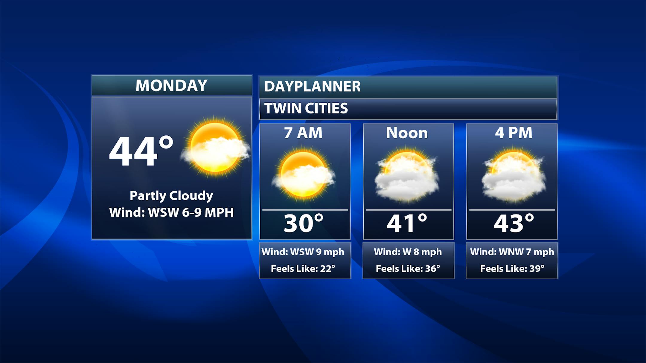
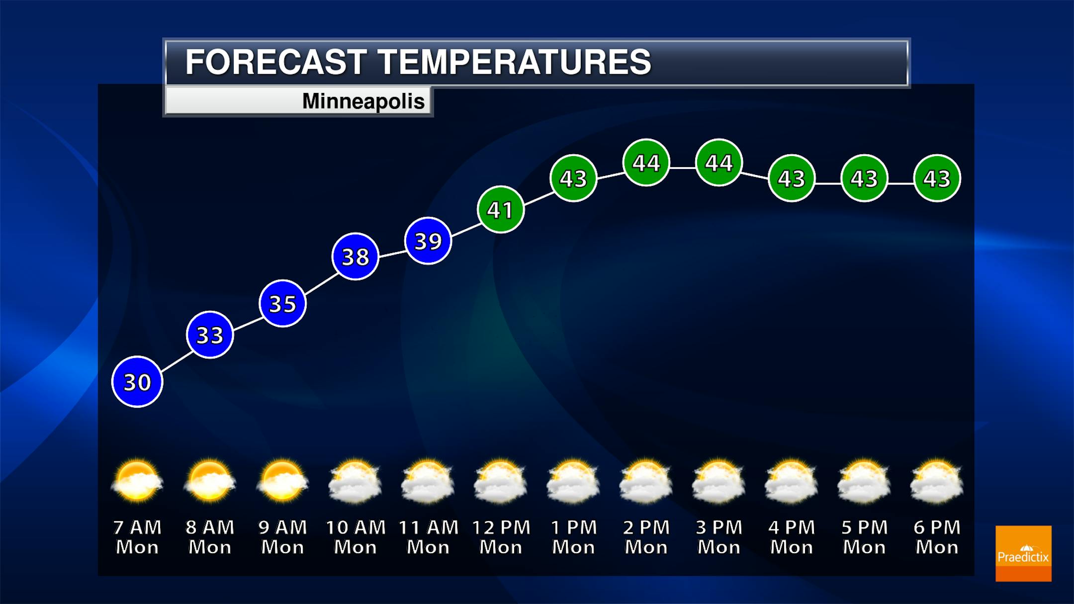
While we will see a few peeks of sun within the first hours of the day Monday, it'll be a mostly cloudy day in the metro. Morning temperatures start just a few degrees below freezing but will climb into the mid-40s as we see another day of some melting snow.
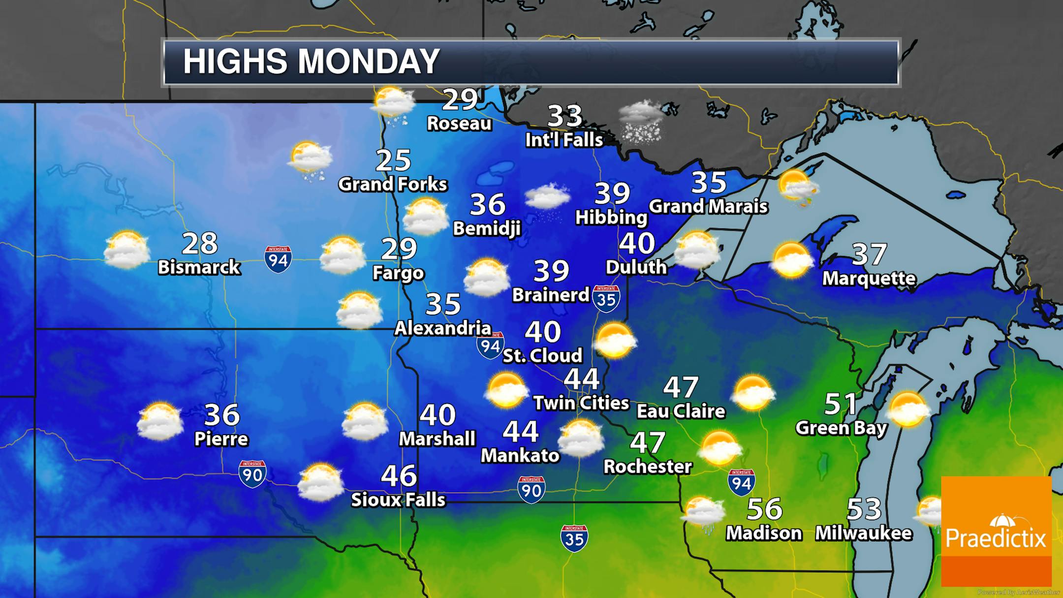
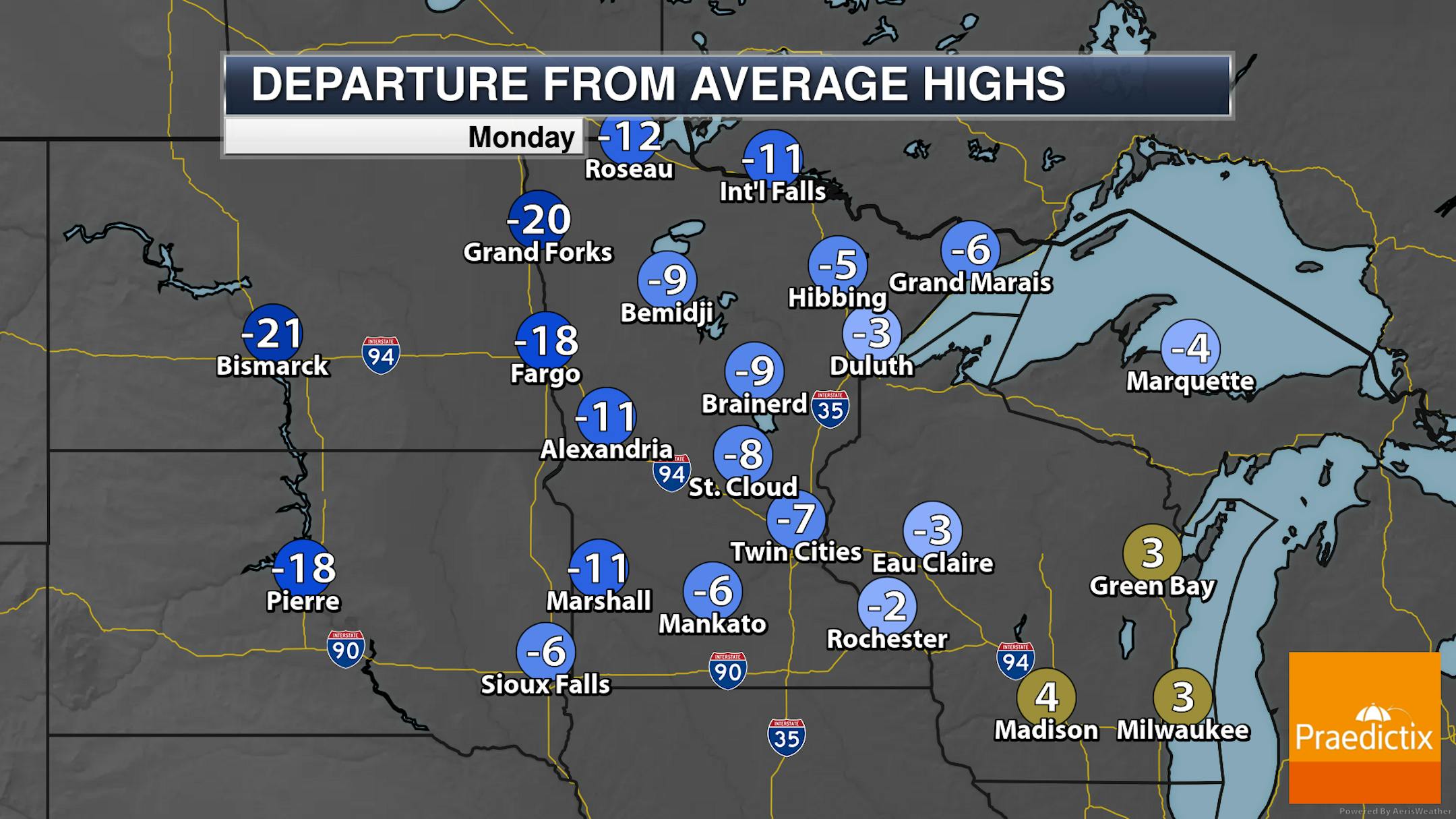
A few areas of light snow will be possible across northern Minnesota as we head through the day (with mainly under an inch of accumulations) - otherwise, mainly cloudy skies are expected across the state. I don't think an isolated shower can be ruled out, though, across southeastern Minnesota toward sunset. Highs will range from the mid/upper 20s in northwestern Minnesota to near 50F in southeastern portions of the state.
_______________________________________________
Another Messy System Tuesday-Wednesday With Rain, Snow, Ice, And Blizzard Conditions

Forecast loop from 7 AM Tuesday to 7 PM Wednesday.
We continue to watch the potential for another major winter storm to impact the region as we head into Tuesday and Wednesday. Precipitation will likely start as some snow Tuesday morning, transitioning to rain here in the metro throughout the day. A wintry mix (potentially including icing) will set up in central Minnesota, with snow continuing north of that. Very gradually Tuesday Night into Wednesday precipitation will start to change back over to all snow in areas that see any sort of changeover. Very heavy snow with this system will fall in parts of northern and western Minnesota and strong wind gusts of 40-50+ mph will lead to blizzard conditions. Just south of the heavy snow, where we see some of that icing set up, a narrow band of 0.1"+ of ice will be possible leading to slick conditions. Thunderstorms could occur in southern Minnesota, with small hail once again being a possibility like last Friday.

For certain, the best chance of heavy snow will be up across northern and northwestern Minnesota, where we could see totals of 12-18" (with isolated higher amounts) fall through the middle of the week. Snow chances closer to the Twin Cities will mainly be due to anything early Tuesday, then the wrap-around snow on Wednesday as the system moves out of the region.


