
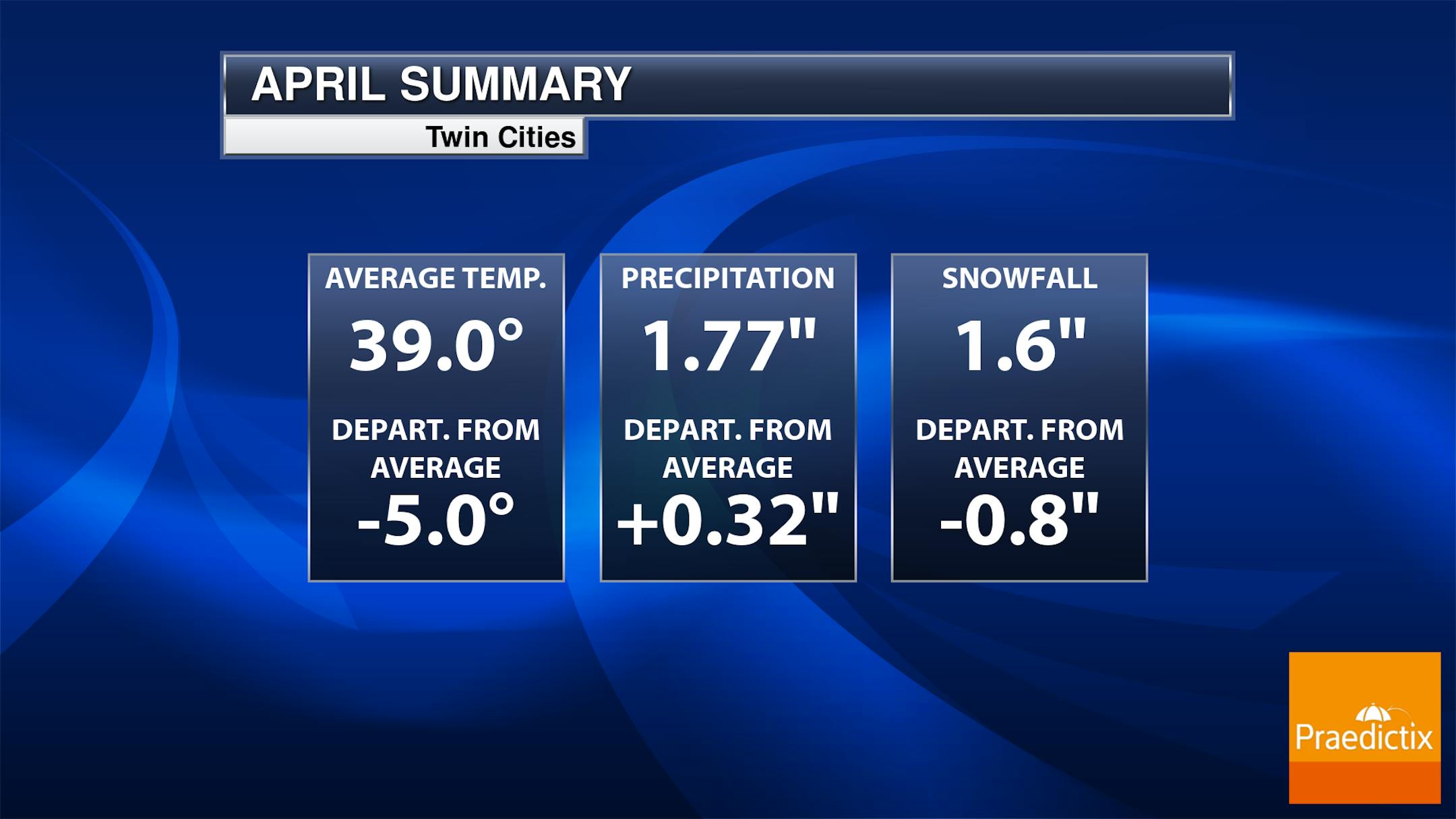
April Weather Summary So Far
Here's the Twin Cities weather summary for April so far. Note that we're running nearly -5F below average so far this month, which is tied for the 37th coldest start to any April on record. We're about 1⁄3 of an inch above average in terms of precipitation, but nearly -1.0" below average in terms of snowfall.
Active Week of Weather
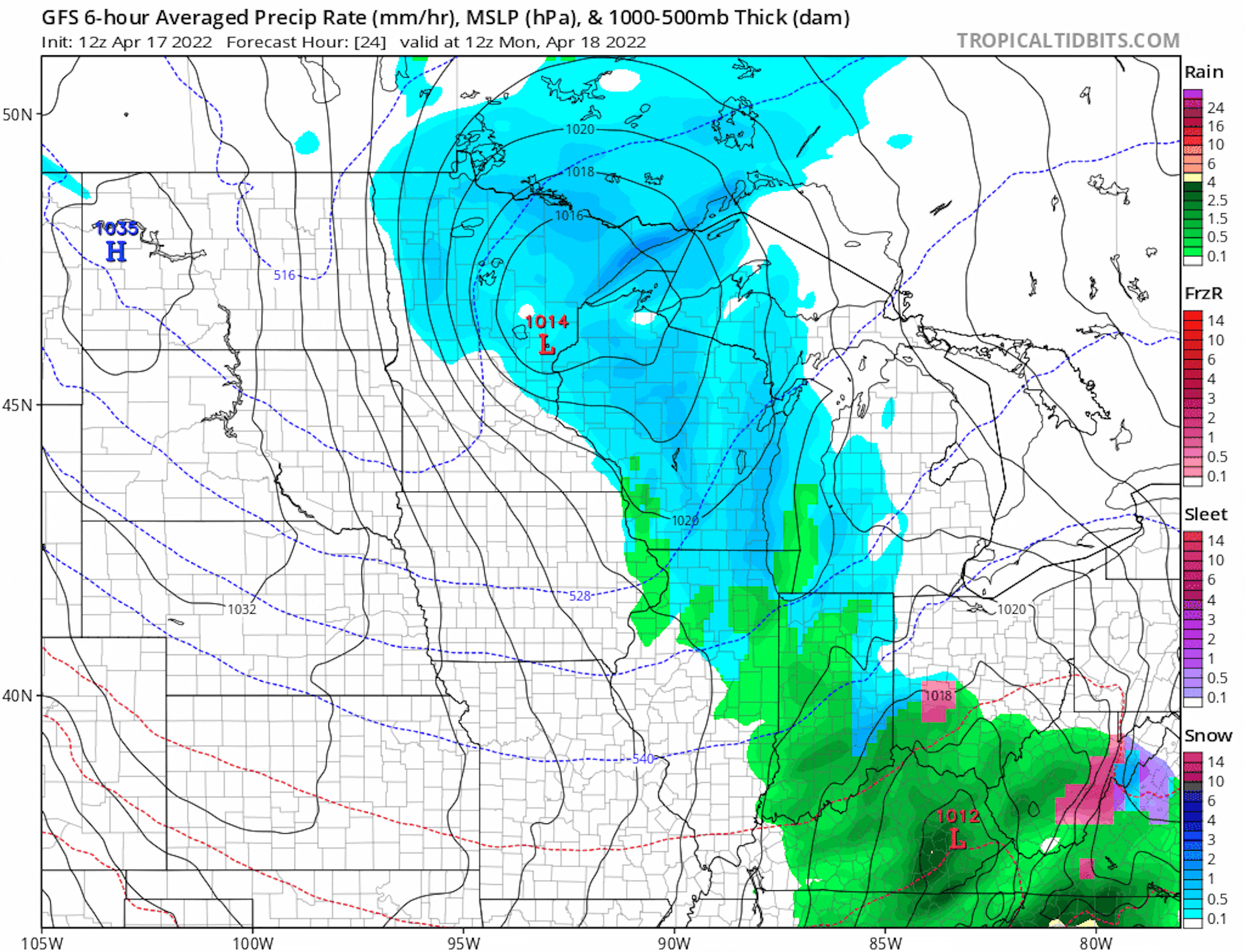
Here's the weather outlook from AM Monday to PM Sunday. The same storm that brought clouds and precipitation to the region on Easter Sunday will still be impacting us on Monday with lingering rain/snow showers and windy conditions. We'll get a brief break Tuesday before our next system moves in midweek with rain and more rain. There is another system that will be moving through with showers and possibly thunderstorms along with more wind. Temps will gradually warm through the week with above average temperatures possible by next weekend. Stay tuned...
Precipitation Outlook
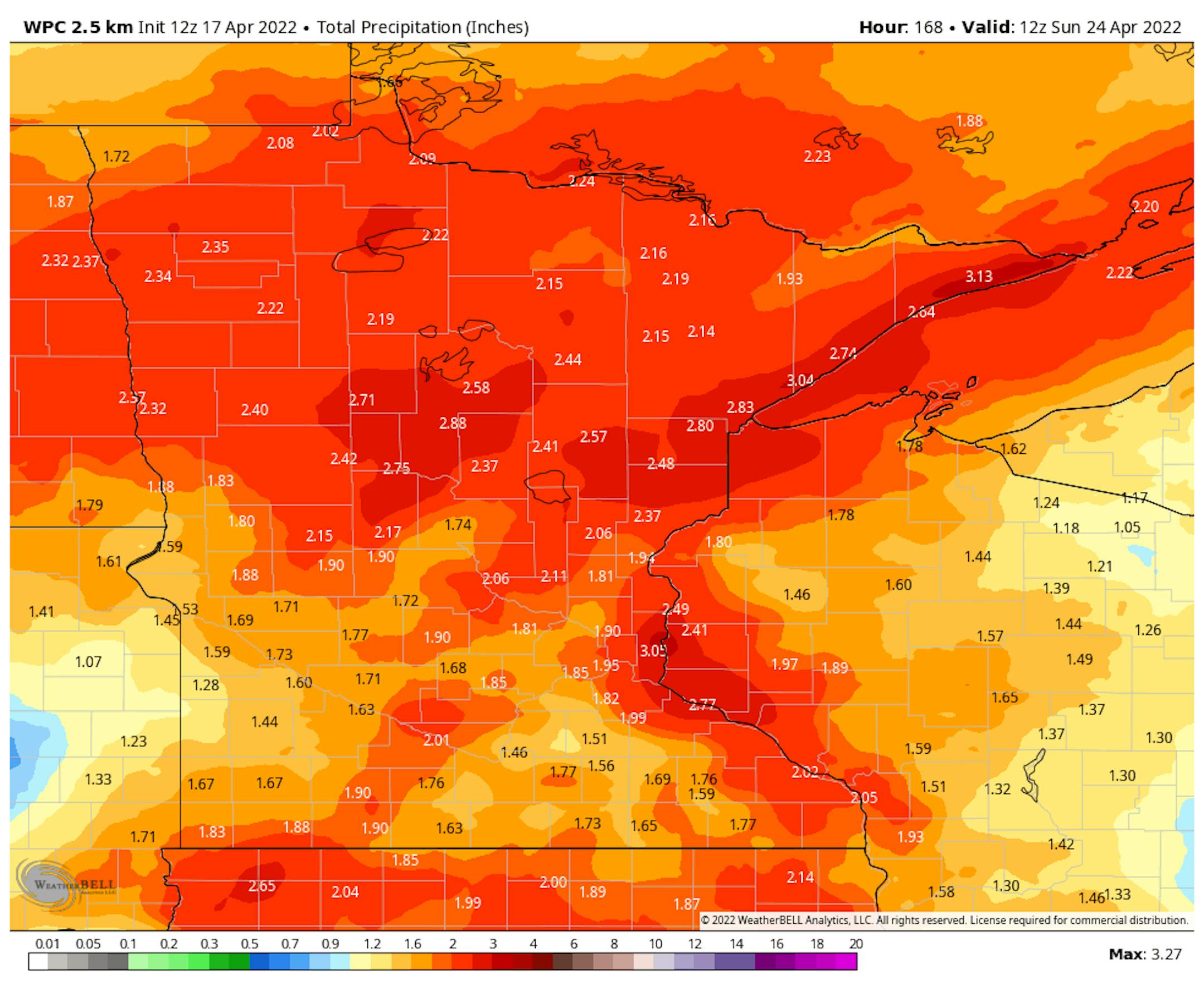
According to NOAA's WPC, the precipitation outlook through next weekend looks pretty impressive with some 1" to 2" liquid tallies possible across parts of the state. This includes the precipitation from Easter Sunday to next Sunday. Interestingly, some of the rain late week and into the weekend could be accompanied by thunder.
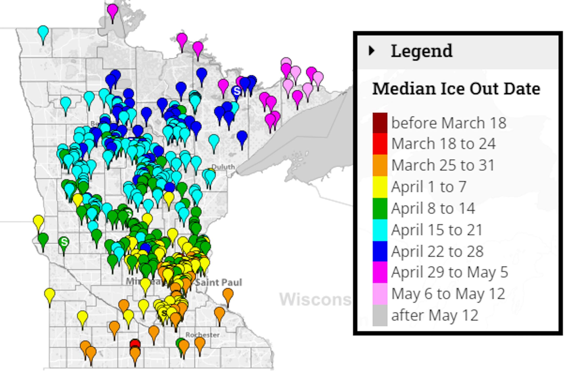
2022 Official Ice Out Dates
Hey - Look at that! More and more lakes are going ice out in the southern part of the state. However, thanks to a chillier than average month of April so far, several lakes are going out a little later than average. Cedar Lake, Lake Nokomis and Medicine Lake in the metro are officially out. According to the MN DNR, Lake Minnetonka typically goes ice out on April 13th, so we're already past that date. Look for more ice outs over the coming days and weeks. It won't be long now before the land of 10,000 unfrozen lakes returns!

Average Ice Out Dates
We're still several weeks away from ice out across parts of the state, but according to the MN DNR, here's a look at the average ice out dates for lakes across the state. Note that some lakes across the southern part of the state typically see ice out around the end of March. Lake Minnetonka typically doesn't see ice out until mid April. A few lakes in far northern & northeastern MN don't see ice out until late April or early May.
Status of Spring
"April 12, 2022 - Spring leaf out continues to progress across the country. Our spring leaf anomaly compares the arrival of spring leaf out this year to a long-term average of 1991-2020. After a slow start to spring across much of the Southeast, spring is progressing more rapidly, arriving days to weeks early across the southern part of the Midwest, the Southern Appalachians, the mid-Atlantic, and the Northeast. Albany, NY is a week early. In western states, spring leaf out is patchy, arriving a week late in some locations and over a month early in others. Parts of Montana and South Dakota are 2-3 weeks early. Spring bloom has also started to arrive in southern states, days to a week late in Texas and Florida and days to several weeks early in California. Spring bloom is over a week early in parts of Georgia, the Carolinas, and Virginia."


