
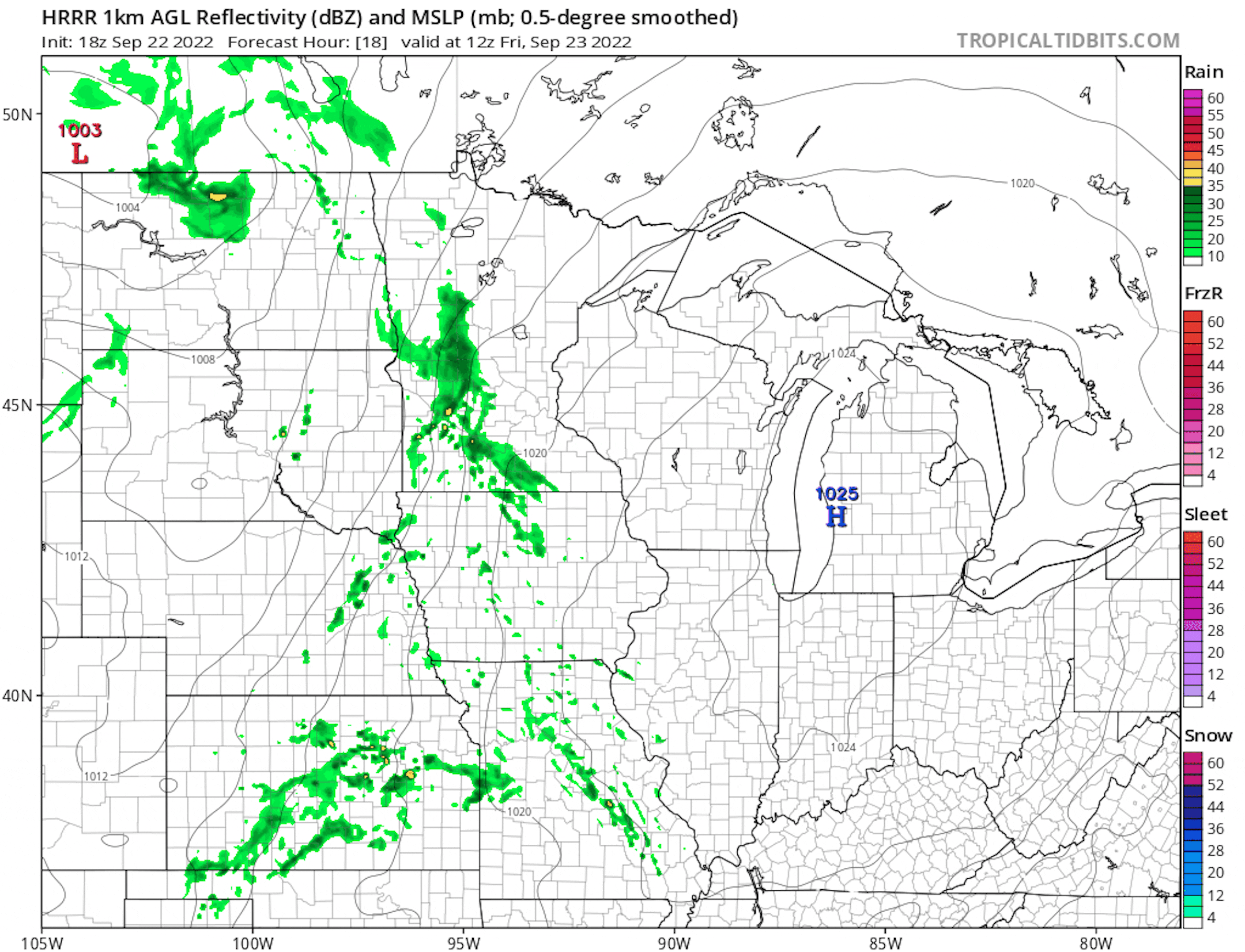
Somewhat Soggy Friday Ahead
A storm system will move through the region on Friday with scattered showers and perhaps a clap of thunder or two. Much of the day will be soggy especially across the Central part of the state into Wisconsin.
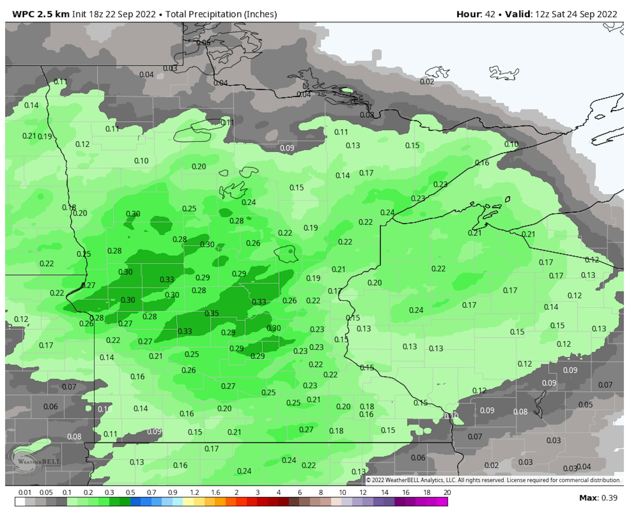
Precipitation Outlook
Here's the precipitation outlook from AM Friday to AM Saturday, which shows up to a few tenths of an inch possible.
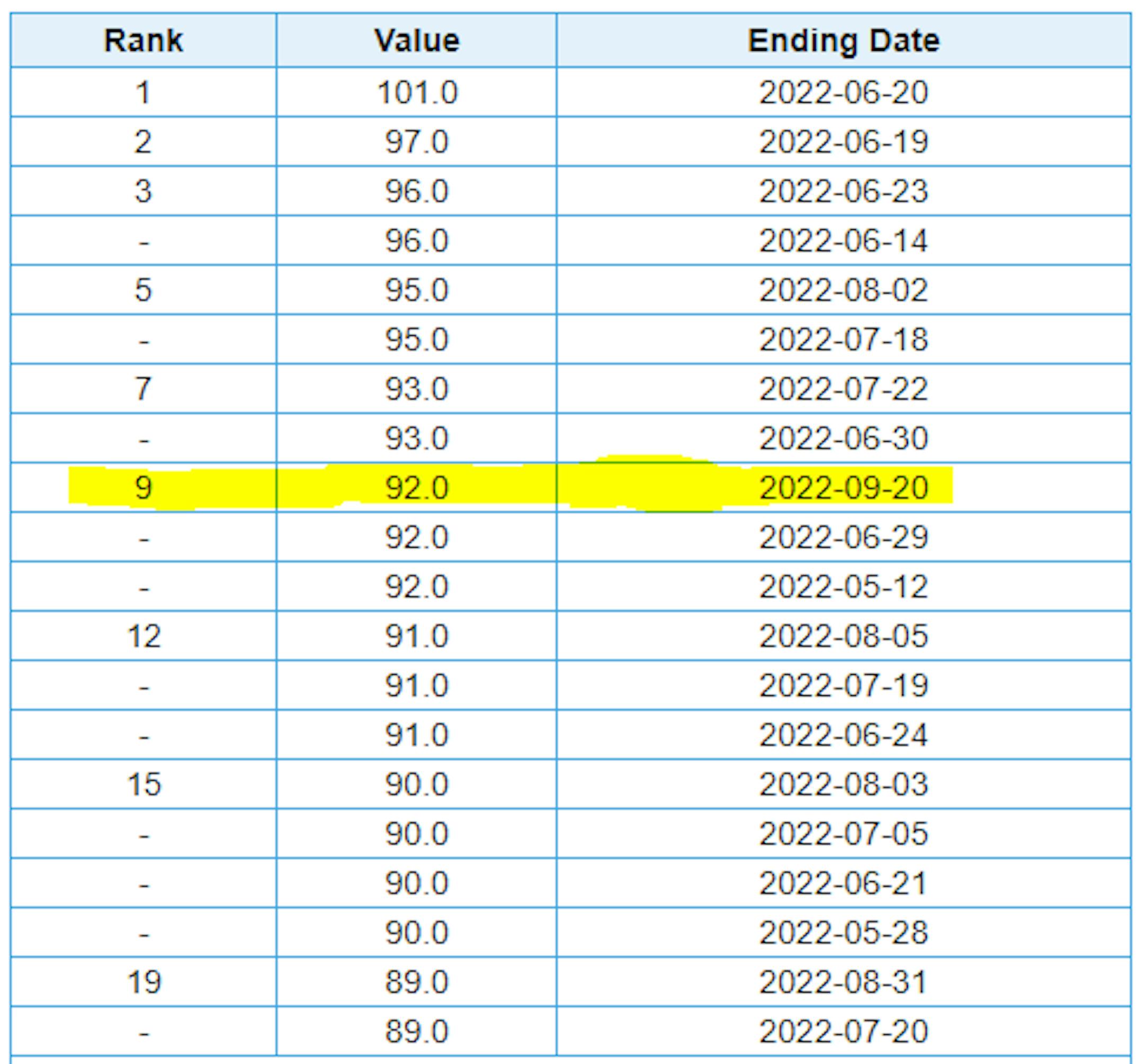
Top 20 Warmest Days of 2022 at MSP
Here are the top 20 warmest days of 2022 at MSP. Note that there have been 18 days at 90F or warmer. The warmest day was June 20th at 101F, but also note that we hit 92F on September 20th, which is tied for the 9th warmest day of the year.
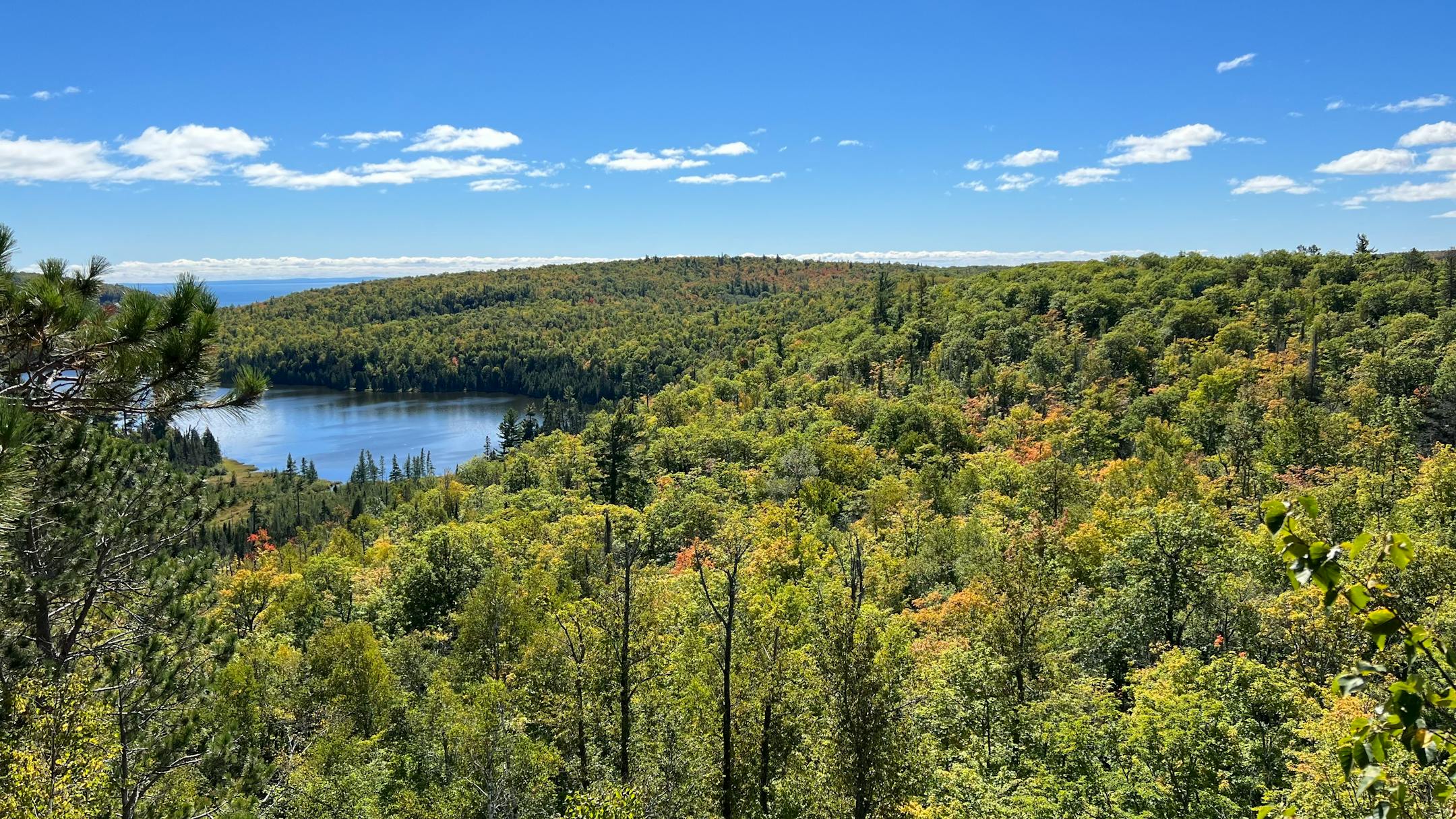
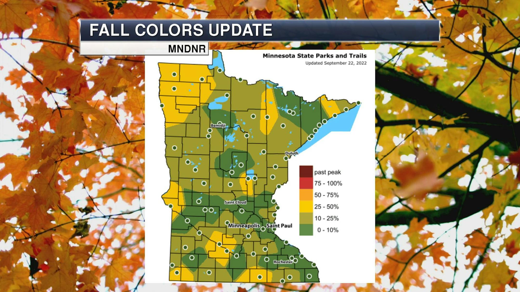
Fall Color Update
It's that time of the year again for fall colors and the MN DNR has their fall color finder up and running. Much of the state is still color free, but there are a few colors popping up here and there.
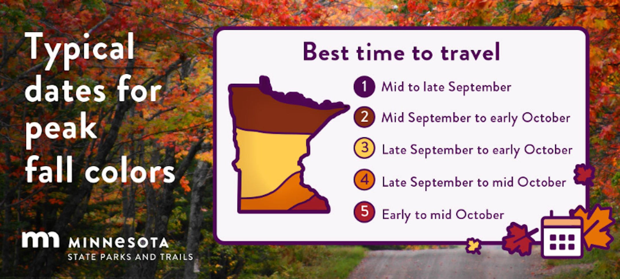
Average Fall Color
The MN DNR has put together a nice graphic that shows typical dates for peak fall color. The northern par of the state starts to peak during the 2nd half of September into early October. Meanwhile, folks in the central part of the state and into the metro typically don't see peak color until the end of September into the middle part of October. It won't be long now - enjoy!
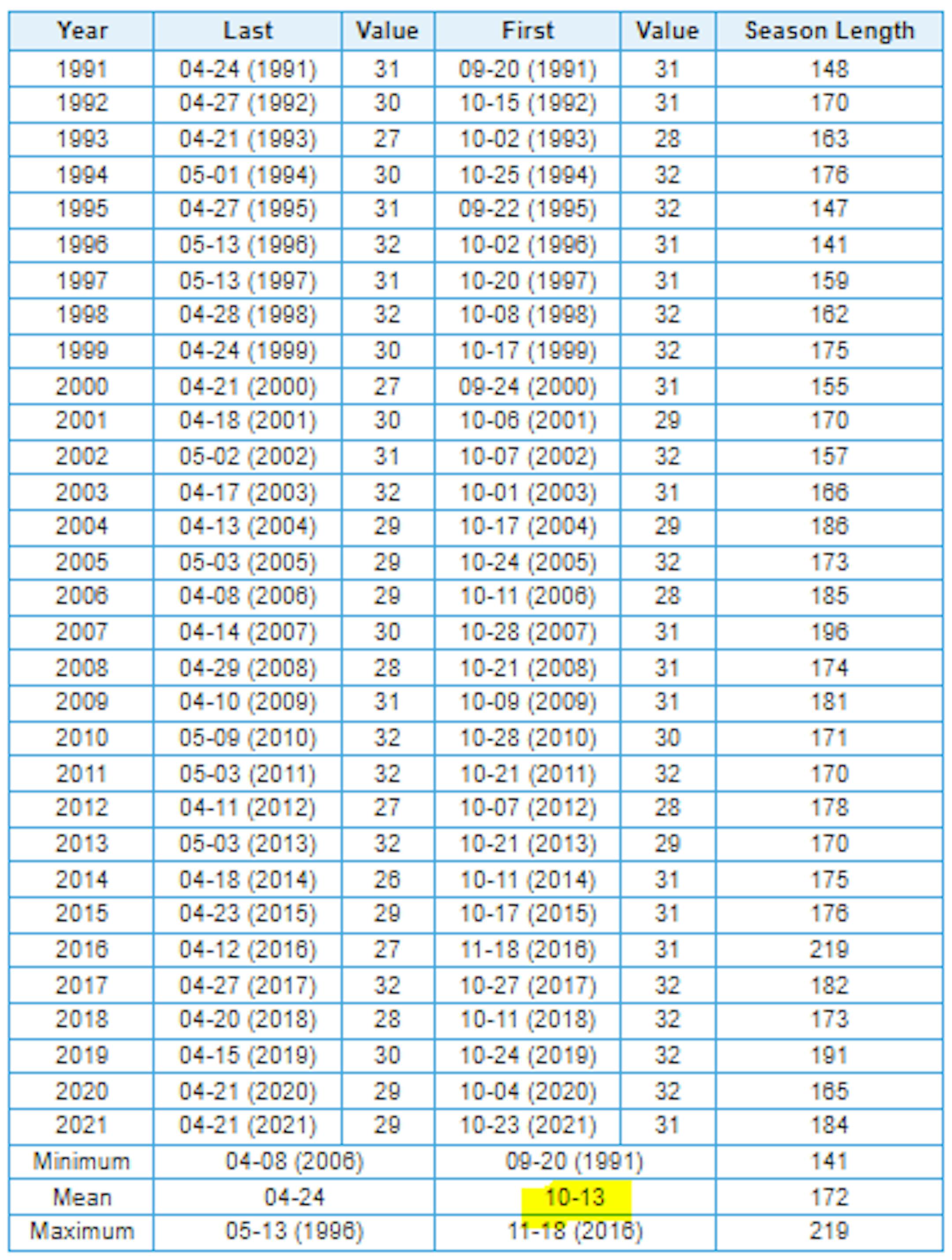
Average First Frost For MSP
Here's the 30 year average for the first frost in Minneapolis, which lands on October 13th. Last year (2021) the first frost was on October 23rd. If you look at the full MSP record, which dates back to 1873, the latest frost was November 18th back in 2016, while the earliest frost was September 3rd back in 1974.
First Measurable Snow at MSP
Here's the average first measurable snowfall (0.01") at MSP over the last 30 years, which lands on November 6th. Last year, MSP had its first measurable snow on November 13th. The last was on December 3rd back in 1928, while the earliest was September 24th in 1985.

Minnesota Drought Update
Here's the latest drought update across Minnesota. As of September 20th, we still have a sliver of moderate and severe drought conditions stretching from the Twin Cities Metro to the Minnesota River Valley.


