

Snow Totals From Friday
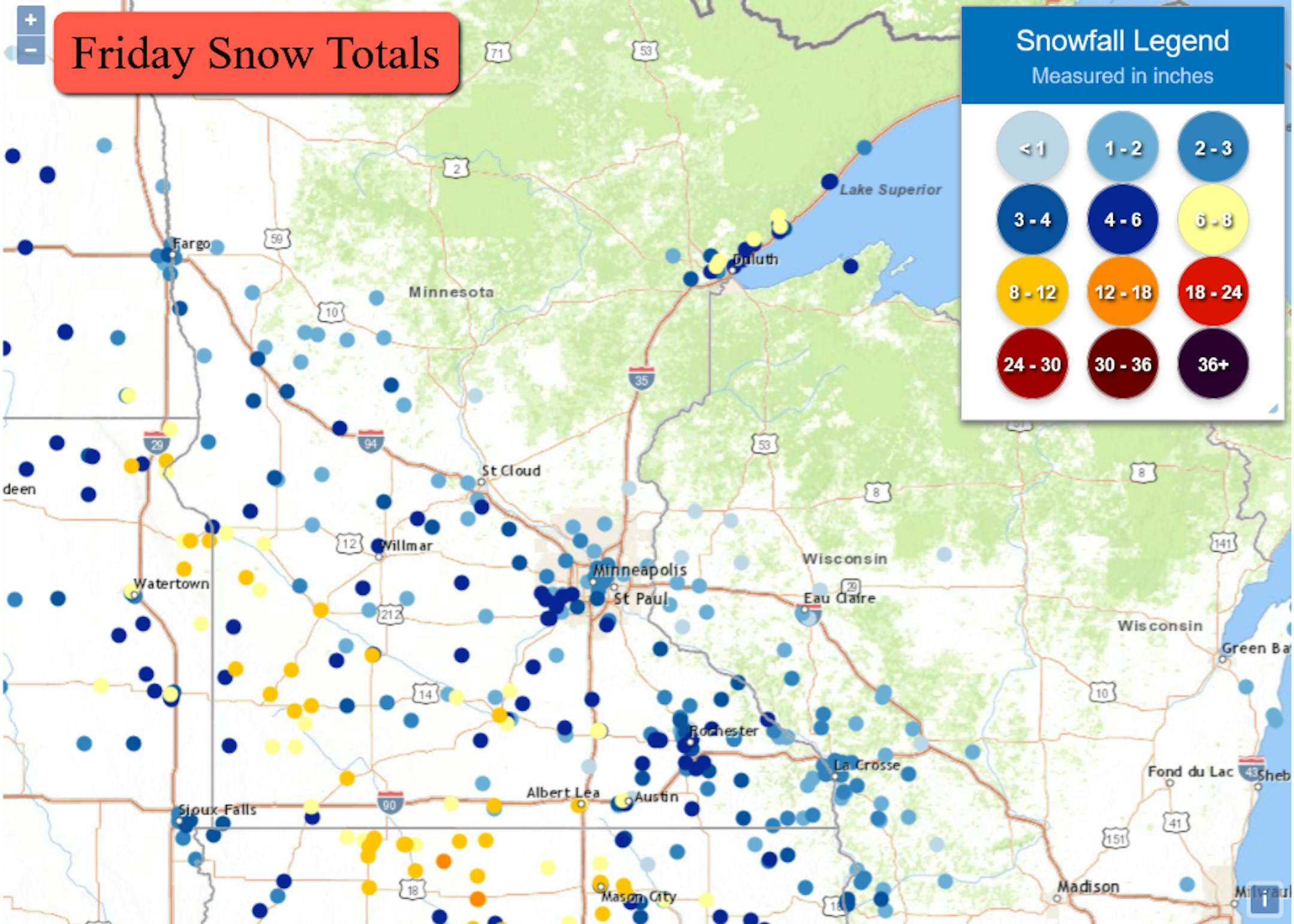
Out latest snowstorm moved through the region Friday, bringing a swath of snow mainly near/along I-94 southward. The heaviest totals of 6"+ were along and south of the Minnesota River. The top total out of Minnesota was 1 mile southwest of Russell, which saw 11" of snow. We also saw a lake effect snow band bring 7.7" of snow 3 miles northeast of Hermantown.
_______________________________________________
Shockwave From The Tonga Volcanic Eruption
_______________________________________________
Snow In Your Sunday Outlook
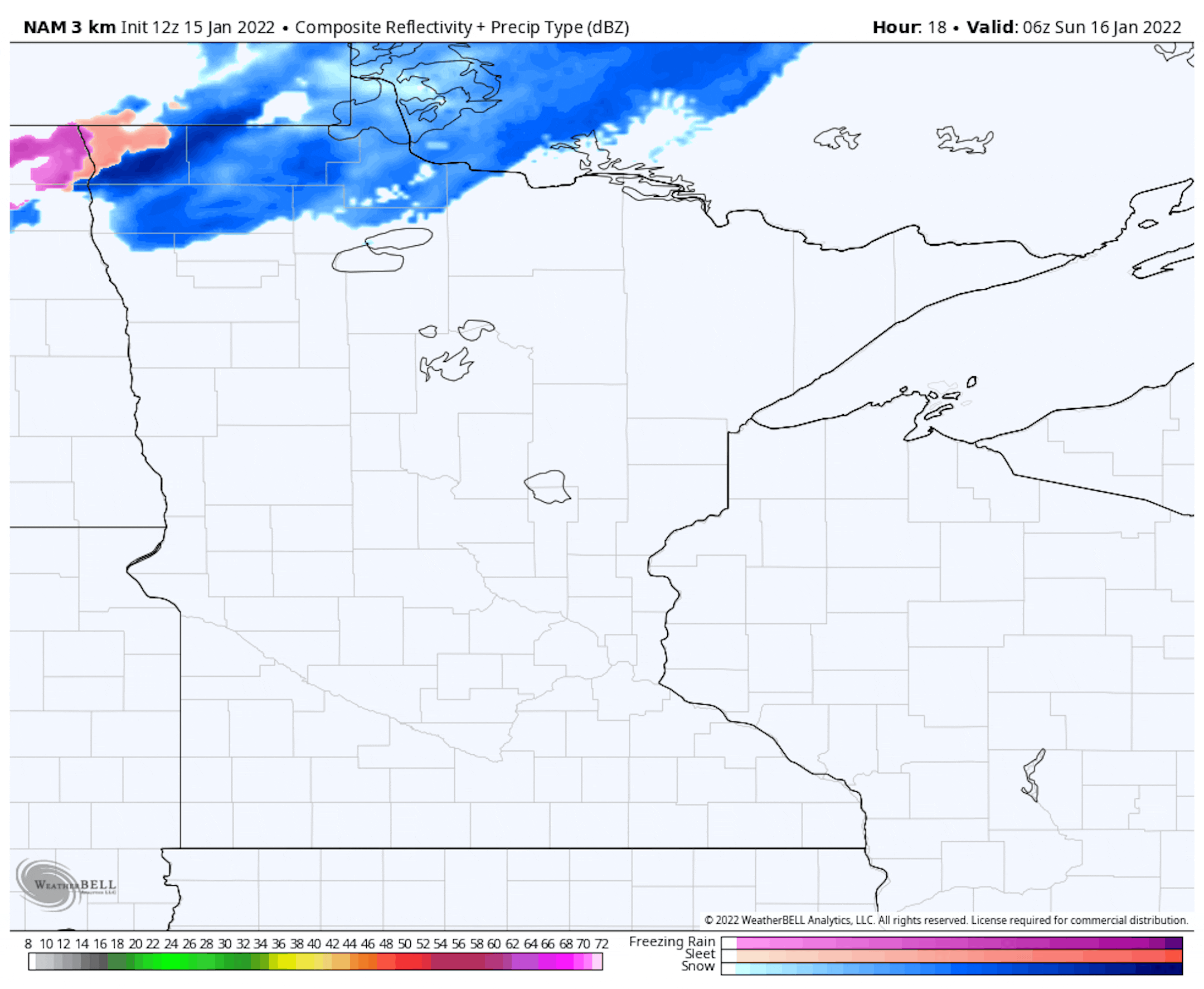
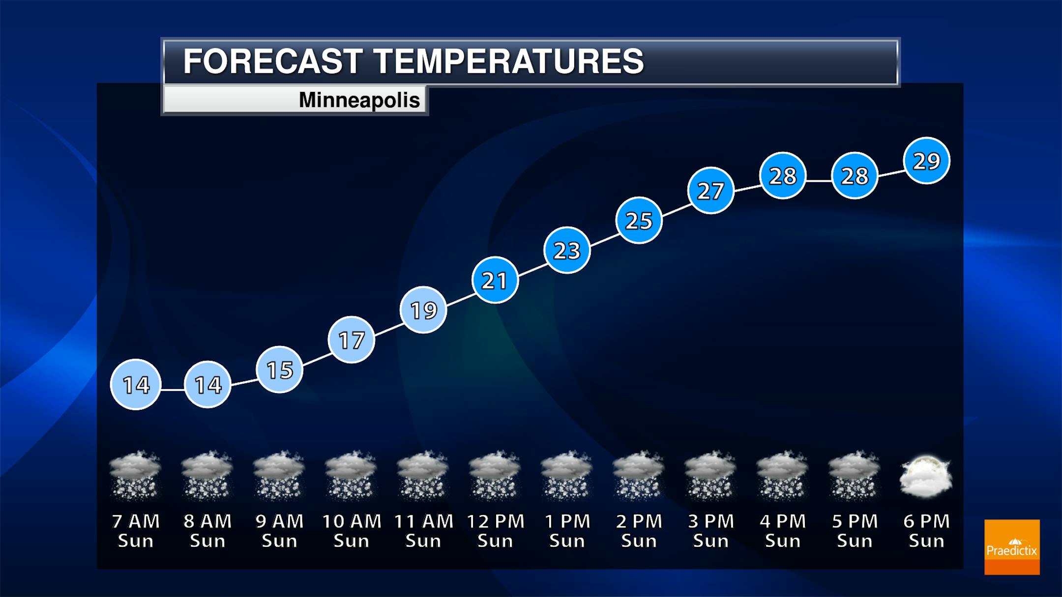
We are going to be watching the chance of some snow moving across the state as we head through Saturday Night into Sunday. The loop above goes from Midnight Saturday Night through Midnight Sunday Night. That first band looks to reach the Twin Cities around 6-8 AM Sunday, bringing up to a quick quarter-inch of snow with it. The second round of snow times itself out for the late afternoon hours, with only light accumulations.
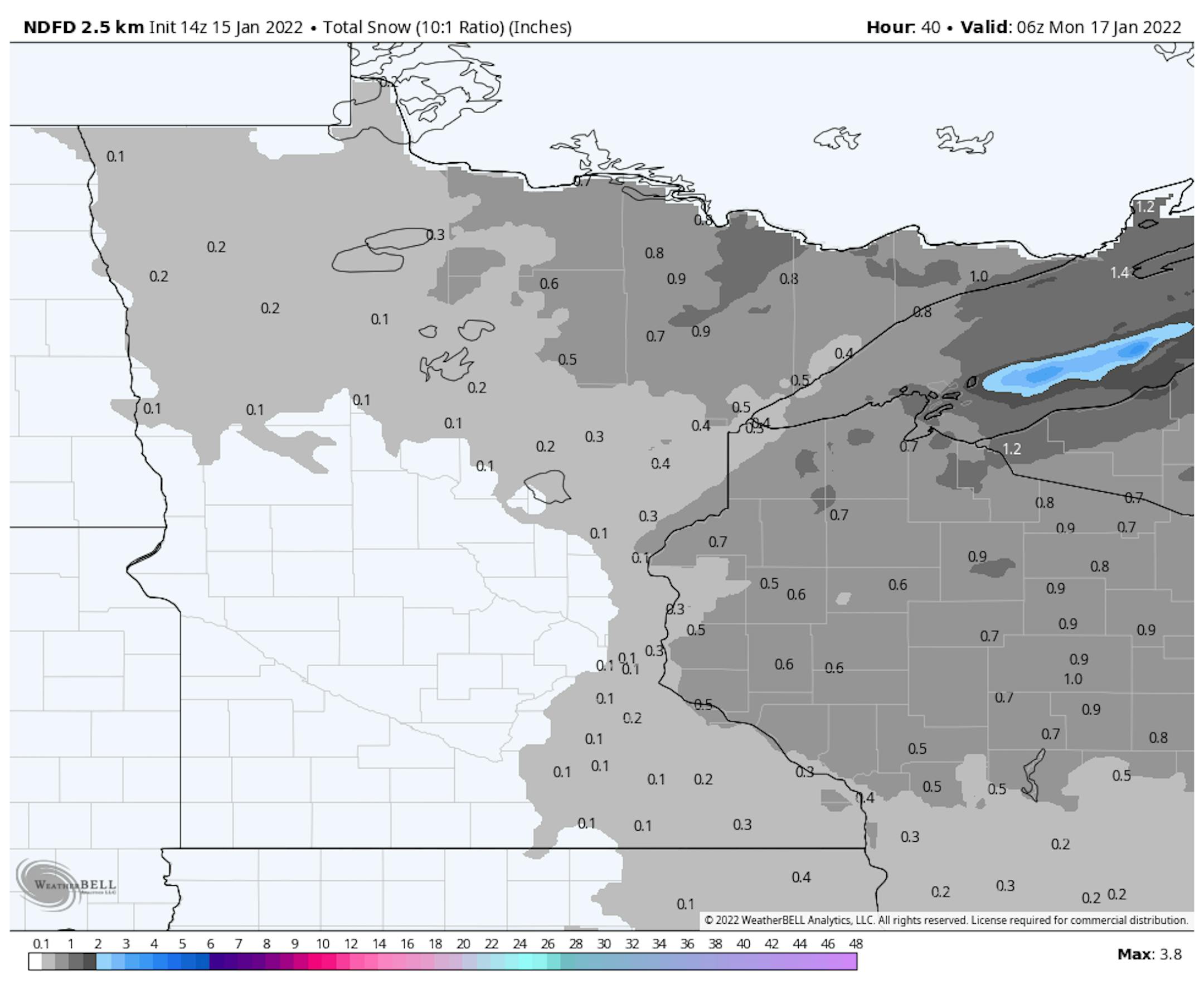
The NWS snowfall forecast shows generally light amounts from this snow across northern and eastern Minnesota. The heaviest amounts will be in the Arrowhead and Iron Range with up to an inch possible.
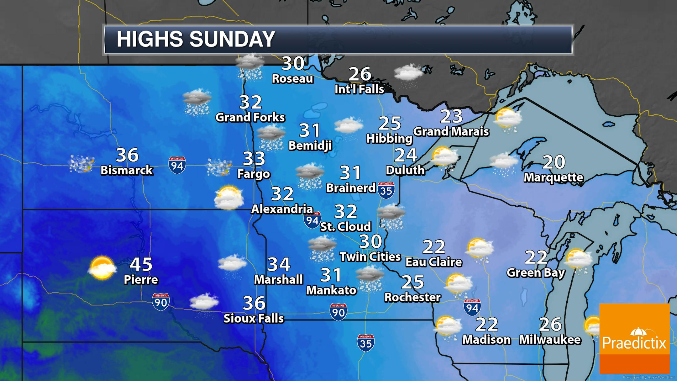
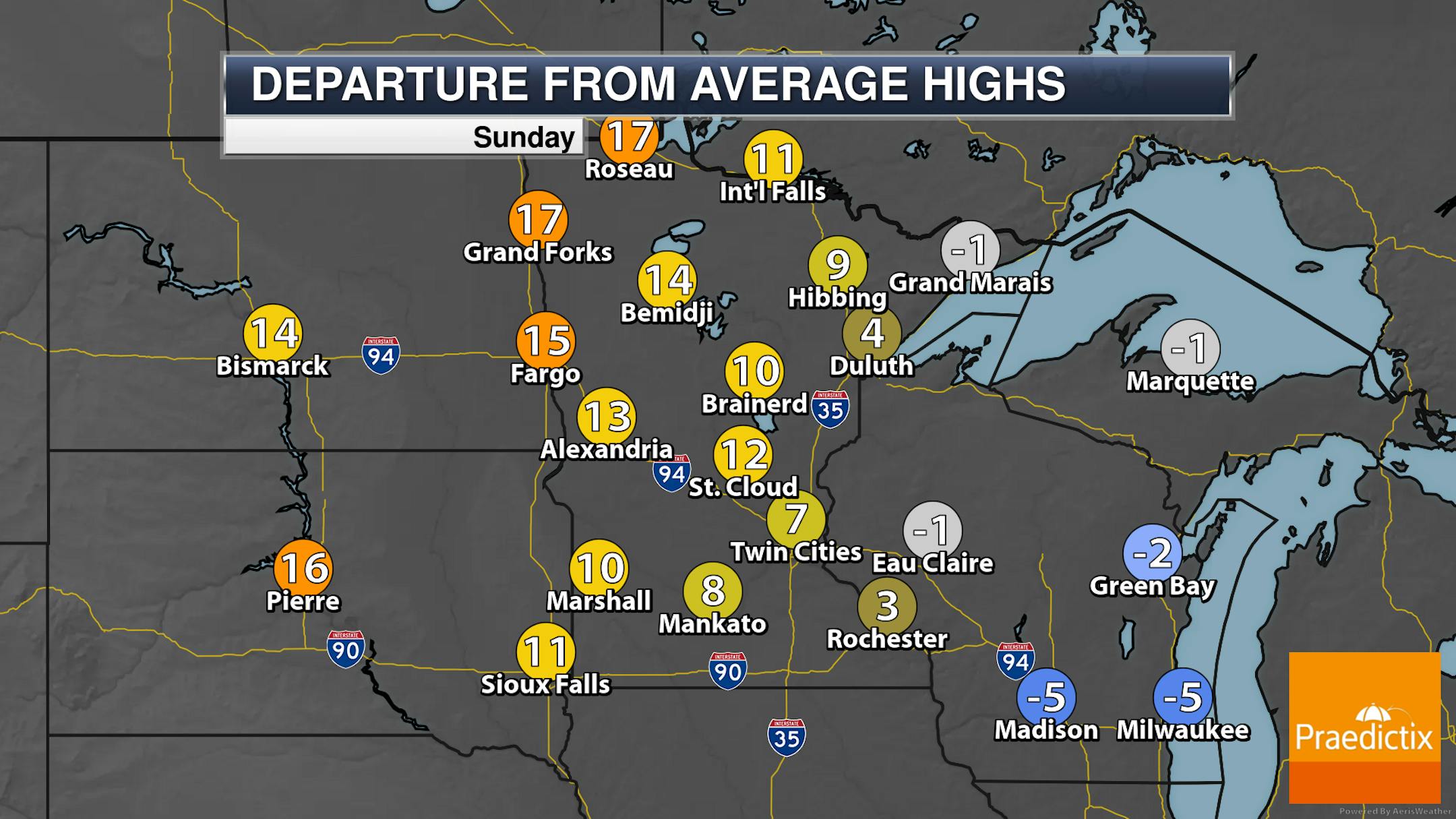
So we'll watch the snow chances across the state on Sunday, but highs will be a lot warmer than what we saw Saturday, climbing into the 20s and 30s. In parts of northwestern Minnesota, these highs will be 15-20F degrees above average.
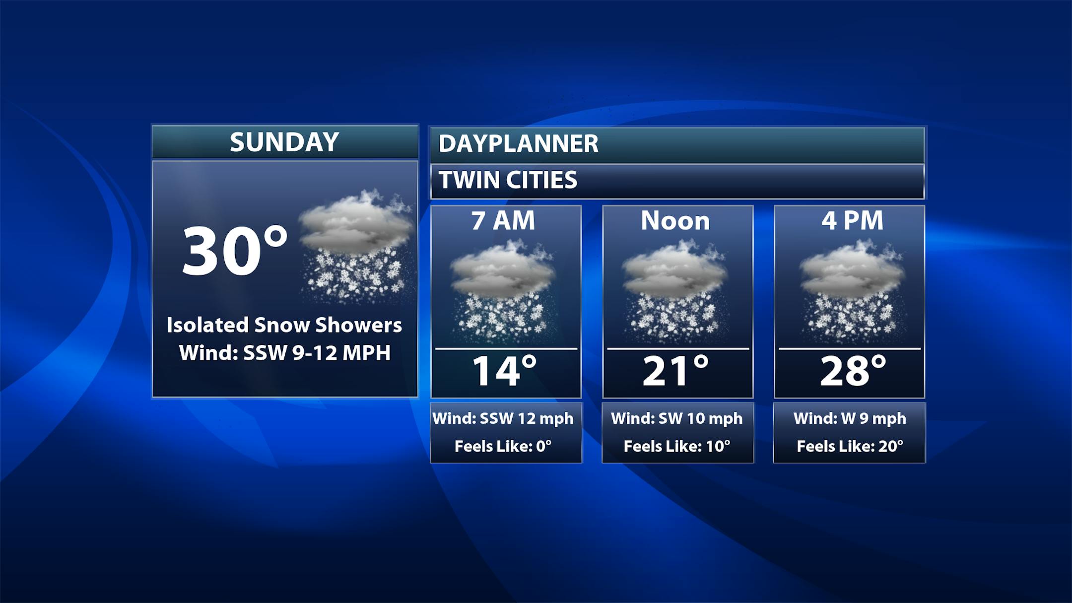
So we'll watch some snow showers at times Sunday in the Twin Cities, particularly in the early morning hours and again later in the afternoon. Morning temperatures start off in the mid-teens with highs topping off around 30F.
_______________________________________________


