Weekend Weather Outlook
The weather outlook for the last weekend of March looks very quiet in the Twin Cities. Both Saturday and Sunday will see a mix of clouds and sun with temps warming into the 30s and 40s.

Status of Spring
"March 20, 2023 - Spring leaf out continues to spread north, arriving several days to weeks earlier than average (the period of 1991-2020) in much of the Southeast, lower Midwest, and mid-Atlantic. PIttsburgh, PA is 17 days early. Parts of SE Colorado and Kansas are days to a week late. The West is a mix of early and late. Southwest UT is days to over a week late and Portland, OR is 2 days late. Spring bloom has also arrived in southern states, days to weeks early in the Southeast, and days to over a week late in the Southwest. Nashville, TN is 25 days early, Las Vegas, NV is 8 days late. How typical is this year's spring? Darker colors represent springs that are unusually early or late in the long-term record. Gray indicates an average spring. Parts of the Southeast, lower Midwest, mid-Atlantic, and New York City area are seeing either the earliest spring leaf on record or a spring that only occurs once every 40 years (dark green). Parts of Arizona are seeing a spring that only occurs this late once every 40 years (purple). Spring bloom is latest on record across parts of the Southwest including California and Arizona, and earliest on record in parts of the upper Southeast including Tennessee, Georgia, South Carolina, and North Carolina."

"Spring Outlook: California drought cut by half with more relief to come"
"Moderate to major spring flooding predicted along upper Mississippi River from Minneapolis to St. Louis. Significant flooding is ongoing in the western U.S., especially in California, following another series of strong Pacific storms that battered the region and piled on to an already historic snowpack. According to NOAA's U.S. Spring Outlook, the abnormally wet winter will further improve drought across much of the western U.S. as the snowpack melts in the coming months. Winter precipitation, combined with recent storms, wiped out exceptional and extreme drought in California for the first time since 2020, and is expected to further improve drought conditions this spring. NOAA's U.S. Spring Outlook highlights temperature, precipitation, drought and flood predictions for April through June to help the nation prepare for potential weather and climate threats to lives and livelihoods."

8th Snowiest Season at MSP
With more than 81" of snow, the MSP Airport is currently sitting at the 8th snowiest winter on record! We need less than 4" of additional snow to get into the top 5, but would need almost an additional 18" to get to the top spot.

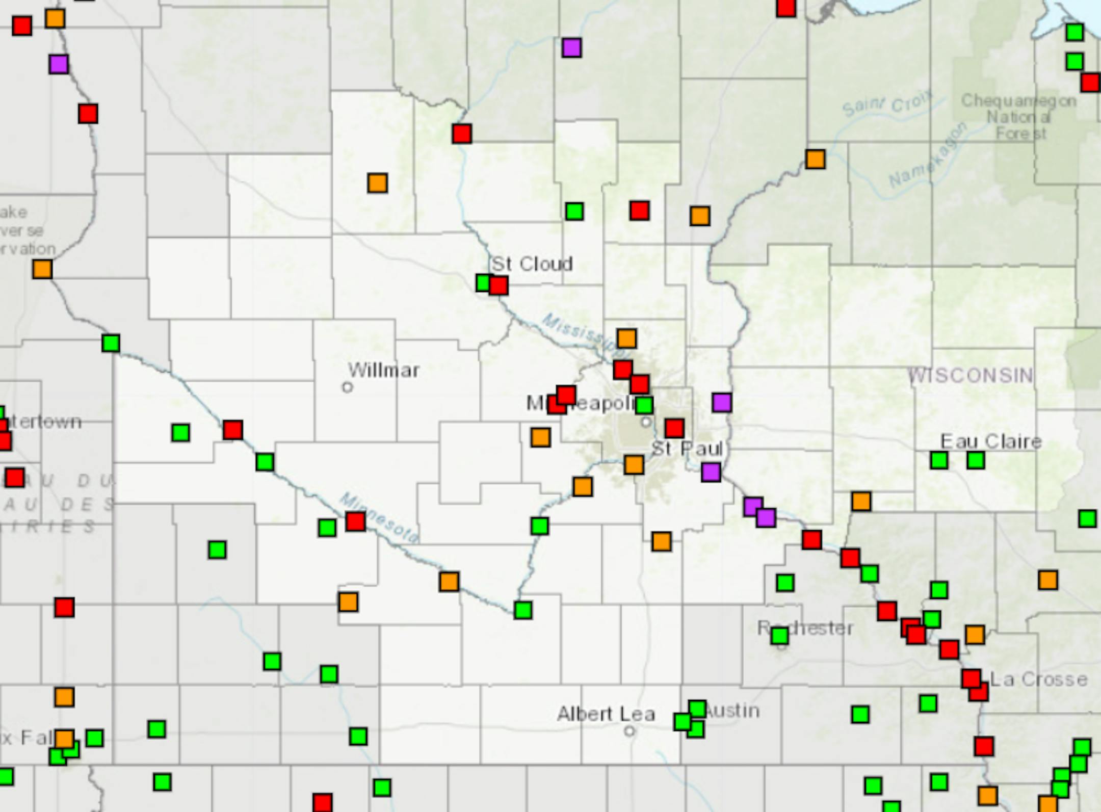
Spring Flood Outlook
"No real changes in the last two weeks... The late March updated outlook for spring flooding in the upper Mississippi, Minnesota, and Chippewa River basins remains well above normal, particularly on the Mississippi from St. Paul downstream. The very high snowpack for this time of year has remained in place over the last two weeks. There is some good news! The 7-10 day temperature and precipitation pattern is favorable for a slow melting period through the end of March (details later in the briefing). As always, the threat of seeing major flooding will still depend on what kind of rainfall/temperature patterns we get as we move into April."