
Slight Deterioration In The Drought Monitor
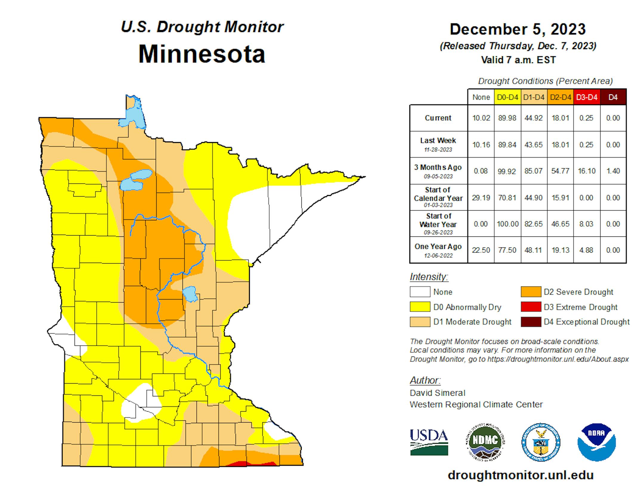
Once we hit winter in Minnesota, it is typically more difficult to see massive changes in the Drought Monitor. Over the past week, there was a slight increase in the amount of Minnesota under the D0 (Abnormally Dry) and D1 (Moderate Drought) categories. This generally occurred in parts of the eastern and northern metro.
_______________________________________________
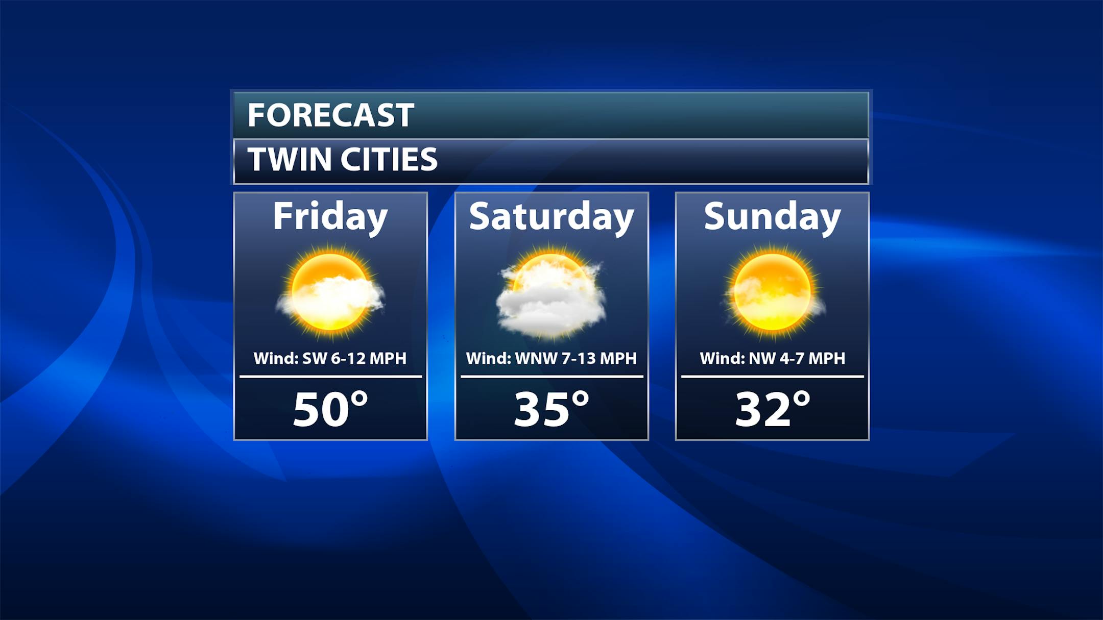
Record Highs Possible Friday
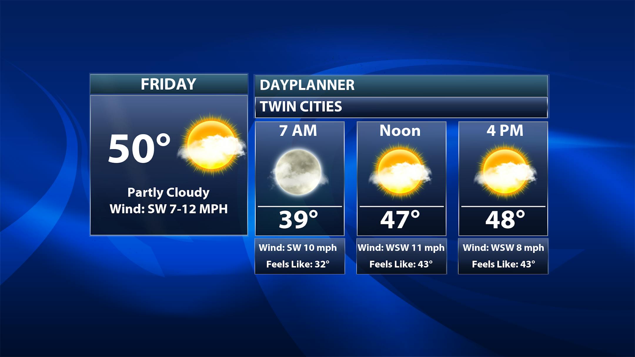
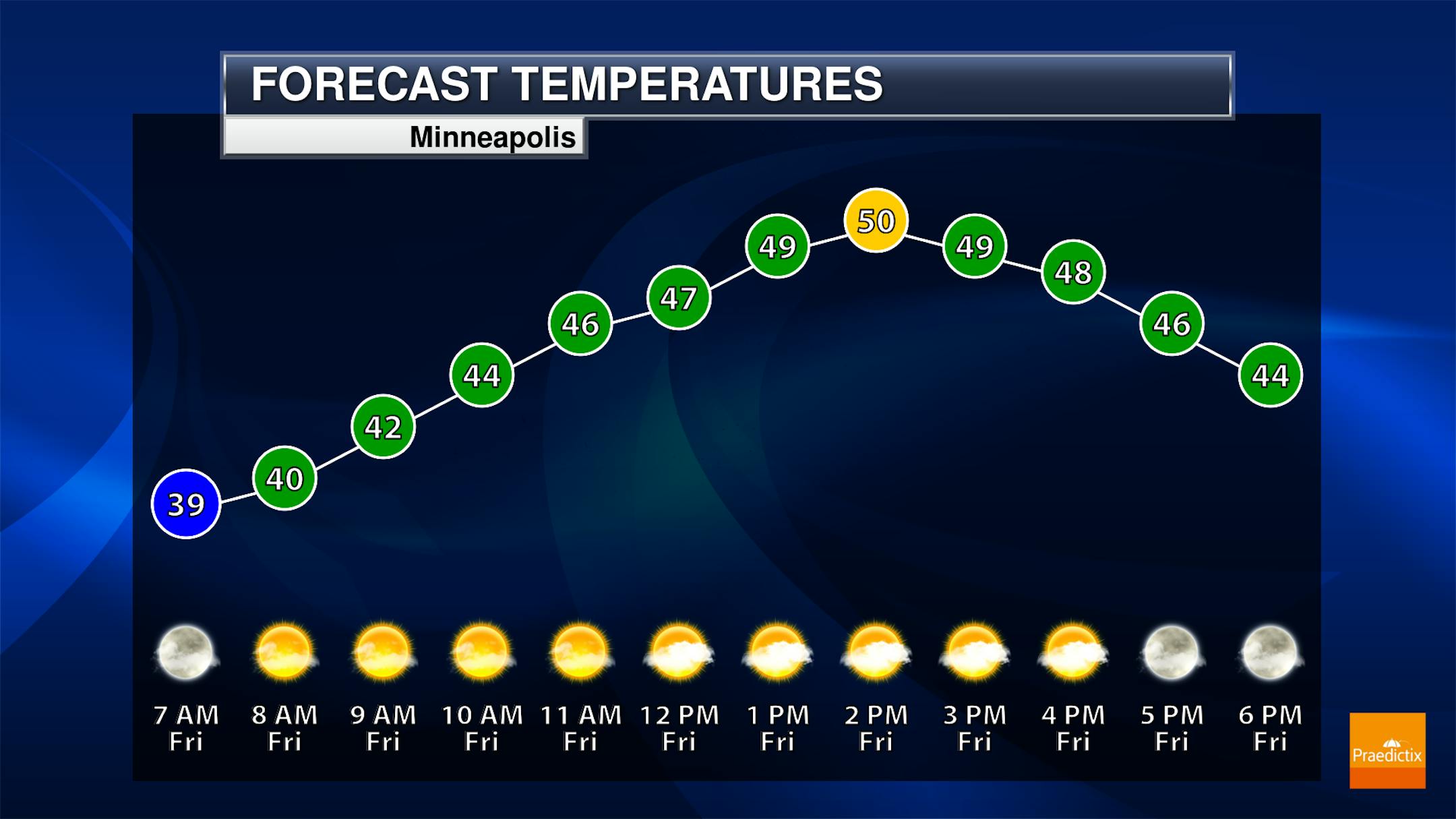
A sun/cloud mix to mainly cloudy Friday is expected here in the metro, with breezy conditions also in place. The high for MSP is expected to be at least near - if not tying or breaking - the record for the day (50F in 1990).
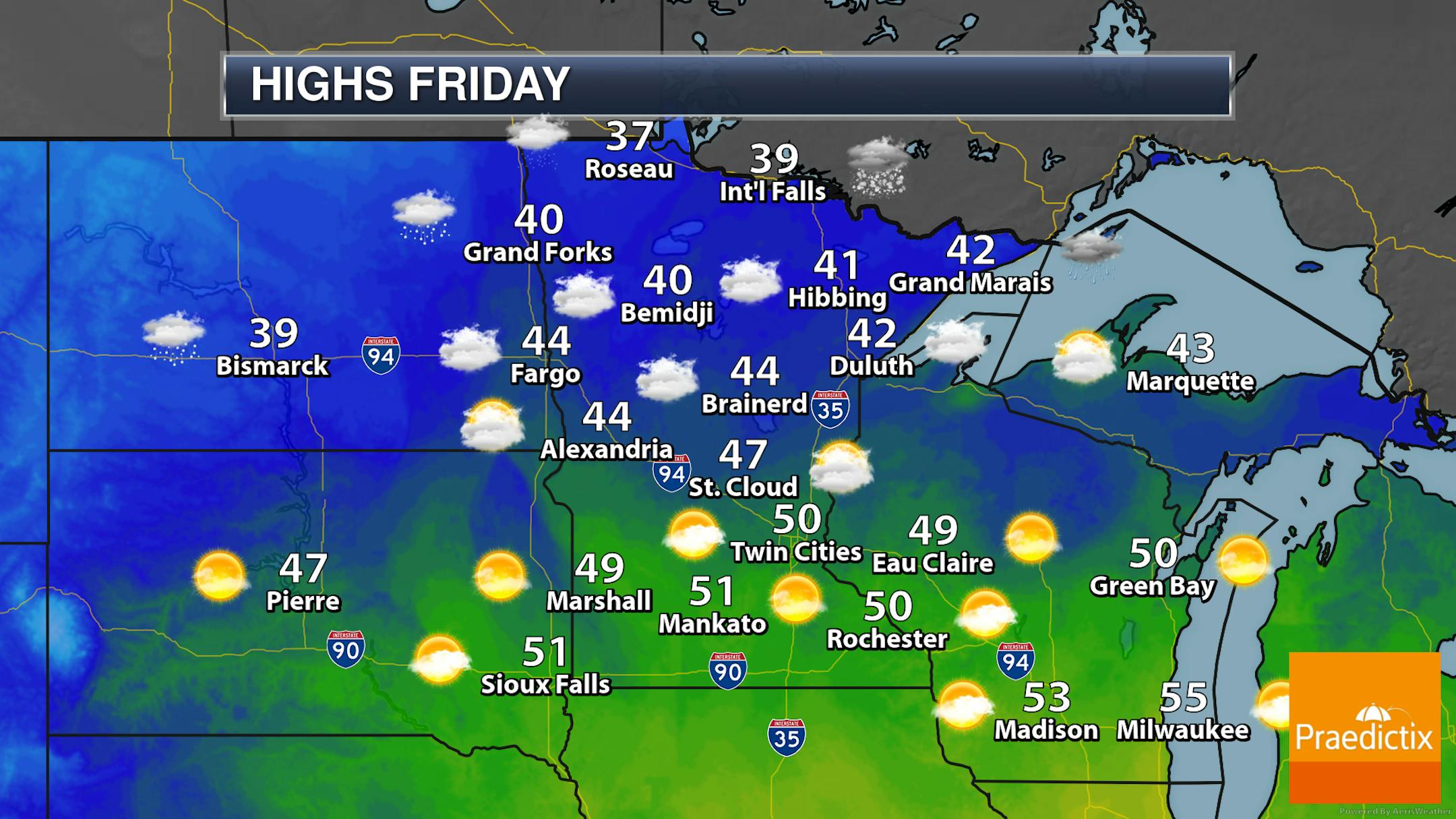
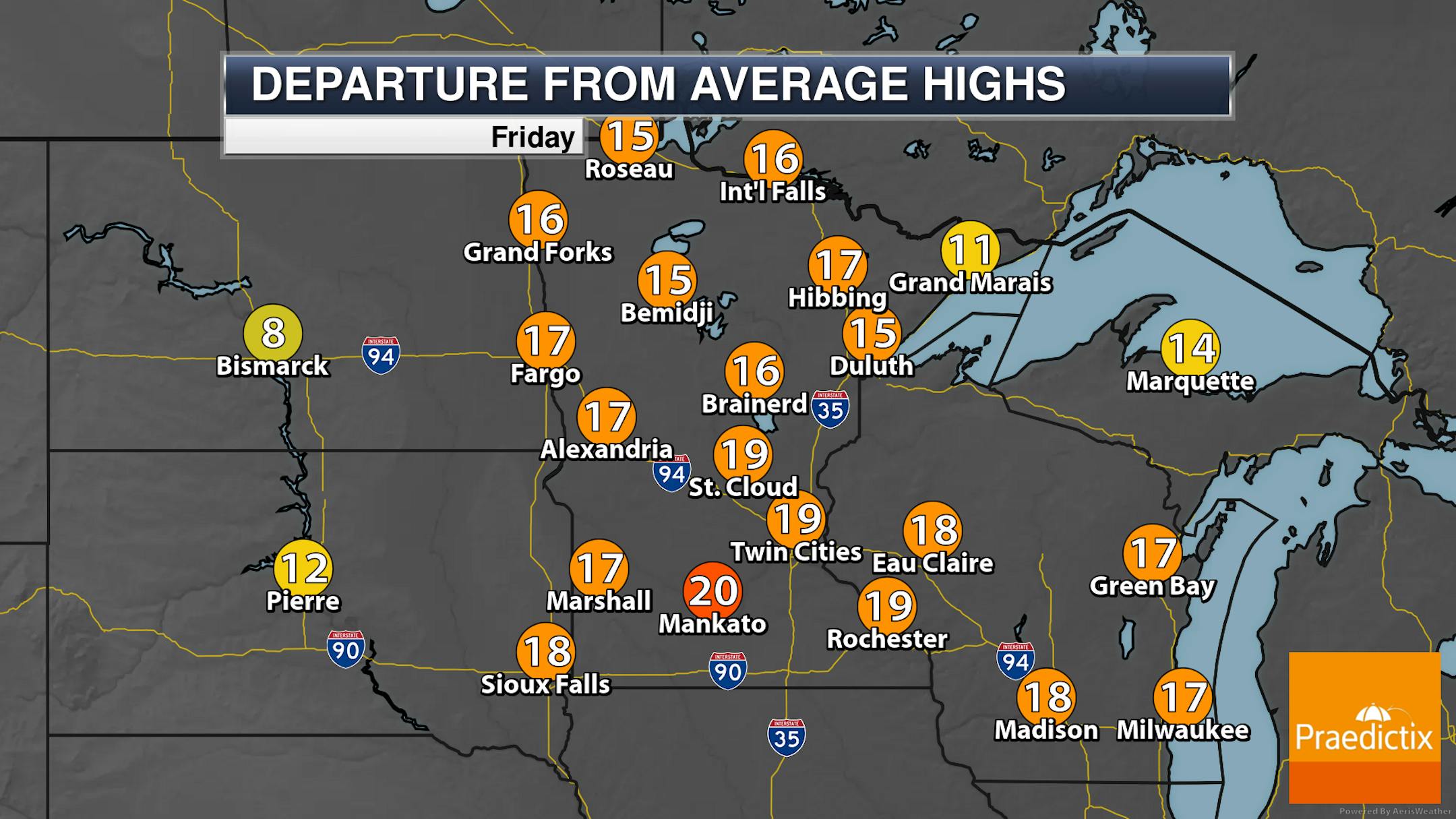
Highs will be quite above average on Friday, ranging from the upper 30s in northern Minnesota to the low 50s in southern parts of the state. Some light rain or mixed precipitation will be possible in northern Minnesota - especially during the morning hours - with snow working into northwestern Minnesota by the evening. Far southern Minnesota will see a lot of sunshine, but work your way to the metro northward and cloud cover will be around most of Friday.
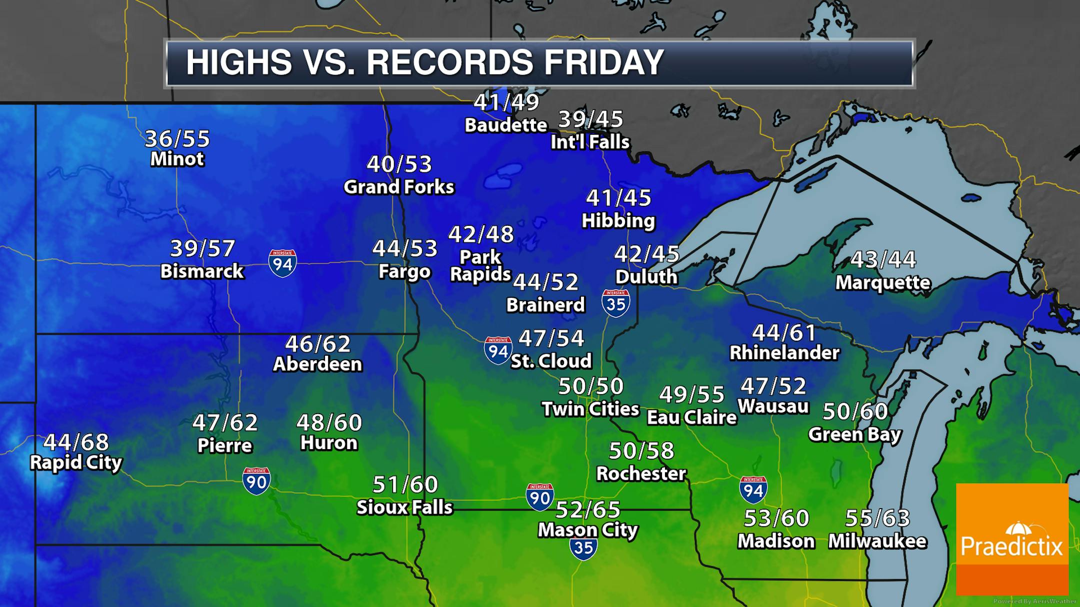
Here's a look at highs vs. records across the state on Friday. The Twin Cities appears to be the only real "reachable" record, again potentially tying the record for the day set back in 1990. It's possible, though, to see at least near-records in places like Duluth and Hibbing.
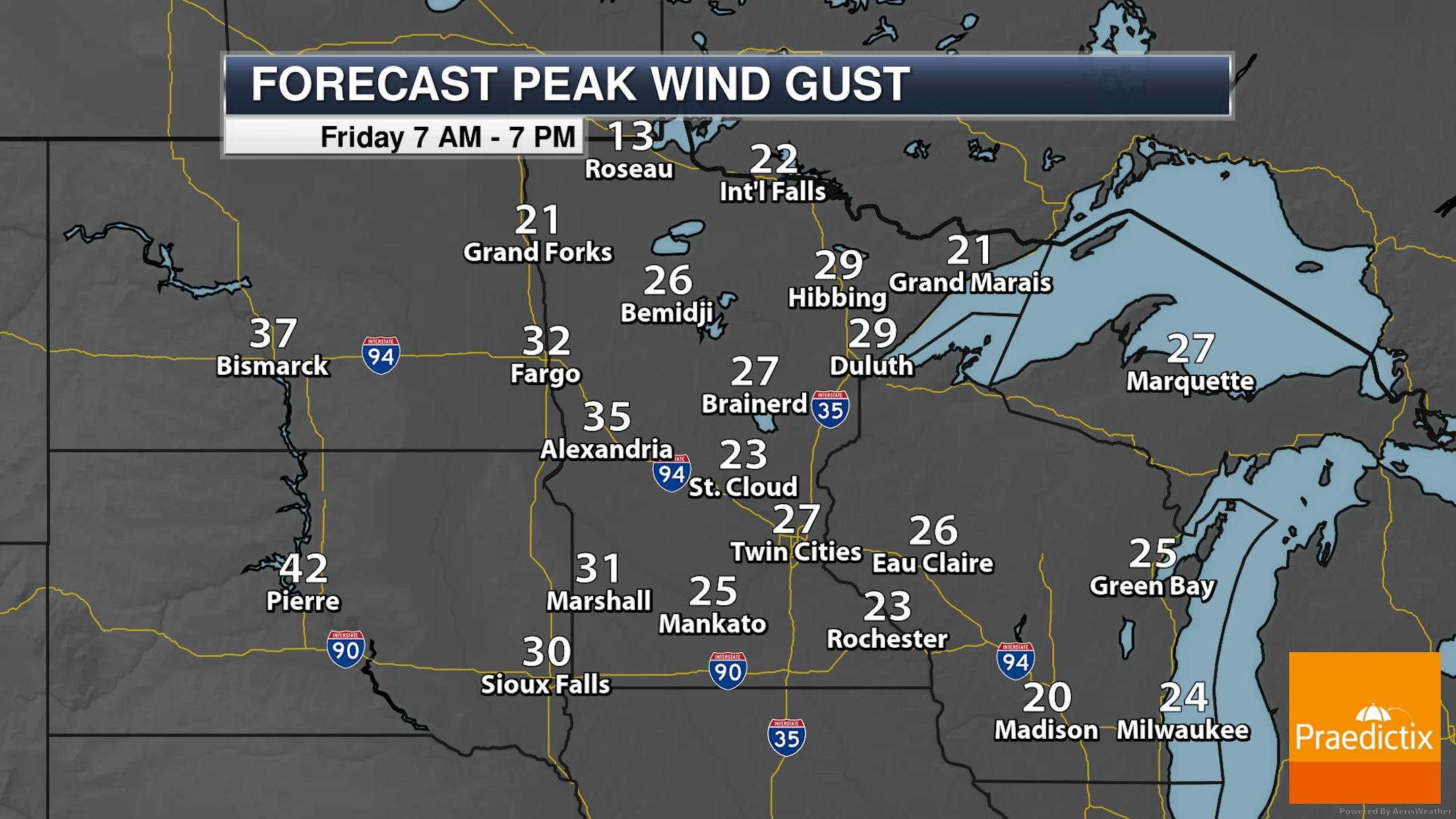
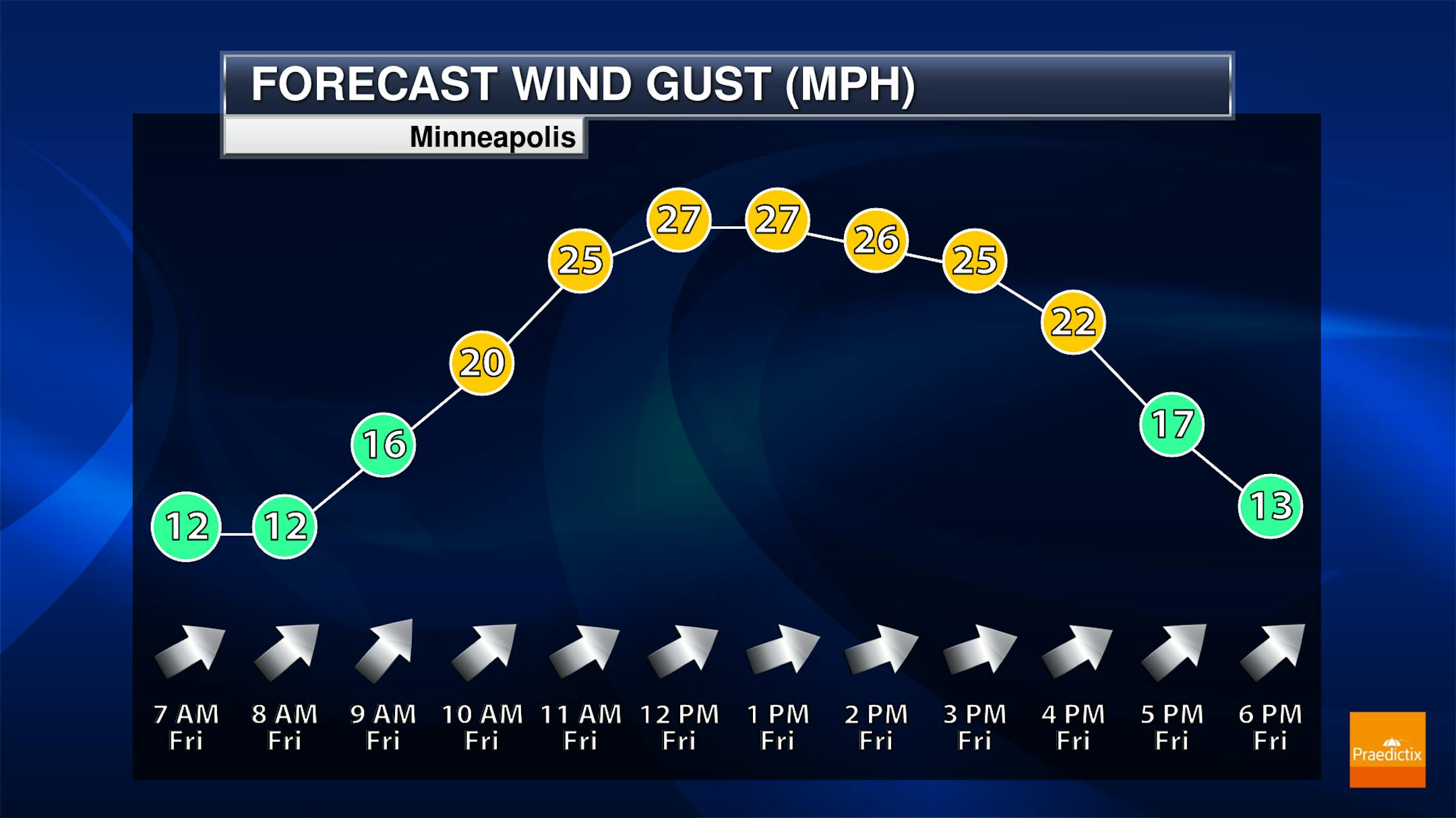
Strong southwesterly winds will also be in place on Friday ahead of a bit of a change in the weather for the weekend. Winds will gust up to around 25 mph in the metro and top 30 mph out in western Minnesota.
_______________________________________________
Snowy Saturday - Calmer Sunday
The weekend is in sight! Got plans? Here's a look at the weather this weekend:


