

Rain/Snow Showers Monday Into Monday Night
Forecast loop from 9 AM Monday to 6 AM Tuesday
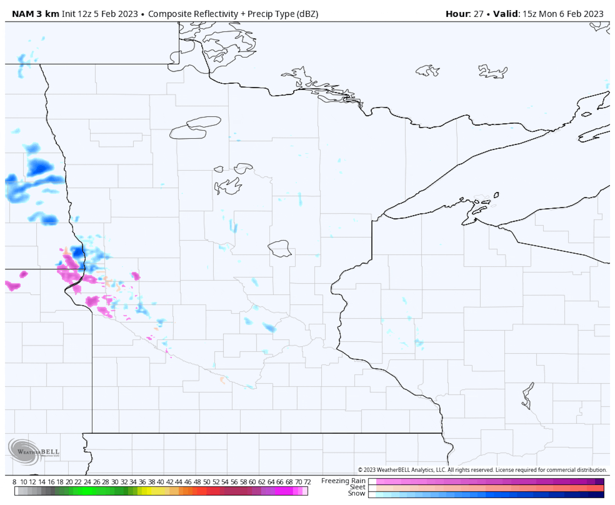
It won't be a quiet start to the work week across the state, unfortunately, as we watch a system move on through. The good news is that the morning commute will be dry - not so much by the evening commute, though, as a mix of rain and snow showers starts moving through southern Minnesota during the afternoon hours with all snow up north. The system will move out into the overnight hours, ending as some light snow in central and southern Minnesota.
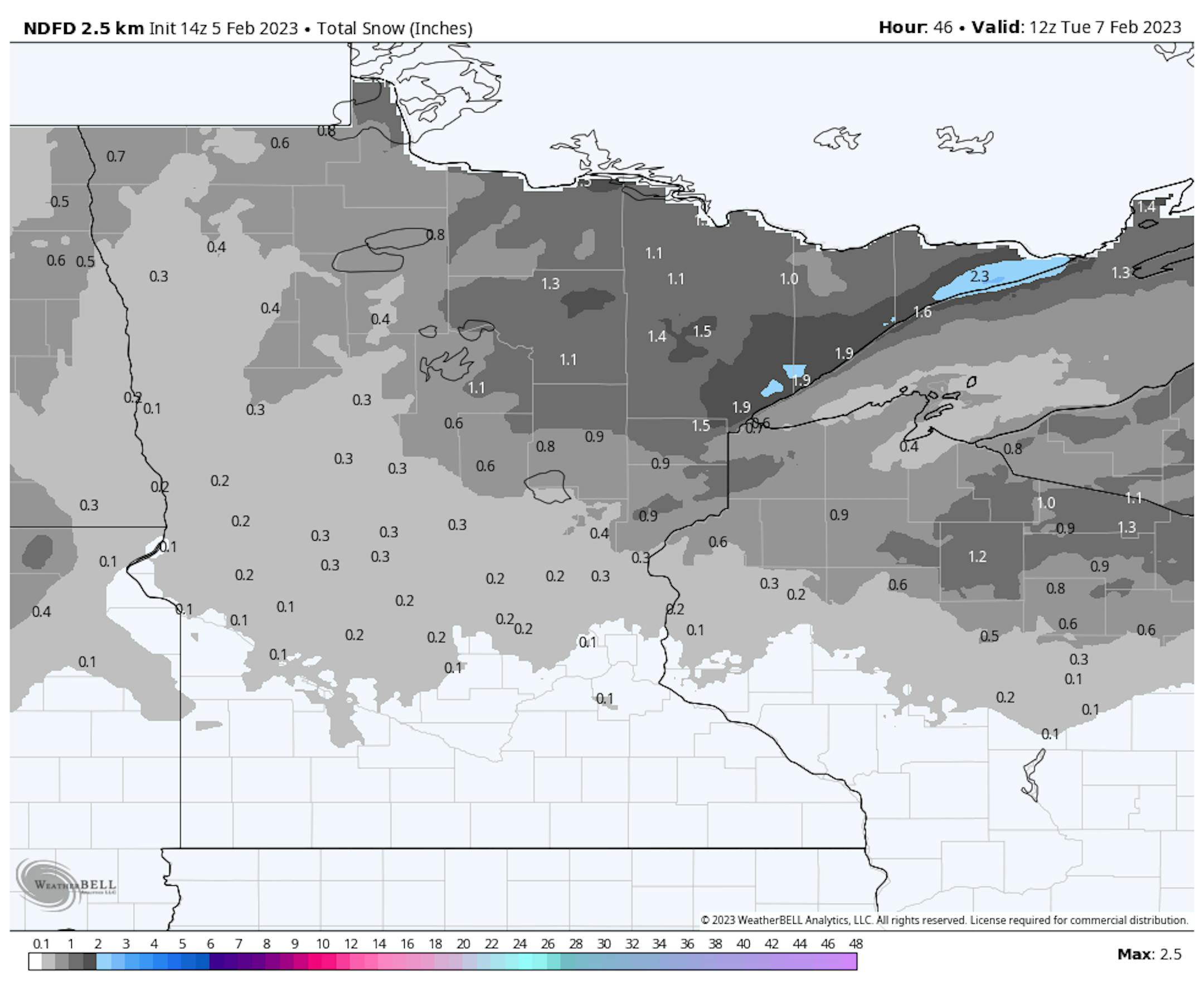
While some slight snow accumulation could occur here across central and southern Minnesota Monday Night, I'm expecting 1-2" up in the Arrowhead with locally higher amounts along the North Shore.
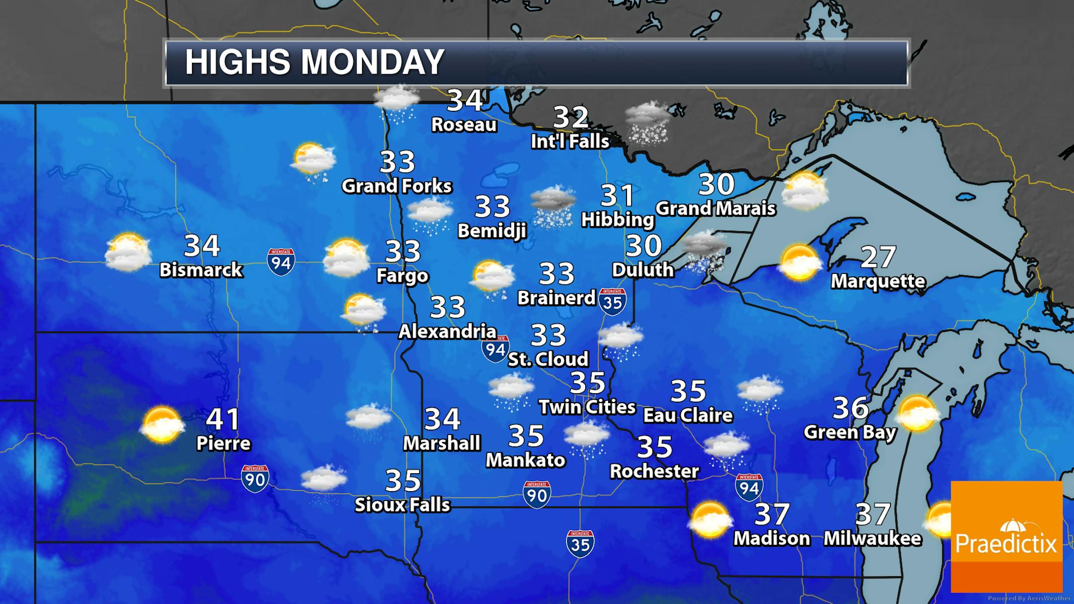
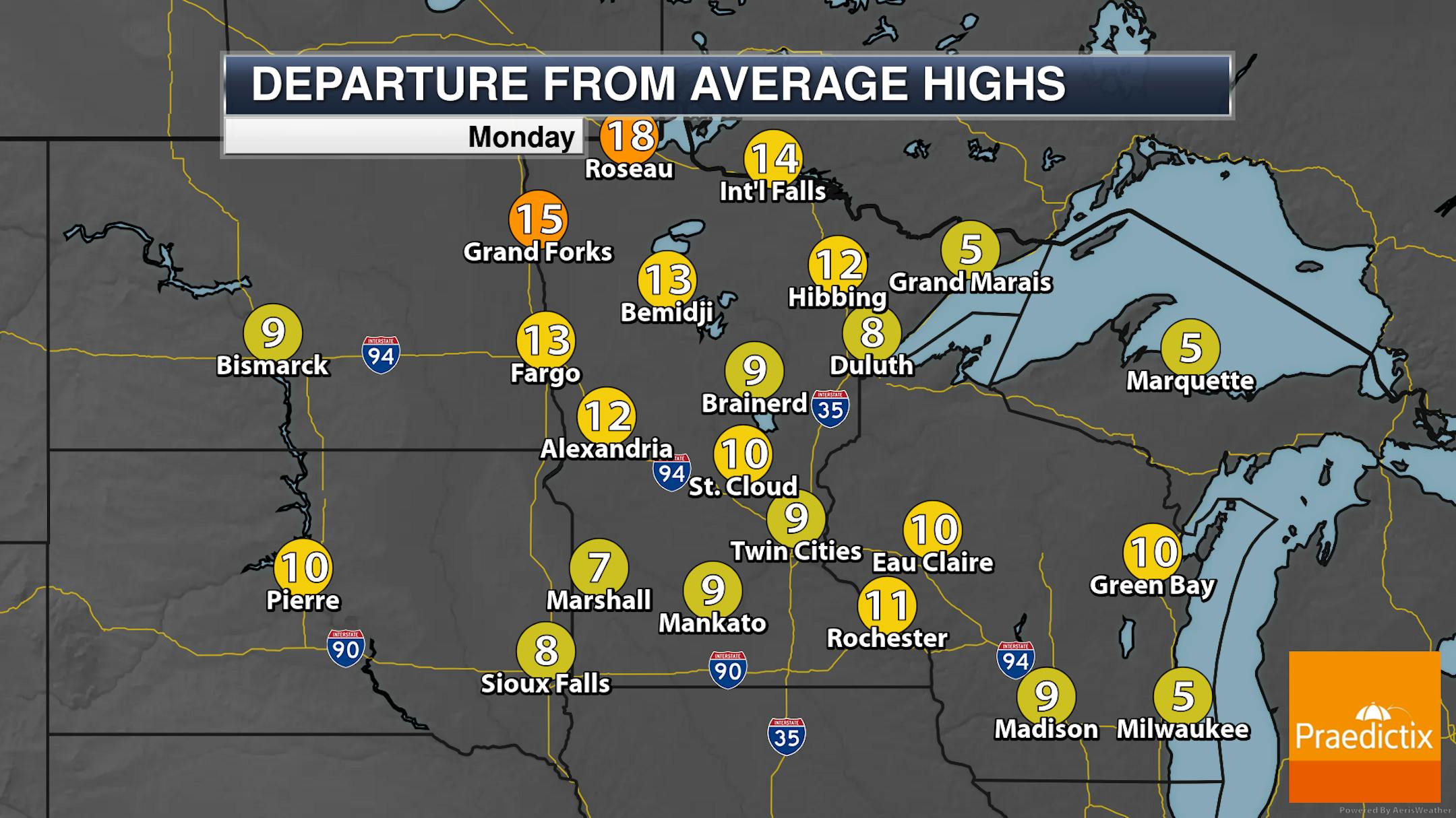
As that system moves through the state on Monday, we'll see warmer-than-average temperatures with highs generally in the 30s. A better chance of snow during the day will occur in northern Minnesota, with a mix to plain rain across southern areas of the state.
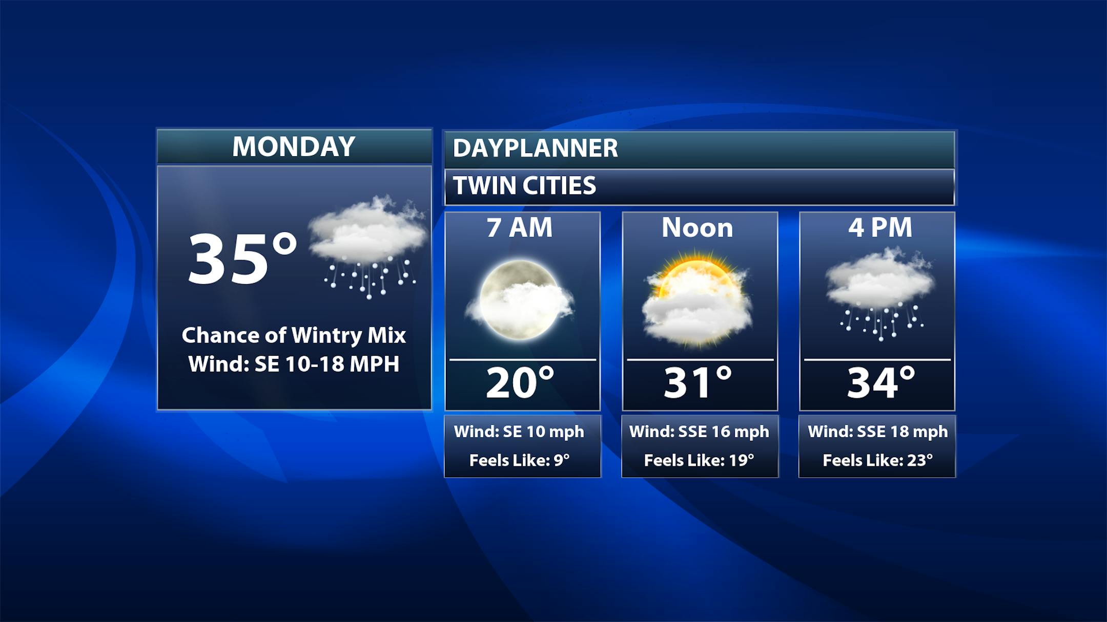
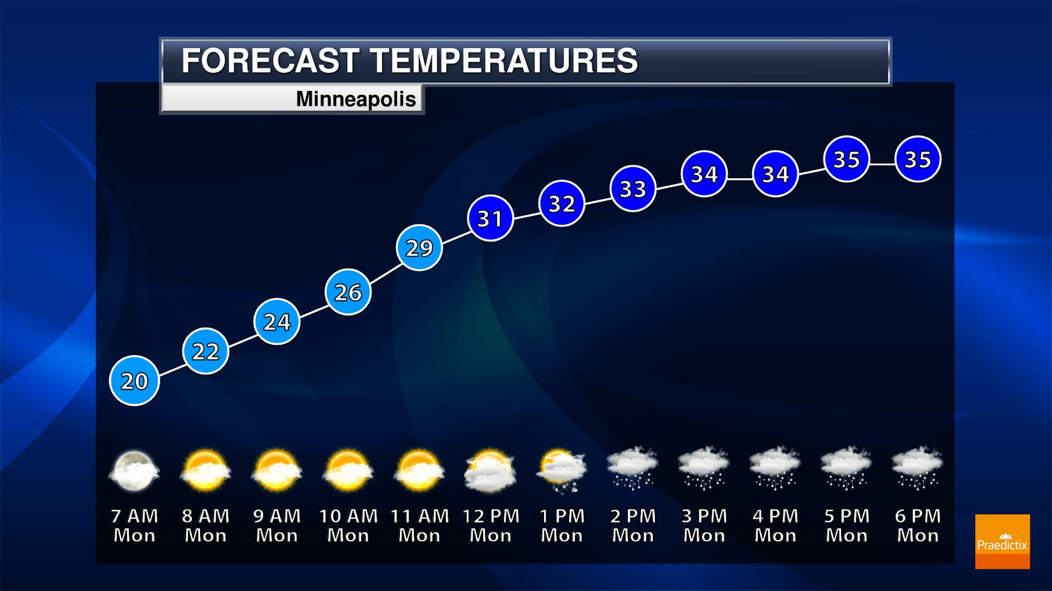
So with the afternoon rain and snow chances in the metro, we'll have our first chance at highs above freezing since January 27th. We should top off in the mid-30s after starting off around 20F. We'll see breezy weather as well with southeast winds at 10-20 mph gusting to 30 mph. Those winds will make it feel more like the teens and 20s.
_______________________________________________
20s And 30s For Highs This Week
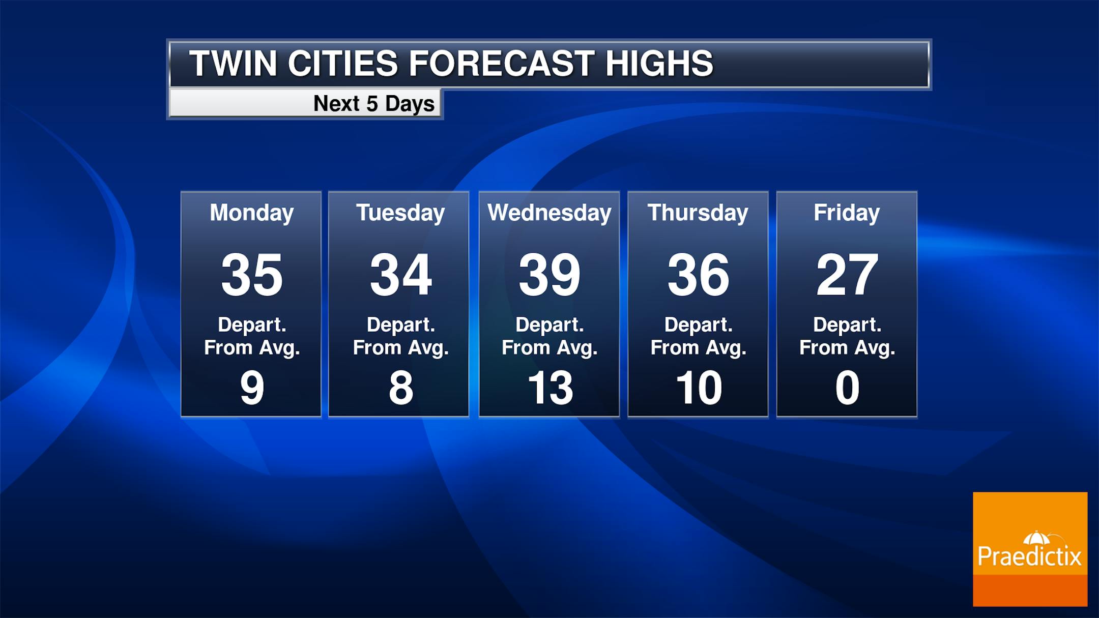
Now, this looks a lot better than some of the weather we've had recently! Highs this week will be in the 20s and 30s, and we could even see a chance at 40F on Wednesday here in the metro.
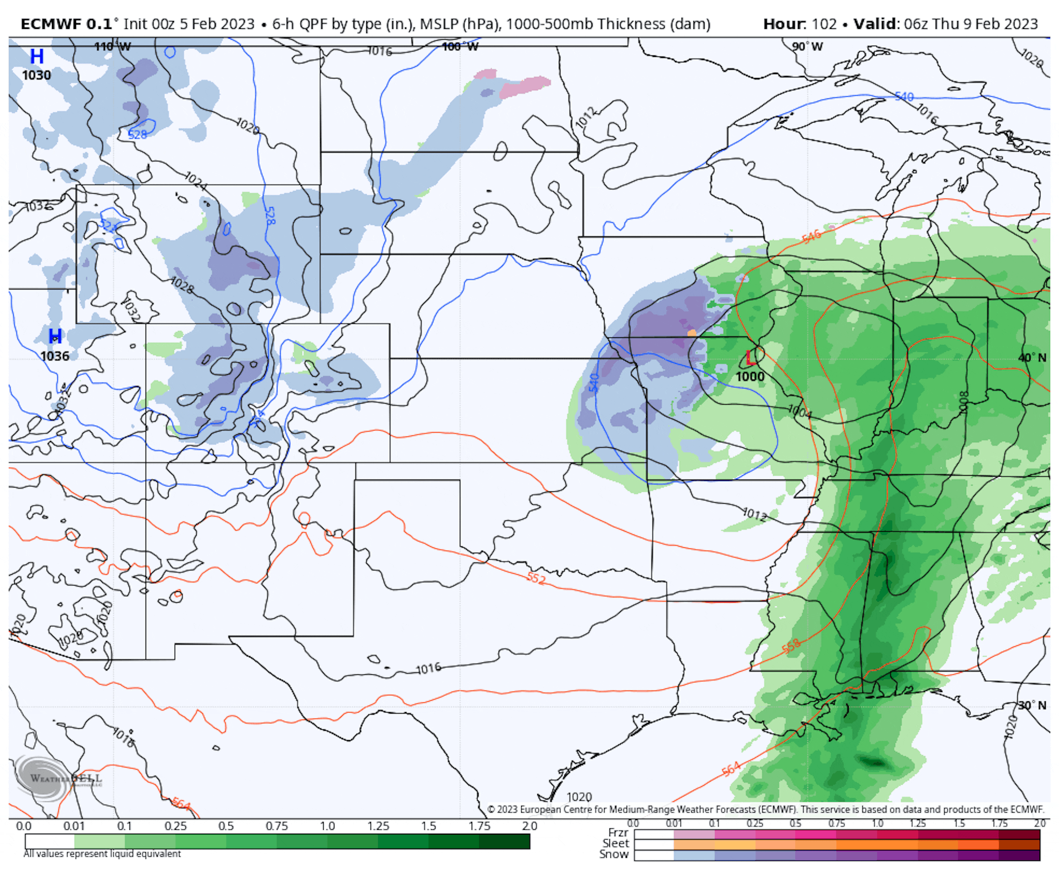
Forecast loop Thursday from Midnight to 6 PM.


