Snowy Landscape
It was a Festivus Miracle... A gift from Mother Nature! It was officially, a "White Christmas" and we got snow just in the nick of time. The MSP Airport reported 8" of snow on the ground on Christmas morning, which ties the record for the 18th "Whitest" Christmas in recorded history. The deepest snow pack on any Christmas Day was 20" back in 1983. Last year we had 6" of snow on the ground and just a Trace in 2018, which was our last Brown Christmas.

December 23rd Blizzard Summary
"On Wednesday December 23rd, blizzard conditions were observed across much of MN as an intense weather system moved from west to east through the region. It produced multiple inches of snow with rates as high as 1-2 inches per hour at times, with a bit of rain falling ahead of the snow which led to ice covered roadways. Temperatures plummeted with strong winds gusting as high as 50-65mph out of the northwest behind the low pressure system. Temperatures reached as high as the mid 40s during the morning before bottoming out in the single digits above zero to near zero by midnight. A robust mid to upper level trough approaching the region continued to strengthen before closing off, with a surface response in the form of a deepening low pressure system. This combined with incredible mid level lapse rates produced significant lift and widespread precipitation, with an intense pressure gradient resulting in strong winds as the system moved eastwards. Winds intensified alongside bands of heavy snow during the afternoon, which resulted in widespread blizzard conditions as visibilities dropped below 1/4 mile across the region and remained low for several hours. Snowfall diminished during the evening and into early Thursday morning but winds remained strong enough to support blizzard conditions into the mid morning on Thursday in some spots. Impacts included significant slowdowns to air travel at airports across the region including MSP, ice and snow covered roads that led to no travel orders and closed highways, and even National Guard rescues at the Governor's request. This was exacerbated due to the timing of the system falling on December 23rd, which is one of the busiest overall travel days of the year before the holidays."

Clipper Arrives Sunday
A fast moving clipper system will push through the region on Sunday with a chance of light snow accumulations across the northern half of the state. Accumulations will be light, but roads could become slippery once again.

Minor Coating of Snow Sunday
Here's the snowfall potential on Sunday. Note that an 1" or 2" could be possible across the northern half of the state with a minor coating possible in the Twin Cities.

Another Snow Storm Next Week?
A much larger storm system could develop around midweek next week with another round of heavy snow and wind. It is too early to get specific, but this certainly could potentially be another high impact storm system for parts of the Upper Midwest, including the Twin Cities. Stay tuned...

Snowfall Potential Through 7PM Tuesday
Here's the early snowfall preview. Again, it's way too early to get specific, but we'll have to watch how this develops. Some locations could see plowable snow once again by midweek.

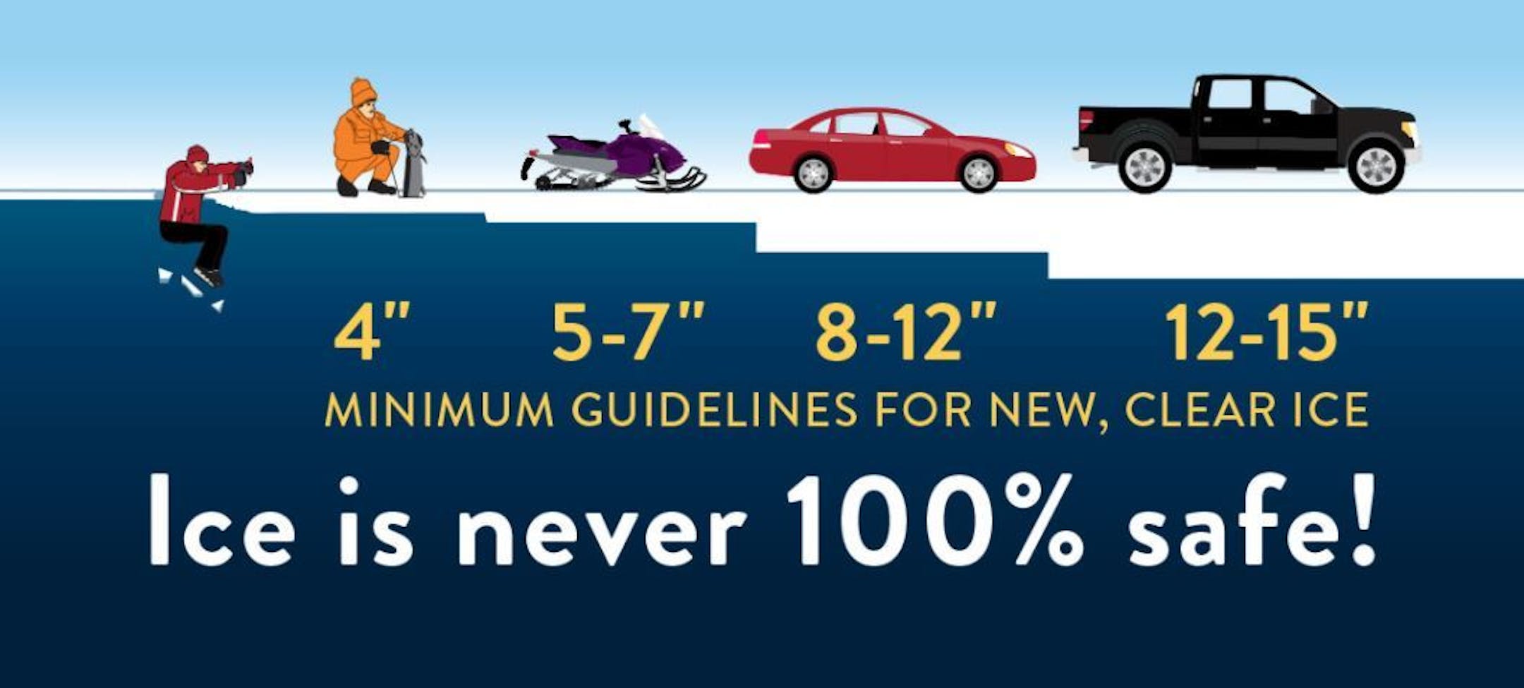
Ice Safety Guidelines
We've had several nights sub-freezing across the state and with that, ice is forming on area lakes and ponds. Keep in mind that many lakes around that state are still not safe to venture out on as of yet! Note that ice is never 100% safe, but you need at least 4" of ice to safely walk on. Stay safe out there!!