

Warm, Sunny Day Thursday - Storms Possible Overnight
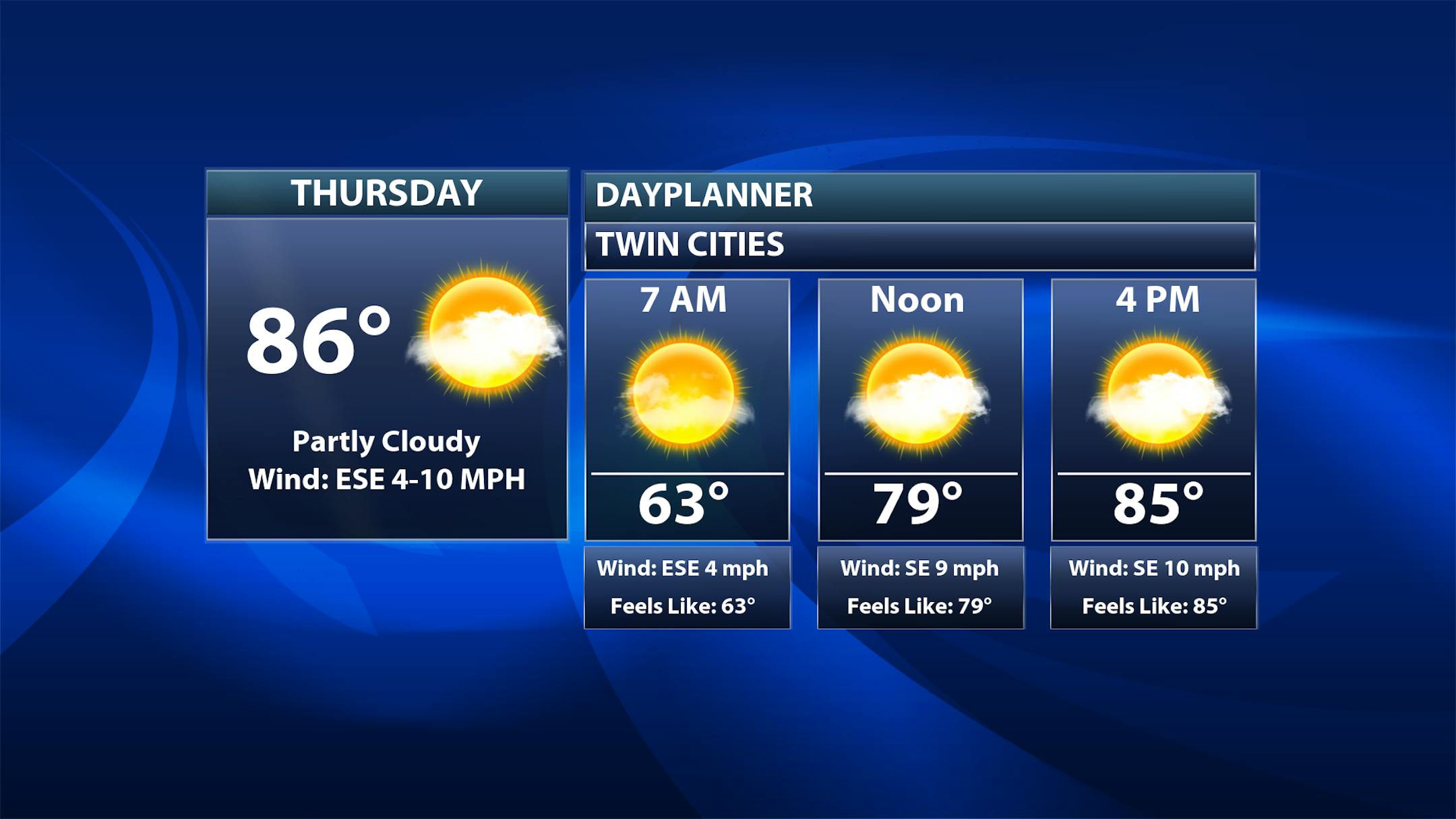
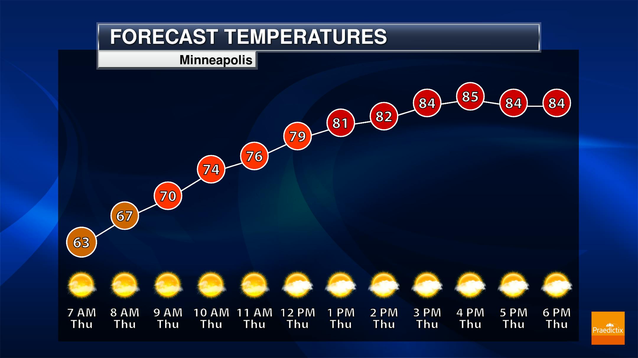
A warm and sunny Thursday is expected in the Twin Cities, with morning temperatures in the low 60s and highs topping off a few degrees above average in the mid-80s.
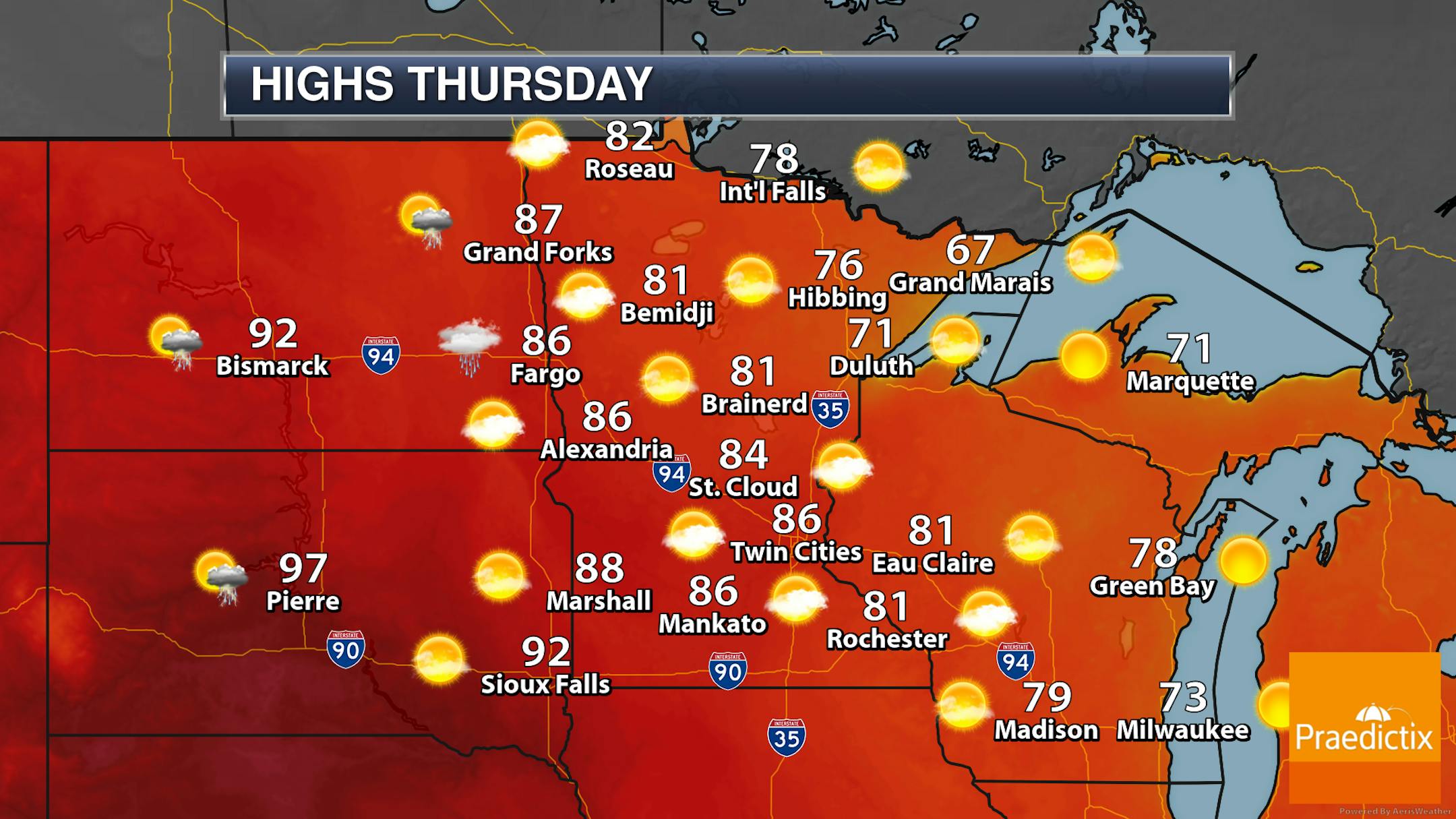
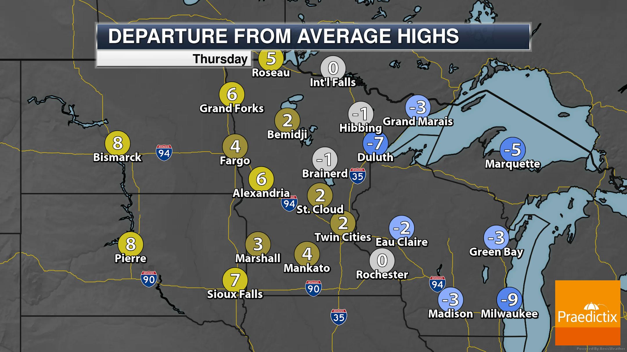
It should be a fairly quiet day statewide on Thursday, with mainly sunny to partly cloudy skies. Highs will generally be in the 70s and 80s - several degrees above average. Highs along parts of the North Shore will be a few degrees below average in the 60s.
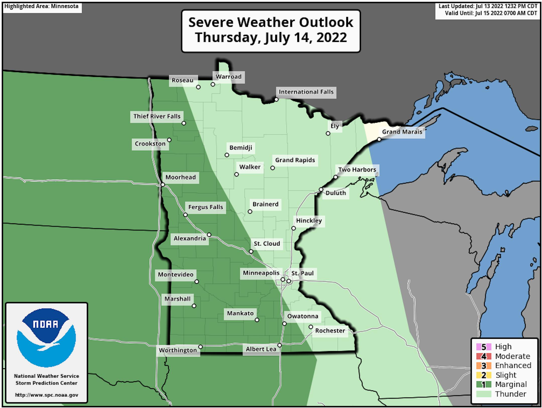
Meanwhile, as we head into Thursday Night, we will be watching the potential for a few showers and thunderstorms that could be on the strong side in western and southern Minnesota. Hail and wind would be the greatest threats where that Marginal Risk (threat level 1 of 5) is in place.
_______________________________________________
Approaching 90F Into The Weekend
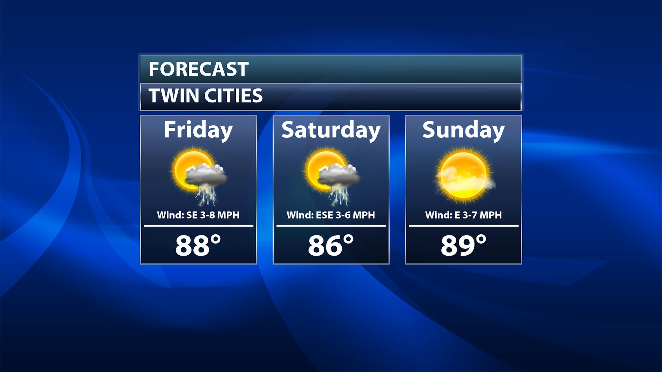
It'll be the third weekend of July this weekend, and we are looking at warm and (at least partly) unsettled weather. If your travels take you out of town already on Friday, we will be watching the potential for some showers and storms. The greatest chance of Friday may be during the morning hours (with anything lingering from Thursday Night) with more scattered storms possible Friday Night into Saturday. Sunday looks dry and sunny at the moment. Highs will be in the mid to upper 80s, and at least Sunday has a chance at breaking the 90F degree mark again.
_______________________________________________
Eleven 90F-Degree Days So Far
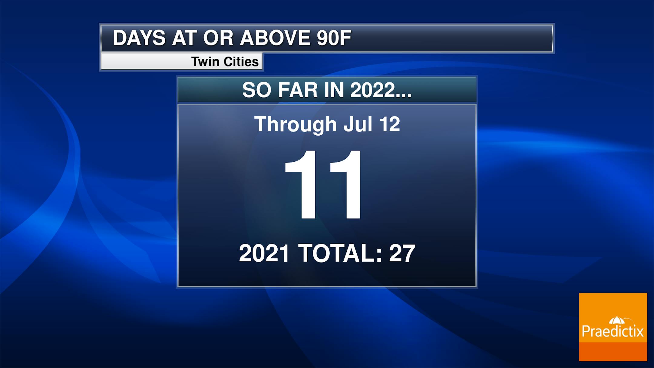
With the potential of 90s in the forecast this weekend, it's a good time to take a look at how many we've had so far in 2022. MSP has observed eleven so far (with one of those being that 101F day from June 20th). Our 1991-2020 average is 13 days.
_______________________________________________


