

Windy Weekend Weather
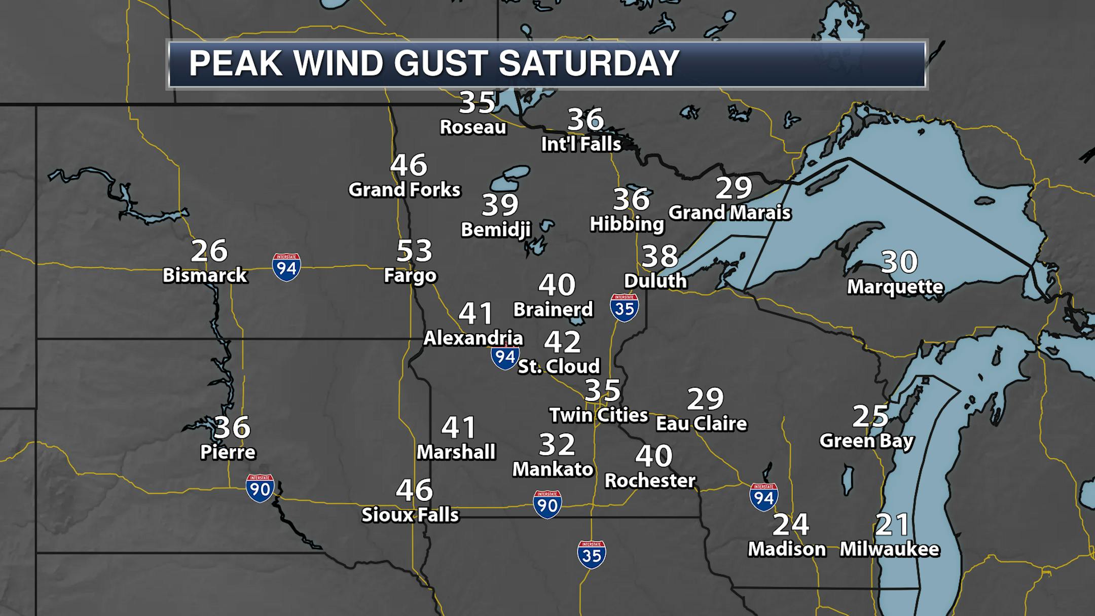
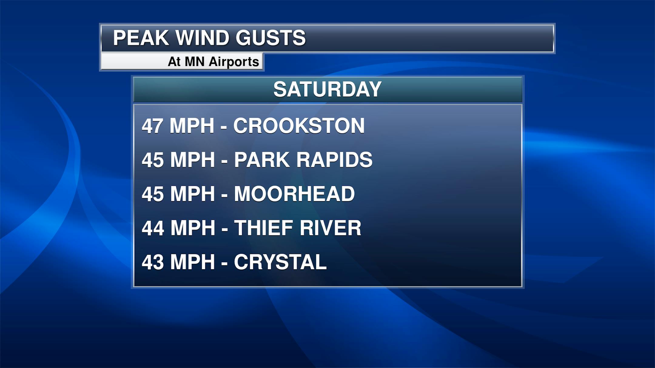
It was a blustery weekend of weather here in the upper Midwest, with windy conditions observed both days. On Saturday, the strongest winds were mainly out in western portions of the state. The peak airport wind gust was 47 mph in Crookston. Fargo, meanwhile, saw a peak of 53 mph.

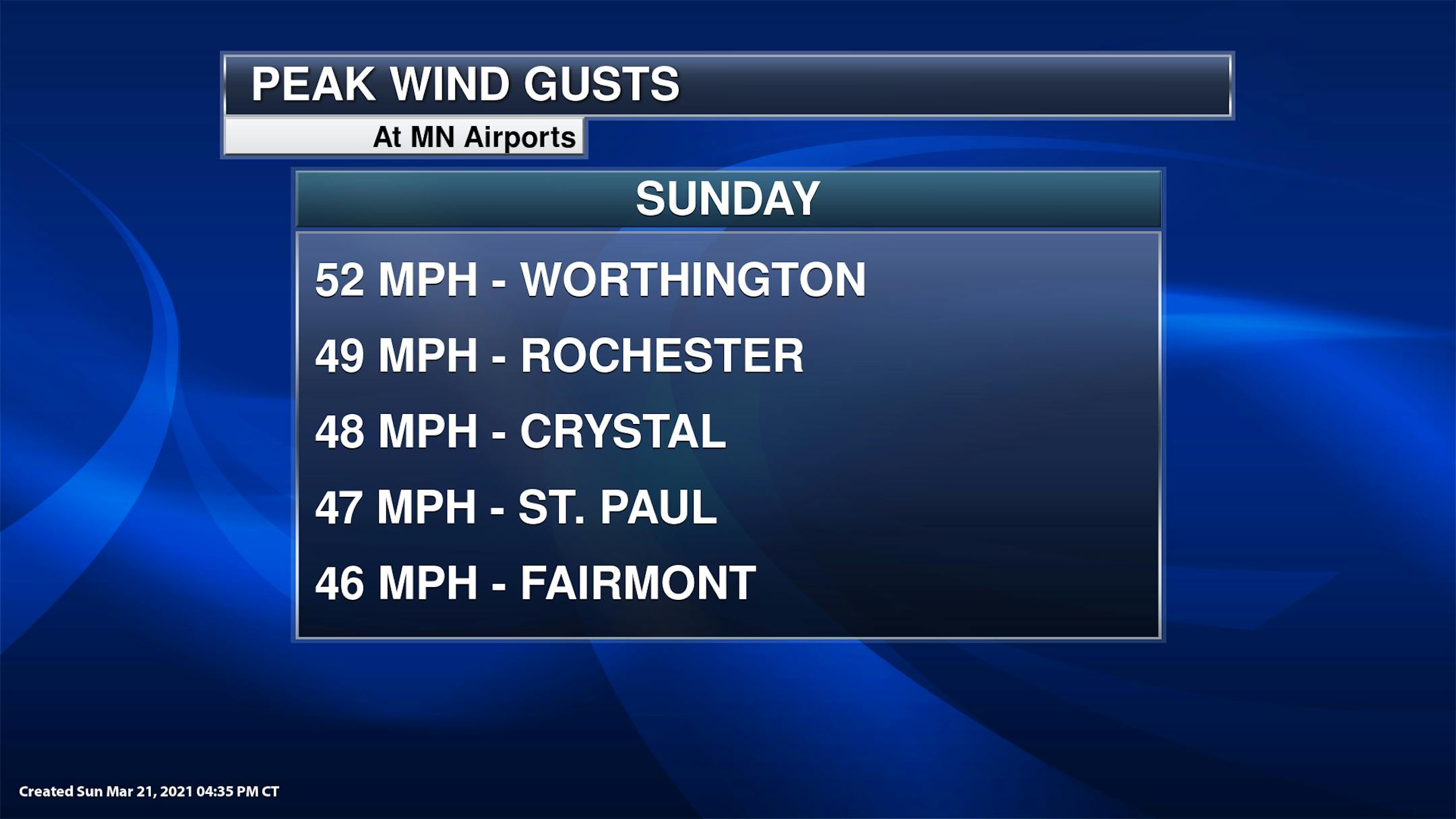
And windy weather continued on Sunday, when a Wind Advisory was in place across southern Minnesota. Through about 4:30 PM, the peak wind gust had been 52 mph in Worthington.
_______________________________________________
Record Highs From Saturday
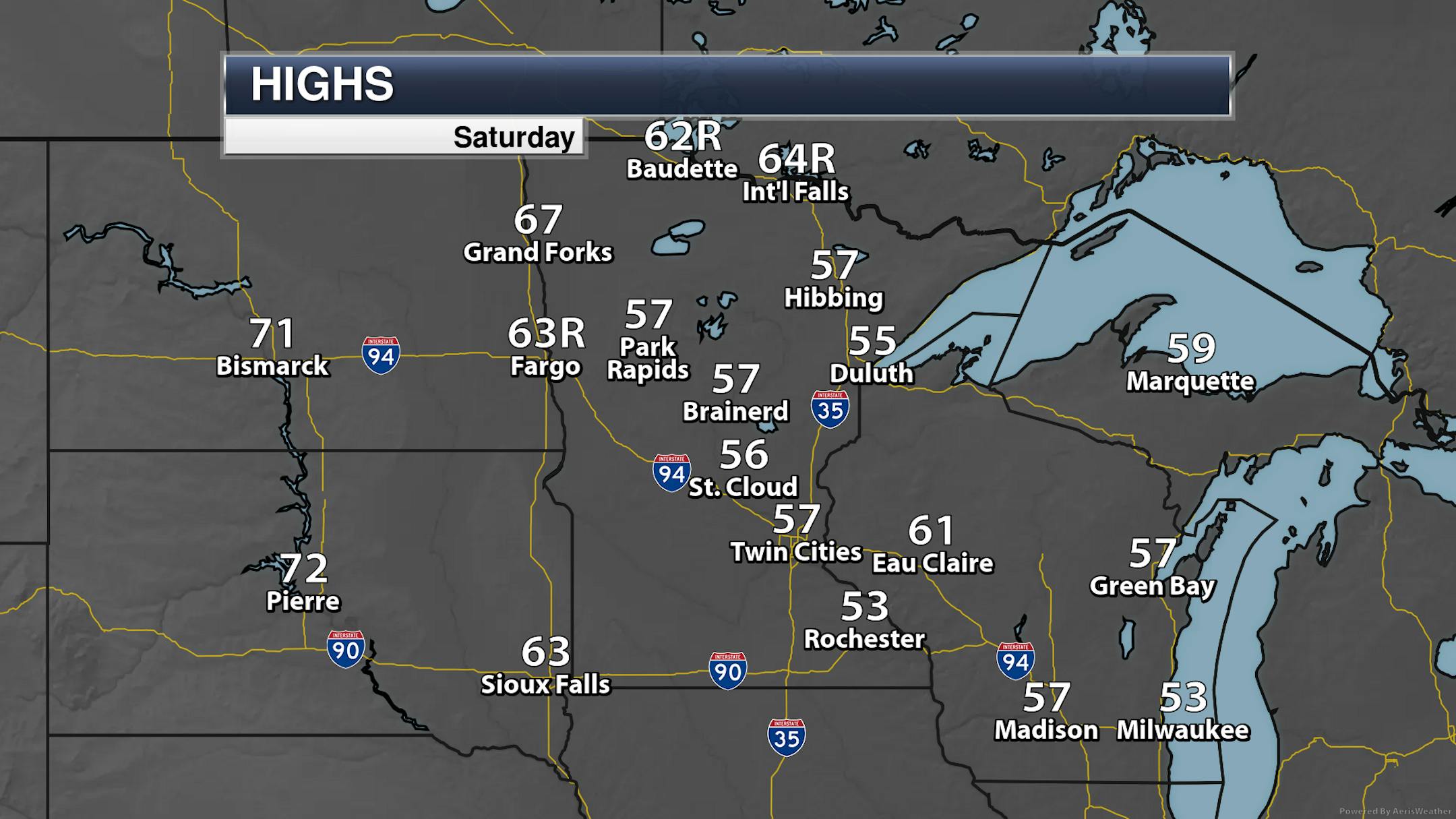
While we didn't see record highs on Saturday in the Twin Cities, we did up in northern portions of the state. The high of 64F in International Falls Saturday beat the previous record of 61F back in 2012 and 1987. The record high in Baudette was 59F in 2012. We also saw records tied or broken in Fargo, Jamestown, and Sisseton.
_______________________________________________
Melting Snow
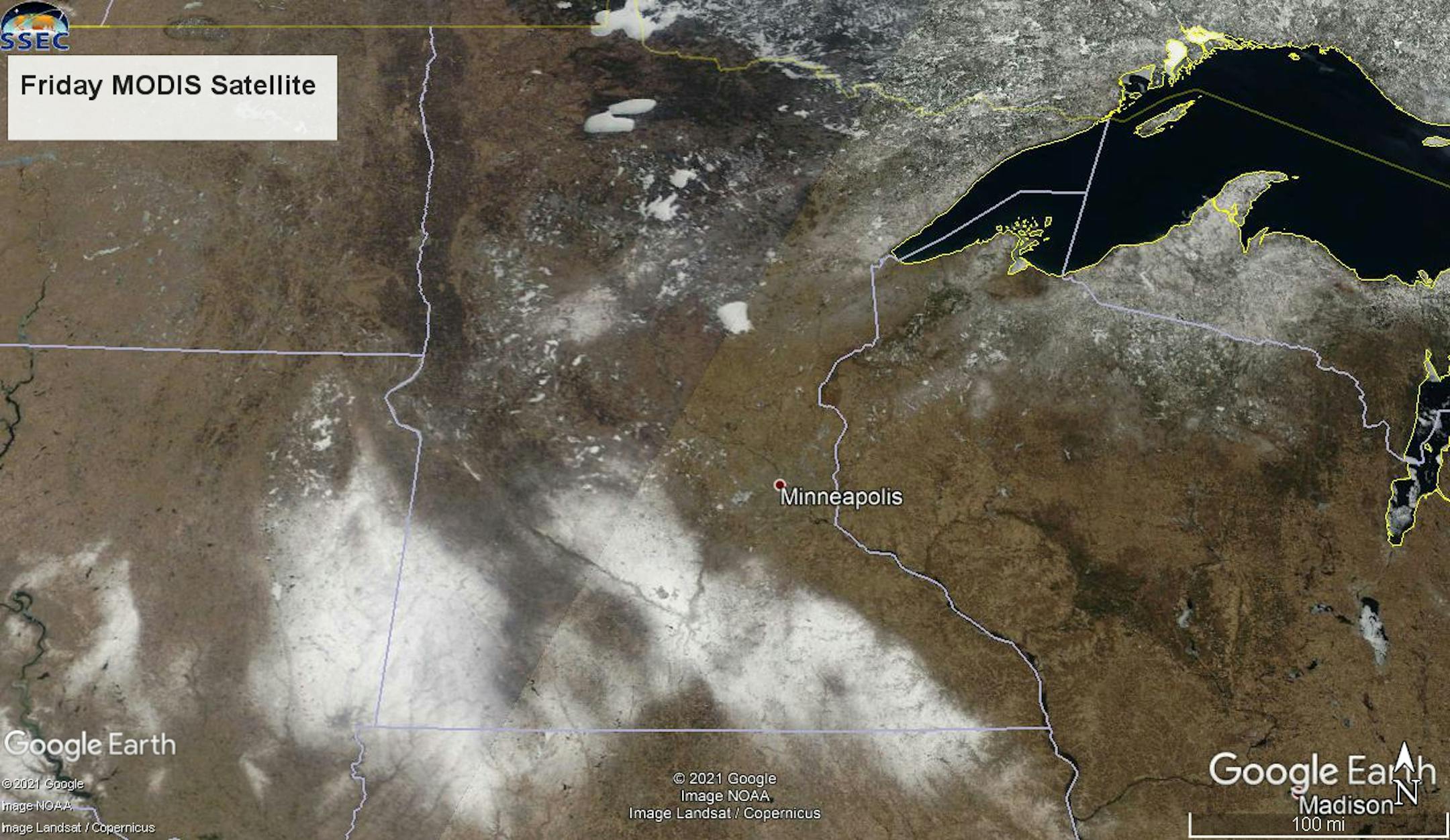
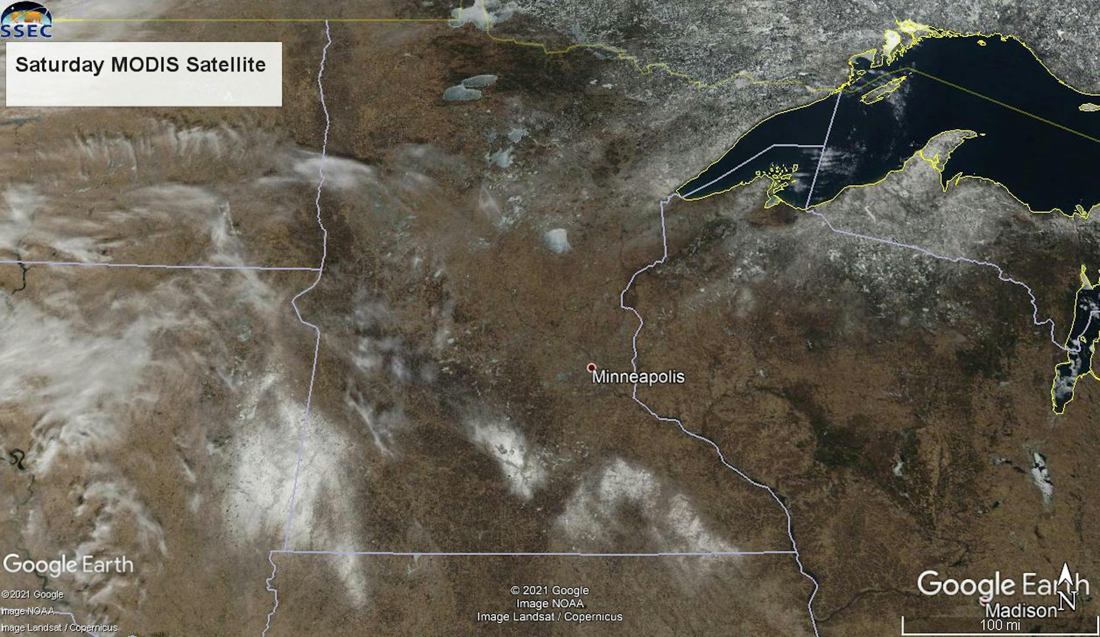
We can see the effect that the warmer temperatures and stronger winds have had on our snowpack the past few days with areas of snow across southern Minnesota greatly decreasing from the midday hours Friday to Saturday. We can also see the snow decreasing across northern Minnesota as well, though it is hanging on in parts of the Arrowhead. On these maps you can also see the ice still on area lakes for the moment. As of Sunday morning, there still had been no ice outs reported to the Minnesota DNR, though I would expect that to change this week with heavy rain in the forecast.
_______________________________________________
Monday Weather Outlook
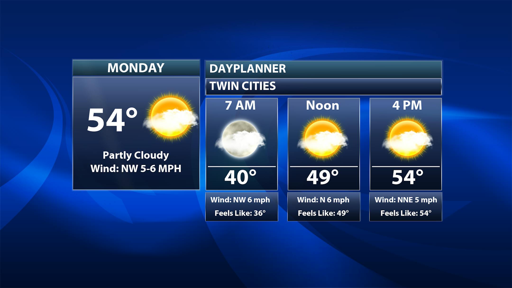
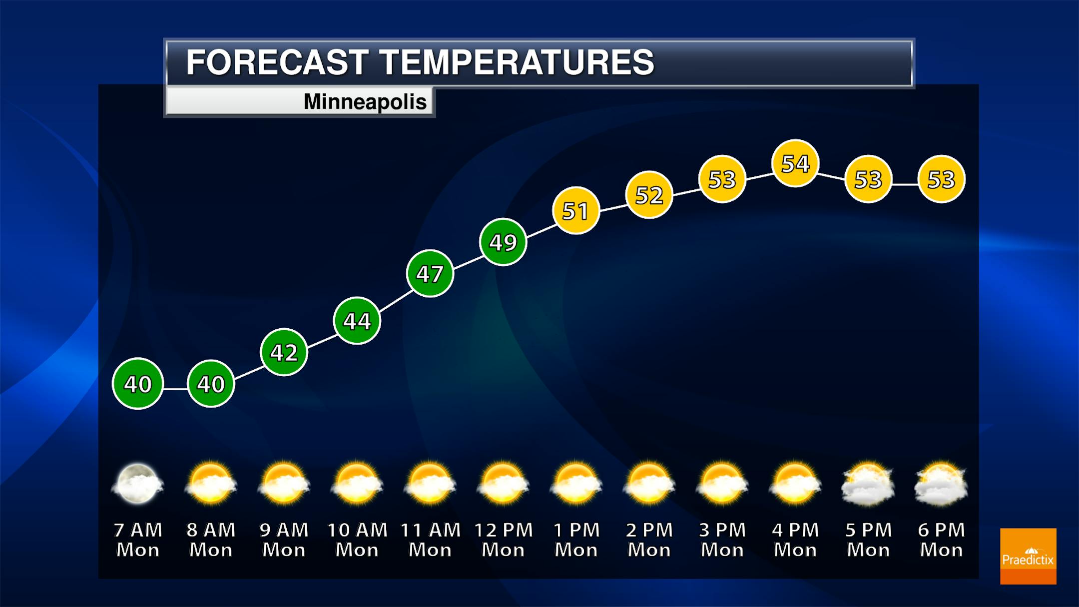
Behind a cold front, temperatures will be several degrees cooler on Monday than what we saw Sunday in the Twin Cities. Morning temperatures will start off around 40F before climbing into the mid-50s for highs. Partly sunny skies can be expected, especially because that frontal system lingers across portions of southeastern Minnesota.


