

Warmer, Not As Windy Monday
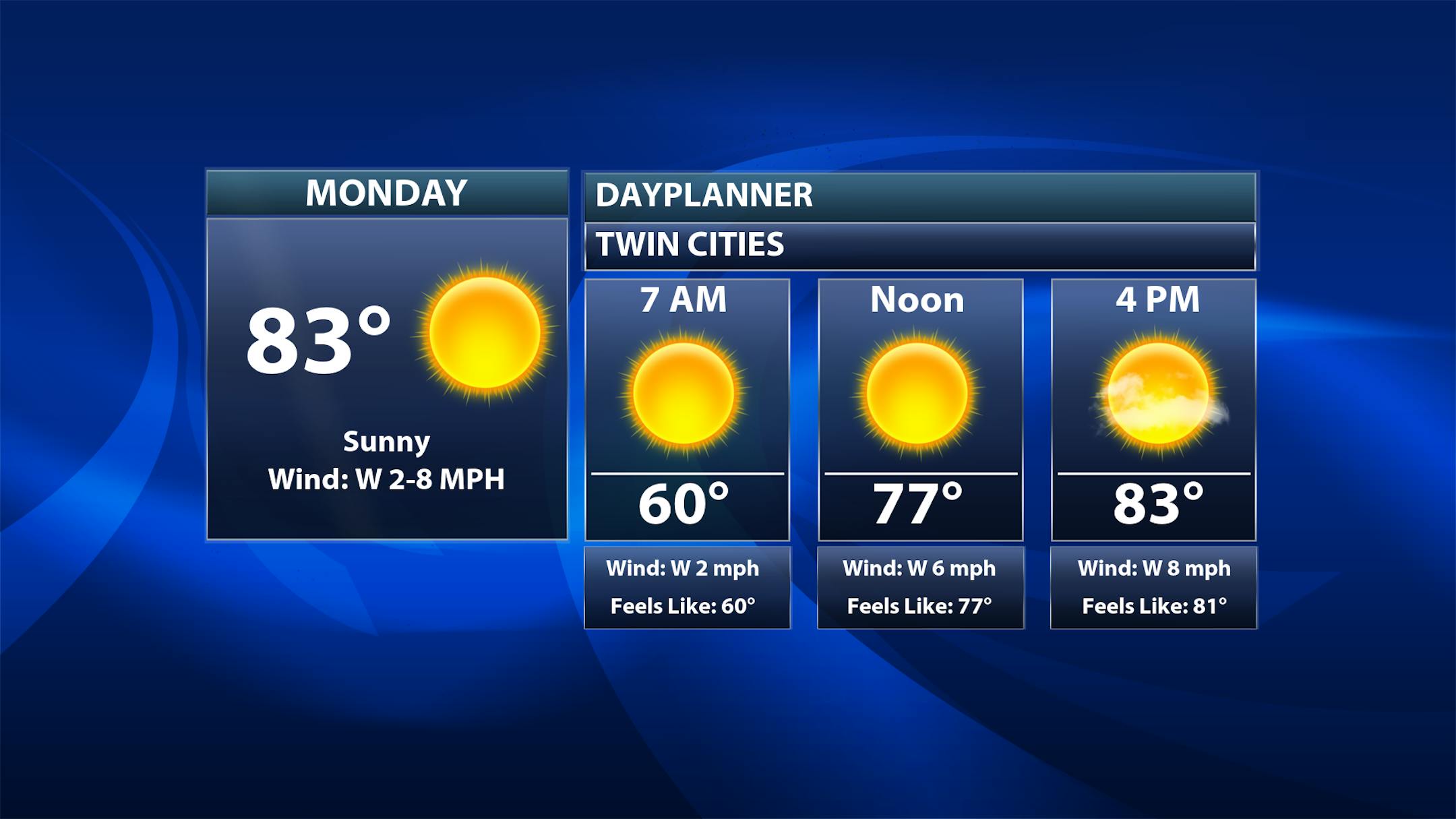
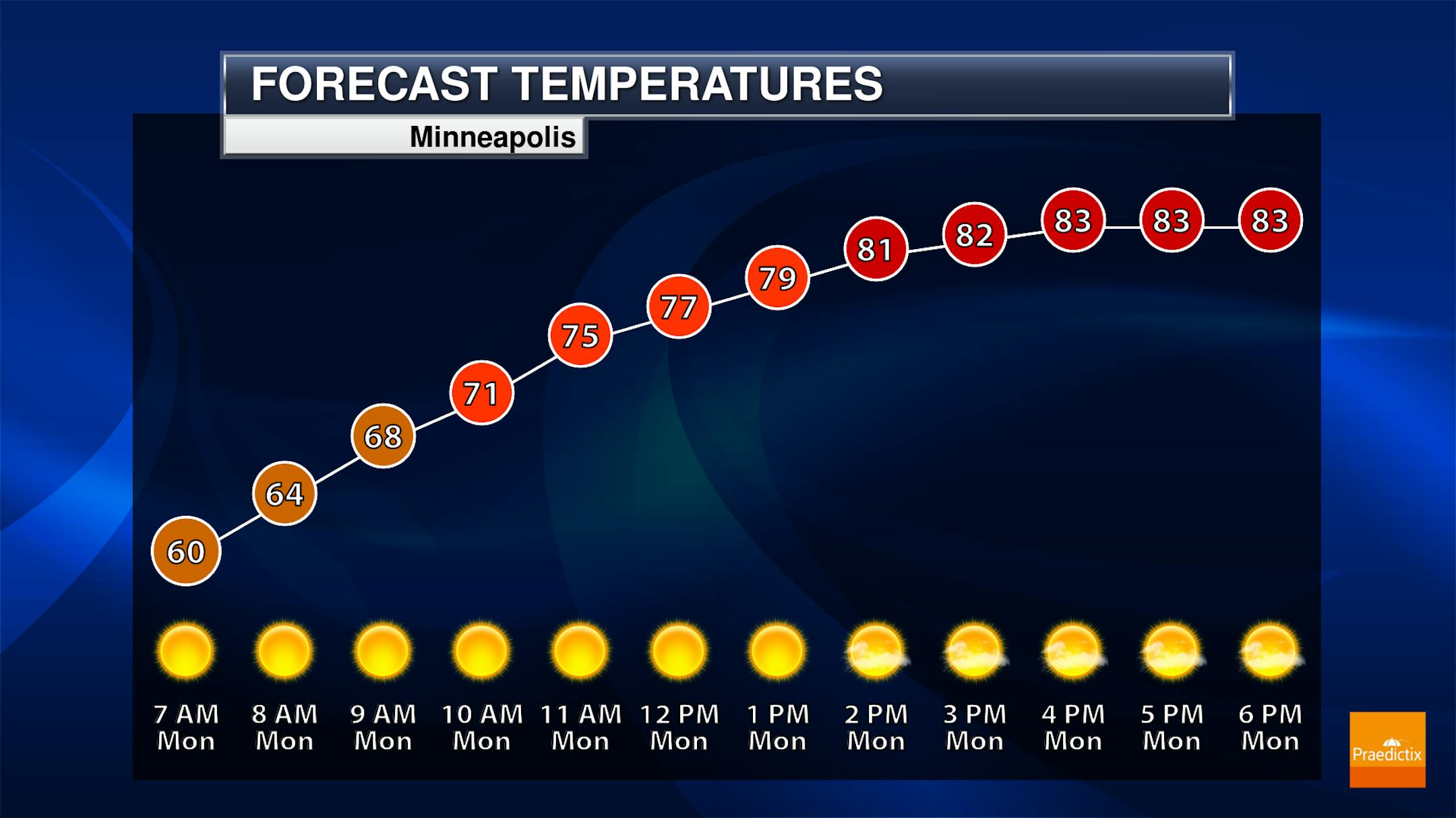
Another mainly sunny day with just some passing clouds is expected to begin the work week in the Twin Cities, with morning temperatures in the upper 50s to low 60s and highs in the low to mid-80s. It won't be as windy either with winds out of the west around 5-10 mph.
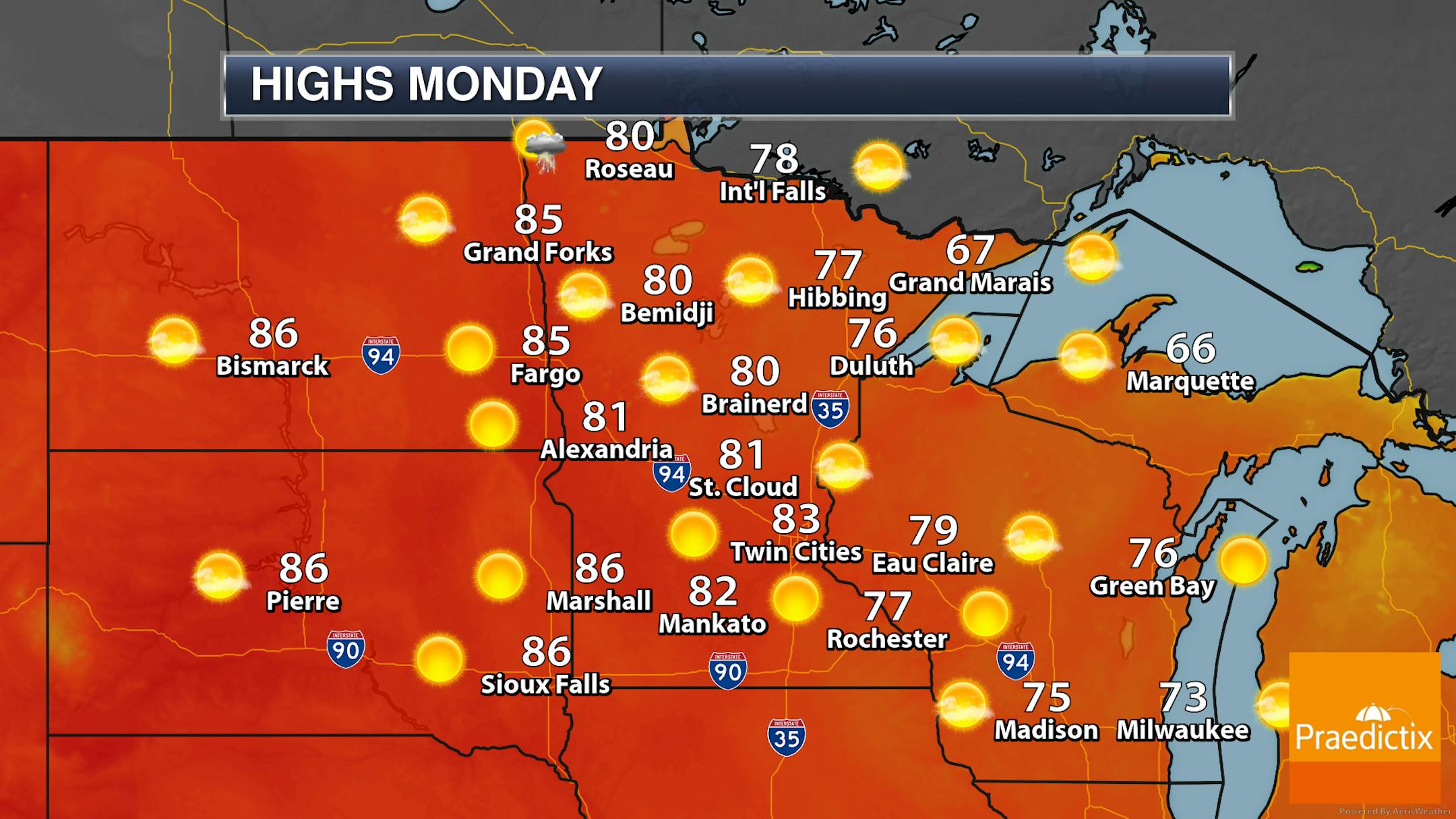
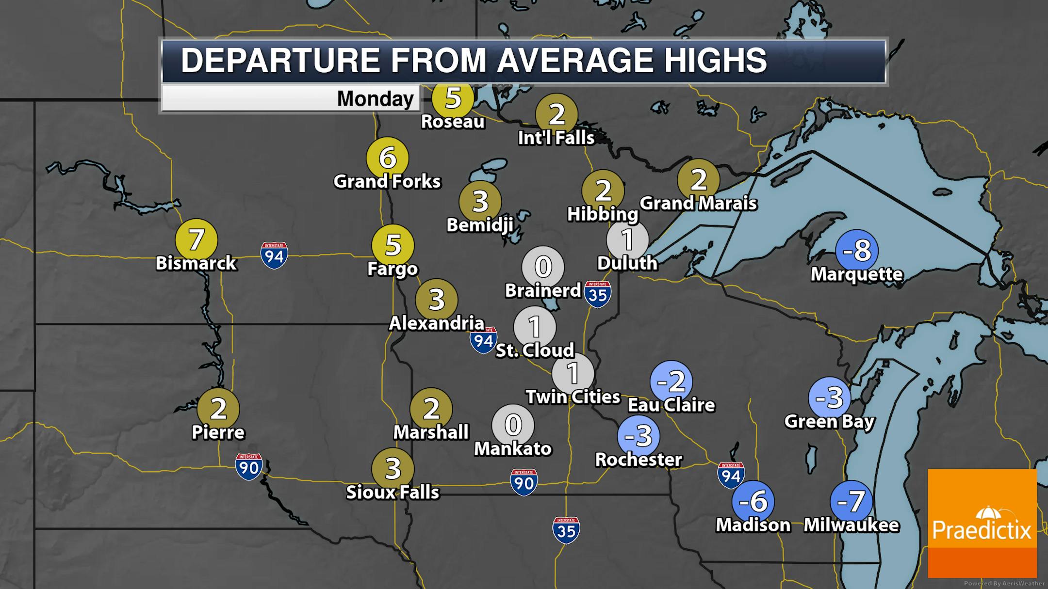
While most of Monday will be sunny across the state (and western Wisconsin), we will have to watch the potential of some pop-up storms during the afternoon hours across northern areas (mainly Brainerd and northward). Highs will climb mainly into the 70s and 80s across the state, with temperatures a few degrees cooler along the North Shore.
_______________________________________________
Severe Threat Tuesday
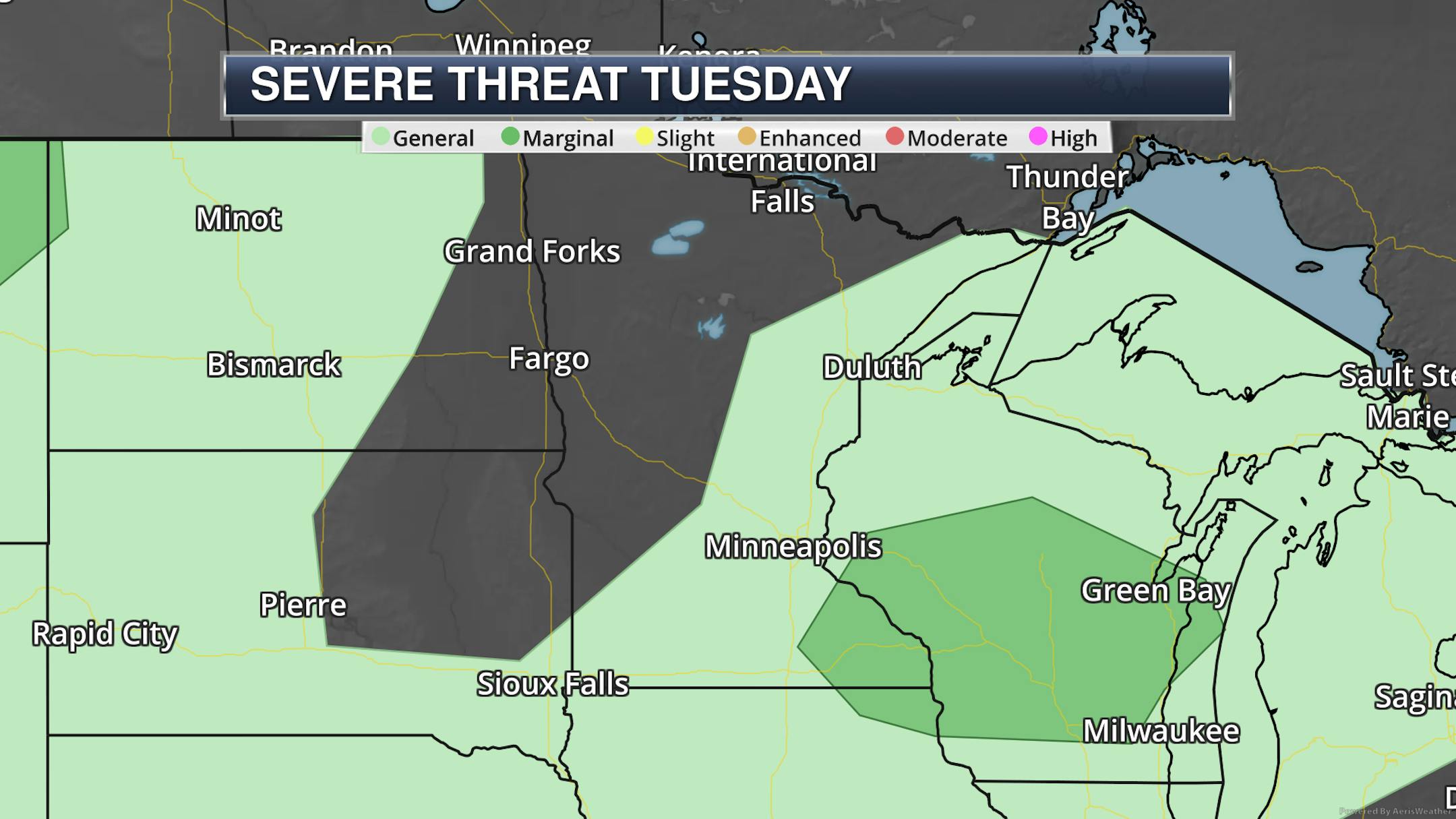
As we head into the late afternoon hours on Tuesday, another round of showers and storms are expected to erupt - mainly across southeastern Minnesota into Wisconsin. A few of those could be strong with hail and wind, and due to that, a Marginal Risk (threat level 1 of 5) is in place.
_______________________________________________
Warming Up For Mid-Week
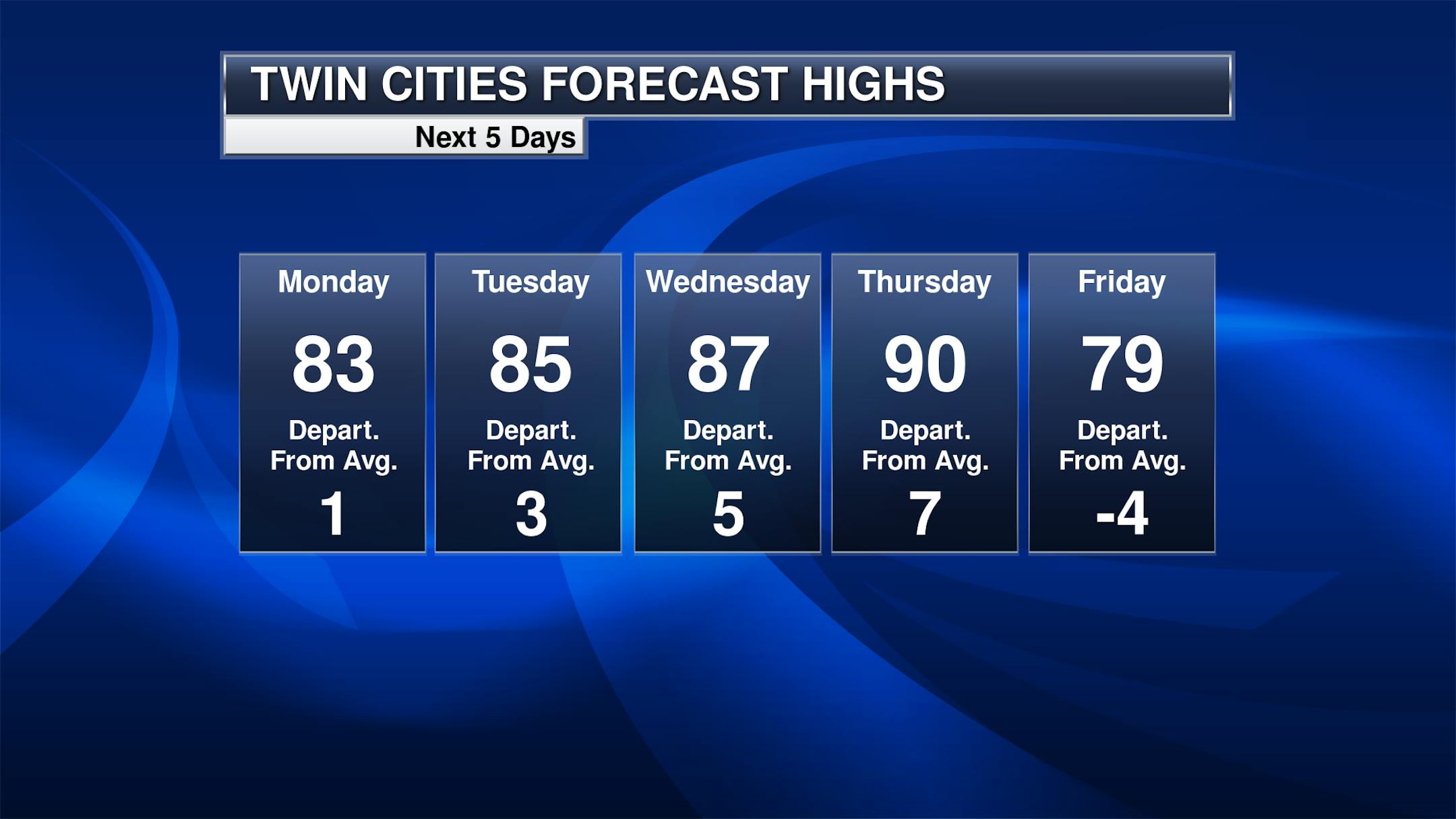
Temperatures will be on the climb as we head into the middle of the week, with highs warming through the 80s and potentially nearing 90F Wednesday and Thursday. A cold front puts a kibosh on the warming trend after that, helping to drop temperatures back into the upper 70s near 80F for Friday.
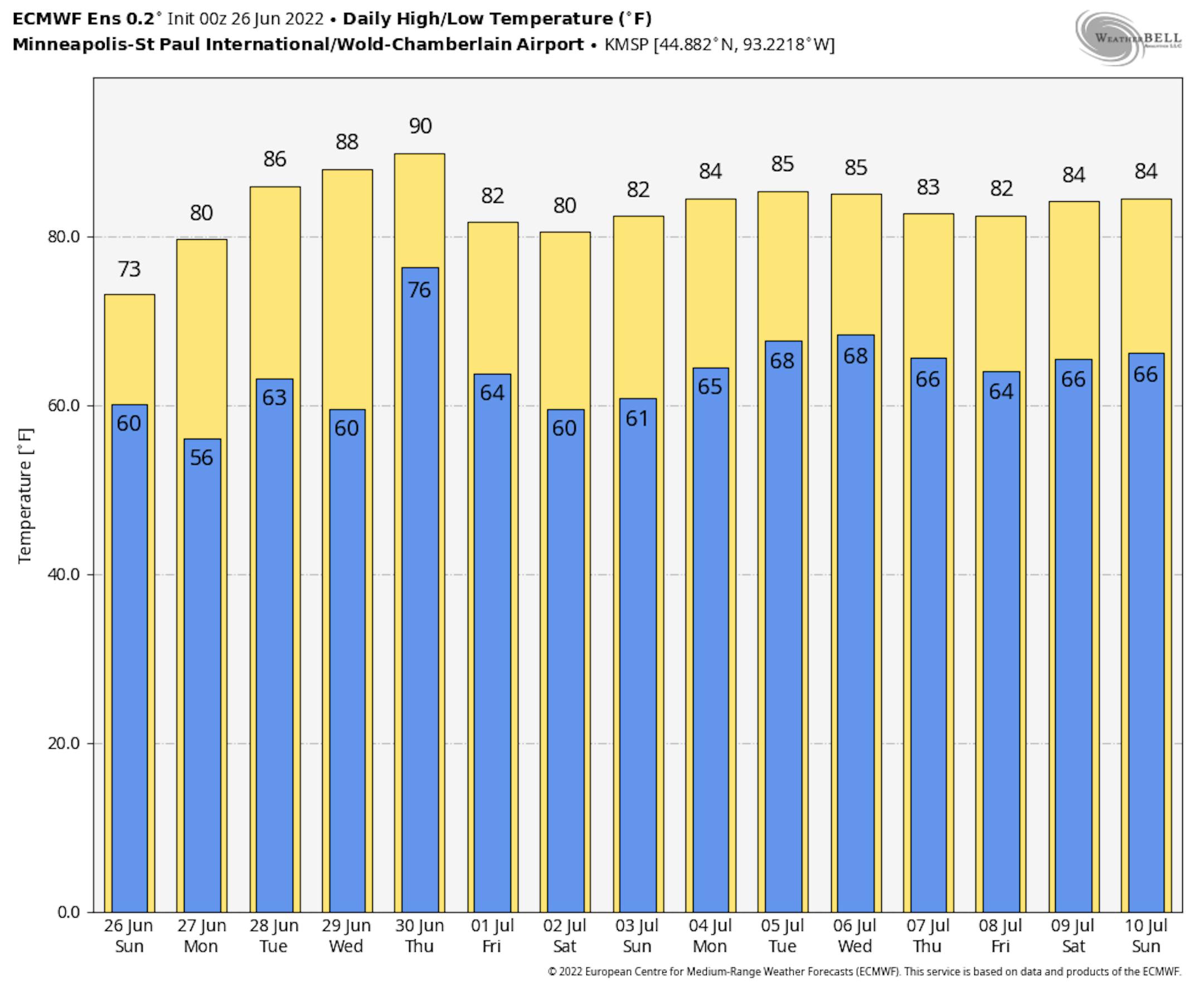
Meanwhile, an early look at temperatures for the extended Independence Day weekend shows low to mid-80s - definitely not too shabby!
_______________________________________________


