

Saturday Weather Outlook
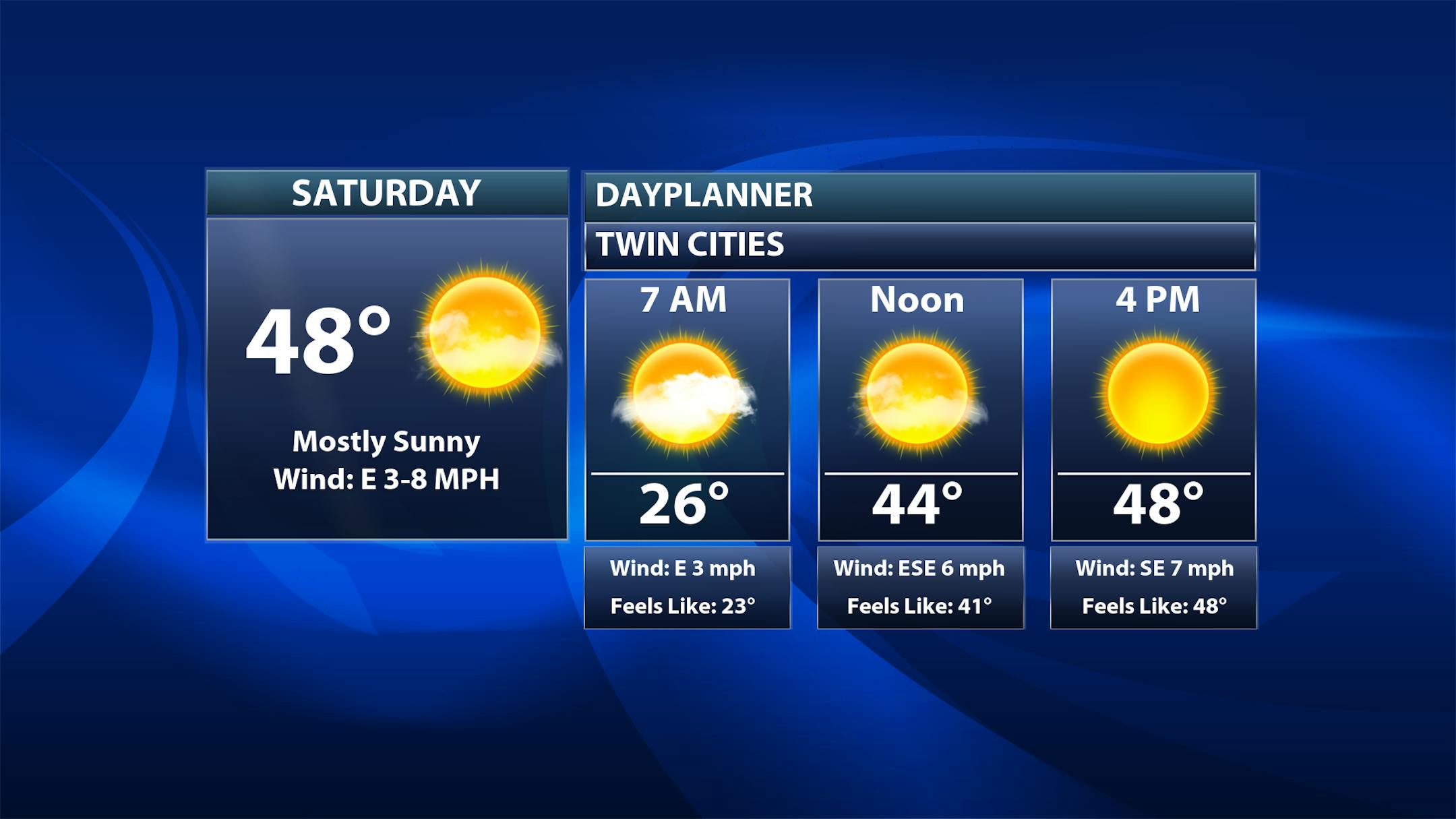
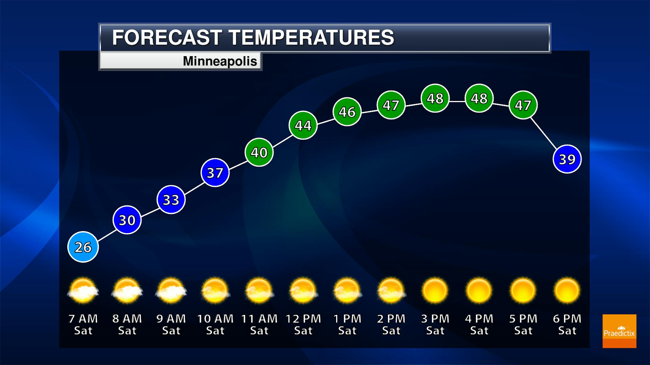
Some clouds could be around as we head into the morning hours Saturday, but sunnier skies are expected by the midday and afternoon hours with another pleasant day ahead. Temperatures will start off in the mid-20s, climbing to near 50F for a high.
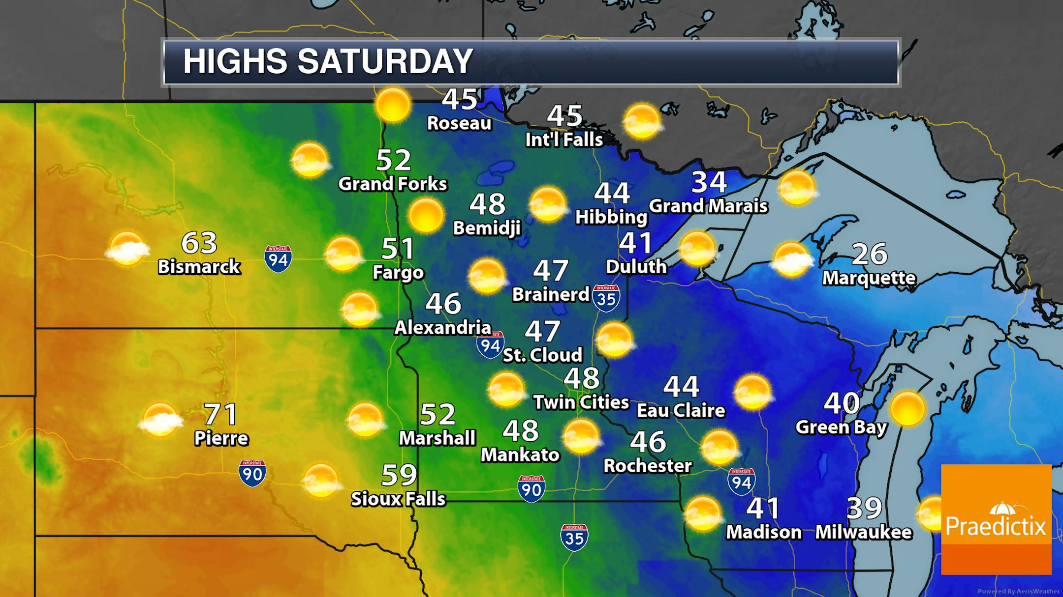
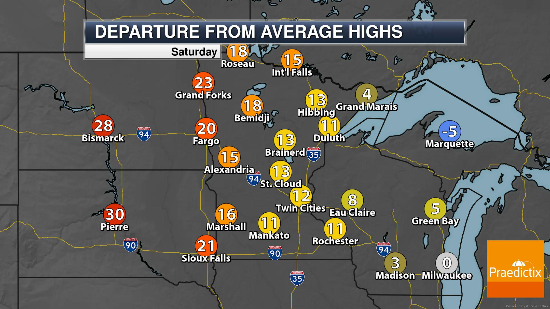
A fairly sunny day is expected across the state on Saturday, with highs mainly climbing into the 40s. Northeastern Minnesota will be the cold spot, with areas staying in the 30s. Across portions of southern Minnesota, highs could climb into the 50s. These highs will be up to 20F degrees above average in western Minnesota.
_______________________________________________
Even Warmer Sunday And Monday
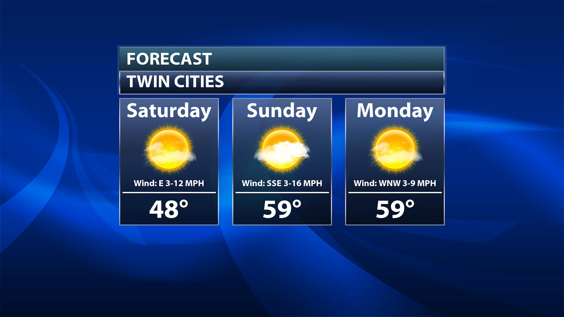
As we look at the rest of the weekend and early next week, temperatures will get another boost upward, with highs topping off around 60F both Sunday and Monday. A few more clouds can be expected Sunday, with sunnier skies once again Monday.
_______________________________________________
Record Highs Tuesday?
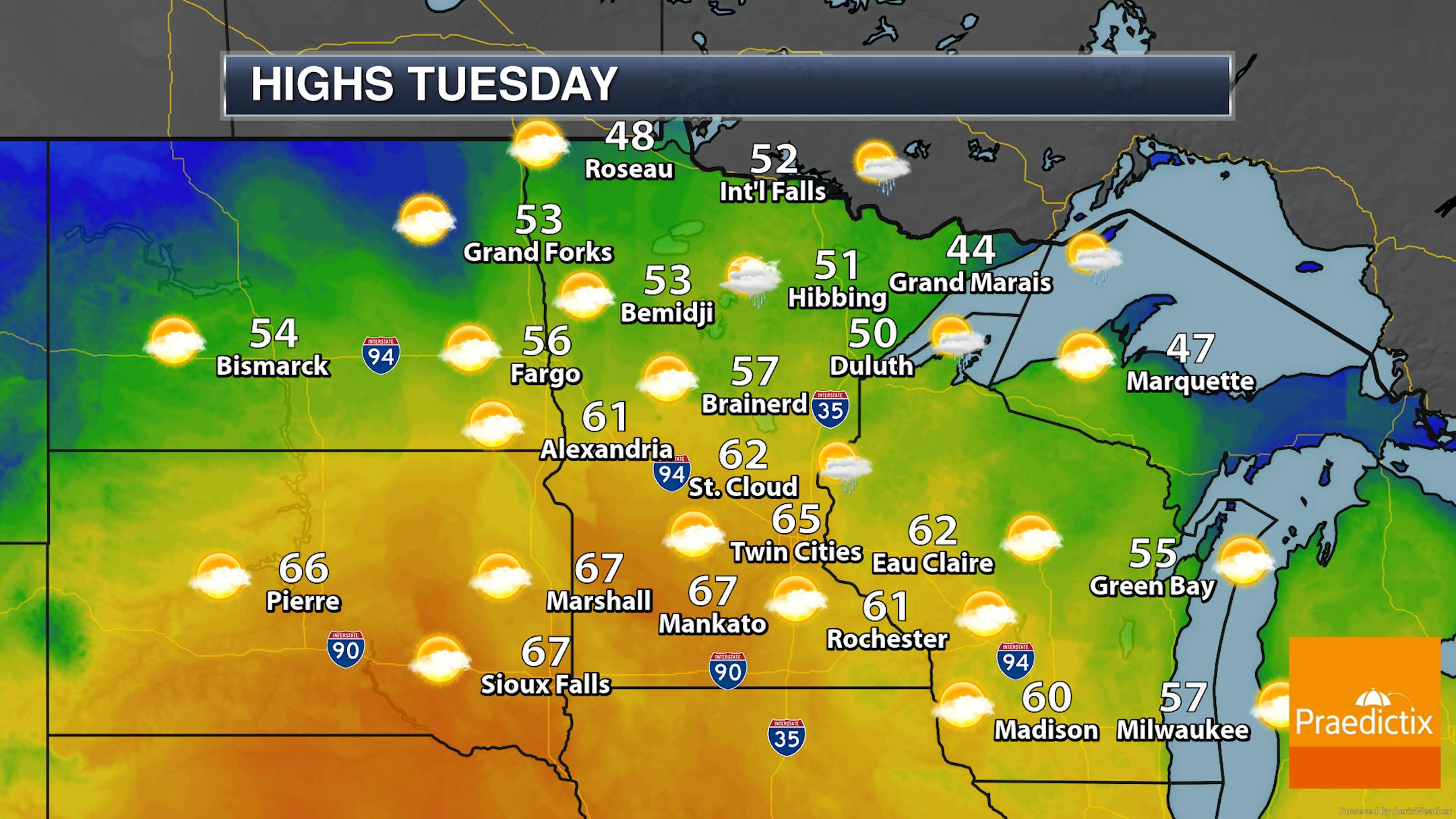
The warmest day of this stretch will be Tuesday, as highs climb into the 60s across southern and central Minnesota. These temperatures could be record-breaking across the region! Here's a listing of the records for Tuesday:
- Twin Cities: 61F in 1879
- St. Cloud: 61F in 1911
- Brainerd: 58F in 1977
- Rochester: 59F in 1977
- Eau Claire: 58F in 1902
_______________________________________________
Average First 50F And 60F
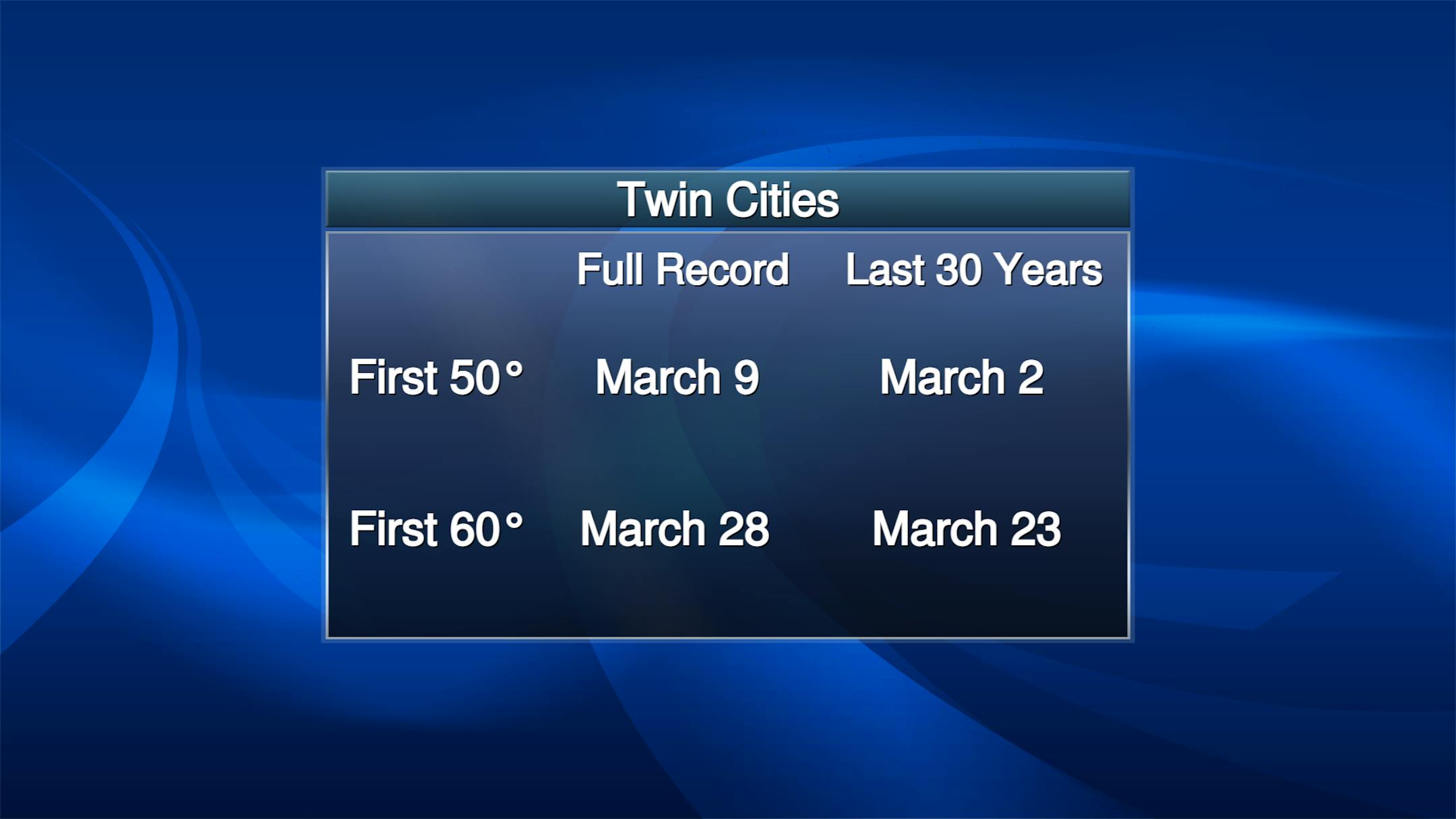
As we look at the average first 50F and 60F temperature in the Twin Cities, the first 50F typically occurs in early March, with the first 60F toward the end of the month. However, our first 50F and 60F has been occurring earlier over the past 30 years vs. looking at the entire Twin Cities record back to the 1870s. In 2020, our first 50F degree day was on March 1st, with the first 60F occurring on March 8th.


