

First Below Zero Low For MSP This Season
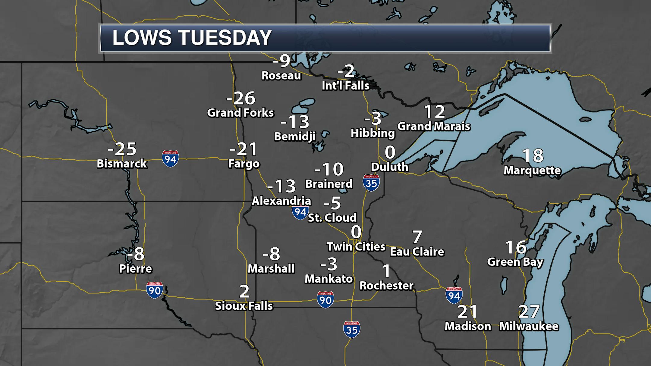
Even as temperatures dropped Tuesday Night here in the Twin Cities, we did not drop below zero on Tuesday with an official low of 0F at 11:59 PM.
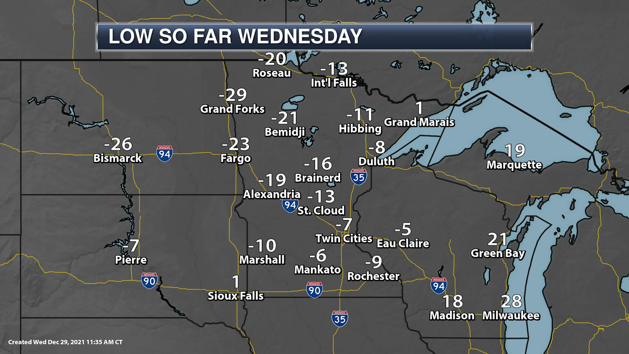
However, as temperatures continued to drop through the overnight hours, we did finally secure our first below zero low this season at MSP with a morning low of -7F. Areas in northwestern Minnesota dipped into the -20s, with the coldest low I could find being Hallock at -33F.
_______________________________________________
Thursday Weather Outlook
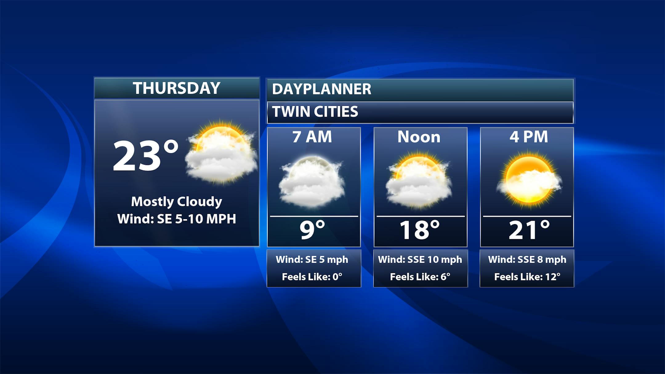
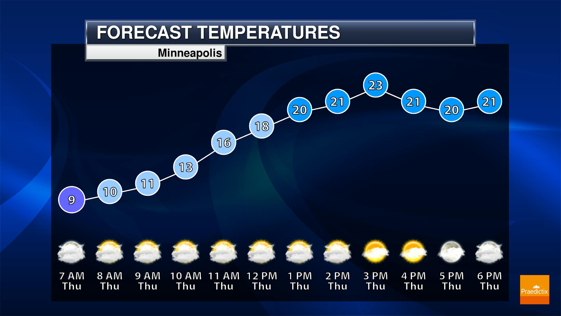
We aren't likely dipping below zero in the Twin Cities Wednesday Night, with overall lows in the low to mid-single digits above zero. Highs will climb in the metro into the low and mid-20s on Thursday with more clouds than sun for most of the day.
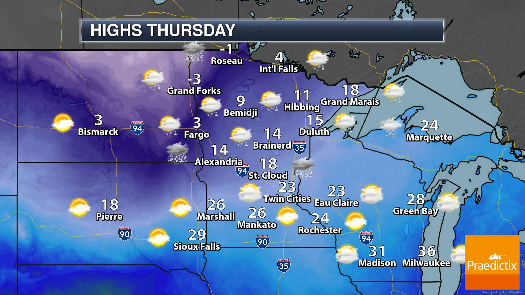
With the clouds around Thursday, we could see some puffs of snow at times during the day that won't accumulate too much. Highs will be below zero in northwestern Minnesota but climb into the 20s across southern areas of the state.
_______________________________________________
Cold End To 2021, Start To 2022
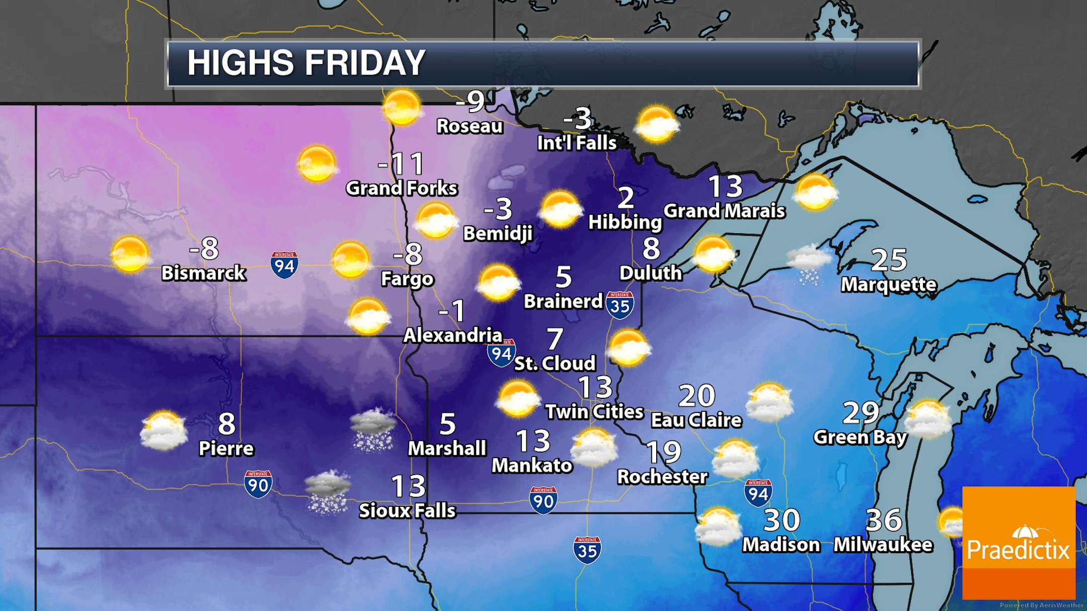
As we head toward the last day of 2021, another blast of cold air will move in across the state, bringing highs far below zero up toward Roseau and Grand Forks but in the teens above zero in southeastern parts of the state. A puff or two of snow might be possible at times, especially farther southwest, but accumulations look minimal if any snow does occur.
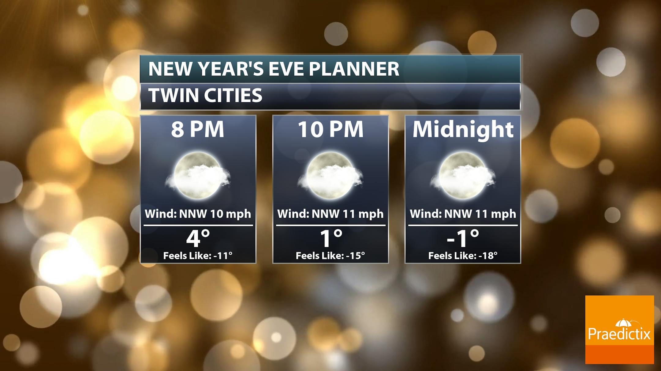
If you're heading out to celebrate the new year Friday Night, you're going to want those parkas! By the time we ring in 2022 at Midnight temperatures are expected to be below zero. However, with north-northwest winds around 10 mph, it'll feel much closer to -20F out!


