
Snow Reports From Saturday
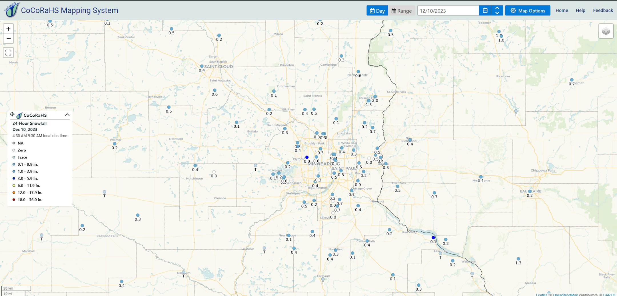
While Saturday's system didn't produce as much accumulating snow as I expected (thanks to daytime temperatures just a few degrees too warm for the light precipitation), we did get some accumulation once temperatures started cooling near sunset. The metro saw a general half inch or so of snowfall, but up toward Chisago City, there were CoCoRaHS reports up to 2". MSP Airport officially picked up 0.4" of snowfall on Saturday, bringing the season total up to 4.5" (6.4" below average so far).
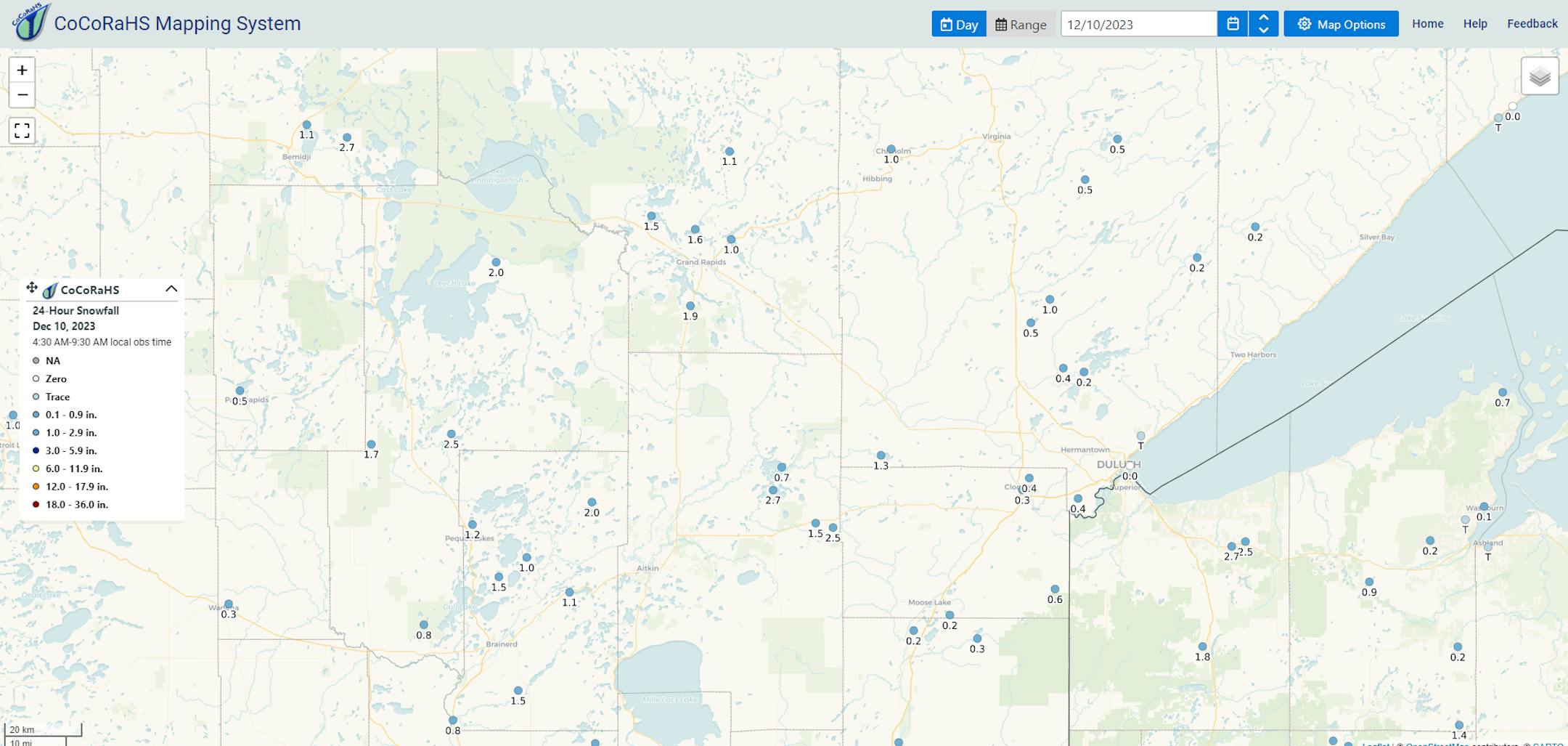
Up across northern Minnesota, where cooler air was in place, nearly 3" fell near McGregor, with 1-2" around Grand Rapids and the Brainerd Lakes area.
_______________________________________________
Mostly Sunny Monday - A Few Snow Showers Up North
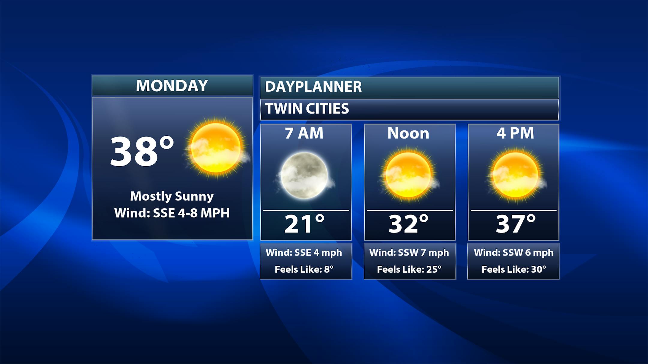
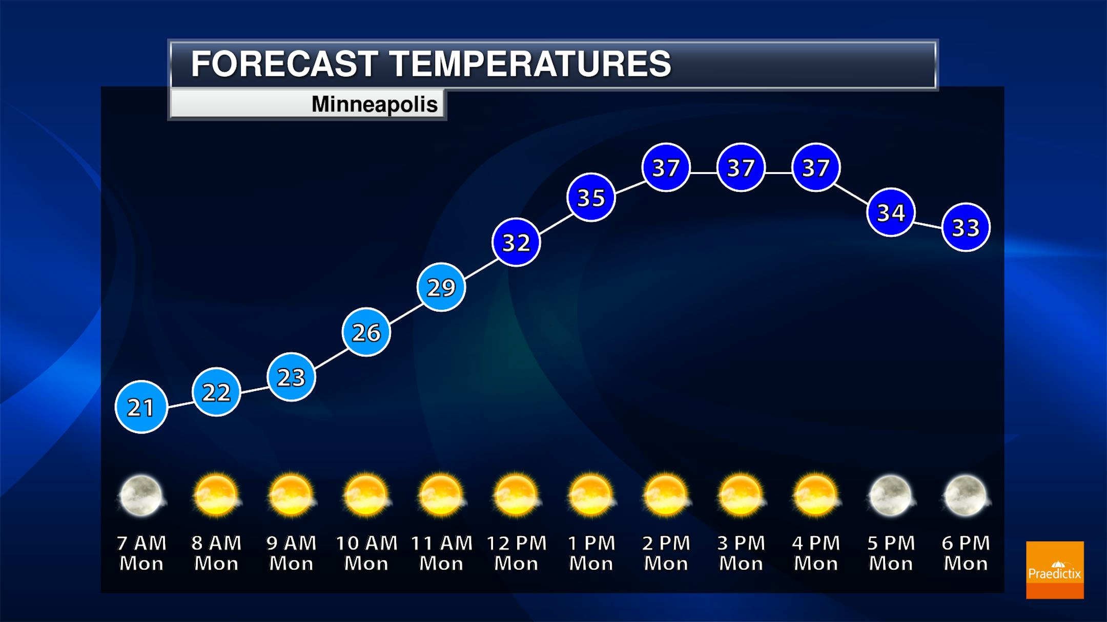
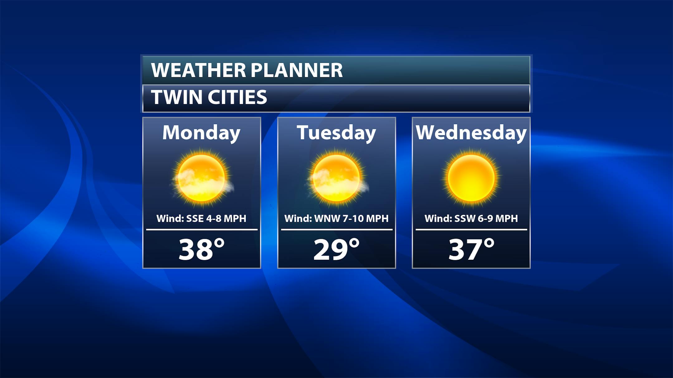
While we will see some clouds around during the morning hours, a mostly sunny day can be expected. Morning lows will be around 20F in the metro - but it'll feel more like the single digits as you head off to work or send the kids off to the bus stop. Highs will climb to the upper 30s.
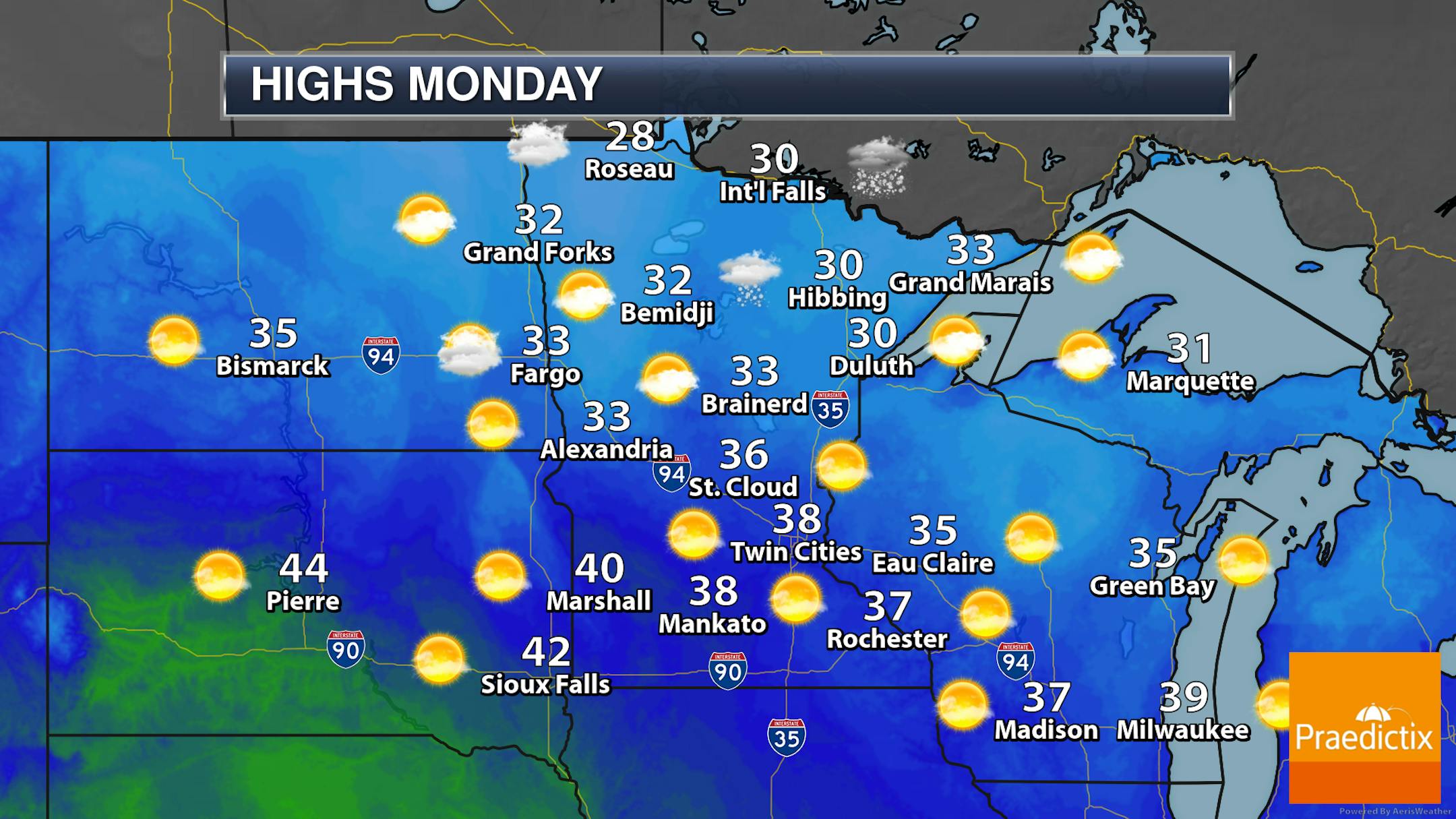

A few snow showers are possible across northern Minnesota during the afternoon and evening hours on Monday, and a few could even be possible in far western Minnesota late in the day. These would be along/just behind a cold front that will bring in a burst of cooler air for Tuesday. However, on Monday, highs will range from the upper 20s in northwestern Minnesota to the low 40s in southwest Minnesota.
_______________________________________________
30s And 40s Continue With Very Few Chances Of Precipitation
Once we get past Monday...
Tuesday: We'll continue to see sunny skies behind the cold front, but it will be a chilly day out there. Highs will only reach the upper 20s. Once you add in northwesterly winds that could gust as high as 30 mph, it'll only feel like the teens through the afternoon hours.


