

Strong Storms Friday Evening
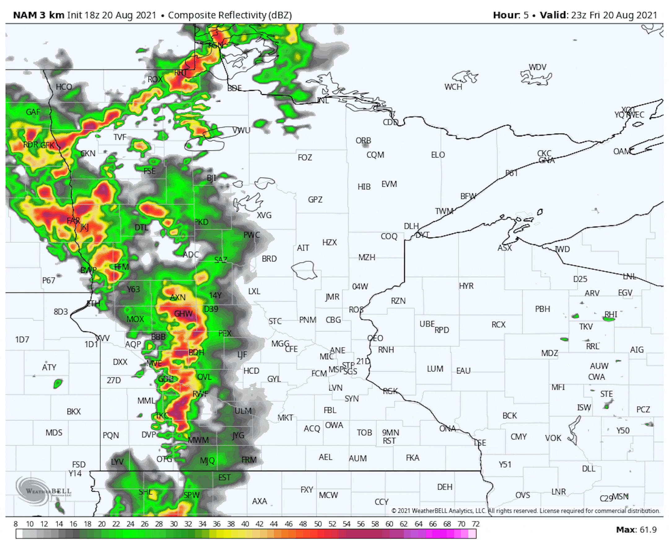
We are watching storms as we head through Friday evening that could be on the strong side as they move across the state. Models show the storms reaching the metro in the 10 PM-12 AM timeframe. The loop above goes from 6 PM Friday to 6 AM Saturday. The greatest threat from storms will be damaging winds, though some large hail and isolated tornadoes can't be ruled out.
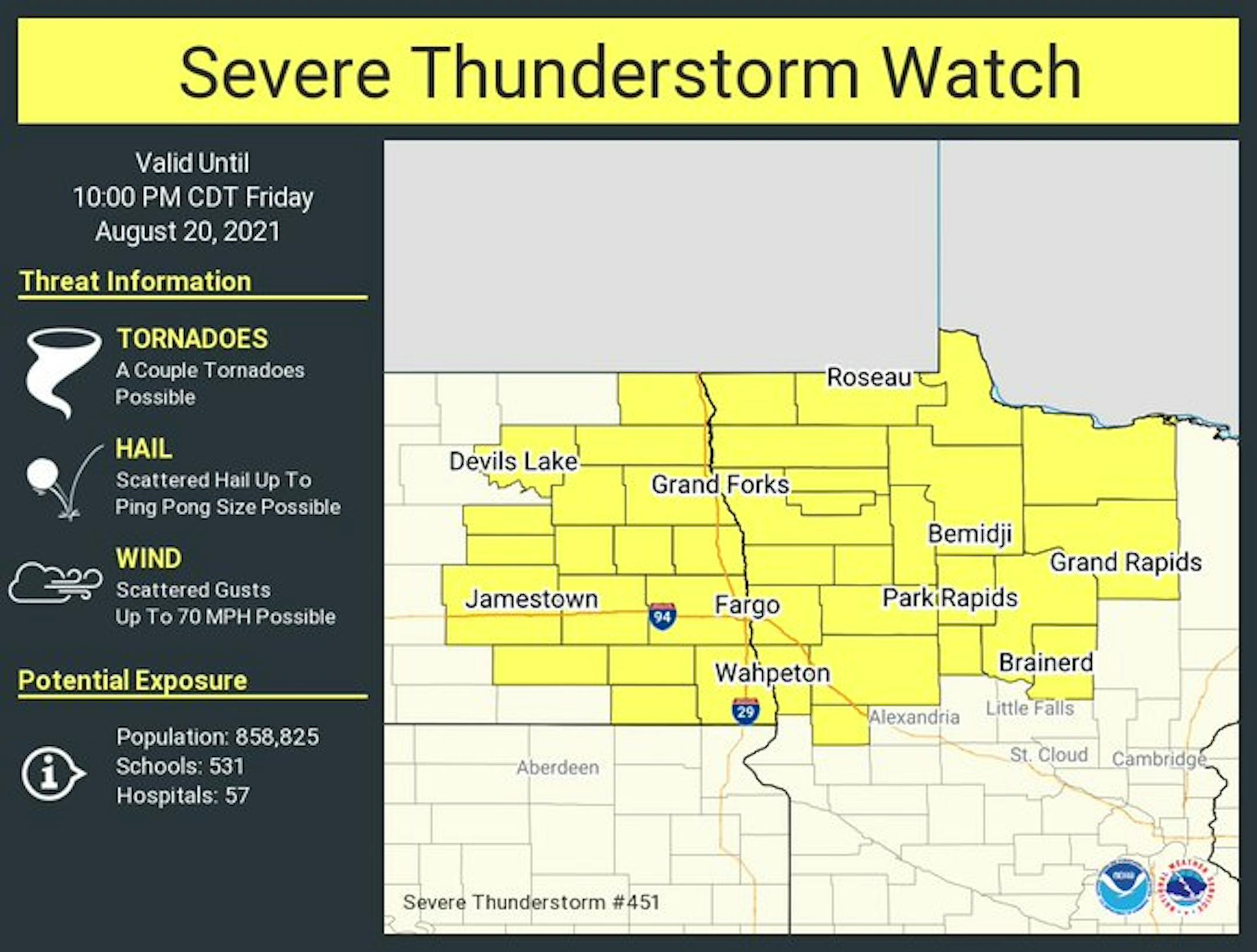
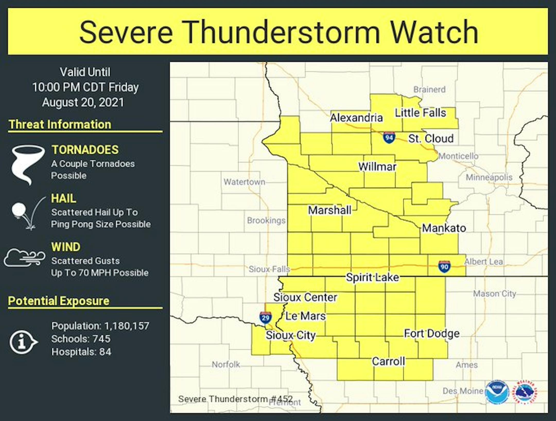
As of posting time, there was a Severe Thunderstorm Watch in place across northwestern Minnesota through 10 PM Friday night, and another one in western Minnesota as close as the St. Cloud, Hutchinson, and Mankato areas through 10 PM as well.
_______________________________________________
Northern Minnesota Fire Update
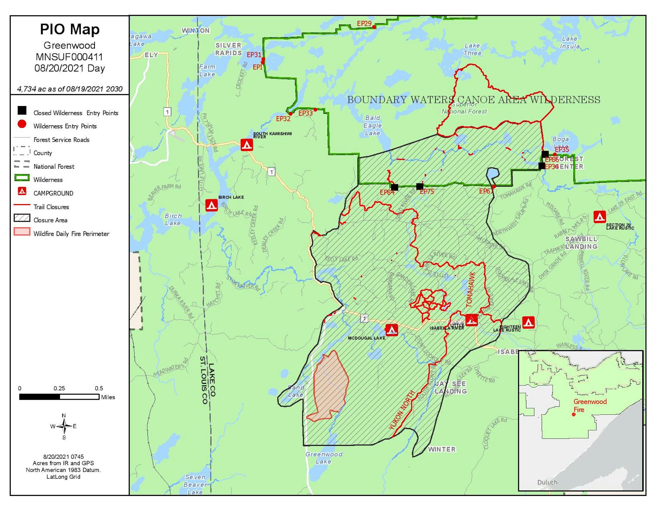
Several wildfires continue to burn across northern Minnesota, the largest of which is the Greenwood Fire. As of an update on the U.S. Forest Service-Superior National Forest Facebook page late Friday morning, that fire was now at 4,734 acres and 0% contained. Meanwhile, as of 2 PM Friday the fire had jumped to the west side of Highway 2 near Stony Lake. You can view more on that and other fires in the Superior National Forest (including the Moose Lake, Bunggee, Fourtown Lake, Sundial South, and Whelp fires) by going to their Facebook at: https://www.facebook.com/SuperiorNF/. Meanwhile, the Minnesota Incident Command System has the latest on the North Norris and Square Fires.
_______________________________________________
Weekend Weather Outlook
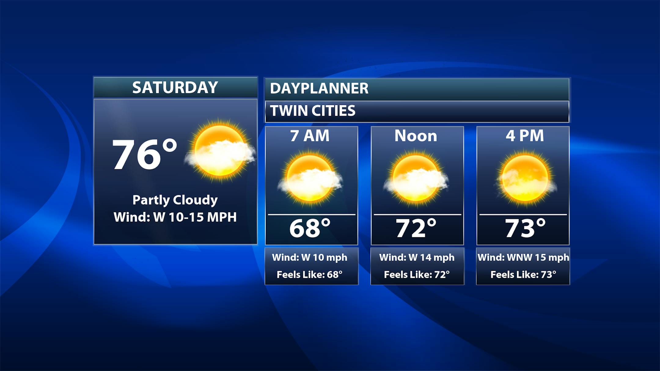
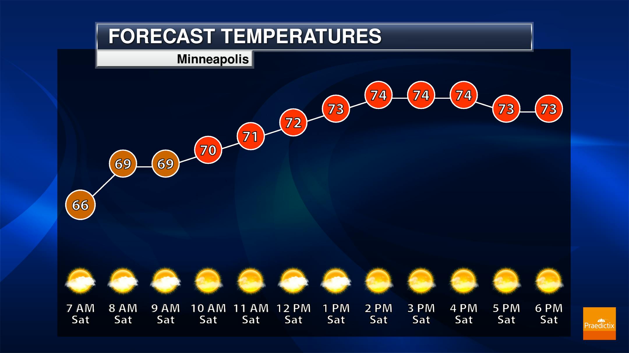
A beautiful day of August weather is expected Saturday with highs topping off in the mid-70s under mainly sunny skies. It will be a bit breezy with wind gusts to 25 mph possible.
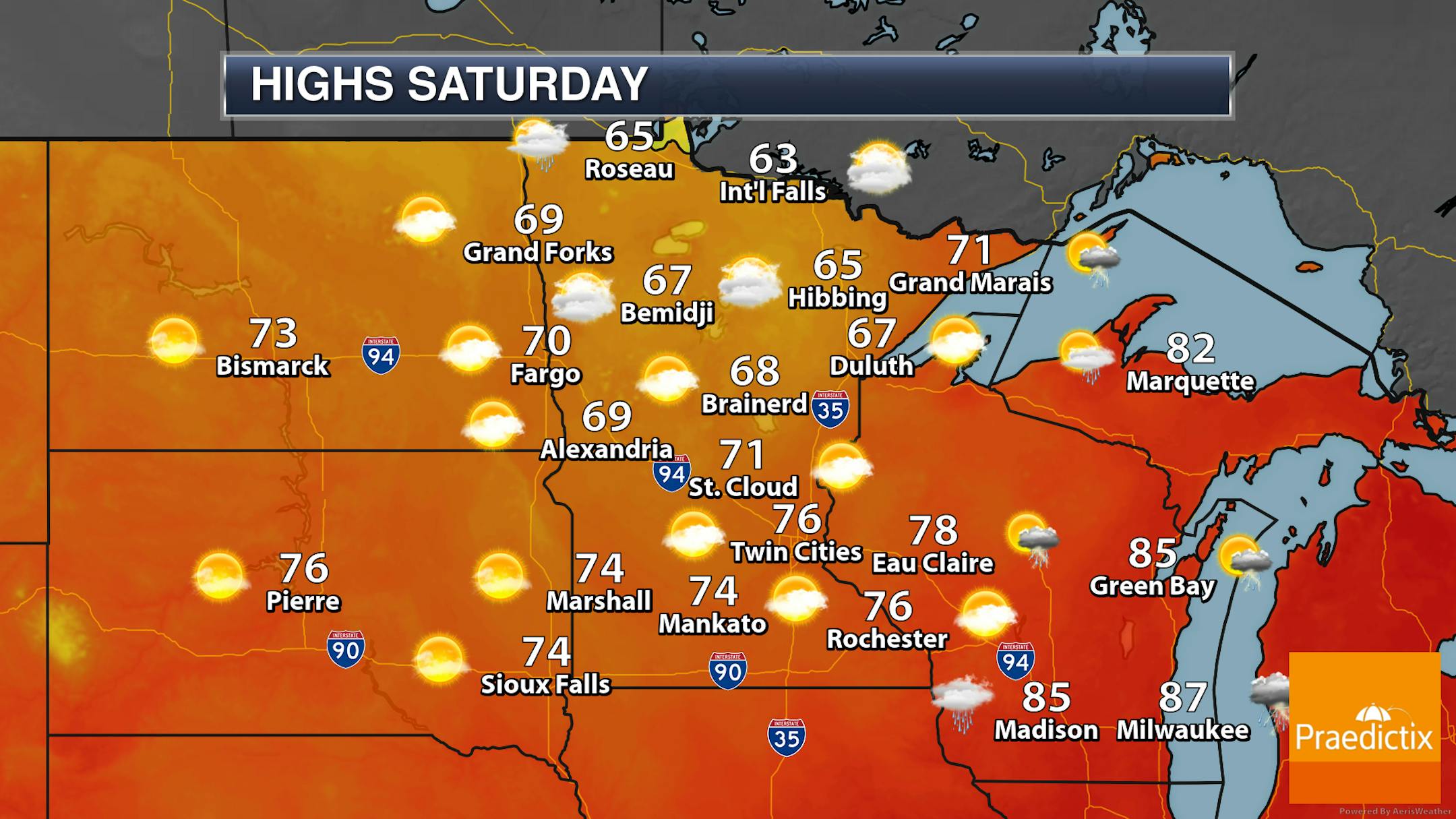
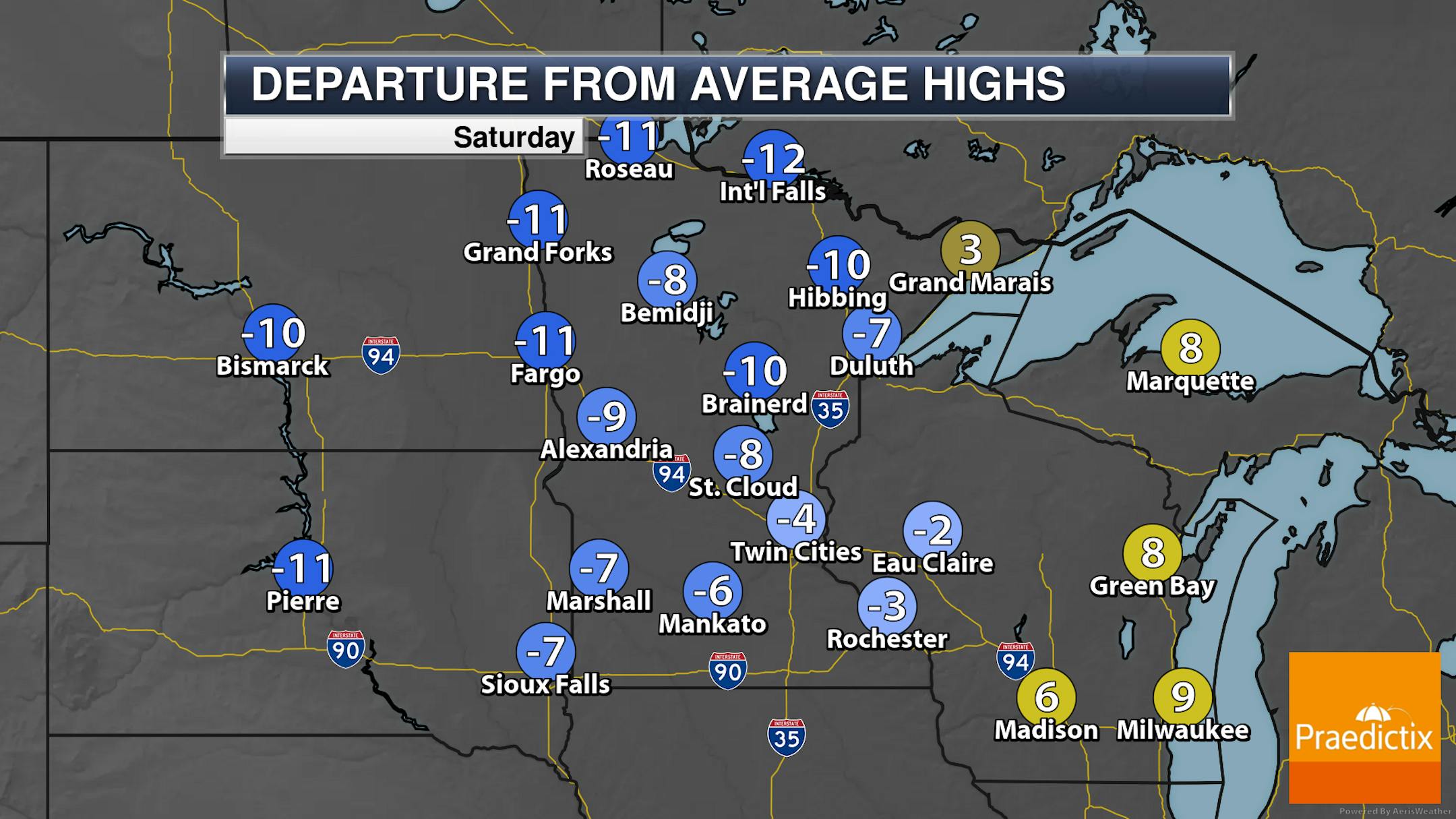
Cloudier skies will hang around northern Minnesota on Saturday, with a few showers possible in northwestern and northeastern portions.
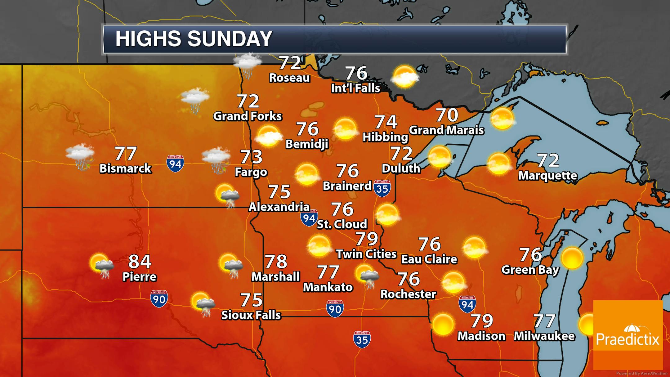
Sunday should be another nice day with mainly sunny skies in the Twin Cities and highs topping off around 80F. A few storms will be possible as we head into the overnight hours.


